How to get to Rockefeller Brothers Fund by bus?
Click on the bus route to see step by step directions with maps, line arrival times and updated time schedules.
From 32nd St W St, Manhattan
49 minFrom Mercury Lounge, Manhattan
69 minFrom Hudson Square, Manhattan
72 minFrom East Tremont Ave, Bronx
57 minFrom City Winery, Manhattan
73 minFrom Katz's Deli, Manhattan
68 minFrom Innside by Melia New York Nomad, Manhattan
52 minFrom United Nations, Manhattan
57 minFrom MTA Bus - M1/M2/M3 (Madison Ave & E 30th St), Manhattan
51 minFrom Katz's Delicatessen, Manhattan
68 min
How to get to Rockefeller Brothers Fund by train?
Click on the train route to see step by step directions with maps, line arrival times and updated time schedules.
From 32nd St W St, Manhattan
59 minFrom Hudson Square, Manhattan
144 minFrom East Tremont Ave, Bronx
47 minFrom City Winery, Manhattan
146 minFrom Katz's Deli, Manhattan
147 minFrom Innside by Melia New York Nomad, Manhattan
101 minFrom United Nations, Manhattan
54 minFrom MTA Bus - M1/M2/M3 (Madison Ave & E 30th St), Manhattan
59 min
How to get to Rockefeller Brothers Fund by subway?
Click on the subway route to see step by step directions with maps, line arrival times and updated time schedules.
From 32nd St W St, Manhattan
35 minFrom Mercury Lounge, Manhattan
47 minFrom Hudson Square, Manhattan
37 minFrom East Tremont Ave, Bronx
62 minFrom City Winery, Manhattan
35 minFrom Katz's Deli, Manhattan
46 minFrom Innside by Melia New York Nomad, Manhattan
30 minFrom United Nations, Manhattan
39 minFrom MTA Bus - M1/M2/M3 (Madison Ave & E 30th St), Manhattan
36 minFrom Katz's Delicatessen, Manhattan
46 min
Bus stops near Rockefeller Brothers Fund in Manhattan
Subway stations near Rockefeller Brothers Fund in Manhattan
Bus lines to Rockefeller Brothers Fund in Manhattan
What are the closest stations to Rockefeller Brothers Fund?
The closest stations to Rockefeller Brothers Fund are:
- Riverside Dr/W 119 St is 5 yards away, 1 min walk.
- Broadway/W 120 St is 231 yards away, 3 min walk.
- 116 St-Columbia University is 425 yards away, 5 min walk.
- Amsterdam Av/W 120 St is 544 yards away, 7 min walk.
- 125 St is 1393 yards away, 17 min walk.
Which bus lines stop near Rockefeller Brothers Fund?
These bus lines stop near Rockefeller Brothers Fund: M5, M60-SBS.
Which train lines stop near Rockefeller Brothers Fund?
These train lines stop near Rockefeller Brothers Fund: 1, 2, 3.
Which subway line stops near Rockefeller Brothers Fund?
1 (Uptown & The Bronx)
What’s the nearest subway station to Rockefeller Brothers Fund in Manhattan?
The nearest subway station to Rockefeller Brothers Fund in Manhattan is 116 St-Columbia University. It’s a 5 min walk away.
What’s the nearest bus station to Rockefeller Brothers Fund in Manhattan?
The nearest bus station to Rockefeller Brothers Fund in Manhattan is Riverside Dr/W 119 St. It’s a 1 min walk away.
What time is the first subway to Rockefeller Brothers Fund in Manhattan?
The 1 is the first subway that goes to Rockefeller Brothers Fund in Manhattan. It stops nearby at 3:05 AM.
What time is the last subway to Rockefeller Brothers Fund in Manhattan?
The A is the last subway that goes to Rockefeller Brothers Fund in Manhattan. It stops nearby at 4:14 AM.
What time is the first bus to Rockefeller Brothers Fund in Manhattan?
The M60-SBS is the first bus that goes to Rockefeller Brothers Fund in Manhattan. It stops nearby at 3:12 AM.
What time is the last bus to Rockefeller Brothers Fund in Manhattan?
The M60-SBS is the last bus that goes to Rockefeller Brothers Fund in Manhattan. It stops nearby at 3:15 AM.
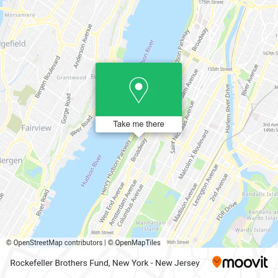
See Rockefeller Brothers Fund, Manhattan, on the map
Public Transit to Rockefeller Brothers Fund in Manhattan
Wondering how to get to Rockefeller Brothers Fund in Manhattan? Moovit helps you find the best way to get to Rockefeller Brothers Fund with step-by-step directions from the nearest public transit station.
Moovit provides free maps and live directions to help you navigate through your city. View schedules, routes, timetables, and find out how long does it take to get to Rockefeller Brothers Fund in real time.
Looking for the nearest stop or station to Rockefeller Brothers Fund? Check out this list of stops closest to your destination: Riverside Dr/W 119 St; Broadway/W 120 St; 116 St-Columbia University; Amsterdam Av/W 120 St; 125 St.
Bus: M5, M60-SBS, M4, M104, M11.Train: 1, 2, 3.Subway: 1, A, B, C, D.
Want to see if there’s another route that gets you there at an earlier time? Moovit helps you find alternative routes or times. Get directions from and directions to Rockefeller Brothers Fund easily from the Moovit App or Website.
We make riding to Rockefeller Brothers Fund easy, which is why over 1.5 million users, including users in Manhattan, trust Moovit as the best app for public transit. You don’t need to download an individual bus app or train app, Moovit is your all-in-one transit app that helps you find the best bus time or train time available.
For information on prices of subway, bus and train, costs and ride fares to Rockefeller Brothers Fund, please check the Moovit app.
Use the app to navigate to popular places including to the airport, hospital, stadium, grocery store, mall, coffee shop, school, college, and university.
Rockefeller Brothers Fund Address: 475 Riverside Dr street in Manhattan
- Council Of Churches Of NY,
- Interchurch Ecumenical Library,
- National Center For Disaster Preparedness,
- Union For Reform Judaism,
- Spsarv,
- Pension Boards United Church,
- New York City Regional Emergency Medical Services Council,
- Iccr,
- New York Justice For Our Neighbors,
- United Care Network,
- Columbia Engineering Outreach Programs,
- Japan Center For International Exchange,
- Children's Health Fund,
- Millennium Promise,
- Hazamir: the International Jewish Teen Choir,
- Ac4,
- Shalom Hartman Institute Of North America,
- Nyc Remsco,
- Vellore Cmc Foundation,
- The Havens Relief Fund Society
Places Near Rockefeller Brothers Fund (Manhattan)
- Wall Street, Manhattan,
- 66 John Street, Manhattan,
- 3 Stone St, Manhattan,
- Bellevue Hospital, Manhattan,
- Chinatown, Manhattan,
- Rockefeller Center, Manhattan,
- qqqq, Manhattan,
- Times Square, Manhattan,
- Hudson Yards, Manhattan,
- Pier 83, Manhattan,
- San Gennaro Feast, Manhattan,
- 1 Police Plaza, Manhattan,
- Queens Center Mall, Queens,
- 111 Centre New York City Supreme Court, Manhattan,
- 26 Federal Plaza, Manhattan,
- 376 Hudson Street, Manhattan,
- SoHo, Manhattan,
- Katz's Deli, Manhattan,
- 911 Memorial, Manhattan,
- Mountainside Hospital, Glen Ridge
How to get to popular places in New York - New Jersey with public transit
Get around Manhattan by public transit!
Traveling around Manhattan has never been so easy. See step by step directions as you travel to any attraction, street or major public transit station. View bus and train schedules, arrival times, service alerts and detailed routes on a map, so you know exactly how to get to anywhere in Manhattan.
When traveling to any destination around Manhattan use Moovit's Live Directions with Get Off Notifications to know exactly where and how far to walk, how long to wait for your line, and how many stops are left. Moovit will alert you when it's time to get off — no need to constantly re-check whether yours is the next stop.
Wondering how to use public transit in Manhattan or how to pay for public transit in Manhattan? Moovit public transit app can help you navigate your way with public transit easily, and at minimum cost. It includes public transit fees, ticket prices, and costs. Looking for a map of Manhattan public transit lines? Moovit public transit app shows all public transit maps in Manhattan with all Bus, Train, Subway, Light Rail, Ferry and Cable Car routes and stops on an interactive map.
New York - New Jersey has 6 transit type(s), including: Bus, Train, Subway, Light Rail, Ferry and Cable Car, operated by several transit agencies, including MTA Subway, Metro-North Railroad, LIRR, PATH, MTA New York City Transit - Express routes, MTA Bus, NJ Transit, NYC Ferry, NICE bus, Bee-Line Bus, NJ Transit Rail, Norwalk Transit District, Hartford Line, River Valley Transit and HART