Directions to Rodel & Rodel - - Atuba with public transportation
The following transit lines have routes that pass near Rodel & Rodel - - Atuba
How to get to Rodel & Rodel - - Atuba by bus?
Click on the bus route to see step by step directions with maps, line arrival times and updated time schedules.
From Rua Francisco Rocha
58 minFrom Rua Engenheiro Costa Barros
52 minFrom Avenida Marechal Floriano Peixoto 2509
50 minFrom Centro Clinico Nossa Saúde
62 minFrom R.U - UFPR Campus Botanico
48 minFrom Electrolux Do Brasil Sa
61 minFrom Estação Tubo Jardim das Américas
46 minFrom Havan
51 minFrom Rua João Parolin
64 minFrom Centro
49 min
Bus stops near Rodel & Rodel - - Atuba
Bus lines to Rodel & Rodel - - Atuba
- 237 PARQUE ATUBA, Terminal Santa Cândida ↺ Parque Atuba (Circular),VIEW
- 030 INTERBAIRROS III, Terminal Bairro Alto → Terminal Santa Cândida,VIEW
- O69 MAD. QUATRO BARRAS / SANTA CÂNDIDA, Terminal Santa Cândida → Terminal Quatro Barras,VIEW
- 238 ATUBA / SANTA CÂNDIDA, Terminal Santa Cândida → Estação Atuba,VIEW
- 214 TINGUI, Terminal Santa Cândida → Terminal Cabral,VIEW
What are the closest stations to Rodel & Rodel - - Atuba?
The closest stations to Rodel & Rodel - - Atuba are:
- R. Odete Laura Foggiato, 116 is 107 meters away, 2 min walk.
- Av. Marechal Mascarenhas de Moraes, 1689 is 721 meters away, 10 min walk.
- R. Miguel Jorge Nasser, 1084 is 787 meters away, 11 min walk.
Which bus lines stop near Rodel & Rodel - - Atuba?
These bus lines stop near Rodel & Rodel - - Atuba: 030 INTERBAIRROS III, 237 PARQUE ATUBA, 238 ATUBA / SANTA CÂNDIDA, 350 ATUBA / PINHEIRINHO, B06 GUARAITUBA / RUI BARBOSA (VIA MARACANÃ / SEMIDIRETO).
What’s the nearest bus station to Rodel & Rodel - - Atuba?
The nearest bus station to Rodel & Rodel - - Atuba is R. Odete Laura Foggiato, 116. It’s a 2 min walk away.
What time is the first bus to Rodel & Rodel - - Atuba?
The O69 MAD. QUATRO BARRAS / SANTA CÂNDIDA is the first bus that goes to Rodel & Rodel - - Atuba. It stops nearby at 4:11 AM.
What time is the last bus to Rodel & Rodel - - Atuba?
The 030 INTERBAIRROS III is the last bus that goes to Rodel & Rodel - - Atuba. It stops nearby at 12:45 AM.
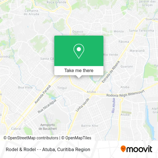
See Rodel & Rodel - - Atuba on the map
Public Transportation to Rodel & Rodel - - Atuba
Wondering how to get to Rodel & Rodel - - Atuba? Moovit helps you find the best way to get to Rodel & Rodel - - Atuba with step-by-step directions from the nearest public transit station.
Moovit provides free maps and live directions to help you navigate through your city. View schedules, routes, timetables, and find out how long does it take to get to Rodel & Rodel - - Atuba in real time.
Looking for the nearest stop or station to Rodel & Rodel - - Atuba? Check out this list of stops closest to your destination: R. Odete Laura Foggiato; Av. Marechal Mascarenhas de Moraes; R. Miguel Jorge Nasser.
Bus: 030 INTERBAIRROS III, 237 PARQUE ATUBA, 238 ATUBA / SANTA CÂNDIDA, 350 ATUBA / PINHEIRINHO, B06 GUARAITUBA / RUI BARBOSA (VIA MARACANÃ / SEMIDIRETO), O69 MAD. QUATRO BARRAS / SANTA CÂNDIDA, 214 TINGUI.
Want to see if there’s another route that gets you there at an earlier time? Moovit helps you find alternative routes or times. Get directions from and directions to Rodel & Rodel - - Atuba easily from the Moovit App or Website.
We make riding to Rodel & Rodel - - Atuba easy, which is why over 1.5 million users, including users in Atuba, trust Moovit as the best app for public transit. You don’t need to download an individual bus app or train app, Moovit is your all-in-one transit app that helps you find the best bus time or train time available.
For information on prices of bus, costs and ride fares to Rodel & Rodel - - Atuba, please check the Moovit app.
Use the app to navigate to popular places including to the airport, hospital, stadium, grocery store, mall, coffee shop, school, college, and university.
Rodel & Rodel - - Atuba Address: Rua Odete Laura Foggiato, 230 Atuba Curitiba-PR 82630-040 street in Atuba
- A Imperial,
- Dolatto Solutions Analytics,
- Margicon Elaboracao de Programas de Computadores,
- Conjunto Residencial Eurico Alves de Araújo,
- Curita Service,
- Andrea Regina Santos,
- Mobelart Moveis,
- Romeu Barbosa Moveis,
- Rua João Fernandes Franca 110,
- Master Class,
- Nicolas Pinotti,
- SOS Bar,
- Rua Alcídes Gonçalves da Rocha 50,
- Comunidade Emaús,
- Ers Servicos,
- Aon - Incorporadora,
- Residencial Alvorada das Araucarias,
- Scp Falleiros,
- Projecao,
- Vovo Miloka Livraria
Places Near Rodel & Rodel - - Atuba
- Arena Da Baixada - Curitiba,
- Shopping Estação, Rebouças,
- Hhhhh, Fazendinha,
- Rua Martim Afonso 558, Mercês,
- Hospital Universitário Evangélico de Curitiba, Bigorrilho,
- Hospital Angelina Caron, Campina Grande Do Sul,
- Hospital Erasto Gaertner, Jardim Das Américas,
- Hospital Da Cruz Vermelha, Batel,
- Hospital do Rocio, Campo,
- Hospital de Clínicas (HC - UFPR), Centro,
- Hospital Nossa Senhora Das Graças, Mercês,
- Pontifícia Universidade Católica do Paraná (PUCPR), Prado Velho,
- Hospital Madalena Sofia, Bairro Alto,
- Shopping Palladium, Portão,
- Parque Barigui, Mercês,
- Campo Largo, Campo,
- Jockey Plaza Shopping Center, Tarumã,
- Park Shopping Barigüi, Mossunguê,
- Rua General Mário Tourinho, Campina Do Siqueira,
- Jardim Botânico de Curitiba PR, Centro
How to get to popular places in Curitiba Region with public transit
Get around Atuba by public transit!
Traveling around Atuba has never been so easy. See step by step directions as you travel to any attraction, street or major public transit station. View bus and train schedules, arrival times, service alerts and detailed routes on a map, so you know exactly how to get to anywhere in Atuba.
When traveling to any destination around Atuba use Moovit's Live Directions with Get Off Notifications to know exactly where and how far to walk, how long to wait for your line, and how many stops are left. Moovit will alert you when it's time to get off — no need to constantly re-check whether yours is the next stop.
Wondering how to use public transit in Atuba or how to pay for public transit in Atuba? Moovit public transit app can help you navigate your way with public transit easily, and at minimum cost. It includes public transit fees, ticket prices, and costs. Looking for a map of Atuba public transit lines? Moovit public transit app shows all public transit maps in Atuba with all Bus and Cable Car routes and stops on an interactive map.
Curitiba Region has 2 transit type(s), including: Bus and Cable Car, operated by several transit agencies, including Sistema Integrado de Mobilidade (URBS), Sistema Integrado de Mobilidade (AMEP), URBS (Cartões bancários e Dinheiro), URBS (Cartões bancários / Cartão URBS), AMEP (Cartões bancários / Cartão MetroCard), AMEP (Cartões bancários / Cartão MetroCard / Dinheiro), Viação Colombo (Dinheiro), TRIAR (Cartão TRIAR / Dinheiro), Empresa Curitiba Cerro Azul (Dinheiro), Expresso Nossa Senhora da Penha (Dinheiro), Empresa Campo Alto Tijucas (Dinheiro), Auto Viação São José (Cartão VEM / Dinheiro), BRT S/A (Cartão VEM / Dinheiro), TransPiedade (Cartão Cidadão / Dinheiro) and Oceânica Sul (Cartão Transporte / Dinheiro)