How to get to Rodeo Western Wear by bus?
Click on the bus route to see step by step directions with maps, line arrival times and updated time schedules.
From Elvis Chapel, Las Vegas
51 minFrom Sahara @ Las Vegas (W), Las Vegas
56 minFrom Mojave High School, North Las Vegas
97 minFrom Martin Luther King and bonanza, Las Vegas
46 minFrom Westgate Las Vegas Resort & Casino, Winchester
64 minFrom Stewart Ave / Las Vegas Blvd N, Las Vegas
34 minFrom Desert Springs Hospital Medical Center, Paradise
51 minFrom Sugar Factory, Las Vegas
56 minFrom Cannery Casino & Hotel, North Las Vegas
37 minFrom Nuleaf Dispensary Las Vegas Strip, Las Vegas
53 min
Bus stops near Rodeo Western Wear in Sunrise Manor
Bus lines to Rodeo Western Wear in Sunrise Manor
What are the closest stations to Rodeo Western Wear?
The closest stations to Rodeo Western Wear are:
- Wb Owens Before Nellis is 94 yards away, 2 min walk.
- Nb Nellis After Kell is 477 yards away, 6 min walk.
- Eb Lake Mead After Nellis is 909 yards away, 11 min walk.
Which bus lines stop near Rodeo Western Wear?
These bus lines stop near Rodeo Western Wear: 115, 209.
What’s the nearest bus station to Rodeo Western Wear in Sunrise Manor?
The nearest bus station to Rodeo Western Wear in Sunrise Manor is Wb Owens Before Nellis. It’s a 2 min walk away.
What time is the first bus to Rodeo Western Wear in Sunrise Manor?
The 115 is the first bus that goes to Rodeo Western Wear in Sunrise Manor. It stops nearby at 3:00 AM.
What time is the last bus to Rodeo Western Wear in Sunrise Manor?
The 210 is the last bus that goes to Rodeo Western Wear in Sunrise Manor. It stops nearby at 3:10 AM.
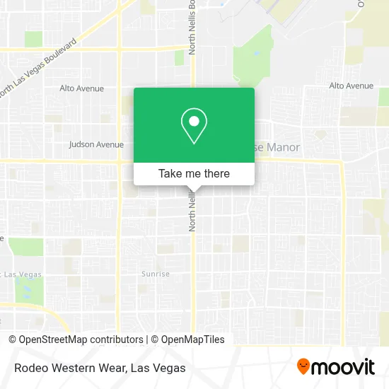
See Rodeo Western Wear, Sunrise Manor, on the map
Public Transit to Rodeo Western Wear in Sunrise Manor
Wondering how to get to Rodeo Western Wear in Sunrise Manor? Moovit helps you find the best way to get to Rodeo Western Wear with step-by-step directions from the nearest public transit station.
Moovit provides free maps and live directions to help you navigate through your city. View schedules, routes, timetables, and find out how long does it take to get to Rodeo Western Wear in real time.
Looking for the nearest stop or station to Rodeo Western Wear? Check out this list of stops closest to your destination: Wb Owens Before Nellis; Nb Nellis After Kell; Eb Lake Mead After Nellis.
Bus: 115, 209, 210.
Want to see if there’s another route that gets you there at an earlier time? Moovit helps you find alternative routes or times. Get directions from and directions to Rodeo Western Wear easily from the Moovit App or Website.
We make riding to Rodeo Western Wear easy, which is why over 1.7 million users, including users in Sunrise Manor, trust Moovit as the best app for public transit. You don’t need to download an individual bus app or train app, Moovit is your all-in-one transit app that helps you find the best bus time or train time available.
For information on prices of bus and Monorail, costs and ride fares to Rodeo Western Wear, please check the Moovit app.
Use the app to navigate to popular places including to the airport, hospital, stadium, grocery store, mall, coffee shop, school, college, and university.
Rodeo Western Wear Address: 1602 N Nellis Blvd street in Sunrise Manor
- Birrieria Gonzalez Inc,
- Lupita’S Furniture,
- Mariscos Carlitros Restaurant,
- Gracie's Beauty Salon,
- Western Union,
- Paradise Vapors,
- Marketon Supermarket,
- Rapid Cash #21569,
- Car Pros Nellis,
- Western Union,
- Love Jesus,
- Las Tarascas Michoacanas Mexican Restaurant,
- Rosa Racing And Fabrication Llc,
- Ac Personal Care,
- All For Health, Health For All, Community Health Center,
- El Zurdo Montańez Boxing Gym,
- Vero Q Party Supplies, Llc,
- Rt Motors,
- Bulldog Liquidators Las Vegas - Nellis,
- Express Auto Center
Places Near Rodeo Western Wear (Sunrise Manor)
- Las Vegas South Premium Outlets, Enterprise,
- Allegiant Stadium, Paradise,
- The Deuce Bus Stop at Fremont St, Las Vegas,
- Zak Bagans Haunted Museum, Las Vegas,
- Omega Mart, Las Vegas,
- The Palms Casino Resort, Paradise,
- Trump International Hotel Las Vegas, Paradise,
- The Neon Museum, Las Vegas,
- Walmart Supercenter, Las Vegas,
- Lee Canyon, Las Vegas,
- Town Square, Enterprise,
- Koolsville Tattoos, Las Vegas,
- Meow Wolf - Las Vegas (Meow Wolf's Omega Mart), Las Vegas,
- Gold & Silver Pawn Shop, Las Vegas,
- Las Vegas North Premium Outlets, Las Vegas,
- Walmart, Las Vegas,
- Arte Museum Las Vegas, Paradise,
- Welcome To Fabulous Las Vegas Sign, Paradise,
- Las Vegas Premium Outlets-North, Enterprise,
- Area15, Las Vegas
How to get to popular places in Las Vegas with public transit
Get around Sunrise Manor by public transit!
Traveling around Sunrise Manor has never been so easy. See step by step directions as you travel to any attraction, street or major public transit station. View bus and train schedules, arrival times, service alerts and detailed routes on a map, so you know exactly how to get to anywhere in Sunrise Manor.
When traveling to any destination around Sunrise Manor use Moovit's Live Directions with Get Off Notifications to know exactly where and how far to walk, how long to wait for your line, and how many stops are left. Moovit will alert you when it's time to get off — no need to constantly re-check whether yours is the next stop.
Wondering how to use public transit in Sunrise Manor or how to pay for public transit in Sunrise Manor? Moovit public transit app can help you navigate your way with public transit easily, and at minimum cost. It includes public transit fees, ticket prices, and costs. Looking for a map of Sunrise Manor public transit lines? Moovit public transit app shows all public transit maps in Sunrise Manor with all Bus and Monorail routes and stops on an interactive map.
Las Vegas has 2 transit type(s), including: Bus and Monorail, operated by several transit agencies, including RTCSNV, City of Las Vegas, Alvand Transportation, Vegas Airporter, Las Vegas Monorail, FlixBus-us and Greyhound-us