How to get to Rodeway Inn by bus?
Click on the bus route to see step by step directions with maps, line arrival times and updated time schedules.
From Stuart, Florida, Stuart
94 minFrom Clover Park, Port St. Lucie
102 minFrom US-1 / SE Port St Lucie Blvd, Port St. Lucie
54 minFrom CVS Pharmacy - (Lyngate Dr), Port St. Lucie
45 minFrom Suncoast High School, Riviera Beach
570 minFrom Suncoast Community High School, Riviera Beach
572 minFrom Tradition Park, Port St. Lucie
120 min
Bus stop near Rodeway Inn in Fort Pierce
- Virginia Ave & US Hwy 1, 8 min walk,VIEW
Bus lines to Rodeway Inn in Fort Pierce
- 1, Avenue D & N 8th St,VIEW
What are the closest stations to Rodeway Inn?
The closest stations to Rodeway Inn are:
- Virginia Ave & US Hwy 1 is 643 yards away, 8 min walk.
Which bus lines stop near Rodeway Inn?
These bus lines stop near Rodeway Inn: 1, 3.
What’s the nearest bus station to Rodeway Inn in Fort Pierce?
The nearest bus station to Rodeway Inn in Fort Pierce is Virginia Ave & US Hwy 1. It’s a 8 min walk away.
What time is the first bus to Rodeway Inn in Fort Pierce?
The 1 is the first bus that goes to Rodeway Inn in Fort Pierce. It stops nearby at 6:10 AM.
What time is the last bus to Rodeway Inn in Fort Pierce?
The 1 is the last bus that goes to Rodeway Inn in Fort Pierce. It stops nearby at 7:45 PM.
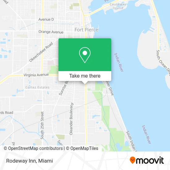
See Rodeway Inn, Fort Pierce, on the map
Public Transit to Rodeway Inn in Fort Pierce
Wondering how to get to Rodeway Inn in Fort Pierce? Moovit helps you find the best way to get to Rodeway Inn with step-by-step directions from the nearest public transit station.
Moovit provides free maps and live directions to help you navigate through your city. View schedules, routes, timetables, and find out how long does it take to get to Rodeway Inn in real time.
Looking for the nearest stop or station to Rodeway Inn? Check out this list of stops closest to your destination: Virginia Ave & US Hwy 1.
Bus: 1, 3.
Want to see if there’s another route that gets you there at an earlier time? Moovit helps you find alternative routes or times. Get directions from and directions to Rodeway Inn easily from the Moovit App or Website.
We make riding to Rodeway Inn easy, which is why over 1.5 million users, including users in Fort Pierce, trust Moovit as the best app for public transit. You don’t need to download an individual bus app or train app, Moovit is your all-in-one transit app that helps you find the best bus time or train time available.
For information on prices of bus, costs and ride fares to Rodeway Inn, please check the Moovit app.
Use the app to navigate to popular places including to the airport, hospital, stadium, grocery store, mall, coffee shop, school, college, and university.
Rodeway Inn Address: 2601 S US Highway 1 Fort Pierce, FL 34982 street in Fort Pierce
- A D T Alarm & ADT Security,
- Ov's Auto Sales,
- Braynens BBQ,
- Stoney's BBQ Ft. Pierce,
- Direct SAT TV,
- Hideaway Ice Cream & Deli,
- Amazon Locker-Adelina,
- FedEx,
- LFB Plasma Fort Pierce,
- Treasure Coast Knee Solutions Clinic,
- Sabal Palm Plaza,
- US Coast Guard,
- Oriental Market VN,
- Iglesia Apostólica de la Fe en Cristo Jesús, fort Pierce Fl.,
- US Navy Recruiting Office,
- HM Discount Beverage,
- Cellular Sales,
- Bealls,
- Melissa Panaderia Bakery,
- Heathcote Botanical Gardens
Places Near Rodeway Inn (Fort Pierce)
- Sawgrass mall ( FL ), Miami Beach,
- Little Havana, Miami,
- Sawgrass Mall, Miami,
- Zoo Miami, Miami,
- Wynwood, Miami,
- Miami Freedom Park, Miami,
- Hard Rock Stadium, Miami Gardens,
- Miami Design District, Miami,
- Port of Miami Cruise Terminal, Miami,
- Keiser University Flagship Campus, West Palm Beach,
- Bayside Marketplace, Miami,
- Dolphin Mall, Miami,
- Richard E. Gerstein Justice Building, Miami,
- Miami VA Hospital, Miami,
- Dolphin Mall Bus, Miami,
- Marlins Park, Miami,
- Brickell City Centre, Miami,
- Miami-Dade County Courthouse, Miami,
- Aventura Mall, Miami Beach,
- Aventura Mall, Miami
How to get to popular places in Miami with public transit
Get around Fort Pierce by public transit!
Traveling around Fort Pierce has never been so easy. See step by step directions as you travel to any attraction, street or major public transit station. View bus and train schedules, arrival times, service alerts and detailed routes on a map, so you know exactly how to get to anywhere in Fort Pierce.
When traveling to any destination around Fort Pierce use Moovit's Live Directions with Get Off Notifications to know exactly where and how far to walk, how long to wait for your line, and how many stops are left. Moovit will alert you when it's time to get off — no need to constantly re-check whether yours is the next stop.
Wondering how to use public transit in Fort Pierce or how to pay for public transit in Fort Pierce? Moovit public transit app can help you navigate your way with public transit easily, and at minimum cost. It includes public transit fees, ticket prices, and costs. Looking for a map of Fort Pierce public transit lines? Moovit public transit app shows all public transit maps in Fort Pierce with all Bus, Train, Light Rail and Ferry routes and stops on an interactive map.
Miami has 4 transit type(s), including: Bus, Train, Light Rail and Ferry, operated by several transit agencies, including Broward County Transit, Miami-Dade Transit, Metrorail, Palm Tran, Tri-Rail, Brightline, MARTY, City of Homestead Trolley, Key West Transit, Treasure Coast Connector, GoLine IRT, Amtrak, Greyhound-us, FlixBus-us and Aventura Express Shuttle Bus