Directions to Rodeway Inn Poughkeepsie (New York - New Jersey) with public transportation
The following transit lines have routes that pass near Rodeway Inn Poughkeepsie
 Bus: E MS, L AMS, L SMS, L SN, D.
- Train: 1, RVL, ADIRONDACK, BERKSHIRE FLYER, EMPIRE SERVICE.
How to get to Rodeway Inn Poughkeepsie by bus?
Click on the bus route to see step by step directions with maps, line arrival times and updated time schedules.
How to get to Rodeway Inn Poughkeepsie by train?
Click on the train route to see step by step directions with maps, line arrival times and updated time schedules.
Bus stops near Rodeway Inn Poughkeepsie in New York - New Jersey
Train station near Rodeway Inn Poughkeepsie in New York - New Jersey
- Poughkeepsie, 48 min walk,VIEW
Bus lines to Rodeway Inn Poughkeepsie in New York - New Jersey
- L AMS, Transit Hub - Adams Fairacre Farms & Route 44,VIEW
- L SMS, Transit Hub - Stop & Shop,VIEW
- L SN, Transit Hub - Adams Fairacre Farms & Route 44,VIEW
- D, Transit Hub - Front Street & Franklin Avenue,VIEW
- E MS, Cousins Cafe - Poughkeepsie Train Station,VIEW
- E SUN, Transit Hub - Route 55 E (Cutout) & Old Manchester Road,VIEW
- WPP, To Poughkeepsie,VIEW
What are the closest stations to Rodeway Inn Poughkeepsie?
The closest stations to Rodeway Inn Poughkeepsie are:
- Fairmont Avenue & Route 44/55 is 149 yards away, 2 min walk.
- Vassar Garden Apartments is 642 yards away, 8 min walk.
- Dot Region Office is 1112 yards away, 13 min walk.
- Poughkeepsie is 4054 yards away, 48 min walk.
Which bus lines stop near Rodeway Inn Poughkeepsie?
These bus lines stop near Rodeway Inn Poughkeepsie: E MS, L AMS, L SMS.
Which train lines stop near Rodeway Inn Poughkeepsie?
These train lines stop near Rodeway Inn Poughkeepsie: 1, RVL.
What’s the nearest bus station to Rodeway Inn Poughkeepsie in New York - New Jersey?
The nearest bus station to Rodeway Inn Poughkeepsie in New York - New Jersey is Fairmont Avenue & Route 44/55. It’s a 2 min walk away.
What time is the first train to Rodeway Inn Poughkeepsie in New York - New Jersey?
The 1 is the first train that goes to Rodeway Inn Poughkeepsie in New York - New Jersey. It stops nearby at 4:08 AM.
What time is the last train to Rodeway Inn Poughkeepsie in New York - New Jersey?
The 1 is the last train that goes to Rodeway Inn Poughkeepsie in New York - New Jersey. It stops nearby at 2:59 AM.
What time is the first bus to Rodeway Inn Poughkeepsie in New York - New Jersey?
The WPP is the first bus that goes to Rodeway Inn Poughkeepsie in New York - New Jersey. It stops nearby at 5:00 AM.
What time is the last bus to Rodeway Inn Poughkeepsie in New York - New Jersey?
The E MS is the last bus that goes to Rodeway Inn Poughkeepsie in New York - New Jersey. It stops nearby at 12:03 AM.
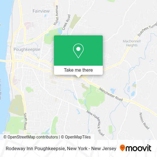
See Rodeway Inn Poughkeepsie, New York - New Jersey, on the map
Public Transit to Rodeway Inn Poughkeepsie in New York - New Jersey
Wondering how to get to Rodeway Inn Poughkeepsie in New York - New Jersey? Moovit helps you find the best way to get to Rodeway Inn Poughkeepsie with step-by-step directions from the nearest public transit station.
Moovit provides free maps and live directions to help you navigate through your city. View schedules, routes, timetables, and find out how long does it take to get to Rodeway Inn Poughkeepsie in real time.
Looking for the nearest stop or station to Rodeway Inn Poughkeepsie? Check out this list of stops closest to your destination: Fairmont Avenue & Route 44/55; Vassar Garden Apartments; Dot Region Office; Poughkeepsie.
Bus: E MS, L AMS, L SMS, L SN, D, E SUN, WPP.Train: 1, RVL, ADIRONDACK, BERKSHIRE FLYER, EMPIRE SERVICE, ETHAN ALLEN EXPRESS, LAKE SHORE LIMITED.
Want to see if there’s another route that gets you there at an earlier time? Moovit helps you find alternative routes or times. Get directions from and directions to Rodeway Inn Poughkeepsie easily from the Moovit App or Website.
We make riding to Rodeway Inn Poughkeepsie easy, which is why over 1.5 million users, including users in New York - New Jersey, trust Moovit as the best app for public transit. You don’t need to download an individual bus app or train app, Moovit is your all-in-one transit app that helps you find the best bus time or train time available.
For information on prices of bus and train, costs and ride fares to Rodeway Inn Poughkeepsie, please check the Moovit app.
Use the app to navigate to popular places including to the airport, hospital, stadium, grocery store, mall, coffee shop, school, college, and university.
Rodeway Inn Poughkeepsie Address: 536 W Haight Ave street in New York - New Jersey
- Rupson Corporation,
- Days Inn by Wyndham Poughkeepsie,
- QUALITY INN Poughkeepsie (Days Inn Poughkeepsie Hotel Poughkeepsie),
- Quality Inn Poughkeepsie,
- Adriance Memorial Library,
- Fred S. Maron, Dentist,
- Maron Fred Dmd,
- J&K Remodeling Construction,
- Century 21,
- Popeyes,
- Fishkill Farms,
- La Hacienda de Mexico,
- IV Nail 3d,
- Hair Restoration Of the Hudson Valley,
- A.S. Medical Aesthetics,
- Glow Girl by Erika,
- Mccormack Lmt,
- Pearl In the Ruff Llc,
- Rebuilding Together Dutchess County,
- Saile Ackerman Llc
Places Near Rodeway Inn Poughkeepsie (New York - New Jersey)
- 66 John Street, Manhattan,
- 111 Centre New York City Supreme Court, Manhattan,
- SoHo, Manhattan,
- Times Square, Manhattan,
- Wall Street, Manhattan,
- Mountainside Hospital, Glen Ridge,
- San Gennaro Feast, Manhattan,
- Hudson Yards, Manhattan,
- Katz's Deli, Manhattan,
- 3 Stone St, Manhattan,
- Rockefeller Center, Manhattan,
- Queens Center Mall, Queens,
- qqqq, Manhattan,
- Bellevue Hospital, Manhattan,
- 1 Police Plaza, Manhattan,
- Chinatown, Manhattan,
- 911 Memorial, Manhattan,
- 376 Hudson Street, Manhattan,
- Pier 83, Manhattan,
- 26 Federal Plaza, Manhattan
How to get to popular places in New York - New Jersey with public transit
Get around New York - New Jersey by public transit!
Traveling around New York - New Jersey has never been so easy. See step by step directions as you travel to any attraction, street or major public transit station. View bus and train schedules, arrival times, service alerts and detailed routes on a map, so you know exactly how to get to anywhere in New York - New Jersey.
When traveling to any destination around New York - New Jersey use Moovit's Live Directions with Get Off Notifications to know exactly where and how far to walk, how long to wait for your line, and how many stops are left. Moovit will alert you when it's time to get off — no need to constantly re-check whether yours is the next stop.
Wondering how to use public transit in New York - New Jersey or how to pay for public transit in New York - New Jersey? Moovit public transit app can help you navigate your way with public transit easily, and at minimum cost. It includes public transit fees, ticket prices, and costs. Looking for a map of New York - New Jersey public transit lines? Moovit public transit app shows all public transit maps in New York - New Jersey with all Bus, Train, Subway, Light Rail, Ferry and Cable Car routes and stops on an interactive map.
New York - New Jersey has 6 transit type(s), including: Bus, Train, Subway, Light Rail, Ferry and Cable Car, operated by several transit agencies, including MTA Subway, Metro-North Railroad, LIRR, PATH, MTA New York City Transit - Express routes, MTA Bus, NJ Transit, NYC Ferry, NICE bus, Bee-Line Bus, NJ Transit Rail, Norwalk Transit District, Hartford Line, River Valley Transit and HART