How to get to Rodilla by bus?
Click on the bus route to see step by step directions with maps, line arrival times and updated time schedules.
From Fuencarral, Madrid
36 minFrom Centro De Especialidades Emigrantes, Área Metropolitana De Madrid Y Corredor Del Henares
72 minFrom Calle Ribera del Loira, Madrid
58 minFrom Distrito Telefónica, Madrid
36 minFrom Calle de Valle de la Fuenfría 3, Madrid
44 minFrom Avenida de Manoteras, Madrid
41 minFrom Ciudad Deportiva Real Madrid, Madrid
56 minFrom Gran Via, Madrid
70 minFrom Kiosko Ramón Y Cajal, Madrid
49 minFrom Universidad Autonoma De Madrid, Madrid
52 min
How to get to Rodilla by train?
Click on the train route to see step by step directions with maps, line arrival times and updated time schedules.
How to get to Rodilla by metro?
Click on the metro route to see step by step directions with maps, line arrival times and updated time schedules.
Bus stops near Rodilla in San Sebastián De Los Reyes
Metro station near Rodilla in San Sebastián De Los Reyes
- Hospital Infanta Sofía, 7 min walk,VIEW
Train station near Rodilla in San Sebastián De Los Reyes
- Alcobendas - San Sebastián De Los Reyes, 53 min walk,VIEW
Bus lines to Rodilla in San Sebastián De Los Reyes
- 161, Senda Ardal - Caseta Control,VIEW
- 152C, Salvador Madariaga - C. C. Alegra,VIEW
- N102, Intercambiador De Plaza De Castilla (Nivel 0, Isla 4),VIEW
- 171, Madrid (Plaza de Castilla) - Urb. Santo Domingo,VIEW
- 180, Alcobendas - Algete,VIEW
- 181, Madrid (Plaza de Castilla) - Algete,VIEW
- 182, Madrid (Plaza de Castilla) - Algete - Valdeolmos,VIEW
- 183, Madrid (Plaza de Castilla) - Cobeña - Algete,VIEW
- 184, Madrid (Plaza de Castilla) - El Casar,VIEW
- 191, Madrid (Plaza de Castilla) - Buitrago,VIEW
- 193, Madrid (Plaza de Castilla) - Pedrezuela - El Vellón,VIEW
- 194, Madrid (Plaza de Castilla) - Rascafria,VIEW
- 195, Madrid (Plaza de Castilla) - Braojos,VIEW
- 196, Madrid (Plaza de Castilla) - La Acebeda,VIEW
- 197, Madrid (Plaza de Castilla) - Torrelaguna/Uceda,VIEW
- N103, Madrid (Plaza de Castilla) - Algete,VIEW
- N104, Madrid (Plaza de Castilla) - El Molar,VIEW
- 7, Circular (Estación FF.CC. - Polígonos - Estación FF.CC.),VIEW
- 166, Av. Principal - Urb. Valdelagua,VIEW
- 210, Av. Circunvalación - Av. Charcos,VIEW
What are the closest stations to Rodilla?
The closest stations to Rodilla are:
- Isla Graciosa - Antena 3 is 77 meters away, 2 min walk.
- P.º Europa - Gta. Antonio Gaudí is 310 meters away, 5 min walk.
- Alonso Z. Vicente - Av. Tenerife is 322 meters away, 5 min walk.
- Hospital Infanta Sofía is 440 meters away, 7 min walk.
- P.º Europa - Hospital Infanta Sofía is 465 meters away, 7 min walk.
- Alcobendas - San Sebastián De Los Reyes is 4110 meters away, 53 min walk.
Which bus lines stop near Rodilla?
These bus lines stop near Rodilla: 152C, 161, 183.
Which train line stops near Rodilla?
C4A (Alcobendas - S. S. De Los Reyes)
Which metro line stops near Rodilla?
M-10 (Hospital Infanta Sofía)
What’s the nearest metro station to Rodilla in San Sebastián De Los Reyes?
The nearest metro station to Rodilla in San Sebastián De Los Reyes is Hospital Infanta Sofía. It’s a 7 min walk away.
What’s the nearest bus station to Rodilla in San Sebastián De Los Reyes?
The nearest bus station to Rodilla in San Sebastián De Los Reyes is Isla Graciosa - Antena 3. It’s a 2 min walk away.
What time is the first metro to Rodilla in San Sebastián De Los Reyes?
The M-10 is the first metro that goes to Rodilla in San Sebastián De Los Reyes. It stops nearby at 6:05 AM.
What time is the last metro to Rodilla in San Sebastián De Los Reyes?
The M-10 is the last metro that goes to Rodilla in San Sebastián De Los Reyes. It stops nearby at 1:54 AM.
What time is the first train to Rodilla in San Sebastián De Los Reyes?
The C4A is the first train that goes to Rodilla in San Sebastián De Los Reyes. It stops nearby at 5:30 AM.
What time is the last train to Rodilla in San Sebastián De Los Reyes?
The C4A is the last train that goes to Rodilla in San Sebastián De Los Reyes. It stops nearby at 12:02 AM.
What time is the first bus to Rodilla in San Sebastián De Los Reyes?
The N104 is the first bus that goes to Rodilla in San Sebastián De Los Reyes. It stops nearby at 3:00 AM.
What time is the last bus to Rodilla in San Sebastián De Los Reyes?
The N103 is the last bus that goes to Rodilla in San Sebastián De Los Reyes. It stops nearby at 2:42 AM.
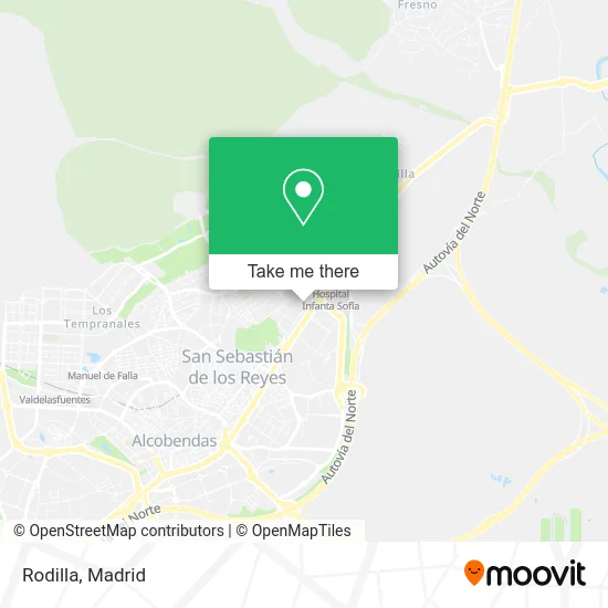
See Rodilla, San Sebastián De Los Reyes, on the map
Public Transit to Rodilla in San Sebastián De Los Reyes
Wondering how to get to Rodilla in San Sebastián De Los Reyes? Moovit helps you find the best way to get to Rodilla with step-by-step directions from the nearest public transit station.
Moovit provides free maps and live directions to help you navigate through your city. View schedules, routes, timetables, and find out how long does it take to get to Rodilla in real time.
Looking for the nearest stop or station to Rodilla? Check out this list of stops closest to your destination: Isla Graciosa - Antena 3; P.º Europa - Gta. Antonio Gaudí; Alonso Z. Vicente - Av. Tenerife; Hospital Infanta Sofía; P.º Europa - Hospital Infanta Sofía; Alcobendas - San Sebastián De Los Reyes.
Bus: 152C, 161, 183, N102, 171, 180, 181, 182, 7, 166, 210.Train: C4A.Metro: M-10.
Want to see if there’s another route that gets you there at an earlier time? Moovit helps you find alternative routes or times. Get directions from and directions to Rodilla easily from the Moovit App or Website.
We make riding to Rodilla easy, which is why over 1.5 million users, including users in San Sebastián De Los Reyes, trust Moovit as the best app for public transit. You don’t need to download an individual bus app or train app, Moovit is your all-in-one transit app that helps you find the best bus time or train time available.
For information on prices of bus, metro and train, costs and ride fares to Rodilla, please check the Moovit app.
Use the app to navigate to popular places including to the airport, hospital, stadium, grocery store, mall, coffee shop, school, college, and university.
Rodilla Address: Calle Isla Graciosa, 13 28703 San Sebastián de los Reyes street in San Sebastián De Los Reyes
- La Sexta,
- Antena 3 Televisión,
- ATRESMEDIA,
- Onda Cero Radio,
- Redacción La Sexta Noticias,
- Europa FM,
- Plató Espejo Público,
- El Hormiguero 3.0,
- Grupo Atresmedia - Antena 3,
- Ozone Bowling,
- Calle Fuerteventura, 21,
- Restaurante Gastrobar,
- Optimarket,
- Bazar Chino Zentral Chinesse,
- Edificio Moncayo,
- Avenida Isla Graciosa,
- Hotel Sb Express Madrid Norte,
- Avenida de Europa 11,
- LIDL,
- Academia Just Dance
Places Near Rodilla (San Sebastián De Los Reyes)
- Hospital Universitario La Paz, Madrid,
- Plaza Mayor, Madrid,
- Hospital Clínico Universitario San Carlos, Madrid,
- Mendez Alvaro, Madrid,
- Sala La Riviera, Madrid,
- Centro Comercial La Gavia, Área Metropolitana De Madrid Y Corredor Del Henares,
- Plenilunio, Área Metropolitana De Madrid Y Corredor Del Henares,
- Wizink Center, Madrid,
- Tres Aguas, Alcorcón,
- Centro Comercial Islazul, Área Metropolitana De Madrid Y Corredor Del Henares,
- Mercadillo de Majadahonda, Majadahonda,
- Estadio Wanda Metropolitano, Área Metropolitana De Madrid Y Corredor Del Henares,
- Nassica, Área Metropolitana De Madrid Y Corredor Del Henares,
- Centro Comercial La Vaguada, Área Metropolitana De Madrid Y Corredor Del Henares,
- Centro Comercial Oasiz Madrid, Área Metropolitana De Madrid Y Corredor Del Henares,
- Palacio De Vistalegre, Área Metropolitana De Madrid Y Corredor Del Henares,
- Calle de López de Hoyos 169, Madrid,
- Hospital Universitario Ramón y Cajal, Madrid,
- Estacion de Chamartin, Madrid,
- Rastro De Madrid, Área Metropolitana De Madrid Y Corredor Del Henares
How to get to popular places in Madrid with public transit
Get around San Sebastián De Los Reyes by public transit!
Traveling around San Sebastián De Los Reyes has never been so easy. See step by step directions as you travel to any attraction, street or major public transit station. View bus and train schedules, arrival times, service alerts and detailed routes on a map, so you know exactly how to get to anywhere in San Sebastián De Los Reyes.
When traveling to any destination around San Sebastián De Los Reyes use Moovit's Live Directions with Get Off Notifications to know exactly where and how far to walk, how long to wait for your line, and how many stops are left. Moovit will alert you when it's time to get off — no need to constantly re-check whether yours is the next stop.
Wondering how to use public transit in San Sebastián De Los Reyes or how to pay for public transit in San Sebastián De Los Reyes? Moovit public transit app can help you navigate your way with public transit easily, and at minimum cost. It includes public transit fees, ticket prices, and costs. Looking for a map of San Sebastián De Los Reyes public transit lines? Moovit public transit app shows all public transit maps in San Sebastián De Los Reyes with all Bus, Train, Metro and Light Rail routes and stops on an interactive map.
Madrid has 4 transit type(s), including: Bus, Train, Metro and Light Rail, operated by several transit agencies, including Metro de Madrid, Metro Ligero, Tranvía de Parla, Renfe Cercanías - Servicios de Autobús especiales, Renfe Cercanias, Renfe Cercanías, EMT, Interurbanos, Urbanos de Alcalá de Henares, Urbanos de Alcobendas, Urbanos de Alcorcón, Urbanos de Algete, Urbanos de Aranjuez, Urbanos de Arganda del Rey and Urbanos de Arroyomolinos