How to get to Roger Boyce by bus?
Click on the bus route to see step by step directions with maps, line arrival times and updated time schedules.
From Annapolis Mall, Anne Arundel County
62 minFrom Glen Burnie, MD, Anne Arundel County
170 minFrom Archbishop Spalding High School, Severn
198 minFrom Anne Arundel Community College, Anne Arundel County
128 minFrom Amazon Fulfillment Center-DCA1, Baltimore County
227 minFrom Pasadena, Maryland, Anne Arundel County
146 minFrom MVA Glen Burnie, Anne Arundel County
180 minFrom Dundalk, Maryland, Baltimore County
193 min
Bus stops near Roger Boyce in Queen Anne's County
Bus lines to Roger Boyce in Queen Anne's County
What are the closest stations to Roger Boyce?
The closest stations to Roger Boyce are:
- Harbor View Apts is 939 yards away, 12 min walk.
- Kent Towne Dollar Tree (Chester) is 1153 yards away, 14 min walk.
- Castle Marina P & R is 1951 yards away, 23 min walk.
Which bus lines stop near Roger Boyce?
These bus lines stop near Roger Boyce: 210, 220, 3.
What’s the nearest bus station to Roger Boyce in Queen Anne's County?
The nearest bus station to Roger Boyce in Queen Anne's County is Harbor View Apts. It’s a 12 min walk away.
What time is the first bus to Roger Boyce in Queen Anne's County?
The 210 is the first bus that goes to Roger Boyce in Queen Anne's County. It stops nearby at 5:30 AM.
What time is the last bus to Roger Boyce in Queen Anne's County?
The 210 is the last bus that goes to Roger Boyce in Queen Anne's County. It stops nearby at 7:22 PM.
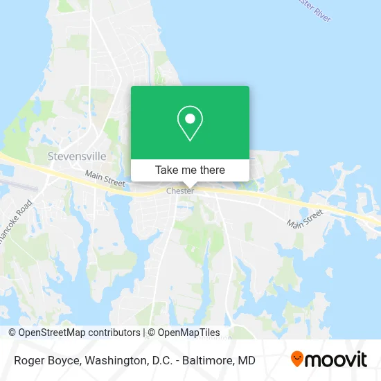
See Roger Boyce, Queen Anne's County, on the map
Public Transit to Roger Boyce in Queen Anne's County
Wondering how to get to Roger Boyce in Queen Anne's County? Moovit helps you find the best way to get to Roger Boyce with step-by-step directions from the nearest public transit station.
Moovit provides free maps and live directions to help you navigate through your city. View schedules, routes, timetables, and find out how long does it take to get to Roger Boyce in real time.
Looking for the nearest stop or station to Roger Boyce? Check out this list of stops closest to your destination: Harbor View Apts; Kent Towne Dollar Tree (Chester); Castle Marina P & R.
Bus: 210, 220, 3, 2, 1.
Want to see if there’s another route that gets you there at an earlier time? Moovit helps you find alternative routes or times. Get directions from and directions to Roger Boyce easily from the Moovit App or Website.
We make riding to Roger Boyce easy, which is why over 1.7 million users, including users in Queen Anne's County, trust Moovit as the best app for public transit. You don’t need to download an individual bus app or train app, Moovit is your all-in-one transit app that helps you find the best bus time or train time available.
For information on prices of bus and train, costs and ride fares to Roger Boyce, please check the Moovit app.
Use the app to navigate to popular places including to the airport, hospital, stadium, grocery store, mall, coffee shop, school, college, and university.
Roger Boyce Address: 1563 Postal Rd street in Queen Anne's County
- Stevensville MD USA,
- Kent Island Express,
- Stevensville Park & Ride ( Near MD 8 & US 50),
- The Inn at Chesapeake Bay Beach Club,
- 734 Long Point Rd,
- Matthew Reynolds,
- 3601 Main St,
- SH- Jackson Creek Ln,
- MD-835,
- 206 Jackson Creek Ln,
- 113 Creek Ct,
- Long Point Park,
- MD-18,
- Parks MD-18,
- Creek Rd MD-835,
- Royal Farms - Tesla Supercharger,
- Air Conditioning Repair,
- ROYAL FARMS,
- 206 Jackson Creek Rd,
- Royal Farms
Places Near Roger Boyce (Queen Anne's County)
- Rock Creek Tennis Center, Washington,
- Georgetown, Washington,
- M&T Bank Stadium, Baltimore,
- Warner Theatre, Washington,
- Museum Of The Bible, Washington,
- Capital One Arena, Washington,
- Marriott Marquis Washington, DC, Washington,
- National Theatre, Washington,
- National Museum of African American History and Culture, Washington,
- Sibley Memorial Hospital, Washington,
- PG Mall, Prince George's County,
- National Zoo, Washington,
- Amazon Hq2, Arlington County,
- The Anthem, Washington,
- Pennsylvania Ave NW (3rd st and pennsylvania), Washington,
- Washington DC VA Medical Center, Washington,
- Westfield Montgomery Mall, Montgomery County,
- Camden Yards, Baltimore,
- Basilica of the National Shrine, Washington,
- Washington National Cathedral, Washington
How to get to popular places in Washington, D.C. - Baltimore, MD with public transit
Get around Queen Anne's County by public transit!
Traveling around Queen Anne's County has never been so easy. See step by step directions as you travel to any attraction, street or major public transit station. View bus and train schedules, arrival times, service alerts and detailed routes on a map, so you know exactly how to get to anywhere in Queen Anne's County.
When traveling to any destination around Queen Anne's County use Moovit's Live Directions with Get Off Notifications to know exactly where and how far to walk, how long to wait for your line, and how many stops are left. Moovit will alert you when it's time to get off — no need to constantly re-check whether yours is the next stop.
Wondering how to use public transit in Queen Anne's County or how to pay for public transit in Queen Anne's County? Moovit public transit app can help you navigate your way with public transit easily, and at minimum cost. It includes public transit fees, ticket prices, and costs. Looking for a map of Queen Anne's County public transit lines? Moovit public transit app shows all public transit maps in Queen Anne's County with all Bus, Train, Metro, Light Rail and Ferry routes and stops on an interactive map.
Washington, D.C. - Baltimore, MD has 5 transit type(s), including: Bus, Train, Metro, Light Rail and Ferry, operated by several transit agencies, including WMATA, Montgomery County Ride On, Fairfax Connector, TheBus, PRTC, DASH - Alexandria, Arlington Transit (ART), RTA of Central Maryland, MDOT MTA, MDOT MTA Light RailLink, MDOT MTA Commuter Bus, MDOT MTA Local Bus, FXBGO!, Virginia Railway Express (VRE) and MARC