How to get to Rohini Building by bus?
Click on the bus route to see step by step directions with maps, line arrival times and updated time schedules.
From Breach Candy, Malabar Hill
42 minFrom Malabar Hill, Malabar Hill
36 minFrom Sardar Pav Bhaji, Malabar Hill
38 minFrom Four Seasons Hotel Mumbai, Worli
49 minFrom Phoenix Mall, Worli
59 minFrom Nehru Science Centre, Worli
51 minFrom Mumbai Port Trust Yellow Gate, Colaba
31 minFrom Maratha Mandir Theatre, Byculla
42 minFrom Charity Commissioner's Office, Worli
53 minFrom Palladium, Worli
59 min
How to get to Rohini Building by metro?
Click on the metro route to see step by step directions with maps, line arrival times and updated time schedules.
From Malabar Hill, Malabar Hill
63 minFrom Sardar Pav Bhaji, Malabar Hill
53 minFrom Four Seasons Hotel Mumbai, Worli
52 minFrom Phoenix Mall, Worli
54 minFrom Nehru Science Centre, Worli
49 minFrom Mumbai Port Trust Yellow Gate, Colaba
57 minFrom Maratha Mandir Theatre, Byculla
45 minFrom Charity Commissioner's Office, Worli
51 minFrom Palladium, Worli
56 min
Bus stops near Rohini Building in Colaba
Metro station near Rohini Building in Colaba
- Vidhan Bhavan, 4 min walk,VIEW
Ferry stations near Rohini Building in Colaba
Bus lines to Rohini Building in Colaba
- A-103, RC Church - Kamala Nehru Park (Malabar Hill),VIEW
- A-106, Kamala Nehru Park (Malabar Hill) - RC Church,VIEW
- A-123, Vasantrao Naik Chowk (Tardeo) - RC Church,VIEW
- 3, Navy Nagar (Colaba),VIEW
- 11 LTD, Bandra Colony Bus Station,VIEW
- A-125, Worli Depot,VIEW
- A-137, Ahilyabai Holkar Chowk (Churchgate),VIEW
- 139, Colaba Depot (Electric House),VIEW
- 139, Geetanagar (Colaba),VIEW
What are the closest stations to Rohini Building?
The closest stations to Rohini Building are:
- RC Church is 89 meters away, 2 min walk.
- Vidhan Bhavan is 262 meters away, 4 min walk.
- Dhobi Ghat (Navy Nagar) is 1045 meters away, 14 min walk.
- Gateway Of India (Colaba) is 1617 meters away, 21 min walk.
- Sassoon Docks is 2873 meters away, 37 min walk.
Which bus lines stop near Rohini Building?
These bus lines stop near Rohini Building: A-103, A-106, A-123.
Which metro line stops near Rohini Building?
LINE 3 (Cuffe Parade)
What’s the nearest metro station to Rohini Building in Colaba?
The nearest metro station to Rohini Building in Colaba is Vidhan Bhavan. It’s a 4 min walk away.
What’s the nearest bus station to Rohini Building in Colaba?
The nearest bus station to Rohini Building in Colaba is RC Church. It’s a 2 min walk away.
What’s the nearest ferry station to Rohini Building in Colaba?
The nearest ferry station to Rohini Building in Colaba is Gateway Of India (Colaba). It’s a 21 min walk away.
What time is the first metro to Rohini Building in Colaba?
The LINE 3 is the first metro that goes to Rohini Building in Colaba. It stops nearby at 5:55 AM.
What time is the last metro to Rohini Building in Colaba?
The LINE 3 is the last metro that goes to Rohini Building in Colaba. It stops nearby at 11:23 PM.
What time is the first bus to Rohini Building in Colaba?
The A-103 is the first bus that goes to Rohini Building in Colaba. It stops nearby at 5:49 AM.
What time is the last bus to Rohini Building in Colaba?
The 3 is the last bus that goes to Rohini Building in Colaba. It stops nearby at 11:39 PM.
What time is the first ferry to Rohini Building in Colaba?
The ⛴ is the first ferry that goes to Rohini Building in Colaba. It stops nearby at 4:50 AM.
What time is the last ferry to Rohini Building in Colaba?
The ⛴ is the last ferry that goes to Rohini Building in Colaba. It stops nearby at 8:25 PM.
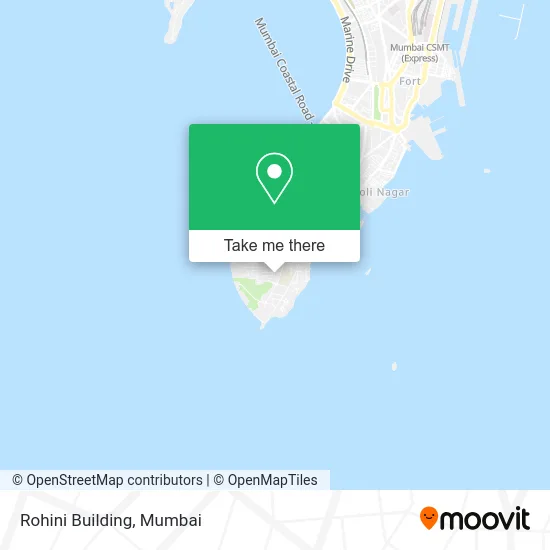
See Rohini Building, Colaba, on the map
Public Transit to Rohini Building in Colaba
Wondering how to get to Rohini Building in Colaba? Moovit helps you find the best way to get to Rohini Building with step-by-step directions from the nearest public transit station.
Moovit provides free maps and live directions to help you navigate through your city. View schedules, routes, timetables, and find out how long does it take to get to Rohini Building in real time.
Looking for the nearest stop or station to Rohini Building? Check out this list of stops closest to your destination: RC Church; Vidhan Bhavan; Dhobi Ghat (Navy Nagar); Gateway Of India (Colaba); Sassoon Docks.
Bus: A-103, A-106, A-123, 3, 11 LTD, A-125, A-137, 139.Metro: LINE 3.Ferry: ⛴, ⛴, ⛴, ⛴.
Want to see if there’s another route that gets you there at an earlier time? Moovit helps you find alternative routes or times. Get directions from and directions to Rohini Building easily from the Moovit App or Website.
We make riding to Rohini Building easy, which is why over 1.7 million users, including users in Colaba, trust Moovit as the best app for public transit. You don’t need to download an individual bus app or train app, Moovit is your all-in-one transit app that helps you find the best bus time or train time available.
For information on prices of bus and metro, costs and ride fares to Rohini Building, please check the Moovit app.
Use the app to navigate to popular places including to the airport, hospital, stadium, grocery store, mall, coffee shop, school, college, and university.
Rohini Building Address: Mumbai 400005 MH street in Colaba
- Arjun Building A,
- NOFRA,
- Chanakya,
- Sofa Cleaning in South Mumbai & Steem Iron,
- Nofra Building,
- Owlogic,
- Navy Nagar,
- Deeana Infotech,
- Tilottama Apartment,
- R K Computers,
- Army Officers Mess Quarters,
- Dockyard House,
- The Big Banyan Tree,
- Robert Road,
- Ncc Mess,
- St Joseph Church,
- Mg & G Area Offers Mess,
- Dargah Road,
- Nofra Administration Office,
- Kapoor Builders and Realtors
Places Near Rohini Building (Colaba)
- Worli Sea Face,
- Gateway Of India,
- Ikea, Worli,
- INFINITI Mall (Infinity Mall, andheri), Versova,
- Govardhan Ecovillage, Palghar (St),
- Mumbai University, Kalina,
- R CITY MALL, Ghatkopar East,
- Bombay Exhibition Center, Goregaon,
- Bhaucha Dhakka,
- Oberoi Mall, Dindoshi,
- Oberoi Sky City, Borivali East,
- J. J. Hospital, Byculla,
- Malabar Hill, Malabar Hill,
- Rani Baug, Byculla,
- Inorbit Mall, Malad West,
- Dome @ Nsci - Svp Stadium Mumbai, Worli,
- TCS Olympus, Thane,
- Hinduja Hospital, Mahim,
- Shanmukhananda Hall, Sion , Mumbai, Sion Koliwada,
- NESCO, Goregaon
How to get to popular places in Mumbai with public transit
Get around Colaba by public transit!
Traveling around Colaba has never been so easy. See step by step directions as you travel to any attraction, street or major public transit station. View bus and train schedules, arrival times, service alerts and detailed routes on a map, so you know exactly how to get to anywhere in Colaba.
When traveling to any destination around Colaba use Moovit's Live Directions with Get Off Notifications to know exactly where and how far to walk, how long to wait for your line, and how many stops are left. Moovit will alert you when it's time to get off — no need to constantly re-check whether yours is the next stop.
Wondering how to use public transit in Colaba or how to pay for public transit in Colaba? Moovit public transit app can help you navigate your way with public transit easily, and at minimum cost. It includes public transit fees, ticket prices, and costs. Looking for a map of Colaba public transit lines? Moovit public transit app shows all public transit maps in Colaba with all Bus, Train, Metro and Ferry routes and stops on an interactive map.
Mumbai has 4 transit type(s), including: Bus, Train, Metro and Ferry, operated by several transit agencies, including MMMOCL (Maha Mumbai Metro Operation Corporation Ltd.), NMM CIDCO (Navi Mumbai Metro Maha Metro), Reliance Mumbai Metro, MMRCL (Mumbai Metro Rail Corporation Ltd), BEST (Brihanmumbai Electricity Supply & Transport), BEST AC Services, A.C.Trains (Air-Conditioning Trains), W.R. (Western Railways), C.R. (Central Railways), C.R.MEMU (Central Railways Shuttle MEMU Trains), H.R. (Harbour Railways), T.R.(Trans Harbour Railways), U.R.(Uran-Ulwe Railways), I.R.(Indian Railways) and TMT (Thane Municipal Transport)