How to get to Rohinjan Container Yard by bus?
Click on the bus route to see step by step directions with maps, line arrival times and updated time schedules.
How to get to Rohinjan Container Yard by train?
Click on the train route to see step by step directions with maps, line arrival times and updated time schedules.
How to get to Rohinjan Container Yard by metro?
Click on the metro route to see step by step directions with maps, line arrival times and updated time schedules.
Metro station near Rohinjan Container Yard in Panvel
- Pethpada, 32 min walk,VIEW
Train station near Rohinjan Container Yard in Panvel
- Taloja Panchnand, 41 min walk,VIEW
What are the closest stations to Rohinjan Container Yard?
The closest stations to Rohinjan Container Yard are:
- Pethpada is 2467 meters away, 32 min walk.
- Taloja Panchnand is 3235 meters away, 41 min walk.
Which bus lines stop near Rohinjan Container Yard?
These bus lines stop near Rohinjan Container Yard: 40AC, 53AC, 55AC.
Which train line stops near Rohinjan Container Yard?
MEMU (Diva (F))
Which metro line stops near Rohinjan Container Yard?
NMM 1 (Pendhar)
What time is the first metro to Rohinjan Container Yard in Panvel?
The NMM 1 is the first metro that goes to Rohinjan Container Yard in Panvel. It stops nearby at 6:00 AM.
What time is the last metro to Rohinjan Container Yard in Panvel?
The NMM 1 is the last metro that goes to Rohinjan Container Yard in Panvel. It stops nearby at 10:27 PM.
What time is the first train to Rohinjan Container Yard in Panvel?
The MEMU is the first train that goes to Rohinjan Container Yard in Panvel. It stops nearby at 7:06 AM.
What time is the last train to Rohinjan Container Yard in Panvel?
The MEMU is the last train that goes to Rohinjan Container Yard in Panvel. It stops nearby at 8:20 PM.
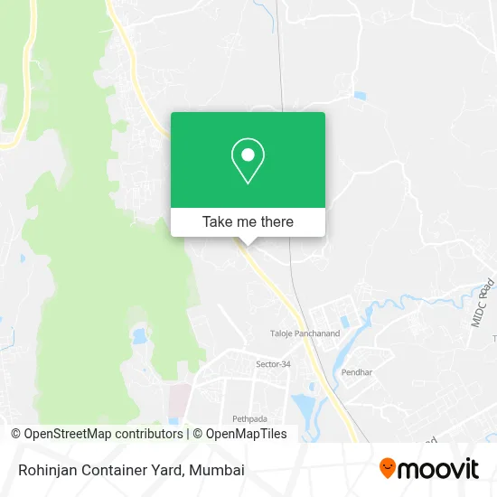
See Rohinjan Container Yard, Panvel, on the map
Public Transit to Rohinjan Container Yard in Panvel
Wondering how to get to Rohinjan Container Yard in Panvel? Moovit helps you find the best way to get to Rohinjan Container Yard with step-by-step directions from the nearest public transit station.
Moovit provides free maps and live directions to help you navigate through your city. View schedules, routes, timetables, and find out how long does it take to get to Rohinjan Container Yard in real time.
Looking for the nearest stop or station to Rohinjan Container Yard? Check out this list of stops closest to your destination: Pethpada; Taloja Panchnand.
Bus: 40AC, 53AC, 55AC.Train: MEMU.Metro: NMM 1, LINE 1.
Want to see if there’s another route that gets you there at an earlier time? Moovit helps you find alternative routes or times. Get directions from and directions to Rohinjan Container Yard easily from the Moovit App or Website.
We make riding to Rohinjan Container Yard easy, which is why over 1.5 million users, including users in Panvel, trust Moovit as the best app for public transit. You don’t need to download an individual bus app or train app, Moovit is your all-in-one transit app that helps you find the best bus time or train time available.
For information on prices of bus, train and metro, costs and ride fares to Rohinjan Container Yard, please check the Moovit app.
Use the app to navigate to popular places including to the airport, hospital, stadium, grocery store, mall, coffee shop, school, college, and university.
Rohinjan Container Yard Address: Panvel Sub-District 410208 MH street in Panvel
- Dr Pratap Patil Clinic,
- Shri Vitthal Rakhumai Mandir,
- Tci XPS,
- Sai Baba Mandir,
- Rohinjan,
- Mobis India,
- Cemetery,
- Swarga Dwar,
- Posh Metal Ind,
- Kiravli Village,
- Swapnapurti,
- Vishal Restaurant,
- Valley Shilp Road,
- Taloja Jail,
- Sri Sathya Sai Sanjeevani Hospital,
- Taloja Jail Road,
- Owe Village,
- Taloja Central Jail,
- Adivali,
- Sai Mannat
Places Near Rohinjan Container Yard (Panvel)
- R CITY MALL, Ghatkopar East,
- Oberoi Mall, Dindoshi,
- Worli Sea Face,
- Oberoi Sky City, Borivali East,
- Mumbai University, Kalina,
- Ikea, Worli,
- Bombay Exhibition Center, Goregaon,
- INFINITI Mall (Infinity Mall, andheri), Versova,
- J. J. Hospital, Byculla,
- Hinduja Hospital, Mahim,
- Govardhan Ecovillage, Palghar (St),
- Juhu Beach,
- Dome @ Nsci - Svp Stadium Mumbai, Worli,
- Rani Baug, Byculla,
- Inorbit Mall, Malad West,
- Bhaucha Dhakka,
- TCS Olympus, Thane,
- Malabar Hill, Malabar Hill,
- Gateway Of India,
- NESCO, Goregaon
How to get to popular places in Mumbai with public transit
Get around Panvel by public transit!
Traveling around Panvel has never been so easy. See step by step directions as you travel to any attraction, street or major public transit station. View bus and train schedules, arrival times, service alerts and detailed routes on a map, so you know exactly how to get to anywhere in Panvel.
When traveling to any destination around Panvel use Moovit's Live Directions with Get Off Notifications to know exactly where and how far to walk, how long to wait for your line, and how many stops are left. Moovit will alert you when it's time to get off — no need to constantly re-check whether yours is the next stop.
Wondering how to use public transit in Panvel or how to pay for public transit in Panvel? Moovit public transit app can help you navigate your way with public transit easily, and at minimum cost. It includes public transit fees, ticket prices, and costs. Looking for a map of Panvel public transit lines? Moovit public transit app shows all public transit maps in Panvel with all Bus, Train, Metro and Ferry routes and stops on an interactive map.
Mumbai has 4 transit type(s), including: Bus, Train, Metro and Ferry, operated by several transit agencies, including MMMOCL (Maha Mumbai Metro Operation Corporation Ltd.), NMM CIDCO (Navi Mumbai Metro Maha Metro), Reliance Mumbai Metro, MMRCL (Mumbai Metro Rail Corporation Ltd), BEST (Brihanmumbai Electricity Supply & Transport), BEST AC Services, A.C.Trains (Air-Conditioning Trains), W.R. (Western Railways), C.R. (Central Railways), C.R.MEMU (Central Railways Shuttle MEMU Trains), H.R. (Harbour Railways), T.R.(Trans Harbour Railways), U.R.(Uran-Ulwe Railways), I.R.(Indian Railways) and TMT (Thane Municipal Transport)