How to get to Rohit Devnani, Md by bus?
Click on the bus route to see step by step directions with maps, line arrival times and updated time schedules.
From Emma Donnan Middle School, Indianapolis City (Balance)
52 minFrom Hinkle Fieldhouse, Indianapolis City (Balance)
48 minFrom IU Health Methodist Professional Center 1, Indianapolis City (Balance)
45 minFrom Broad Ripple Park Tennis Courts, Indianapolis City (Balance)
60 minFrom Emerson & Raymond, Indianapolis City (Balance)
55 minFrom Cloverskullco, Indianapolis City (Balance)
59 minFrom 4600 Sunset Ave Parking, Indianapolis City (Balance)
51 minFrom 10859 E Washington St Parking, Indianapolis City (Balance)
28 minFrom Eli Lilly Building 314, Indianapolis City (Balance)
49 min
Bus stops near Rohit Devnani, Md in Indianapolis City (Balance)
Bus lines to Rohit Devnani, Md in Indianapolis City (Balance)
What are the closest stations to Rohit Devnani, Md?
The closest stations to Rohit Devnani, Md are:
- 16th St & Irvington Ave is 538 yards away, 7 min walk.
- Ritter Ave & 13th St is 601 yards away, 8 min walk.
Which bus lines stop near Rohit Devnani, Md?
These bus lines stop near Rohit Devnani, Md: 10, 11, 3.
What’s the nearest bus station to Rohit Devnani, Md in Indianapolis City (Balance)?
The nearest bus station to Rohit Devnani, Md in Indianapolis City (Balance) is 16th St & Irvington Ave. It’s a 7 min walk away.
What time is the first bus to Rohit Devnani, Md in Indianapolis City (Balance)?
The 11 is the first bus that goes to Rohit Devnani, Md in Indianapolis City (Balance). It stops nearby at 5:04 AM.
What time is the last bus to Rohit Devnani, Md in Indianapolis City (Balance)?
The 10 is the last bus that goes to Rohit Devnani, Md in Indianapolis City (Balance). It stops nearby at 12:06 AM.
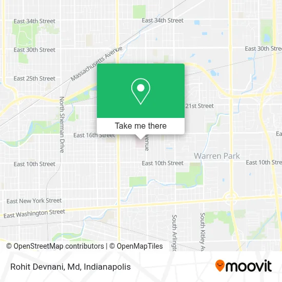
See Rohit Devnani, Md, Indianapolis City (Balance), on the map
Public Transit to Rohit Devnani, Md in Indianapolis City (Balance)
Wondering how to get to Rohit Devnani, Md in Indianapolis City (Balance)? Moovit helps you find the best way to get to Rohit Devnani, Md with step-by-step directions from the nearest public transit station.
Moovit provides free maps and live directions to help you navigate through your city. View schedules, routes, timetables, and find out how long does it take to get to Rohit Devnani, Md in real time.
Looking for the nearest stop or station to Rohit Devnani, Md? Check out this list of stops closest to your destination: 16th St & Irvington Ave; Ritter Ave & 13th St.
Bus: 10, 11, 3.
Want to see if there’s another route that gets you there at an earlier time? Moovit helps you find alternative routes or times. Get directions from and directions to Rohit Devnani, Md easily from the Moovit App or Website.
We make riding to Rohit Devnani, Md easy, which is why over 1.5 million users, including users in Indianapolis City (Balance), trust Moovit as the best app for public transit. You don’t need to download an individual bus app or train app, Moovit is your all-in-one transit app that helps you find the best bus time or train time available.
For information on prices of bus, costs and ride fares to Rohit Devnani, Md, please check the Moovit app.
Use the app to navigate to popular places including to the airport, hospital, stadium, grocery store, mall, coffee shop, school, college, and university.
Rohit Devnani, Md Address: 1400 N Ritter Ave Ste 375 street in Indianapolis City (Balance)
- Joseph W. Yedlicka, MD,
- Thomas H. Ledyard, MD,
- Lauren Gorden, Pa,
- Community Physician Network, Infectious Disease Care - East,
- Community Hospital East,
- Pablo M. Bedano, MD,
- Michael C. McMains, MD - East Office,
- Farah Doxey, Pa,
- Community Physician Network, Orthopedic Specialty Care - East 351,
- Jagadeesh Yella, MD,
- Monica Elizabeth Mazda, MD,
- Howard Dash, MD,
- Meghan Leslie Beer, do,
- Kaitlin Michelle Woolley, MD,
- Haddad Hany, MD,
- General Surgical Care East,
- George John Rubeiz, MD,
- Karen Meighen MD,
- Heather Lynette Benson, MD,
- Community Physician Network, Ear, Nose & Throat Care - East
Places Near Rohit Devnani, Md (Indianapolis City (Balance))
- St. Vincent entrance #1, Indianapolis City (Balance),
- Lilly Corporate Center (Eli Lilly & Co), Indianapolis City (Balance),
- Eskenazi Hospital, Indianapolis City (Balance),
- Indiana Convention Center, Indianapolis City (Balance),
- Cotter's Massage Parlor With Happy Endings, Indianapolis City (Balance),
- Lucas Oil Stadium, Indianapolis City (Balance),
- St. Vincent Hospital - Indianapolis, Indianapolis City (Balance),
- I-465 / I-65 Interchange, Indianapolis City (Balance),
- Jersey Barn, Indianapolis City (Balance),
- Indiana, Indianapolis City (Balance),
- 119 W 19th St Parking, Indianapolis City (Balance),
- Methodist Hospital of Indianapolis, Indianapolis City (Balance),
- Indianapolis Motor Speedway, Speedway,
- Castleton Square Mall, Indianapolis,
- Train Ride At Castleton Mall, Indianapolis City (Balance),
- THE BALT, Indianapolis City (Balance),
- Plainfield, IN, Plainfield,
- I U Health Methodist Hospital, Indianapolis City (Balance),
- Indianapolis Airport Zone 2, Indianapolis City (Balance),
- Gainbridge Fieldhouse, Indianapolis City (Balance)
How to get to popular places in Indianapolis with public transit
Get around Indianapolis City (Balance) by public transit!
Traveling around Indianapolis City (Balance) has never been so easy. See step by step directions as you travel to any attraction, street or major public transit station. View bus and train schedules, arrival times, service alerts and detailed routes on a map, so you know exactly how to get to anywhere in Indianapolis City (Balance).
When traveling to any destination around Indianapolis City (Balance) use Moovit's Live Directions with Get Off Notifications to know exactly where and how far to walk, how long to wait for your line, and how many stops are left. Moovit will alert you when it's time to get off — no need to constantly re-check whether yours is the next stop.
Wondering how to use public transit in Indianapolis City (Balance) or how to pay for public transit in Indianapolis City (Balance)? Moovit public transit app can help you navigate your way with public transit easily, and at minimum cost. It includes public transit fees, ticket prices, and costs. Looking for a map of Indianapolis City (Balance) public transit lines? Moovit public transit app shows all public transit maps in Indianapolis City (Balance) with all bus routes and stops on an interactive map.
Indianapolis has 1 transit type(s), including: bus, operated by several transit agencies, including IndyGo, FlixBus-us and Greyhound-us