How to get to Rohleder R & C by bus?
Click on the bus route to see step by step directions with maps, line arrival times and updated time schedules.
From Loyola University Maryland, Baltimore
53 minFrom Walmart, Baltimore
47 minFrom Oriole Park at Camden Yards, Baltimore
54 minFrom Inner Harbor, Baltimore
55 minFrom Hampden, Baltimore
60 minFrom I-83 Exit 5 (Maryland Ave/Charles St), Baltimore
70 minFrom Federal Hill, Baltimore
50 minFrom City Hall Fields, Baltimore
48 minFrom National Aquarium-Baltimore, Baltimore
56 minFrom I-695 @ Exit 18 (Liberty Rd/MD 26), Baltimore County
45 min
Bus stops near Rohleder R & C in Baltimore County
What are the closest stations to Rohleder R & C?
The closest stations to Rohleder R & C are:
- Ingleside Ave & Sunset Ave FS Eb is 621 yards away, 8 min walk.
- Harwall Rd & Ingleside Ave Wb is 686 yards away, 9 min walk.
- Woodlawn Dr & Parallel Dr Sb is 3118 yards away, 37 min walk.
Which bus lines stop near Rohleder R & C?
These bus lines stop near Rohleder R & C: 34, 78.
What’s the nearest bus station to Rohleder R & C in Baltimore County?
The nearest bus station to Rohleder R & C in Baltimore County is Ingleside Ave & Sunset Ave FS Eb. It’s a 8 min walk away.
What time is the first bus to Rohleder R & C in Baltimore County?
The 78 is the first bus that goes to Rohleder R & C in Baltimore County. It stops nearby at 4:13 AM.
What time is the last bus to Rohleder R & C in Baltimore County?
The 78 is the last bus that goes to Rohleder R & C in Baltimore County. It stops nearby at 2:26 AM.
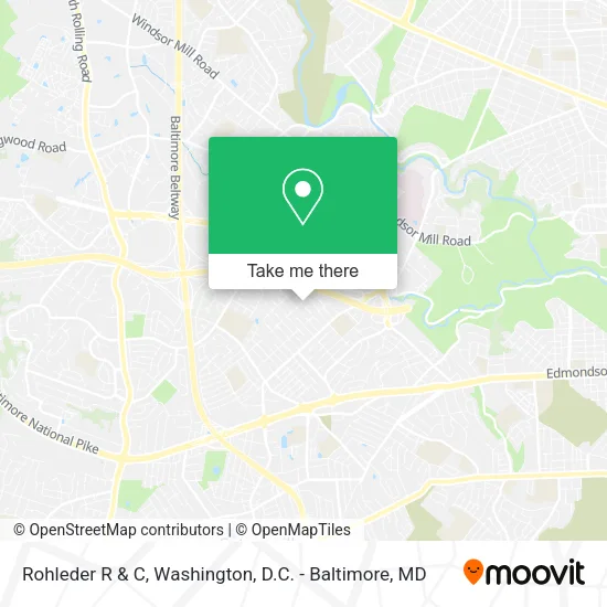
See Rohleder R & C, Baltimore County, on the map
Public Transit to Rohleder R & C in Baltimore County
Wondering how to get to Rohleder R & C in Baltimore County? Moovit helps you find the best way to get to Rohleder R & C with step-by-step directions from the nearest public transit station.
Moovit provides free maps and live directions to help you navigate through your city. View schedules, routes, timetables, and find out how long does it take to get to Rohleder R & C in real time.
Looking for the nearest stop or station to Rohleder R & C? Check out this list of stops closest to your destination: Ingleside Ave & Sunset Ave FS Eb; Harwall Rd & Ingleside Ave Wb; Woodlawn Dr & Parallel Dr Sb.
Bus: 34, 78, 37.
Want to see if there’s another route that gets you there at an earlier time? Moovit helps you find alternative routes or times. Get directions from and directions to Rohleder R & C easily from the Moovit App or Website.
We make riding to Rohleder R & C easy, which is why over 1.5 million users, including users in Baltimore County, trust Moovit as the best app for public transit. You don’t need to download an individual bus app or train app, Moovit is your all-in-one transit app that helps you find the best bus time or train time available.
For information on prices of bus, costs and ride fares to Rohleder R & C, please check the Moovit app.
Use the app to navigate to popular places including to the airport, hospital, stadium, grocery store, mall, coffee shop, school, college, and university.
Rohleder R & C Address: 1501 Kent Ave street in Baltimore County
- Cameo Construction,
- Mason's Variety Home Improvements,
- Baltimore Virginia Pl,
- Kays Management,
- Lucky Irish Plumbing,
- Videoqueen Photography,
- Sosa Consulting,
- The Arc Baltimore,
- Hotpoint Factory Certified Appliance Repair,
- Blu Bully Apparel,
- 5914 Franklin Avenue,
- Ingleside Ave Franklin Ave,
- Ray C Helving & Sons,
- McPherson Property Services,
- Mariachi Esmeralda,
- Catonsville Manor,
- Catonsville Manor ,
- The Reserve at West Hills,
- Camren's Cleaning & Janitorial Service,
- White Diamond Services
Places Near Rohleder R & C (Baltimore County)
- Westfield Montgomery Mall, Montgomery County,
- The Anthem, Washington,
- Sibley Memorial Hospital, Washington,
- National Theatre, Washington,
- M&T Bank Stadium, Baltimore,
- Marriott Marquis Washington, DC, Washington,
- Amazon Hq2, Arlington County,
- Basilica of the National Shrine, Washington,
- Camden Yards, Baltimore,
- Warner Theatre, Washington,
- Pennsylvania Ave NW (3rd st and pennsylvania), Washington,
- Museum Of The Bible, Washington,
- National Zoo, Washington,
- Georgetown, Washington,
- Rock Creek Tennis Center, Washington,
- Capital One Arena, Washington,
- Washington National Cathedral, Washington,
- Washington DC VA Medical Center, Washington,
- PG Mall, Prince George's County,
- National Museum of African American History and Culture, Washington
How to get to popular places in Washington, D.C. - Baltimore, MD with public transit
Get around Baltimore County by public transit!
Traveling around Baltimore County has never been so easy. See step by step directions as you travel to any attraction, street or major public transit station. View bus and train schedules, arrival times, service alerts and detailed routes on a map, so you know exactly how to get to anywhere in Baltimore County.
When traveling to any destination around Baltimore County use Moovit's Live Directions with Get Off Notifications to know exactly where and how far to walk, how long to wait for your line, and how many stops are left. Moovit will alert you when it's time to get off — no need to constantly re-check whether yours is the next stop.
Wondering how to use public transit in Baltimore County or how to pay for public transit in Baltimore County? Moovit public transit app can help you navigate your way with public transit easily, and at minimum cost. It includes public transit fees, ticket prices, and costs. Looking for a map of Baltimore County public transit lines? Moovit public transit app shows all public transit maps in Baltimore County with all Bus, Train, Metro, Light Rail and Ferry routes and stops on an interactive map.
Washington, D.C. - Baltimore, MD has 5 transit type(s), including: Bus, Train, Metro, Light Rail and Ferry, operated by several transit agencies, including WMATA, Montgomery County Ride On, Fairfax Connector, TheBus, PRTC, DASH - Alexandria, Arlington Transit (ART), RTA of Central Maryland, MDOT MTA, MDOT MTA Light RailLink, MDOT MTA Commuter Bus, MDOT MTA Local Bus, FXBGO!, Virginia Railway Express (VRE) and MARC