How to get to Rok Enterprises by bus?
Click on the bus route to see step by step directions with maps, line arrival times and updated time schedules.
From North Miami Senior Highschool, Miami
52 minFrom Dolphin Mall, Miami
71 minFrom Broward College South Campus, Miramar-Pembroke Pines
93 minFrom Miami Jackson North Medical Center, Miami
60 minFrom Oakwood Plaza, Hollywood
70 minFrom Surfside Beach, Miami Beach
53 minFrom Yellow Green Farmers Market, Hollywood
64 minFrom Miami Shores, Miami
49 minFrom Dania Beach, Hollywood
60 minFrom Fort Lauderdale airport terminal 3 Jet Blue, Hollywood
69 min
How to get to Rok Enterprises by train?
Click on the train route to see step by step directions with maps, line arrival times and updated time schedules.
Bus stops near Rok Enterprises in Miami
- Biscayne Bd & Ne 195 St, 3 min walk,VIEW
- Ne 203 St & 26 Av, 10 min walk,VIEW
- Biscayne Lake Gardens, 19 min walk,VIEW
- Biscayne Lane Gardens, 19 min walk,VIEW
- Avntura Bd & # 2845, 21 min walk,VIEW
- Mount Sinai, 21 min walk,VIEW
- Mt Sinai Hospital, 21 min walk,VIEW
- Bus Terminal at Aventura Mall, 22 min walk,VIEW
- Aventura Mall, 26 min walk,VIEW
Train station near Rok Enterprises in Miami
- Aventura, 37 min walk,VIEW
Bus lines to Rok Enterprises in Miami
- 3, 3 - Downtown Miami,VIEW
- 9, 9a - Aventura Mall Terminal Via 171 St,VIEW
- 183, 183 - Okeechobee Station,VIEW
- 203, 203 - Aventura Mall Terminal,VIEW
- 199, 199 - Aventura Mall Terminal,VIEW
- AVTPUR, Purple,VIEW
- SATURDAY NIGHT EXPRESS NORTH ROUTE, Aventura Mall Transit Terminal,VIEW
- SUNNYOR, Orange,VIEW
- GREEN EXPRESS ROUTE, Circular with library,VIEW
- RED EXPRESS ROUTE, Circular without library,VIEW
- SILVER EXPRESS ROUTE, Circular without Library,VIEW
- AVTGRN, Green,VIEW
- BLUE EXPRESS ROUTE, Circular without library,VIEW
- PURPLE EXPRESS ROUTE, Circular with library,VIEW
- SATURDAY NIGHT EXPRESS SOUTH ROUTE, Aventura Mall Transit Terminal,VIEW
- YELLOW EXPRESS ROUTE , Circular Without Library,VIEW
- 95, 95a - Aventura Mall Terminal Via Golden Glades Park & Ride,VIEW
- 100, 100 - Aventura Mall Terminal Via Beach,VIEW
- AVTYEL, Yellow,VIEW
- NMBEACB, City Of North Miami Beach B Route,VIEW
What are the closest stations to Rok Enterprises?
The closest stations to Rok Enterprises are:
- Biscayne Bd & Ne 195 St is 92 yards away, 3 min walk.
- Ne 203 St & 26 Av is 815 yards away, 10 min walk.
- Biscayne Lake Gardens is 1533 yards away, 19 min walk.
- Biscayne Lane Gardens is 1594 yards away, 19 min walk.
- Avntura Bd & # 2845 is 1727 yards away, 21 min walk.
- Mount Sinai is 1753 yards away, 21 min walk.
- Mt Sinai Hospital is 1783 yards away, 21 min walk.
- Bus Terminal at Aventura Mall is 1889 yards away, 22 min walk.
- Aventura Mall is 2095 yards away, 26 min walk.
- Aventura is 3120 yards away, 37 min walk.
Which bus lines stop near Rok Enterprises?
These bus lines stop near Rok Enterprises: 01, 06, 100, 101, 199, 203, 3, 9.
Which train line stops near Rok Enterprises?
BLFM (Wpt)
What’s the nearest bus station to Rok Enterprises in Miami?
The nearest bus station to Rok Enterprises in Miami is Biscayne Bd & Ne 195 St. It’s a 3 min walk away.
What time is the first train to Rok Enterprises in Miami?
The BLFM is the first train that goes to Rok Enterprises in Miami. It stops nearby at 6:09 AM.
What time is the last train to Rok Enterprises in Miami?
The BLFM is the last train that goes to Rok Enterprises in Miami. It stops nearby at 12:07 AM.
What time is the first bus to Rok Enterprises in Miami?
The 3 is the first bus that goes to Rok Enterprises in Miami. It stops nearby at 3:16 AM.
What time is the last bus to Rok Enterprises in Miami?
The 100 is the last bus that goes to Rok Enterprises in Miami. It stops nearby at 3:20 AM.
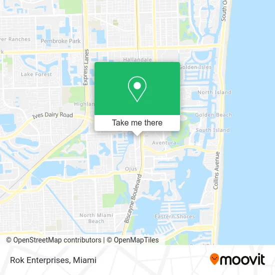
See Rok Enterprises, Miami, on the map
Public Transit to Rok Enterprises in Miami
Wondering how to get to Rok Enterprises in Miami? Moovit helps you find the best way to get to Rok Enterprises with step-by-step directions from the nearest public transit station.
Moovit provides free maps and live directions to help you navigate through your city. View schedules, routes, timetables, and find out how long does it take to get to Rok Enterprises in real time.
Looking for the nearest stop or station to Rok Enterprises? Check out this list of stops closest to your destination: Biscayne Bd & Ne 195 St; Ne 203 St & 26 Av; Biscayne Lake Gardens; Biscayne Lane Gardens; Avntura Bd & # 2845; Mount Sinai; Mt Sinai Hospital; Bus Terminal at Aventura Mall; Aventura Mall; Aventura.
Bus: 01, 06, 100, 101, 199, 203, 3, 9, 183, AVTPUR, SATURDAY NIGHT EXPRESS NORTH ROUTE, SUNNYOR.Train: BLFM.
Want to see if there’s another route that gets you there at an earlier time? Moovit helps you find alternative routes or times. Get directions from and directions to Rok Enterprises easily from the Moovit App or Website.
We make riding to Rok Enterprises easy, which is why over 1.5 million users, including users in Miami, trust Moovit as the best app for public transit. You don’t need to download an individual bus app or train app, Moovit is your all-in-one transit app that helps you find the best bus time or train time available.
For information on prices of bus and train, costs and ride fares to Rok Enterprises, please check the Moovit app.
Use the app to navigate to popular places including to the airport, hospital, stadium, grocery store, mall, coffee shop, school, college, and university.
Rok Enterprises Address: 19790 W Dixie Hwy Miami, FL 33180 street in Miami
- Preguntas Frecuentes,
- Imoro Logistics and Transportation Enterprise,
- Sophie Bay Harbor,
- Century 21,
- Deal Flow Realty LLC,
- Public Notary of Florida,
- Caesar Chukwuma,
- Advocacy for All Eisenberg & Baum, LLP,
- The Law Offices of Stephen B. Kass, P.C.,
- Oya Beauty,
- Viñas & Deluca,
- 360 Painting of Miami Gardens,
- Farber Law, P.A. Divorce and Family Law Firm,
- First Credit Repair,
- Garkor Home Improvement,
- AVIS,
- Aventura Station (Brightline),
- Brightline Aventura Station,
- Brightline Aventura,
- HomeGoods
Places Near Rok Enterprises (Miami)
- Aventura Mall, Miami,
- Sawgrass mall ( FL ), Miami Beach,
- Aventura Mall, Miami Beach,
- Wynwood, Miami,
- Port of Miami Cruise Terminal, Miami,
- Miami Design District, Miami,
- Dolphin Mall Bus, Miami,
- Keiser University Flagship Campus, West Palm Beach,
- Zoo Miami, Miami,
- Hard Rock Stadium, Miami Gardens,
- Miami Freedom Park, Miami,
- Miami VA Hospital, Miami,
- Marlins Park, Miami,
- Brickell City Centre, Miami,
- Richard E. Gerstein Justice Building, Miami,
- Little Havana, Miami,
- Sawgrass Mall, Miami,
- Dolphin Mall, Miami,
- Bayside Marketplace, Miami,
- Miami-Dade County Courthouse, Miami
How to get to popular places in Miami with public transit
Get around Miami by public transit!
Traveling around Miami has never been so easy. See step by step directions as you travel to any attraction, street or major public transit station. View bus and train schedules, arrival times, service alerts and detailed routes on a map, so you know exactly how to get to anywhere in Miami.
When traveling to any destination around Miami use Moovit's Live Directions with Get Off Notifications to know exactly where and how far to walk, how long to wait for your line, and how many stops are left. Moovit will alert you when it's time to get off — no need to constantly re-check whether yours is the next stop.
Wondering how to use public transit in Miami or how to pay for public transit in Miami? Moovit public transit app can help you navigate your way with public transit easily, and at minimum cost. It includes public transit fees, ticket prices, and costs. Looking for a map of Miami public transit lines? Moovit public transit app shows all public transit maps in Miami with all Bus, Train, Light Rail and Ferry routes and stops on an interactive map.
Miami has 4 transit type(s), including: Bus, Train, Light Rail and Ferry, operated by several transit agencies, including Broward County Transit, Miami-Dade Transit, Metrorail, Palm Tran, Tri-Rail, Brightline, MARTY, City of Homestead Trolley, Key West Transit, Treasure Coast Connector, GoLine IRT, Amtrak, Greyhound-us, FlixBus-us and Aventura Express Shuttle Bus