How to get to Rokatex Warehouse by bus?
Click on the bus route to see step by step directions with maps, line arrival times and updated time schedules.
From Teaneck, NJ, Teaneck
69 minFrom Bergen Community College, Paramus
76 minFrom Medieval Times, Lyndhurst
49 minFrom Totowa, NJ, Totowa
56 minFrom Riverside Square Mall, Hackensack
86 minFrom Wayne, NJ, Wayne
95 minFrom Kearny, NJ, Kearny
67 minFrom American Dream, East Rutherford
55 minFrom Bloomfield, NJ, Bloomfield
43 minFrom Clara Maass Medical Center, Belleville
56 min
How to get to Rokatex Warehouse by train?
Click on the train route to see step by step directions with maps, line arrival times and updated time schedules.
Bus stops near Rokatex Warehouse in Clifton
What are the closest stations to Rokatex Warehouse?
The closest stations to Rokatex Warehouse are:
- Paulison Ave at De Mott Ave is 65 yards away, 2 min walk.
- Clifton Ave at Paulison Ave is 405 yards away, 6 min walk.
- Plauderville is 2760 yards away, 33 min walk.
- Msu is 5446 yards away, 64 min walk.
Which bus lines stop near Rokatex Warehouse?
These bus lines stop near Rokatex Warehouse: 705, 707.
Which train line stops near Rokatex Warehouse?
MCL (Suffern)
What’s the nearest bus station to Rokatex Warehouse in Clifton?
The nearest bus station to Rokatex Warehouse in Clifton is Paulison Ave at De Mott Ave. It’s a 2 min walk away.
What time is the first train to Rokatex Warehouse in Clifton?
The ML is the first train that goes to Rokatex Warehouse in Clifton. It stops nearby at 4:40 AM.
What time is the last train to Rokatex Warehouse in Clifton?
The MCL is the last train that goes to Rokatex Warehouse in Clifton. It stops nearby at 1:59 AM.
What time is the first bus to Rokatex Warehouse in Clifton?
The 707 is the first bus that goes to Rokatex Warehouse in Clifton. It stops nearby at 5:33 AM.
What time is the last bus to Rokatex Warehouse in Clifton?
The 705 is the last bus that goes to Rokatex Warehouse in Clifton. It stops nearby at 10:17 PM.
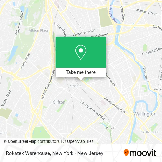
See Rokatex Warehouse, Clifton, on the map
Public Transit to Rokatex Warehouse in Clifton
Wondering how to get to Rokatex Warehouse in Clifton? Moovit helps you find the best way to get to Rokatex Warehouse with step-by-step directions from the nearest public transit station.
Moovit provides free maps and live directions to help you navigate through your city. View schedules, routes, timetables, and find out how long does it take to get to Rokatex Warehouse in real time.
Looking for the nearest stop or station to Rokatex Warehouse? Check out this list of stops closest to your destination: Paulison Ave at De Mott Ave; Clifton Ave at Paulison Ave; Plauderville; Msu.
Bus: 705, 707.Train: MCL, PJL, ML.
Want to see if there’s another route that gets you there at an earlier time? Moovit helps you find alternative routes or times. Get directions from and directions to Rokatex Warehouse easily from the Moovit App or Website.
We make riding to Rokatex Warehouse easy, which is why over 1.5 million users, including users in Clifton, trust Moovit as the best app for public transit. You don’t need to download an individual bus app or train app, Moovit is your all-in-one transit app that helps you find the best bus time or train time available.
For information on prices of bus and train, costs and ride fares to Rokatex Warehouse, please check the Moovit app.
Use the app to navigate to popular places including to the airport, hospital, stadium, grocery store, mall, coffee shop, school, college, and university.
Rokatex Warehouse Address: 791 Paulison Ave street in Clifton
- Blank Knights,
- Clean Solutions Llc,
- All Star Wholesale,
- Allstate Printing & Graphics,
- ATM,
- United States Postal Service,
- Clifton NJ Sdc,
- Medicare Insurance Advisors Clifton,
- Magic Touch Decoration,
- S and Y Natural Stone,
- Orellana Construcción,
- NJT - Clifton Station (MBPJ),
- Gates Of Hell,
- Clifton Train Station,
- Sunbelt Rentals,
- Elba's House,
- Angelina Trading Llc,
- NJ TRANSIT Clifton-Parking Lot 1,
- NJ TRANSIT Clifton Station-Parking Lot 2,
- NJT - Bus 705
Places Near Rokatex Warehouse (Clifton)
- Queens Center Mall, Queens,
- 911 Memorial, Manhattan,
- 3 Stone St, Manhattan,
- Bellevue Hospital, Manhattan,
- Rockefeller Center, Manhattan,
- 1 Police Plaza, Manhattan,
- Hudson Yards, Manhattan,
- SoHo, Manhattan,
- Pier 83, Manhattan,
- Wall Street, Manhattan,
- qqqq, Manhattan,
- 376 Hudson Street, Manhattan,
- Times Square, Manhattan,
- San Gennaro Feast, Manhattan,
- Chinatown, Manhattan,
- Katz's Deli, Manhattan,
- 111 Centre New York City Supreme Court, Manhattan,
- Mountainside Hospital, Glen Ridge,
- 26 Federal Plaza, Manhattan,
- 66 John Street, Manhattan
How to get to popular places in New York - New Jersey with public transit
Get around Clifton by public transit!
Traveling around Clifton has never been so easy. See step by step directions as you travel to any attraction, street or major public transit station. View bus and train schedules, arrival times, service alerts and detailed routes on a map, so you know exactly how to get to anywhere in Clifton.
When traveling to any destination around Clifton use Moovit's Live Directions with Get Off Notifications to know exactly where and how far to walk, how long to wait for your line, and how many stops are left. Moovit will alert you when it's time to get off — no need to constantly re-check whether yours is the next stop.
Wondering how to use public transit in Clifton or how to pay for public transit in Clifton? Moovit public transit app can help you navigate your way with public transit easily, and at minimum cost. It includes public transit fees, ticket prices, and costs. Looking for a map of Clifton public transit lines? Moovit public transit app shows all public transit maps in Clifton with all Bus, Train, Subway, Light Rail, Ferry and Cable Car routes and stops on an interactive map.
New York - New Jersey has 6 transit type(s), including: Bus, Train, Subway, Light Rail, Ferry and Cable Car, operated by several transit agencies, including MTA Subway, Metro-North Railroad, LIRR, PATH, MTA New York City Transit - Express routes, MTA Bus, NJ Transit, NYC Ferry, NICE bus, Bee-Line Bus, NJ Transit Rail, Norwalk Transit District, Hartford Line, River Valley Transit and HART