Directions to Rokin (Henderson) with public transportation
The following transit lines have routes that pass near Rokin
 Bus: 115.
How to get to Rokin by bus?
Click on the bus route to see step by step directions with maps, line arrival times and updated time schedules.
From Sunset And Mountain Vista, Henderson
36 minFrom Coral Academy of Science Las Vegas, Henderson
77 minFrom Mountasia Family Fun Center, Henderson
39 minFrom Janet's Old Fashioned Shoe Shine Stand, Paradise
61 minFrom Aveda Institute Las Vegas, Paradise
60 minFrom E Sunset Rd / S Maryland Pkwy, Paradise
48 minFrom Walmart Supercenter, Paradise
55 minFrom Oasis Express Lube, Paradise
60 minFrom Arizona Charlie's Boulder, Paradise
61 minFrom Palm Green Valley Mortuary & Cemetery, Paradise
55 min
Bus stop near Rokin in Henderson
- Sb Gibson After Mary Crest, 2 min walk,VIEW
Bus lines to Rokin in Henderson
- 115, 115 Nellis / Stephanie Southbound,VIEW
What are the closest stations to Rokin?
The closest stations to Rokin are:
- Sb Gibson After Mary Crest is 140 yards away, 2 min walk.
Which bus line stops near Rokin?
115 (115 Nellis / Stephanie Southbound)
What’s the nearest bus station to Rokin in Henderson?
The nearest bus station to Rokin in Henderson is Sb Gibson After Mary Crest. It’s a 2 min walk away.
What time is the first bus to Rokin in Henderson?
The 115 is the first bus that goes to Rokin in Henderson. It stops nearby at 4:32 AM.
What time is the last bus to Rokin in Henderson?
The 115 is the last bus that goes to Rokin in Henderson. It stops nearby at 12:57 AM.
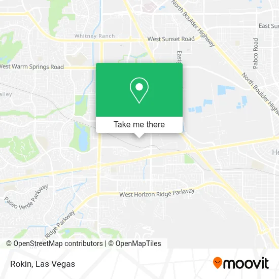
See Rokin, Henderson, on the map
Public Transit to Rokin in Henderson
Wondering how to get to Rokin in Henderson? Moovit helps you find the best way to get to Rokin with step-by-step directions from the nearest public transit station.
Moovit provides free maps and live directions to help you navigate through your city. View schedules, routes, timetables, and find out how long does it take to get to Rokin in real time.
Looking for the nearest stop or station to Rokin? Check out this list of stops closest to your destination: Sb Gibson After Mary Crest.
Bus: 115.
Want to see if there’s another route that gets you there at an earlier time? Moovit helps you find alternative routes or times. Get directions from and directions to Rokin easily from the Moovit App or Website.
We make riding to Rokin easy, which is why over 1.7 million users, including users in Henderson, trust Moovit as the best app for public transit. You don’t need to download an individual bus app or train app, Moovit is your all-in-one transit app that helps you find the best bus time or train time available.
For information on prices of bus, costs and ride fares to Rokin, please check the Moovit app.
Use the app to navigate to popular places including to the airport, hospital, stadium, grocery store, mall, coffee shop, school, college, and university.
Rokin Address: 118 Corporate Park Dr Ste 121 street in Henderson
- I-215 & Gibson Rd,
- 702 Macarons,
- Liquidationrugs.Com,
- Big Bully Turf,
- Sin City Collectibles,
- Morgon Locks,
- Redbox,
- WinCo Foods,
- Guardian Realty Investment & Property Management,
- Stephanie @ Wigwam (N),
- Urgentvet,
- Gäbi Boutique Donut & Pastry,
- Gabi Boutique Donut And Pastry,
- Calatlantic Homes at Acadia,
- Carl’S Jr.,
- Marco's Pizza,
- Las Vegas Trip,
- Nevada Dmv Now Kiosk,
- DMV,
- Landisautodetail
Places Near Rokin (Henderson)
- The Deuce Bus Stop at Fremont St, Las Vegas,
- The Palms Casino Resort, Paradise,
- Las Vegas South Premium Outlets, Enterprise,
- Gold & Silver Pawn Shop, Las Vegas,
- Area15, Las Vegas,
- Koolsville Tattoos, Las Vegas,
- Welcome To Fabulous Las Vegas Sign, Paradise,
- Town Square, Enterprise,
- Trump International Hotel Las Vegas, Paradise,
- Walmart Supercenter, Las Vegas,
- Lee Canyon, Las Vegas,
- Meow Wolf - Las Vegas (Meow Wolf's Omega Mart), Las Vegas,
- Walmart, Las Vegas,
- Las Vegas Premium Outlets-North, Enterprise,
- Las Vegas North Premium Outlets, Las Vegas,
- The Neon Museum, Las Vegas,
- Zak Bagans Haunted Museum, Las Vegas,
- Omega Mart, Las Vegas,
- Allegiant Stadium, Paradise,
- Arte Museum Las Vegas, Paradise
How to get to popular places in Las Vegas with public transit
Get around Henderson by public transit!
Traveling around Henderson has never been so easy. See step by step directions as you travel to any attraction, street or major public transit station. View bus and train schedules, arrival times, service alerts and detailed routes on a map, so you know exactly how to get to anywhere in Henderson.
When traveling to any destination around Henderson use Moovit's Live Directions with Get Off Notifications to know exactly where and how far to walk, how long to wait for your line, and how many stops are left. Moovit will alert you when it's time to get off — no need to constantly re-check whether yours is the next stop.
Wondering how to use public transit in Henderson or how to pay for public transit in Henderson? Moovit public transit app can help you navigate your way with public transit easily, and at minimum cost. It includes public transit fees, ticket prices, and costs. Looking for a map of Henderson public transit lines? Moovit public transit app shows all public transit maps in Henderson with all Bus and Monorail routes and stops on an interactive map.
Las Vegas has 2 transit type(s), including: Bus and Monorail, operated by several transit agencies, including RTCSNV, City of Las Vegas, Alvand Transportation, Vegas Airporter, Las Vegas Monorail, FlixBus-us and Greyhound-us