How to get to Roland Road @ 95st by bus?
Click on the bus route to see step by step directions with maps, line arrival times and updated time schedules.
From Landmark Cinemas, Edmonton
53 minFrom Amazon Locker-Overboard, Edmonton
49 minFrom Burnco Landscape Centre, Edmonton
45 minFrom Plato's Closet, Edmonton
55 minFrom Rundle Inn and Suites, Edmonton
50 minFrom 111 St NW, Edmonton
64 minFrom Ed's Bowling, Edmonton
49 minFrom Meadows, Edmonton
78 minFrom Canada Steel Works, Edmonton
90 minFrom Villa Caritas, Edmonton
43 min
Bus stops near Roland Road @ 95st in Edmonton
Light Rail stations near Roland Road @ 95st in Edmonton
Bus lines to Roland Road @ 95st in Edmonton
- 001A, Capilano Transit Centre,VIEW
- 001B, 102 Street & Macdonald Drive,VIEW
- 002, West Clareview Transit Centre,VIEW
- 005, Westmount Transit Centre,VIEW
- 111, Stadium Transit Centre,VIEW
- 130X, Baturyn - Eaux Claires - Government Centre,VIEW
- 150X, Dunluce - Castle Downs - Government Centre,VIEW
- 900X, Lewis Farms - Downtown,VIEW
- 211, Edmonton Express,VIEW
What are the closest stations to Roland Road @ 95st?
The closest stations to Roland Road @ 95st are:
- 95 Street & Jasper Avenue is 190 meters away, 3 min walk.
- 96 Street & Jasper Avenue is 322 meters away, 5 min walk.
- 97 Street & Angel Way is 667 meters away, 9 min walk.
- 97 Street & 102 Avenue is 674 meters away, 9 min walk.
- Churchill Stop is 941 meters away, 13 min walk.
- Central Station is 990 meters away, 13 min walk.
Which bus lines stop near Roland Road @ 95st?
These bus lines stop near Roland Road @ 95st: 001A, 001B, 002, 005.
Which light rail line stops near Roland Road @ 95st?
VALLEY (Downtown)
What’s the nearest light rail station to Roland Road @ 95st in Edmonton?
The nearest light rail stations to Roland Road @ 95st in Edmonton are Churchill Stop and Central Station. The closest one is a 13 min walk away.
What’s the nearest bus station to Roland Road @ 95st in Edmonton?
The nearest bus station to Roland Road @ 95st in Edmonton is 95 Street & Jasper Avenue. It’s a 3 min walk away.
What time is the first light rail to Roland Road @ 95st in Edmonton?
The VALLEY is the first light rail that goes to Roland Road @ 95st in Edmonton. It stops nearby at 5:17 AM.
What time is the last light rail to Roland Road @ 95st in Edmonton?
The VALLEY is the last light rail that goes to Roland Road @ 95st in Edmonton. It stops nearby at 1:11 AM.
What time is the first bus to Roland Road @ 95st in Edmonton?
The 002 is the first bus that goes to Roland Road @ 95st in Edmonton. It stops nearby at 3:01 AM.
What time is the last bus to Roland Road @ 95st in Edmonton?
The 002 is the last bus that goes to Roland Road @ 95st in Edmonton. It stops nearby at 3:03 AM.
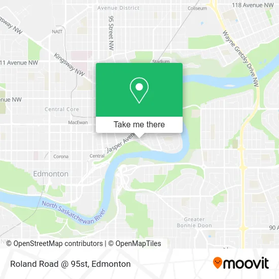
See Roland Road @ 95st, Edmonton, on the map
Public Transit to Roland Road @ 95st in Edmonton
Wondering how to get to Roland Road @ 95st in Edmonton? Moovit helps you find the best way to get to Roland Road @ 95st with step-by-step directions from the nearest public transit station.
Moovit provides free maps and live directions to help you navigate through your city. View schedules, routes, timetables, and find out how long does it take to get to Roland Road @ 95st in real time.
Looking for the nearest stop or station to Roland Road @ 95st? Check out this list of stops closest to your destination: 95 Street & Jasper Avenue; 96 Street & Jasper Avenue; 97 Street & Angel Way; 97 Street & 102 Avenue; Churchill Stop; Central Station.
Bus: 001A, 001B, 002, 005, 111, 130X, 150X, 900X, 211.Light Rail: VALLEY.
Want to see if there’s another route that gets you there at an earlier time? Moovit helps you find alternative routes or times. Get directions from and directions to Roland Road @ 95st easily from the Moovit App or Website.
We make riding to Roland Road @ 95st easy, which is why over 1.5 million users, including users in Edmonton, trust Moovit as the best app for public transit. You don’t need to download an individual bus app or train app, Moovit is your all-in-one transit app that helps you find the best bus time or train time available.
For information on prices of bus and light rail, costs and ride fares to Roland Road @ 95st, please check the Moovit app.
Use the app to navigate to popular places including to the airport, hospital, stadium, grocery store, mall, coffee shop, school, college, and university.
Location: Edmonton
- Riverdale,
- Grierson Centre,
- Edmonton Chinatown Multicultural Centre,
- DoubleTree by Hilton Edmonton Downtown,
- Shaw Conference Centre Parking Lot,
- Weac,
- Tawatinâ Bridge,
- Louise McKinney Park Pedestrian Bridge,
- Edmonton Chinatown Care Centre,
- Boyle McCauley Health Centre,
- River Valley Adventure Co.,
- Diamond Parking Location #Ce45,
- 9617 - 102a Avenue,
- Edmonton Riverboat,
- Rafter's Landing (Edmonton Queen Riverboat),
- George F. Hustler Memorial Park,
- Dogpatch,
- Pearl City (Impark Lot #250),
- Louise McKinney Riverfront Park,
- Shaw Conference Centre Hall A
Places Near Roland Road @ 95st (Edmonton)
- Alberta Legislature Building, Edmonton,
- University of Alberta, Edmonton,
- Grey Nuns Community Hospital, Edmonton,
- Borden Park, Edmonton,
- Londonderry Mall, Edmonton,
- Fort Edmonton Park, Edmonton,
- Whyte Avenue, Edmonton,
- MacEwan University, Edmonton,
- Royal Alexandra Hospital, Edmonton,
- Edmonton VIA Rail Station, Edmonton,
- Rogers Place, Edmonton,
- West Edmonton Mall, Edmonton,
- Edmonton Valley Zoo, Edmonton,
- Cross Cancer Institute, Edmonton,
- Northgate Centre, Edmonton,
- Kaye Edmonton Clinic, Edmonton,
- Edmonton Commonwealth Stadium, Edmonton,
- Edmonton EXPO Centre, Edmonton,
- Kingsway Mall, Edmonton,
- Canada Place Service Canada Centre, Edmonton
How to get to popular places in Edmonton with public transit
Get around Edmonton by public transit!
Traveling around Edmonton has never been so easy. See step by step directions as you travel to any attraction, street or major public transit station. View bus and train schedules, arrival times, service alerts and detailed routes on a map, so you know exactly how to get to anywhere in Edmonton.
When traveling to any destination around Edmonton use Moovit's Live Directions with Get Off Notifications to know exactly where and how far to walk, how long to wait for your line, and how many stops are left. Moovit will alert you when it's time to get off — no need to constantly re-check whether yours is the next stop.
Wondering how to use public transit in Edmonton or how to pay for public transit in Edmonton? Moovit public transit app can help you navigate your way with public transit easily, and at minimum cost. It includes public transit fees, ticket prices, and costs. Looking for a map of Edmonton public transit lines? Moovit public transit app shows all public transit maps in Edmonton with all Bus and Light Rail routes and stops on an interactive map.
Edmonton has 2 transit type(s), including: Bus and Light Rail, operated by several transit agencies, including ETS LRT, ETS, Strathcona County Transit, St. Albert Transit, Spruce Grove Transit, Fort Saskatchewan Transit, Beaumont Transit and Leduc Transit