How to get to Rolf Lerch U. Roswitha by bus?
Click on the bus route to see step by step directions with maps, line arrival times and updated time schedules.
From Parkplatz Ratiopharm Arena, Neu-Ulm
78 minFrom Kloster Untermarchtal, Verwaltungsgemeinschaft Munderkingen
224 minFrom Oh VV, Leutkirch
167 minFrom Heidenheim an der Brenz, Heidenheim An Der Brenz
156 minFrom Amazon-DBX8, Herbrechtingen
248 minFrom Kaufland Geislingen, Vereinbarte Verwaltungsgemeinschaft Der Stadt Geislingen An Der Steige
163 min
Bus stops near Rolf Lerch U. Roswitha in Gemeindeverwaltungsverband Dietenheim
Train stations near Rolf Lerch U. Roswitha in Gemeindeverwaltungsverband Dietenheim
Bus lines to Rolf Lerch U. Roswitha in Gemeindeverwaltungsverband Dietenheim
What are the closest stations to Rolf Lerch U. Roswitha?
The closest stations to Rolf Lerch U. Roswitha are:
- Regglisweiler Schule is 234 meters away, 4 min walk.
- Regglisweiler Raiffeisenbank is 562 meters away, 8 min walk.
- Illertissen Bahnhof is 573 meters away, 8 min walk.
- Bellenberg is 3983 meters away, 51 min walk.
Which bus lines stop near Rolf Lerch U. Roswitha?
These bus lines stop near Rolf Lerch U. Roswitha: 215, 70.
What’s the nearest train station to Rolf Lerch U. Roswitha in Gemeindeverwaltungsverband Dietenheim?
The nearest train station to Rolf Lerch U. Roswitha in Gemeindeverwaltungsverband Dietenheim is Illertissen Bahnhof. It’s a 8 min walk away.
What’s the nearest bus station to Rolf Lerch U. Roswitha in Gemeindeverwaltungsverband Dietenheim?
The nearest bus station to Rolf Lerch U. Roswitha in Gemeindeverwaltungsverband Dietenheim is Regglisweiler Schule. It’s a 4 min walk away.
What time is the first train to Rolf Lerch U. Roswitha in Gemeindeverwaltungsverband Dietenheim?
The RS7 is the first train that goes to Rolf Lerch U. Roswitha in Gemeindeverwaltungsverband Dietenheim. It stops nearby at 4:55 AM.
What time is the last train to Rolf Lerch U. Roswitha in Gemeindeverwaltungsverband Dietenheim?
The RE75 is the last train that goes to Rolf Lerch U. Roswitha in Gemeindeverwaltungsverband Dietenheim. It stops nearby at 12:49 AM.
What time is the first bus to Rolf Lerch U. Roswitha in Gemeindeverwaltungsverband Dietenheim?
The 70 is the first bus that goes to Rolf Lerch U. Roswitha in Gemeindeverwaltungsverband Dietenheim. It stops nearby at 5:27 AM.
What time is the last bus to Rolf Lerch U. Roswitha in Gemeindeverwaltungsverband Dietenheim?
The 70 is the last bus that goes to Rolf Lerch U. Roswitha in Gemeindeverwaltungsverband Dietenheim. It stops nearby at 12:04 AM.
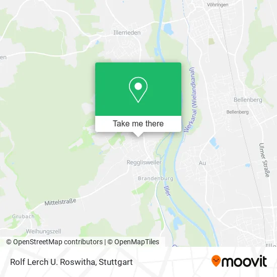
See Rolf Lerch U. Roswitha, Gemeindeverwaltungsverband Dietenheim, on the map
Public Transit to Rolf Lerch U. Roswitha in Gemeindeverwaltungsverband Dietenheim
Wondering how to get to Rolf Lerch U. Roswitha in Gemeindeverwaltungsverband Dietenheim? Moovit helps you find the best way to get to Rolf Lerch U. Roswitha with step-by-step directions from the nearest public transit station.
Moovit provides free maps and live directions to help you navigate through your city. View schedules, routes, timetables, and find out how long does it take to get to Rolf Lerch U. Roswitha in real time.
Looking for the nearest stop or station to Rolf Lerch U. Roswitha? Check out this list of stops closest to your destination: Regglisweiler Schule; Regglisweiler Raiffeisenbank; Illertissen Bahnhof; Bellenberg.
Bus: 215, 70, 716, 723.Train: RS7, RE75, RS 7, RE 75, RE 75.
Want to see if there’s another route that gets you there at an earlier time? Moovit helps you find alternative routes or times. Get directions from and directions to Rolf Lerch U. Roswitha easily from the Moovit App or Website.
We make riding to Rolf Lerch U. Roswitha easy, which is why over 1.5 million users, including users in Gemeindeverwaltungsverband Dietenheim, trust Moovit as the best app for public transit. You don’t need to download an individual bus app or train app, Moovit is your all-in-one transit app that helps you find the best bus time or train time available.
For information on prices of bus and train, costs and ride fares to Rolf Lerch U. Roswitha, please check the Moovit app.
Use the app to navigate to popular places including to the airport, hospital, stadium, grocery store, mall, coffee shop, school, college, and university.
Rolf Lerch U. Roswitha Address: Herrenweiher 29 Regglisweiler, 89165 Dietenheim street in Gemeindeverwaltungsverband Dietenheim
- Salon Garni,
- Lambacher Werkzeug,
- Kleine Blume,
- Lambacher Maschinenbau,
- Rudolf Rauer Bau- Und Betonsanierungs Gmbh,
- Desjoyaux Ulm,
- Alois Högerle,
- Savuka Air,
- Ethon Technologies,
- Gtm Widmann,
- Regglisweiler,
- Fugo Consult,
- Lares Gerhard Dipl.-Ing. Kfz-Sachverst,
- Dekra,
- Autohaus Widmann,
- Ks Autoglas Zentrum,
- Dpd-Partner,
- Deutsche Post,
- Autohaus Widmann GmbH & Co. KG,
- Erika Buchholz Kfz-Teile
Places Near Rolf Lerch U. Roswitha (Gemeindeverwaltungsverband Dietenheim)
- Mercedes-Benz Museum (Mercedes Museum Stuttgart), Bad Cannstatt,
- SI-Centrum, Möhringen,
- Pariser Platz Stuttgart, Stuttgart-Mitte,
- Hanns-Martin-Schleyer-Halle, Bad Cannstatt,
- Gasometer Pforzheim, Pforzheim,
- Mettingen Eros-Center Puff Laufhaus, Esslingen Am Neckar,
- Gleis 101/102 (tief), Stuttgart-Mitte,
- Klinikum Stuttgart - Katharinenhospital, Stuttgart-Mitte,
- Porsche Museum, Zuffenhausen,
- Hauptbahnhof Stuttgart, Stuttgart-Mitte,
- Marmorsaal Im Weissenburgpark, Stuttgart-Süd,
- Porsche-Arena, Bad Cannstatt,
- Mercedes-Benz Museum, Bad Cannstatt,
- Wilhelma (U-Bahn Wilhelma), Bad Cannstatt,
- Hanns-Martin-Schleyer-Halle (Stuttgart Hans-Martin-Schleyerhalle), Bad Cannstatt,
- Im Wizemann (Halle), Bad Cannstatt,
- FlixBus Haltestelle, Stuttgart,
- Schleyerhalle, Bad Cannstatt,
- Geilhaus Haus 33a, Reutlingen-Betzingen,
- Waldfriedhof, Degerloch
How to get to popular places in Stuttgart with public transit
Get around Gemeindeverwaltungsverband Dietenheim by public transit!
Traveling around Gemeindeverwaltungsverband Dietenheim has never been so easy. See step by step directions as you travel to any attraction, street or major public transit station. View bus and train schedules, arrival times, service alerts and detailed routes on a map, so you know exactly how to get to anywhere in Gemeindeverwaltungsverband Dietenheim.
When traveling to any destination around Gemeindeverwaltungsverband Dietenheim use Moovit's Live Directions with Get Off Notifications to know exactly where and how far to walk, how long to wait for your line, and how many stops are left. Moovit will alert you when it's time to get off — no need to constantly re-check whether yours is the next stop.
Wondering how to use public transit in Gemeindeverwaltungsverband Dietenheim or how to pay for public transit in Gemeindeverwaltungsverband Dietenheim? Moovit public transit app can help you navigate your way with public transit easily, and at minimum cost. It includes public transit fees, ticket prices, and costs. Looking for a map of Gemeindeverwaltungsverband Dietenheim public transit lines? Moovit public transit app shows all public transit maps in Gemeindeverwaltungsverband Dietenheim with all Bus, Train, Subway, Light Rail, Ferry, S-Bahn and Funicular routes and stops on an interactive map.
Stuttgart has 7 transit type(s), including: Bus, Train, Subway, Light Rail, Ferry, S-Bahn and Funicular, operated by several transit agencies, including SSB - Stadtbahn, SSB, SSB - Seilbahn / Zacke, S-Bahn Stuttgart, Rhein-Neckar-Verkehr GmbH (rnv), Karlsruher Verkehrsverbund, DB AG, DB Regiobus BW, Arverio Baden-Württemberg GmbH, DB RegioNetz Verkehrs GmbH Westfrankenbahn, DB Regio AG Baden-Württemberg, Südwestdeutsche Verkehrs-AG, DB Regio AG Mitte Region Hessen, DB and Bodensee-Oberschwaben-Bahn