How to get to Rolf N. Terkelsen by bus?
Click on the bus route to see step by step directions with maps, line arrival times and updated time schedules.
From Langrønningen, Bamble
58 minFrom Brevik, Porsgrunn
49 minFrom Farris Bad, Larvik
71 minFrom Skien Fritidspark, Skien
29 minFrom Sykehuset Telemark, Skien, Skien
29 minFrom Foldvik Familiepark, Larvik
147 minFrom Bergsbygda, Porsgrunn
37 minFrom Quality Hotel Skjærgården Langesund, Bamble
76 minFrom Herkules Kjøpesenter, Skien
31 minFrom Langesund, Bamble
67 min
How to get to Rolf N. Terkelsen by train?
Click on the train route to see step by step directions with maps, line arrival times and updated time schedules.
Bus stops near Rolf N. Terkelsen in Porsgrunn
Train stations near Rolf N. Terkelsen in Porsgrunn
- Porsgrunn Stasjon, 55 min walk,VIEW
Bus lines to Rolf N. Terkelsen in Porsgrunn
- M2, Falkum Via Brattås-Eidanger,VIEW
- M2N, Skjelsvik Via Tollnes,VIEW
- S2, Svanen Skole,VIEW
- M3, Skjelsvik Via Klyve,VIEW
- M3N, Skien Via Stridsklev,VIEW
- P5, Herøya Ind.Park Via Bølehøgda,VIEW
- P9, Porsgrunn Kammerherreløkka,VIEW
- S16, Moflata,VIEW
- S17, Skien Via Tollnes,VIEW
- S19, Skien Via Klyve,VIEW
- S22, Svanen Skole,VIEW
- 80, Franklintorget Via Rødmyr-Kongerød,VIEW
- 601, Porsgrunn-Skien,VIEW
- S9, Porsgrunn,VIEW
- M1, Langesund Via Eikstrand,VIEW
- M1N, Langesund Øvre Via Øyekast,VIEW
- 77, Gimsøy -Kjørbekkhøgda,VIEW
- 78, Kilebygda Skole,VIEW
What are the closest stations to Rolf N. Terkelsen?
The closest stations to Rolf N. Terkelsen are:
- Porsgrunn Porselen is 415 meters away, 6 min walk.
- Down Town Franklintorget is 901 meters away, 12 min walk.
- Nedre Frydenlund is 999 meters away, 13 min walk.
- Porsgrunn Stasjon is 4309 meters away, 55 min walk.
Which bus lines stop near Rolf N. Terkelsen?
These bus lines stop near Rolf N. Terkelsen: M1, M2, M3.
Which train line stops near Rolf N. Terkelsen?
RE11 (Skien)
What’s the nearest bus station to Rolf N. Terkelsen in Porsgrunn?
The nearest bus station to Rolf N. Terkelsen in Porsgrunn is Porsgrunn Porselen. It’s a 6 min walk away.
What time is the first train to Rolf N. Terkelsen in Porsgrunn?
The RE11 is the first train that goes to Rolf N. Terkelsen in Porsgrunn. It stops nearby at 5:18 AM.
What time is the last train to Rolf N. Terkelsen in Porsgrunn?
The RE11 is the last train that goes to Rolf N. Terkelsen in Porsgrunn. It stops nearby at 1:23 AM.
What time is the first bus to Rolf N. Terkelsen in Porsgrunn?
The M2 is the first bus that goes to Rolf N. Terkelsen in Porsgrunn. It stops nearby at 9:59 AM.
What time is the last bus to Rolf N. Terkelsen in Porsgrunn?
The M1 is the last bus that goes to Rolf N. Terkelsen in Porsgrunn. It stops nearby at 11:25 PM.
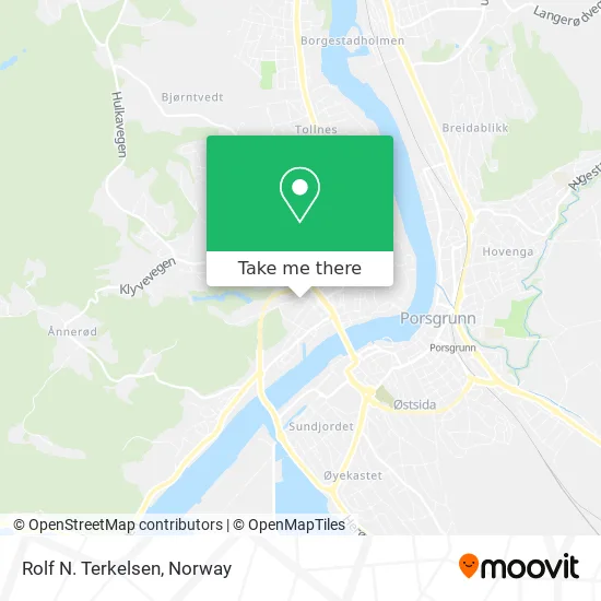
See Rolf N. Terkelsen, Porsgrunn, on the map
Public Transit to Rolf N. Terkelsen in Porsgrunn
Wondering how to get to Rolf N. Terkelsen in Porsgrunn? Moovit helps you find the best way to get to Rolf N. Terkelsen with step-by-step directions from the nearest public transit station.
Moovit provides free maps and live directions to help you navigate through your city. View schedules, routes, timetables, and find out how long does it take to get to Rolf N. Terkelsen in real time.
Looking for the nearest stop or station to Rolf N. Terkelsen? Check out this list of stops closest to your destination: Porsgrunn Porselen; Down Town Franklintorget; Nedre Frydenlund; Porsgrunn Stasjon.
Bus: M1, M2, M3, M2N, S2, M3N, S9, M1N, 77, 78.Train: RE11, R55, RX11.
Want to see if there’s another route that gets you there at an earlier time? Moovit helps you find alternative routes or times. Get directions from and directions to Rolf N. Terkelsen easily from the Moovit App or Website.
We make riding to Rolf N. Terkelsen easy, which is why over 1.5 million users, including users in Porsgrunn, trust Moovit as the best app for public transit. You don’t need to download an individual bus app or train app, Moovit is your all-in-one transit app that helps you find the best bus time or train time available.
For information on prices of bus and train, costs and ride fares to Rolf N. Terkelsen, please check the Moovit app.
Use the app to navigate to popular places including to the airport, hospital, stadium, grocery store, mall, coffee shop, school, college, and university.
Rolf N. Terkelsen Address: Heigata 32 3920 Porsgrunn street in Porsgrunn
- AS Concurrenten Porsgrunn,
- Arne Thomas Lund,
- Boliviahjelpen - Barnehjemmet Betania i Uritaca,
- Pizzabakeren Vessia,
- Mobit Porsgrunn,
- Jovo Invest,
- Porsgrunn Frikirke,
- Kiwi 560 Porsel,
- APCOA PARKING,
- Norsk Fjell og Betongsplitting Tom Lund,
- Bilfreak,
- Vestsida,
- Vestsiden Bo- og Aktivitetssenter,
- Laven Antikk og,
- Gatsoft,
- Boots Apotek,
- Porsgrunds Porselænsfabrik,
- Rh Båt og Motorservice Roger Henrichsen,
- Mer,
- Vestsiden Legesenter
Places Near Rolf N. Terkelsen (Porsgrunn)
- DFDS Seaways, Oslo,
- Voldsløkka, Oslo,
- Quality Hotel Edvard Grieg, Bergen,
- Radiumhospitalet, Oslo,
- IKEA, Bergen,
- Rikshospitalet (trikk), Oslo,
- Ulriken, Bergen,
- Oslo S spor 19 (Trelastgata), Oslo,
- Color Line Terminal, Oslo,
- Ullevål Stadion (T), Oslo,
- Nylandsbrua, Oslo,
- Lovisenberg Diakonale Sykehus, Oslo,
- Bjerke Travbane, Oslo,
- Vestby Outlet Store, Vestby,
- Tyholttårnet, Trondheim,
- Haukeland Universitetssjukehus, Bergen,
- Drammen Sykehus, Drammen,
- Ikea Leangen, Trondheim,
- IKEA, Oslo,
- Jekta Storsenter, Tromsø
How to get to popular places in Norway with public transit
Get around Porsgrunn by public transit!
Traveling around Porsgrunn has never been so easy. See step by step directions as you travel to any attraction, street or major public transit station. View bus and train schedules, arrival times, service alerts and detailed routes on a map, so you know exactly how to get to anywhere in Porsgrunn.
When traveling to any destination around Porsgrunn use Moovit's Live Directions with Get Off Notifications to know exactly where and how far to walk, how long to wait for your line, and how many stops are left. Moovit will alert you when it's time to get off — no need to constantly re-check whether yours is the next stop.
Wondering how to use public transit in Porsgrunn or how to pay for public transit in Porsgrunn? Moovit public transit app can help you navigate your way with public transit easily, and at minimum cost. It includes public transit fees, ticket prices, and costs. Looking for a map of Porsgrunn public transit lines? Moovit public transit app shows all public transit maps in Porsgrunn with all Bus, Train, Subway, Light Rail, Ferry and Cable Car routes and stops on an interactive map.
Norway has 6 transit type(s), including: Bus, Train, Subway, Light Rail, Ferry and Cable Car, operated by several transit agencies, including Ruter, Skyss, AtB, Flytoget, Vy Tåg, SJ, Go-Ahead Norge AS, SJ Nord, Vestfold Kollektivtrafikk as, Snelandia, Innlandstrafikk, FRAM, FlixBus, Kolumbus and Brakar