How to get to Rolfs Elert Office by bus?
Click on the bus route to see step by step directions with maps, line arrival times and updated time schedules.
From New Rochelle, NY, New Rochelle
45 minFrom White Plains, NY, White Plains
30 minFrom Ridge Hill Mall, Yonkers
86 minFrom Regeneron Pharmaceuticals Inc, Tarrytown
84 minFrom Mamaroneck NY, Mamaroneck
45 minFrom Cross County Mall, Yonkers
83 minFrom Cross County Shopping Center, Yonkers
84 minFrom Westchester Mall, White Plains
31 minFrom GFFF, Stamford
76 minFrom NBC Sports Shuttle, Stamford
98 min
How to get to Rolfs Elert Office by train?
Click on the train route to see step by step directions with maps, line arrival times and updated time schedules.
Bus stops near Rolfs Elert Office in Port Chester
Train stations near Rolfs Elert Office in Port Chester
Bus lines to Rolfs Elert Office in Port Chester
What are the closest stations to Rolfs Elert Office?
The closest stations to Rolfs Elert Office are:
- Westchester Ave @ Smith St is 103 yards away, 2 min walk.
- S Main St @ Westchester Ave is 413 yards away, 6 min walk.
- Port Chester is 1261 yards away, 15 min walk.
- Greenwich is 4486 yards away, 53 min walk.
Which bus lines stop near Rolfs Elert Office?
These bus lines stop near Rolfs Elert Office: 13, 311, 61.
Which train line stops near Rolfs Elert Office?
3 (1410#| Stamford)
What’s the nearest train station to Rolfs Elert Office in Port Chester?
The nearest train station to Rolfs Elert Office in Port Chester is Port Chester. It’s a 15 min walk away.
What’s the nearest bus station to Rolfs Elert Office in Port Chester?
The nearest bus station to Rolfs Elert Office in Port Chester is Westchester Ave @ Smith St. It’s a 2 min walk away.
What time is the first train to Rolfs Elert Office in Port Chester?
The 3 is the first train that goes to Rolfs Elert Office in Port Chester. It stops nearby at 4:49 AM.
What time is the last train to Rolfs Elert Office in Port Chester?
The 3 is the last train that goes to Rolfs Elert Office in Port Chester. It stops nearby at 2:46 AM.
What time is the first bus to Rolfs Elert Office in Port Chester?
The 13 is the first bus that goes to Rolfs Elert Office in Port Chester. It stops nearby at 5:35 AM.
What time is the last bus to Rolfs Elert Office in Port Chester?
The 311 is the last bus that goes to Rolfs Elert Office in Port Chester. It stops nearby at 11:56 PM.
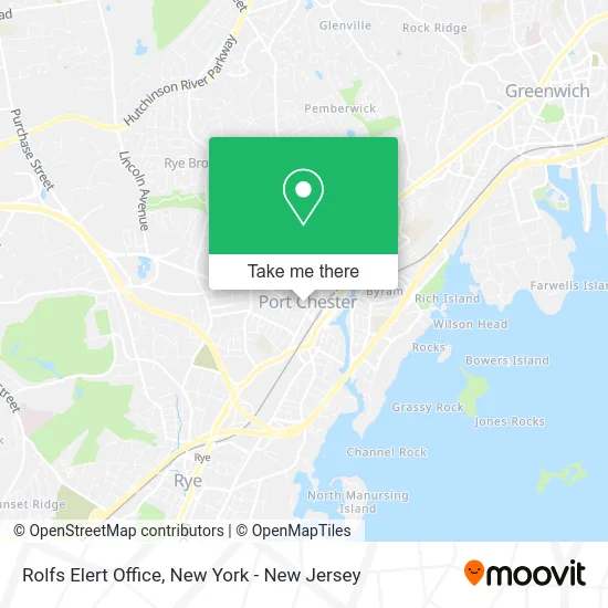
See Rolfs Elert Office, Port Chester, on the map
Public Transit to Rolfs Elert Office in Port Chester
Wondering how to get to Rolfs Elert Office in Port Chester? Moovit helps you find the best way to get to Rolfs Elert Office with step-by-step directions from the nearest public transit station.
Moovit provides free maps and live directions to help you navigate through your city. View schedules, routes, timetables, and find out how long does it take to get to Rolfs Elert Office in real time.
Looking for the nearest stop or station to Rolfs Elert Office? Check out this list of stops closest to your destination: Westchester Ave @ Smith St; S Main St @ Westchester Ave; Port Chester; Greenwich.
Bus: 13, 311, 61.Train: 3, 4, 5.
Want to see if there’s another route that gets you there at an earlier time? Moovit helps you find alternative routes or times. Get directions from and directions to Rolfs Elert Office easily from the Moovit App or Website.
We make riding to Rolfs Elert Office easy, which is why over 1.5 million users, including users in Port Chester, trust Moovit as the best app for public transit. You don’t need to download an individual bus app or train app, Moovit is your all-in-one transit app that helps you find the best bus time or train time available.
For information on prices of bus and train, costs and ride fares to Rolfs Elert Office, please check the Moovit app.
Use the app to navigate to popular places including to the airport, hospital, stadium, grocery store, mall, coffee shop, school, college, and university.
Rolfs Elert Office Address: 168 Irving Ave Port Chester, NY 10573 street in Port Chester
- EC Wellness,
- Matters Ink,
- Paradise Kids,
- Taylor Graham,
- Loft Fitness,
- Wholebody Myofascial Release & Massage,
- Vellone Promotions,
- Led and Fiber Optic Lights,
- Wellborn Coffee Co.,
- Bsmart Training Club,
- Bm Ortho Appliances Inc.,
- Prana Prenatal Yoga,
- Spectrum Comm,
- Elissa Held Corporation,
- Moderna Llc,
- Upholstery by Fernando,
- El Rancho De Lupita,
- Outside,
- El Dolar Latino Inc,
- Reliance Engine and Hose
Places Near Rolfs Elert Office (Port Chester)
- qqqq, Manhattan,
- Times Square, Manhattan,
- Mountainside Hospital, Glen Ridge,
- 3 Stone St, Manhattan,
- Pier 83, Manhattan,
- 66 John Street, Manhattan,
- Hudson Yards, Manhattan,
- 26 Federal Plaza, Manhattan,
- 111 Centre New York City Supreme Court, Manhattan,
- Chinatown, Manhattan,
- 376 Hudson Street, Manhattan,
- Rockefeller Center, Manhattan,
- Katz's Deli, Manhattan,
- Queens Center Mall, Queens,
- 911 Memorial, Manhattan,
- San Gennaro Feast, Manhattan,
- 1 Police Plaza, Manhattan,
- SoHo, Manhattan,
- Bellevue Hospital, Manhattan,
- Wall Street, Manhattan
How to get to popular places in New York - New Jersey with public transit
Get around Port Chester by public transit!
Traveling around Port Chester has never been so easy. See step by step directions as you travel to any attraction, street or major public transit station. View bus and train schedules, arrival times, service alerts and detailed routes on a map, so you know exactly how to get to anywhere in Port Chester.
When traveling to any destination around Port Chester use Moovit's Live Directions with Get Off Notifications to know exactly where and how far to walk, how long to wait for your line, and how many stops are left. Moovit will alert you when it's time to get off — no need to constantly re-check whether yours is the next stop.
Wondering how to use public transit in Port Chester or how to pay for public transit in Port Chester? Moovit public transit app can help you navigate your way with public transit easily, and at minimum cost. It includes public transit fees, ticket prices, and costs. Looking for a map of Port Chester public transit lines? Moovit public transit app shows all public transit maps in Port Chester with all Bus, Train, Subway, Light Rail, Ferry and Cable Car routes and stops on an interactive map.
New York - New Jersey has 6 transit type(s), including: Bus, Train, Subway, Light Rail, Ferry and Cable Car, operated by several transit agencies, including MTA Subway, Metro-North Railroad, LIRR, PATH, MTA New York City Transit - Express routes, MTA Bus, NJ Transit, NYC Ferry, NICE bus, Bee-Line Bus, NJ Transit Rail, Norwalk Transit District, Hartford Line, River Valley Transit and HART