How to get to Roly Poly Sandwiches by bus?
Click on the bus route to see step by step directions with maps, line arrival times and updated time schedules.
From IU Health Gateway Office Building, Indianapolis City (Balance)
44 minFrom Check Into Cash, Indianapolis City (Balance)
97 minFrom Scheefer Cleaners, Indianapolis City (Balance)
79 minFrom Fastenal, Indianapolis City (Balance)
99 minFrom CBC-Nedho, Indianapolis City (Balance)
48 minFrom Truth & Life Church, Indianapolis City (Balance)
35 minFrom Entrance I-65 N, Indianapolis City (Balance)
64 minFrom Indiana University Health / Gateway Plaza - Lot G, Indianapolis City (Balance)
44 minFrom Pffui News, Indianapolis City (Balance)
42 minFrom Shop Express, Indianapolis City (Balance)
48 min
Bus stops near Roly Poly Sandwiches in Indianapolis City (Balance)
Bus lines to Roly Poly Sandwiches in Indianapolis City (Balance)
What are the closest stations to Roly Poly Sandwiches?
The closest stations to Roly Poly Sandwiches are:
- Rural St - 6100 N Glendale Town Center is 147 yards away, 3 min walk.
- Rural St - 6100 N Glendale Towne Ctr is 162 yards away, 3 min walk.
Which bus lines stop near Roly Poly Sandwiches?
These bus lines stop near Roly Poly Sandwiches: 19, 26, 82.
What’s the nearest bus station to Roly Poly Sandwiches in Indianapolis City (Balance)?
The nearest bus stations to Roly Poly Sandwiches in Indianapolis City (Balance) are Rural St - 6100 N Glendale Town Center and Rural St - 6100 N Glendale Towne Ctr. The closest one is a 3 min walk away.
What time is the first bus to Roly Poly Sandwiches in Indianapolis City (Balance)?
The 19 is the first bus that goes to Roly Poly Sandwiches in Indianapolis City (Balance). It stops nearby at 4:36 AM.
What time is the last bus to Roly Poly Sandwiches in Indianapolis City (Balance)?
The 26 is the last bus that goes to Roly Poly Sandwiches in Indianapolis City (Balance). It stops nearby at 11:16 PM.
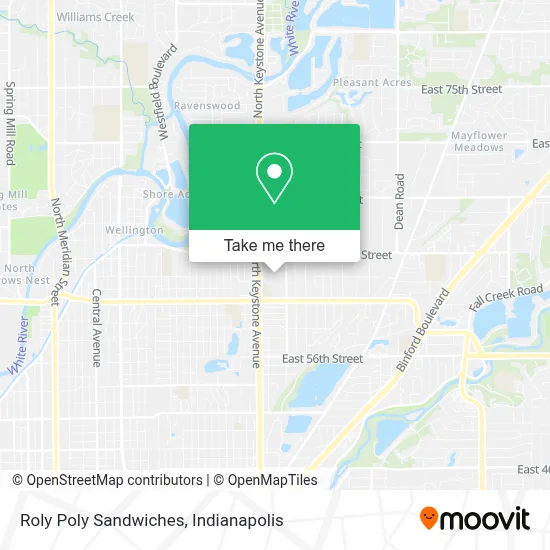
See Roly Poly Sandwiches, Indianapolis City (Balance), on the map
Public Transit to Roly Poly Sandwiches in Indianapolis City (Balance)
Wondering how to get to Roly Poly Sandwiches in Indianapolis City (Balance)? Moovit helps you find the best way to get to Roly Poly Sandwiches with step-by-step directions from the nearest public transit station.
Moovit provides free maps and live directions to help you navigate through your city. View schedules, routes, timetables, and find out how long does it take to get to Roly Poly Sandwiches in real time.
Looking for the nearest stop or station to Roly Poly Sandwiches? Check out this list of stops closest to your destination: Rural St - 6100 N Glendale Town Center; Rural St - 6100 N Glendale Towne Ctr.
Bus: 19, 26, 82.
Want to see if there’s another route that gets you there at an earlier time? Moovit helps you find alternative routes or times. Get directions from and directions to Roly Poly Sandwiches easily from the Moovit App or Website.
We make riding to Roly Poly Sandwiches easy, which is why over 1.5 million users, including users in Indianapolis City (Balance), trust Moovit as the best app for public transit. You don’t need to download an individual bus app or train app, Moovit is your all-in-one transit app that helps you find the best bus time or train time available.
For information on prices of bus, costs and ride fares to Roly Poly Sandwiches, please check the Moovit app.
Use the app to navigate to popular places including to the airport, hospital, stadium, grocery store, mall, coffee shop, school, college, and university.
Roly Poly Sandwiches Address: 6101 N Keystone Ave street in Indianapolis City (Balance)
- Glendale Mall,
- Amazon Locker Tambo,
- Glendale Town Center,
- Amazon Locker-Beppino,
- John Geiger Photography - Digital Imaging Inc.,
- Sperry,
- Zirmen Global Solutions,
- Bumblebee Holdings,
- Raggett Locksmith Services,
- Pocketbiz,
- 6101 N Keystone Ave Parking,
- STARBUCKS,
- Reo Lending,
- Carter's,
- Towman Towing,
- Ross Dress For Less,
- Darling Helping Hands,
- Glendale Mall (Glendale Town Center),
- G I Jane's Sparkle Services,
- Ferris Property Group
Places Near Roly Poly Sandwiches (Indianapolis City (Balance))
- Indiana, Indianapolis City (Balance),
- St. Vincent entrance #1, Indianapolis City (Balance),
- Lilly Corporate Center (Eli Lilly & Co), Indianapolis City (Balance),
- Lucas Oil Stadium, Indianapolis City (Balance),
- Castleton Square Mall, Indianapolis,
- Cotter's Massage Parlor With Happy Endings, Indianapolis City (Balance),
- Indiana Convention Center, Indianapolis City (Balance),
- Methodist Hospital of Indianapolis, Indianapolis City (Balance),
- Gainbridge Fieldhouse, Indianapolis City (Balance),
- Indianapolis Motor Speedway, Speedway,
- St. Vincent Hospital - Indianapolis, Indianapolis City (Balance),
- I-465 / I-65 Interchange, Indianapolis City (Balance),
- Train Ride At Castleton Mall, Indianapolis City (Balance),
- 119 W 19th St Parking, Indianapolis City (Balance),
- Indianapolis Airport Zone 2, Indianapolis City (Balance),
- Jersey Barn, Indianapolis City (Balance),
- Plainfield, IN, Plainfield,
- Eskenazi Hospital, Indianapolis City (Balance),
- THE BALT, Indianapolis City (Balance),
- I U Health Methodist Hospital, Indianapolis City (Balance)
How to get to popular places in Indianapolis with public transit
Get around Indianapolis City (Balance) by public transit!
Traveling around Indianapolis City (Balance) has never been so easy. See step by step directions as you travel to any attraction, street or major public transit station. View bus and train schedules, arrival times, service alerts and detailed routes on a map, so you know exactly how to get to anywhere in Indianapolis City (Balance).
When traveling to any destination around Indianapolis City (Balance) use Moovit's Live Directions with Get Off Notifications to know exactly where and how far to walk, how long to wait for your line, and how many stops are left. Moovit will alert you when it's time to get off — no need to constantly re-check whether yours is the next stop.
Wondering how to use public transit in Indianapolis City (Balance) or how to pay for public transit in Indianapolis City (Balance)? Moovit public transit app can help you navigate your way with public transit easily, and at minimum cost. It includes public transit fees, ticket prices, and costs. Looking for a map of Indianapolis City (Balance) public transit lines? Moovit public transit app shows all public transit maps in Indianapolis City (Balance) with all bus routes and stops on an interactive map.
Indianapolis has 1 transit type(s), including: bus, operated by several transit agencies, including IndyGo, FlixBus-us and Greyhound-us