How to get to Roma by bus?
Click on the bus route to see step by step directions with maps, line arrival times and updated time schedules.
From Calle Ribera del Loira, Madrid
73 minFrom Eurostars Madrid Tower, Área Metropolitana De Madrid Y Corredor Del Henares
66 minFrom Comisaría de Policía de Madrid-Latina (y Oficina de Tramitación del DNI y Pasaporte), Madrid
44 minFrom Plaza Don Antonio de Andrés 18, Madrid
69 minFrom Calle Arturo Soria, Madrid
70 minFrom Avenida de Machupichu, Madrid
72 minFrom Argüelles, Madrid
40 minFrom Parquesur, Leganés
54 minFrom Tanatorio de Madrid M-30, Madrid
58 min
How to get to Roma by train?
Click on the train route to see step by step directions with maps, line arrival times and updated time schedules.
From Eurostars Madrid Tower, Área Metropolitana De Madrid Y Corredor Del Henares
48 minFrom Comisaría de Policía de Madrid-Latina (y Oficina de Tramitación del DNI y Pasaporte), Madrid
40 minFrom Plaza Don Antonio de Andrés 18, Madrid
57 minFrom Calle Arturo Soria, Madrid
65 minFrom Argüelles, Madrid
56 minFrom Parquesur, Leganés
41 min
How to get to Roma by metro?
Click on the metro route to see step by step directions with maps, line arrival times and updated time schedules.
From Calle Ribera del Loira, Madrid
52 minFrom Eurostars Madrid Tower, Área Metropolitana De Madrid Y Corredor Del Henares
54 minFrom Comisaría de Policía de Madrid-Latina (y Oficina de Tramitación del DNI y Pasaporte), Madrid
49 minFrom Plaza Don Antonio de Andrés 18, Madrid
42 minFrom Calle Arturo Soria, Madrid
57 minFrom Avenida de Machupichu, Madrid
38 minFrom Argüelles, Madrid
29 minFrom Parquesur, Leganés
41 minFrom Tanatorio de Madrid M-30, Madrid
44 min
Bus stops near Roma in Madrid
Train station near Roma in Madrid
- Doce De Octubre, 11 min walk,VIEW
Bus lines to Roma in Madrid
- 23, Plaza Mayor,VIEW
- 123, Legazpi,VIEW
- N12, Butarque,VIEW
- 18, Plaza Mayor - Villaverde Cruce,VIEW
- 22, Plaza de Legazpi - Villaverde Alto,VIEW
- 59, Estacion de Atocha - Colonia San Cristobal de los Angeles,VIEW
- 76, Plaza Beata Maria Ana de Jesus - Villaverde Alto,VIEW
- 79, Plaza de Legazpi - Villaverde Alto,VIEW
- 85, Estacion de Atocha - Butarque,VIEW
- 86, Estacion de Atocha - Villaverde Alto,VIEW
- N13, Plaza de Cibeles - Colonia San Cristobal de los Angeles,VIEW
- N14, Plaza de Cibeles - Villaverde Alto,VIEW
- 411, Madrid (Legazpi) - Perales del Río,VIEW
- 421, Madrid (Legazpi) - Pinto,VIEW
- 422, Madrid (Legazpi) - Valdemoro,VIEW
- 424, Madrid (Legazpi) - Valdemoro (El Restón),VIEW
- 426, Madrid (Legazpi) - Ciempozuelos,VIEW
- 447, Madrid (Legazpi) - Getafe (Hospital),VIEW
- 448, Madrid (Legazpi) - Getafe (por Villaverde),VIEW
- N401, Madrid (Atocha) - Pinto - Valdemoro,VIEW
What are the closest stations to Roma?
The closest stations to Roma are:
- Antonio López - Vado is 83 meters away, 2 min walk.
- Almendrales is 304 meters away, 5 min walk.
- Glorieta De Cádiz is 395 meters away, 6 min walk.
- Santuario is 474 meters away, 7 min walk.
- Doce De Octubre is 839 meters away, 11 min walk.
- Legazpi is 862 meters away, 12 min walk.
Which bus lines stop near Roma?
These bus lines stop near Roma: 123, 18, 23, 45, 6, 78, 85.
Which train line stops near Roma?
C5 (Fuenlabrada)
Which metro line stops near Roma?
M-3 (El Casar)
What’s the nearest metro station to Roma in Madrid?
The nearest metro station to Roma in Madrid is Almendrales. It’s a 5 min walk away.
What’s the nearest train station to Roma in Madrid?
The nearest train station to Roma in Madrid is Doce De Octubre. It’s a 11 min walk away.
What’s the nearest bus station to Roma in Madrid?
The nearest bus station to Roma in Madrid is Antonio López - Vado. It’s a 2 min walk away.
What time is the first metro to Roma in Madrid?
The M-3 is the first metro that goes to Roma in Madrid. It stops nearby at 6:05 AM.
What time is the last metro to Roma in Madrid?
The M-3 is the last metro that goes to Roma in Madrid. It stops nearby at 1:50 AM.
What time is the first train to Roma in Madrid?
The C5 is the first train that goes to Roma in Madrid. It stops nearby at 5:34 AM.
What time is the last train to Roma in Madrid?
The C5 is the last train that goes to Roma in Madrid. It stops nearby at 12:16 AM.
What time is the first bus to Roma in Madrid?
The 411 is the first bus that goes to Roma in Madrid. It stops nearby at 3:08 AM.
What time is the last bus to Roma in Madrid?
The N401 is the last bus that goes to Roma in Madrid. It stops nearby at 3:25 AM.
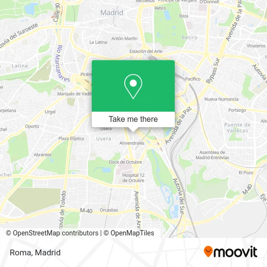
See Roma, Madrid, on the map
Public Transit to Roma in Madrid
Wondering how to get to Roma in Madrid? Moovit helps you find the best way to get to Roma with step-by-step directions from the nearest public transit station.
Moovit provides free maps and live directions to help you navigate through your city. View schedules, routes, timetables, and find out how long does it take to get to Roma in real time.
Looking for the nearest stop or station to Roma? Check out this list of stops closest to your destination: Antonio López - Vado; Almendrales; Glorieta De Cádiz; Santuario; Doce De Octubre; Legazpi.
Bus: 123, 18, 23, 45, 6, 78, 85, N12, 22, 59, 76, 79, 411, 421, 422, 424, 426.Train: C5.Metro: M-3, M-6.
Want to see if there’s another route that gets you there at an earlier time? Moovit helps you find alternative routes or times. Get directions from and directions to Roma easily from the Moovit App or Website.
We make riding to Roma easy, which is why over 1.5 million users, including users in Madrid, trust Moovit as the best app for public transit. You don’t need to download an individual bus app or train app, Moovit is your all-in-one transit app that helps you find the best bus time or train time available.
For information on prices of metro, bus and train, costs and ride fares to Roma, please check the Moovit app.
Use the app to navigate to popular places including to the airport, hospital, stadium, grocery store, mall, coffee shop, school, college, and university.
Roma Address: Calle de Antonio López, 191 street in Madrid
- Calle de Antonio López 193,
- Lidl,
- C/ Antonio López 232,
- Farmacia 12 de Octubre,
- José Ángel Veiga Dupre,
- Urbanización Los Madroños,
- La Cordelera Manchega S. L.,
- La Reina De Las Tortillas,
- Calle de Antonio López 177,
- Avenida de Córdoba 21,
- Edificio Empresarial Avenida Córdoba, 21,
- Parada de Autobus # 5703,
- Lux Direct España,
- Fundación Asha-Kiran,
- Bar La Alegria,
- Farmacia - Calle Antonio López 199,
- C/ Antonio López 199,
- Hernandez Martinez Angel,
- Metro Almendrales,
- Estación de Almendrales
Places Near Roma (Madrid)
- Mercadillo de Majadahonda, Majadahonda,
- Wizink Center, Madrid,
- Palacio De Vistalegre, Área Metropolitana De Madrid Y Corredor Del Henares,
- Centro Comercial La Gavia, Área Metropolitana De Madrid Y Corredor Del Henares,
- Hospital Universitario La Paz, Madrid,
- Mendez Alvaro, Madrid,
- Centro Comercial Islazul, Área Metropolitana De Madrid Y Corredor Del Henares,
- Estacion de Chamartin, Madrid,
- Plenilunio, Área Metropolitana De Madrid Y Corredor Del Henares,
- Plaza Mayor, Madrid,
- Centro Comercial La Vaguada, Área Metropolitana De Madrid Y Corredor Del Henares,
- Nassica, Área Metropolitana De Madrid Y Corredor Del Henares,
- Hospital Clínico Universitario San Carlos, Madrid,
- Rastro De Madrid, Área Metropolitana De Madrid Y Corredor Del Henares,
- Tres Aguas, Alcorcón,
- Centro Comercial Oasiz Madrid, Área Metropolitana De Madrid Y Corredor Del Henares,
- Calle de López de Hoyos 169, Madrid,
- Sala La Riviera, Madrid,
- Estadio Wanda Metropolitano, Área Metropolitana De Madrid Y Corredor Del Henares,
- Hospital Universitario Ramón y Cajal, Madrid
How to get to popular places in Madrid with public transit
Get around Madrid by public transit!
Traveling around Madrid has never been so easy. See step by step directions as you travel to any attraction, street or major public transit station. View bus and train schedules, arrival times, service alerts and detailed routes on a map, so you know exactly how to get to anywhere in Madrid.
When traveling to any destination around Madrid use Moovit's Live Directions with Get Off Notifications to know exactly where and how far to walk, how long to wait for your line, and how many stops are left. Moovit will alert you when it's time to get off — no need to constantly re-check whether yours is the next stop.
Wondering how to use public transit in Madrid or how to pay for public transit in Madrid? Moovit public transit app can help you navigate your way with public transit easily, and at minimum cost. It includes public transit fees, ticket prices, and costs. Looking for a map of Madrid public transit lines? Moovit public transit app shows all public transit maps in Madrid with all Bus, Train, Metro and Light Rail routes and stops on an interactive map.
Madrid has 4 transit type(s), including: Bus, Train, Metro and Light Rail, operated by several transit agencies, including Metro de Madrid, Metro Ligero, Tranvía de Parla, Renfe Cercanías - Servicios de Autobús especiales, Renfe Cercanias, Renfe Cercanías, EMT, Interurbanos, Urbanos de Alcalá de Henares, Urbanos de Alcobendas, Urbanos de Alcorcón, Urbanos de Algete, Urbanos de Aranjuez, Urbanos de Arganda del Rey and Urbanos de Arroyomolinos