How to get to Roma Cafe by bus?
Click on the bus route to see step by step directions with maps, line arrival times and updated time schedules.
From SMS Bus Lot, Indianapolis City (Balance)
35 minFrom I-465 at 10th Street, Indianapolis City (Balance)
40 minFrom Indiana State Fairgrounds South Pavilion (Saddle Horse Barn), Indianapolis City (Balance)
35 minFrom Rockitcoin, Indianapolis City (Balance)
45 minFrom S Arlington Ave / E Raymond St, Indianapolis City (Balance)
45 minFrom Rockville Rd. and Holt Rd., Indianapolis City (Balance)
33 minFrom 46th Street & Emerson Avenue, Indianapolis City (Balance)
42 minFrom Topwot, Indianapolis City (Balance)
23 min
Bus stops near Roma Cafe in Indianapolis City (Balance)
- Indianapolis (E Washington St), 4 min walk,VIEW
- Ohio St & Pennsylvania St, 4 min walk,VIEW
- Ctc-R, 4 min walk,VIEW
- Ctc-J, 5 min walk,VIEW
- Ctc-D, 5 min walk,VIEW
- Ctc-K, 5 min walk,VIEW
- Ctc-C, 5 min walk,VIEW
- Ctc-A, 5 min walk,VIEW
- Ctc-G, 10 min walk,VIEW
- Ctc-F, 10 min walk,VIEW
- Ctc-T, 11 min walk,VIEW
- Ctc-H, 11 min walk,VIEW
- Ctc-S, 11 min walk,VIEW
Bus lines to Roma Cafe in Indianapolis City (Balance)
- FLIXBUS 2511, Milwaukee - Chicago - Columbus,VIEW
- FLIXBUS 2512, Chicago - Louisville - Atlanta,VIEW
- FLIXBUS 2514, Madison - Chicago - Cincinnati,VIEW
- FLIXBUS 2515, Chicago - Indianapolis - Bloomington,IN,VIEW
- FLIXBUS N2640, NYC - Pittsburgh - Chicago,VIEW
- FLIXBUS N2642, NYC - Cincinnati - Chicago,VIEW
- 11, East 16th St,VIEW
- 25, W 16th St,VIEW
- 6, Harding,VIEW
- 15, West 34th St,VIEW
- 21, East 21st St,VIEW
- 31, U S 31,VIEW
- 37, Park 100,VIEW
- 38, West 38th St,VIEW
- 26, Keystone Crossing,VIEW
- 92, Transit Center,VIEW
- 16, Transit Center,VIEW
- 24, Ameriplex,VIEW
- 10, Meijer Avon,VIEW
- 28, Transit Center,VIEW
What are the closest stations to Roma Cafe?
The closest stations to Roma Cafe are:
- Indianapolis (E Washington St) is 261 yards away, 4 min walk.
- Ohio St & Pennsylvania St is 277 yards away, 4 min walk.
- Ctc-R is 282 yards away, 4 min walk.
- Ctc-J is 340 yards away, 5 min walk.
- Ctc-D is 367 yards away, 5 min walk.
- Ctc-K is 374 yards away, 5 min walk.
- Ctc-C is 390 yards away, 5 min walk.
- Ctc-A is 405 yards away, 5 min walk.
- Ctc-G is 752 yards away, 10 min walk.
- Ctc-F is 793 yards away, 10 min walk.
- Ctc-T is 822 yards away, 11 min walk.
- Ctc-H is 823 yards away, 11 min walk.
- Ctc-S is 848 yards away, 11 min walk.
Which bus lines stop near Roma Cafe?
These bus lines stop near Roma Cafe: 2, 25, 3, 4, 56, 8, 90, 92.
What’s the nearest bus station to Roma Cafe in Indianapolis City (Balance)?
The nearest bus stations to Roma Cafe in Indianapolis City (Balance) are Indianapolis (E Washington St), Ohio St & Pennsylvania St and Ctc-R. The closest one is a 4 min walk away.
What time is the first bus to Roma Cafe in Indianapolis City (Balance)?
The FLIXBUS N2640 is the first bus that goes to Roma Cafe in Indianapolis City (Balance). It stops nearby at 3:15 AM.
What time is the last bus to Roma Cafe in Indianapolis City (Balance)?
The FLIXBUS N2642 is the last bus that goes to Roma Cafe in Indianapolis City (Balance). It stops nearby at 4:10 PM.
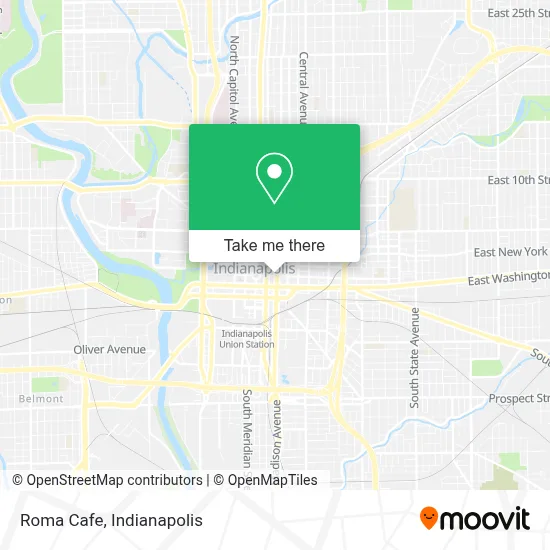
See Roma Cafe, Indianapolis City (Balance), on the map
Public Transit to Roma Cafe in Indianapolis City (Balance)
Wondering how to get to Roma Cafe in Indianapolis City (Balance)? Moovit helps you find the best way to get to Roma Cafe with step-by-step directions from the nearest public transit station.
Moovit provides free maps and live directions to help you navigate through your city. View schedules, routes, timetables, and find out how long does it take to get to Roma Cafe in real time.
Looking for the nearest stop or station to Roma Cafe? Check out this list of stops closest to your destination: Indianapolis (E Washington St); Ohio St & Pennsylvania St; Ctc-R; Ctc-J; Ctc-D; Ctc-K; Ctc-C; Ctc-A; Ctc-G; Ctc-F; Ctc-T; Ctc-H; Ctc-S.
Bus: 2, 25, 3, 4, 56, 8, 90, 92, FLIXBUS 2511, FLIXBUS 2512, FLIXBUS 2514, FLIXBUS 2515, FLIXBUS N2640, 11, 6, 15, 21, 31, 37, 26, 16, 24.
Want to see if there’s another route that gets you there at an earlier time? Moovit helps you find alternative routes or times. Get directions from and directions to Roma Cafe easily from the Moovit App or Website.
We make riding to Roma Cafe easy, which is why over 1.5 million users, including users in Indianapolis City (Balance), trust Moovit as the best app for public transit. You don’t need to download an individual bus app or train app, Moovit is your all-in-one transit app that helps you find the best bus time or train time available.
For information on prices of bus, costs and ride fares to Roma Cafe, please check the Moovit app.
Use the app to navigate to popular places including to the airport, hospital, stadium, grocery store, mall, coffee shop, school, college, and university.
Roma Cafe Address: 156 E Market St street in Indianapolis City (Balance)
- Paniq Escape Room,
- Paddock,
- Skiles Detrude,
- Law Offices of Cook, Richard A,
- Jackson Legal Services, PC,
- T&R CPA Services,
- Compass Residential & Consulting Market,
- Policy Studies,
- Mays Property,
- Law Office of Danielle Gregory,
- Law Office of Michael Barnes,
- Meredith Bail Bonds,
- Lmodelz Model Management,
- Reed LLC Thomas,
- Custom Expressions Alterations & Design,
- Indiana Council on Problem Gambling,
- Stock Yards Bank,
- Aloft,
- Sipes Law Firm,
- Ethos Market Strategy
Places Near Roma Cafe (Indianapolis City (Balance))
- Plainfield, IN, Plainfield,
- Cotter's Massage Parlor With Happy Endings, Indianapolis City (Balance),
- Indiana, Indianapolis City (Balance),
- 119 W 19th St Parking, Indianapolis City (Balance),
- Gainbridge Fieldhouse, Indianapolis City (Balance),
- I-465 / I-65 Interchange, Indianapolis City (Balance),
- Indiana Convention Center, Indianapolis City (Balance),
- St. Vincent Hospital - Indianapolis, Indianapolis City (Balance),
- Lilly Corporate Center (Eli Lilly & Co), Indianapolis City (Balance),
- St. Vincent entrance #1, Indianapolis City (Balance),
- Indianapolis Airport Zone 2, Indianapolis City (Balance),
- Indianapolis Motor Speedway, Speedway,
- Castleton Square Mall, Indianapolis,
- Train Ride At Castleton Mall, Indianapolis City (Balance),
- Eskenazi Hospital, Indianapolis City (Balance),
- Methodist Hospital of Indianapolis, Indianapolis City (Balance),
- Jersey Barn, Indianapolis City (Balance),
- I U Health Methodist Hospital, Indianapolis City (Balance),
- Lucas Oil Stadium, Indianapolis City (Balance),
- THE BALT, Indianapolis City (Balance)
How to get to popular places in Indianapolis with public transit
Get around Indianapolis City (Balance) by public transit!
Traveling around Indianapolis City (Balance) has never been so easy. See step by step directions as you travel to any attraction, street or major public transit station. View bus and train schedules, arrival times, service alerts and detailed routes on a map, so you know exactly how to get to anywhere in Indianapolis City (Balance).
When traveling to any destination around Indianapolis City (Balance) use Moovit's Live Directions with Get Off Notifications to know exactly where and how far to walk, how long to wait for your line, and how many stops are left. Moovit will alert you when it's time to get off — no need to constantly re-check whether yours is the next stop.
Wondering how to use public transit in Indianapolis City (Balance) or how to pay for public transit in Indianapolis City (Balance)? Moovit public transit app can help you navigate your way with public transit easily, and at minimum cost. It includes public transit fees, ticket prices, and costs. Looking for a map of Indianapolis City (Balance) public transit lines? Moovit public transit app shows all public transit maps in Indianapolis City (Balance) with all bus routes and stops on an interactive map.
Indianapolis has 1 transit type(s), including: bus, operated by several transit agencies, including IndyGo, FlixBus-us and Greyhound-us