How to get to Romeros Cleaning by bus?
Click on the bus route to see step by step directions with maps, line arrival times and updated time schedules.
Bus stops near Romeros Cleaning in Worcester County
Bus lines to Romeros Cleaning in Worcester County
What are the closest stations to Romeros Cleaning?
The closest stations to Romeros Cleaning are:
- Franklin Ave. (Across From Medical Center) is 278 yards away, 4 min walk.
- Atlantic General Hospital is 1215 yards away, 15 min walk.
Which bus line stops near Romeros Cleaning?
203W (Salisbury)
What’s the nearest bus station to Romeros Cleaning in Worcester County?
The nearest bus station to Romeros Cleaning in Worcester County is Franklin Ave. (Across From Medical Center). It’s a 4 min walk away.
What time is the first bus to Romeros Cleaning in Worcester County?
The 203E is the first bus that goes to Romeros Cleaning in Worcester County. It stops nearby at 5:49 AM.
What time is the last bus to Romeros Cleaning in Worcester County?
The 503S is the last bus that goes to Romeros Cleaning in Worcester County. It stops nearby at 12:32 AM.
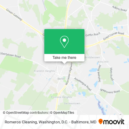
See Romeros Cleaning, Worcester County, on the map
Public Transit to Romeros Cleaning in Worcester County
Wondering how to get to Romeros Cleaning in Worcester County? Moovit helps you find the best way to get to Romeros Cleaning with step-by-step directions from the nearest public transit station.
Moovit provides free maps and live directions to help you navigate through your city. View schedules, routes, timetables, and find out how long does it take to get to Romeros Cleaning in real time.
Looking for the nearest stop or station to Romeros Cleaning? Check out this list of stops closest to your destination: Franklin Ave. (Across From Medical Center); Atlantic General Hospital.
Bus: 203W, 203E, 503N, 503S.
Want to see if there’s another route that gets you there at an earlier time? Moovit helps you find alternative routes or times. Get directions from and directions to Romeros Cleaning easily from the Moovit App or Website.
We make riding to Romeros Cleaning easy, which is why over 1.5 million users, including users in Worcester County, trust Moovit as the best app for public transit. You don’t need to download an individual bus app or train app, Moovit is your all-in-one transit app that helps you find the best bus time or train time available.
For information on prices of bus, costs and ride fares to Romeros Cleaning, please check the Moovit app.
Use the app to navigate to popular places including to the airport, hospital, stadium, grocery store, mall, coffee shop, school, college, and university.
Romeros Cleaning Address: Williams St Berlin, MD 21811 street in Worcester County
- Positive Passing,
- Codapet,
- Taylored To You Services,
- Local Plumbing,
- Freeman Landscape,
- Adkins Electric Co.,
- Amanda F Kiesewetter CPA,
- Maryland State Government Drinking Driver Monitor Program DDMP,
- Atlantic General Hospital,
- Coinstar - Bitcoin ATM,
- Frank Benvenuto, PA,
- Counseling Associates,
- Akman & Associates LLC,
- Cozy Recordings,
- Fresh Face Esthetics,
- Briana Lee DPT,
- MD Berlin MD,
- Berlin Maryland,
- Versatile Homes,
- Forgotten 50 Distilling
Places Near Romeros Cleaning (Worcester County)
- Georgetown, Washington,
- Washington DC VA Medical Center, Washington,
- Rock Creek Tennis Center, Washington,
- National Zoo, Washington,
- PG Mall, Prince George's County,
- Camden Yards, Baltimore,
- Warner Theatre, Washington,
- Basilica of the National Shrine, Washington,
- The Anthem, Washington,
- Pennsylvania Ave NW (3rd st and pennsylvania), Washington,
- National Mall, Washington,
- Washington National Cathedral, Washington,
- M&T Bank Stadium, Baltimore,
- Marriott Marquis Washington, DC, Washington,
- Amazon Hq2, Arlington County,
- National Museum of African American History and Culture, Washington,
- Westfield Montgomery Mall, Montgomery County,
- Museum Of The Bible, Washington,
- Sibley Memorial Hospital, Washington,
- Capital One Arena, Washington
How to get to popular places in Washington, D.C. - Baltimore, MD with public transit
Get around Worcester County by public transit!
Traveling around Worcester County has never been so easy. See step by step directions as you travel to any attraction, street or major public transit station. View bus and train schedules, arrival times, service alerts and detailed routes on a map, so you know exactly how to get to anywhere in Worcester County.
When traveling to any destination around Worcester County use Moovit's Live Directions with Get Off Notifications to know exactly where and how far to walk, how long to wait for your line, and how many stops are left. Moovit will alert you when it's time to get off — no need to constantly re-check whether yours is the next stop.
Wondering how to use public transit in Worcester County or how to pay for public transit in Worcester County? Moovit public transit app can help you navigate your way with public transit easily, and at minimum cost. It includes public transit fees, ticket prices, and costs. Looking for a map of Worcester County public transit lines? Moovit public transit app shows all public transit maps in Worcester County with all Bus, Train, Metro, Light Rail and Ferry routes and stops on an interactive map.
Washington, D.C. - Baltimore, MD has 5 transit type(s), including: Bus, Train, Metro, Light Rail and Ferry, operated by several transit agencies, including WMATA, Montgomery County Ride On, Fairfax Connector, TheBus, PRTC, DASH - Alexandria, Arlington Transit (ART), RTA of Central Maryland, MDOT MTA, MDOT MTA Light RailLink, MDOT MTA Commuter Bus, MDOT MTA Local Bus, FXBGO!, Virginia Railway Express (VRE) and MARC