How to get to Romo by bus?
Click on the bus route to see step by step directions with maps, line arrival times and updated time schedules.
From Fundación Juan March, Área Metropolitana De Madrid Y Corredor Del Henares
70 minFrom Serrano, Madrid
73 minFrom Islazul (Centro Comercial Islazul), Madrid
92 minFrom Centro Comercial H2O, Rivas-Vaciamadrid
73 minFrom Calle de Santa Cruz de Marcenado, Madrid
81 minFrom San Isidro, Área Metropolitana De Madrid Y Corredor Del Henares
71 minFrom Palacio Vistalegre, Madrid
82 minFrom Calle de Juan Bravo 49, Madrid
57 minFrom Caixa Forum, Madrid
48 minFrom Hospital HM Universitario Madrid, Madrid
65 min
How to get to Romo by train?
Click on the train route to see step by step directions with maps, line arrival times and updated time schedules.
From Fundación Juan March, Área Metropolitana De Madrid Y Corredor Del Henares
65 minFrom Serrano, Madrid
56 minFrom Calle de Santa Cruz de Marcenado, Madrid
65 minFrom San Isidro, Área Metropolitana De Madrid Y Corredor Del Henares
64 minFrom Palacio Vistalegre, Madrid
78 minFrom Caixa Forum, Madrid
47 minFrom Hospital HM Universitario Madrid, Madrid
68 min
How to get to Romo by metro?
Click on the metro route to see step by step directions with maps, line arrival times and updated time schedules.
From Fundación Juan March, Área Metropolitana De Madrid Y Corredor Del Henares
46 minFrom Serrano, Madrid
41 minFrom Islazul (Centro Comercial Islazul), Madrid
69 minFrom Centro Comercial H2O, Rivas-Vaciamadrid
105 minFrom Calle de Santa Cruz de Marcenado, Madrid
43 minFrom San Isidro, Área Metropolitana De Madrid Y Corredor Del Henares
48 minFrom Palacio Vistalegre, Madrid
52 minFrom Calle de Juan Bravo 49, Madrid
35 minFrom Caixa Forum, Madrid
30 minFrom Hospital HM Universitario Madrid, Madrid
41 min
Bus stops near Romo in Madrid
Metro station near Romo in Madrid
- Congosto, 5 min walk,VIEW
Train station near Romo in Madrid
- Vallecas, 26 min walk,VIEW
Bus lines to Romo in Madrid
What are the closest stations to Romo?
The closest stations to Romo are:
- Fuentidueña - Peña Cervera is 137 meters away, 2 min walk.
- Congosto is 268 meters away, 4 min walk.
- Ecobulevar is 532 meters away, 7 min walk.
- Vallecas is 1988 meters away, 26 min walk.
Which bus lines stop near Romo?
These bus lines stop near Romo: 142, 145, 54.
Which train lines stop near Romo?
These train lines stop near Romo: C2, C7.
Which metro line stops near Romo?
M-1 (Valdecarros)
What’s the nearest metro station to Romo in Madrid?
The nearest metro station to Romo in Madrid is Congosto. It’s a 5 min walk away.
What’s the nearest train station to Romo in Madrid?
The nearest train station to Romo in Madrid is Vallecas. It’s a 26 min walk away.
What’s the nearest bus station to Romo in Madrid?
The nearest bus station to Romo in Madrid is Fuentidueña - Peña Cervera. It’s a 2 min walk away.
What time is the first metro to Romo in Madrid?
The M-1 is the first metro that goes to Romo in Madrid. It stops nearby at 6:05 AM.
What time is the last metro to Romo in Madrid?
The M-1 is the last metro that goes to Romo in Madrid. It stops nearby at 2:19 AM.
What time is the first train to Romo in Madrid?
The C2 is the first train that goes to Romo in Madrid. It stops nearby at 5:51 AM.
What time is the last train to Romo in Madrid?
The C2 is the last train that goes to Romo in Madrid. It stops nearby at 12:00 AM.
What time is the first bus to Romo in Madrid?
The 54 is the first bus that goes to Romo in Madrid. It stops nearby at 7:00 AM.
What time is the last bus to Romo in Madrid?
The N9 is the last bus that goes to Romo in Madrid. It stops nearby at 3:36 AM.
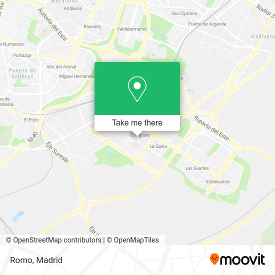
See Romo, Madrid, on the map
Public Transit to Romo in Madrid
Wondering how to get to Romo in Madrid? Moovit helps you find the best way to get to Romo with step-by-step directions from the nearest public transit station.
Moovit provides free maps and live directions to help you navigate through your city. View schedules, routes, timetables, and find out how long does it take to get to Romo in real time.
Looking for the nearest stop or station to Romo? Check out this list of stops closest to your destination: Fuentidueña - Peña Cervera; Congosto; Ecobulevar; Vallecas.
Bus: 142, 145, 54, N9, 103.Train: C2, C7.Metro: M-1.
Want to see if there’s another route that gets you there at an earlier time? Moovit helps you find alternative routes or times. Get directions from and directions to Romo easily from the Moovit App or Website.
We make riding to Romo easy, which is why over 1.5 million users, including users in Madrid, trust Moovit as the best app for public transit. You don’t need to download an individual bus app or train app, Moovit is your all-in-one transit app that helps you find the best bus time or train time available.
For information on prices of metro, bus and train, costs and ride fares to Romo, please check the Moovit app.
Use the app to navigate to popular places including to the airport, hospital, stadium, grocery store, mall, coffee shop, school, college, and university.
Romo Address: Calle de Villacañas, 1 28031 Casco Histórico de Vallecas Madrid street in Madrid
- Asesoria Jesan,
- Luxury Pintura y Decoración,
- Peluquería Rayan,
- Farmacia José Chacon Hernández,
- Peña Cervera - Fuentidueña,
- Cl Congosto,
- Calle del Congosto 68,
- Ponte Mas Guapa -Tallas para Todas,
- cajamar,
- av. Villa de Vallecas - Congosto,
- I Más B,
- Estetica Mini,
- Drogueria Perfumeria L,
- Calle de Peña Cervera / Calle de Fuentidueña,
- Juan Miguel Almagro Pascual,
- Calle Sierra de Bobia 3,
- Avenida Cerro Milano 1,
- Calle Congosto 47,
- Estación de Congosto,
- Serendipia Lounge
Places Near Romo (Madrid)
- Centro Comercial Oasiz Madrid, Área Metropolitana De Madrid Y Corredor Del Henares,
- Hospital Universitario La Paz, Madrid,
- Mercadillo de Majadahonda, Majadahonda,
- Tres Aguas, Alcorcón,
- Centro Comercial La Vaguada, Área Metropolitana De Madrid Y Corredor Del Henares,
- Mendez Alvaro, Madrid,
- Plenilunio, Área Metropolitana De Madrid Y Corredor Del Henares,
- Wizink Center, Madrid,
- Centro Comercial La Gavia, Área Metropolitana De Madrid Y Corredor Del Henares,
- Centro Comercial Islazul, Área Metropolitana De Madrid Y Corredor Del Henares,
- Estadio Wanda Metropolitano, Área Metropolitana De Madrid Y Corredor Del Henares,
- Palacio De Vistalegre, Área Metropolitana De Madrid Y Corredor Del Henares,
- Hospital Clínico Universitario San Carlos, Madrid,
- Hospital Universitario Ramón y Cajal, Madrid,
- Nassica, Área Metropolitana De Madrid Y Corredor Del Henares,
- Plaza Mayor, Madrid,
- Estacion de Chamartin, Madrid,
- Rastro De Madrid, Área Metropolitana De Madrid Y Corredor Del Henares,
- Calle de López de Hoyos 169, Madrid,
- Sala La Riviera, Madrid
How to get to popular places in Madrid with public transit
Get around Madrid by public transit!
Traveling around Madrid has never been so easy. See step by step directions as you travel to any attraction, street or major public transit station. View bus and train schedules, arrival times, service alerts and detailed routes on a map, so you know exactly how to get to anywhere in Madrid.
When traveling to any destination around Madrid use Moovit's Live Directions with Get Off Notifications to know exactly where and how far to walk, how long to wait for your line, and how many stops are left. Moovit will alert you when it's time to get off — no need to constantly re-check whether yours is the next stop.
Wondering how to use public transit in Madrid or how to pay for public transit in Madrid? Moovit public transit app can help you navigate your way with public transit easily, and at minimum cost. It includes public transit fees, ticket prices, and costs. Looking for a map of Madrid public transit lines? Moovit public transit app shows all public transit maps in Madrid with all Bus, Train, Metro and Light Rail routes and stops on an interactive map.
Madrid has 4 transit type(s), including: Bus, Train, Metro and Light Rail, operated by several transit agencies, including Metro de Madrid, Metro Ligero, Tranvía de Parla, Renfe Cercanías - Servicios de Autobús especiales, Renfe Cercanias, Renfe Cercanías, EMT, Interurbanos, Urbanos de Alcalá de Henares, Urbanos de Alcobendas, Urbanos de Alcorcón, Urbanos de Algete, Urbanos de Aranjuez, Urbanos de Arganda del Rey and Urbanos de Arroyomolinos