How to get to Rond-Point du Forest by bus?
Click on the bus route to see step by step directions with maps, line arrival times and updated time schedules.
How to get to Rond-Point du Forest by train?
Click on the train route to see step by step directions with maps, line arrival times and updated time schedules.
How to get to Rond-Point du Forest by metro?
Click on the metro route to see step by step directions with maps, line arrival times and updated time schedules.
From La Luck, Lille
81 minFrom Koezio, Villeneuve-D'Ascq
72 minFrom Rectorat de Lille, Lille
70 minFrom Rue des Canonniers, Lille
65 minFrom Mama Shelter Lille, Lille
64 minFrom Rue du Palais de Justice, Lille
74 minFrom Oney, Croix
60 minFrom Romarin, La Madeleine
71 minFrom Tribunal D'instance, Lille
74 minFrom Ifp, Lille
61 min
Bus stops near Rond-Point du Forest in Bondues
Light Rail stations near Rond-Point du Forest in Bondues
- Faidherbe, 7 min walk,VIEW
Metro station near Rond-Point du Forest in Bondues
- Colbert, 18 min walk,VIEW
Bus lines to Rond-Point du Forest in Bondues
What are the closest stations to Rond-Point du Forest?
The closest stations to Rond-Point du Forest are:
- Voltaire is 238 meters away, 4 min walk.
- Amsterdam is 493 meters away, 7 min walk.
- Faidherbe is 540 meters away, 7 min walk.
- Lorthiois is 1080 meters away, 14 min walk.
- Les Fougères is 1238 meters away, 16 min walk.
- Colbert is 1385 meters away, 18 min walk.
Which bus lines stop near Rond-Point du Forest?
These bus lines stop near Rond-Point du Forest: 87, 906, Z4.
Which train lines stop near Rond-Point du Forest?
These train lines stop near Rond-Point du Forest: K80, P80.
Which metro line stops near Rond-Point du Forest?
M2 (Tourcoing C.H. Dron)
What’s the nearest light rail station to Rond-Point du Forest in Bondues?
The nearest light rail station to Rond-Point du Forest in Bondues is Faidherbe. It’s a 7 min walk away.
What’s the nearest metro station to Rond-Point du Forest in Bondues?
The nearest metro station to Rond-Point du Forest in Bondues is Colbert. It’s a 18 min walk away.
What’s the nearest bus station to Rond-Point du Forest in Bondues?
The nearest bus station to Rond-Point du Forest in Bondues is Voltaire. It’s a 4 min walk away.
What time is the first light rail to Rond-Point du Forest in Bondues?
The TRAM is the first light rail that goes to Rond-Point du Forest in Bondues. It stops nearby at 5:22 AM.
What time is the last light rail to Rond-Point du Forest in Bondues?
The TRAM is the last light rail that goes to Rond-Point du Forest in Bondues. It stops nearby at 1:05 AM.
What time is the first metro to Rond-Point du Forest in Bondues?
The M2 is the first metro that goes to Rond-Point du Forest in Bondues. It stops nearby at 5:05 AM.
What time is the last metro to Rond-Point du Forest in Bondues?
The M2 is the last metro that goes to Rond-Point du Forest in Bondues. It stops nearby at 12:59 AM.
What time is the first bus to Rond-Point du Forest in Bondues?
The Z4 is the first bus that goes to Rond-Point du Forest in Bondues. It stops nearby at 5:08 AM.
What time is the last bus to Rond-Point du Forest in Bondues?
The Z4 is the last bus that goes to Rond-Point du Forest in Bondues. It stops nearby at 9:13 PM.
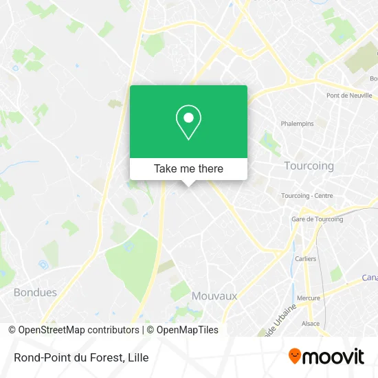
See Rond-Point du Forest, Bondues, on the map
Public Transit to Rond-Point du Forest in Bondues
Wondering how to get to Rond-Point du Forest in Bondues? Moovit helps you find the best way to get to Rond-Point du Forest with step-by-step directions from the nearest public transit station.
Moovit provides free maps and live directions to help you navigate through your city. View schedules, routes, timetables, and find out how long does it take to get to Rond-Point du Forest in real time.
Looking for the nearest stop or station to Rond-Point du Forest? Check out this list of stops closest to your destination: Voltaire; Amsterdam; Faidherbe; Lorthiois; Les Fougères; Colbert.
Bus: 87, 906, Z4, C8, 978, 904.Train: K80, P80.Metro: M2.
Want to see if there’s another route that gets you there at an earlier time? Moovit helps you find alternative routes or times. Get directions from and directions to Rond-Point du Forest easily from the Moovit App or Website.
We make riding to Rond-Point du Forest easy, which is why over 1.5 million users, including users in Bondues, trust Moovit as the best app for public transit. You don’t need to download an individual bus app or train app, Moovit is your all-in-one transit app that helps you find the best bus time or train time available.
For information on prices of bus, metro, light rail and train, costs and ride fares to Rond-Point du Forest, please check the Moovit app.
Use the app to navigate to popular places including to the airport, hospital, stadium, grocery store, mall, coffee shop, school, college, and university.
Rond-Point du Forest Address: Rond-Point du Forest, 59910 Bondues, France street in Bondues
- Poney du Forest,
- Le Comptoir de l'Hirondelle,
- Z.A. Ravennes Les Francs,
- Societe Ftr,
- La Botte Chantilly,
- Axodiet,
- Avenue d'Amsterdam 93,
- Ravennes les Francs,
- V.A.A.T,
- La Botte Chantilly Bondues,
- Sure Hotel by Best Western Lille Tourcoing,
- Axone,
- Groupe Vandenberghe,
- PA Ravennes les Francs,
- So Végétal,
- Sonepar,
- Burger King Lille Bondues,
- Codexia,
- Ferme du Forest,
- Rond-Point des Ravennes
Places Near Rond-Point du Forest (Bondues)
- Champ De Mars, Lille,
- Kinepolis Lomme, Lille,
- Ikea, Lille,
- Théâtre Sébastopol, Lille,
- Rue de la Porte d'Ypres 1, Lille,
- Euratechnologies, Lille,
- Zoo De Lille, Lille,
- Hôpital Salengro, Lille,
- Marché De Wazemmes, Lille,
- Clinique du Bois, Lille,
- Centre Commercial V2, Villeneuve-D'Ascq,
- Consulat General D'Algerie, Lille,
- Auchan Englos, Englos,
- Hôpital Saint-Vincent De Paul, Lille,
- Université Catholique, Lille,
- Ffffff, Lezennes,
- L'Usine, Roubaix,
- Saint-André-Lez-Lille, Saint-André-Lez-Lille,
- Zénith Arena, Lille,
- Hôpital Claude Huriez, Lille
How to get to popular places in Lille with public transit
Get around Bondues by public transit!
Traveling around Bondues has never been so easy. See step by step directions as you travel to any attraction, street or major public transit station. View bus and train schedules, arrival times, service alerts and detailed routes on a map, so you know exactly how to get to anywhere in Bondues.
When traveling to any destination around Bondues use Moovit's Live Directions with Get Off Notifications to know exactly where and how far to walk, how long to wait for your line, and how many stops are left. Moovit will alert you when it's time to get off — no need to constantly re-check whether yours is the next stop.
Wondering how to use public transit in Bondues or how to pay for public transit in Bondues? Moovit public transit app can help you navigate your way with public transit easily, and at minimum cost. It includes public transit fees, ticket prices, and costs. Looking for a map of Bondues public transit lines? Moovit public transit app shows all public transit maps in Bondues with all Bus, Train, Metro and Light Rail routes and stops on an interactive map.
Lille has 4 transit type(s), including: Bus, Train, Metro and Light Rail, operated by several transit agencies, including TRANSPOLE and SNCF VOYAGEURS