How to get to Ronda De Toledo by bus?
Click on the bus route to see step by step directions with maps, line arrival times and updated time schedules.
From Tanatorio Norte, Madrid
65 minFrom Julián Camarillo, Madrid
59 minFrom IKEA-La Gavia, Madrid
63 minFrom Centro Comercial La Gavia, Área Metropolitana De Madrid Y Corredor Del Henares
59 minFrom Avenida Poblados s/n, Madrid
39 minFrom Poligono Los Olivos, Getafe
79 minFrom Paseo de la Habana, Madrid
51 minFrom Ikea, Área Metropolitana De Madrid Y Corredor Del Henares
62 minFrom Extracciones Hospital La Paz, Madrid
49 minFrom La Gavia, Madrid
63 min
How to get to Ronda De Toledo by train?
Click on the train route to see step by step directions with maps, line arrival times and updated time schedules.
How to get to Ronda De Toledo by metro?
Click on the metro route to see step by step directions with maps, line arrival times and updated time schedules.
From Tanatorio Norte, Madrid
61 minFrom Julián Camarillo, Madrid
53 minFrom IKEA-La Gavia, Madrid
55 minFrom Centro Comercial La Gavia, Área Metropolitana De Madrid Y Corredor Del Henares
50 minFrom Avenida Poblados s/n, Madrid
35 minFrom Paseo de la Habana, Madrid
49 minFrom Ikea, Área Metropolitana De Madrid Y Corredor Del Henares
51 minFrom Extracciones Hospital La Paz, Madrid
51 minFrom La Gavia, Madrid
54 min
Bus stops near Ronda De Toledo in Madrid
Train station near Ronda De Toledo in Madrid
- Embajadores, 6 min walk,VIEW
Bus lines to Ronda De Toledo in Madrid
- M1, Embajadores,VIEW
- 27, Embajadores,VIEW
- 41, Col. Manzanares,VIEW
- 60, Orcasitas,VIEW
- 148, Puente Vallecas,VIEW
- C1, Circular 1,VIEW
- C03, Puerta Toledo,VIEW
- C2, Circular 2,VIEW
- NC2, Estacion Atocha,VIEW
- 34, Las Aguilas,VIEW
- 36, Campamento,VIEW
- 119, Barrio Goya,VIEW
- N12, Butarque,VIEW
- N15, H. 12 Octubre,VIEW
- 78, San Fermin,VIEW
- 116, Villaverde Cruce,VIEW
- 118, La Peseta,VIEW
- 62, Los Puertos,VIEW
- NC1, Cuatro Caminos,VIEW
What are the closest stations to Ronda De Toledo?
The closest stations to Ronda De Toledo are:
- Mercado San Fernando is 266 meters away, 4 min walk.
- Embajadores is 419 meters away, 6 min walk.
- Embajadores - Ronda De Toledo is 489 meters away, 7 min walk.
- Embajadores - Acacias is 540 meters away, 8 min walk.
- Acacias is 797 meters away, 11 min walk.
- El Rastro is 817 meters away, 11 min walk.
Which bus lines stop near Ronda De Toledo?
These bus lines stop near Ronda De Toledo: 148, 27, 34, C1.
Which train line stops near Ronda De Toledo?
C5 (Móstoles - El Soto)
Which metro lines stop near Ronda De Toledo?
These metro lines stop near Ronda De Toledo: M-3, M-5.
What’s the nearest metro station to Ronda De Toledo in Madrid?
The nearest metro station to Ronda De Toledo in Madrid is Embajadores. It’s a 6 min walk away.
What’s the nearest train station to Ronda De Toledo in Madrid?
The nearest train station to Ronda De Toledo in Madrid is Embajadores. It’s a 6 min walk away.
What’s the nearest bus station to Ronda De Toledo in Madrid?
The nearest bus station to Ronda De Toledo in Madrid is Mercado San Fernando. It’s a 4 min walk away.
What time is the first metro to Ronda De Toledo in Madrid?
The M-5 is the first metro that goes to Ronda De Toledo in Madrid. It stops nearby at 6:05 AM.
What time is the last metro to Ronda De Toledo in Madrid?
The M-5 is the last metro that goes to Ronda De Toledo in Madrid. It stops nearby at 2:07 AM.
What time is the first train to Ronda De Toledo in Madrid?
The C5 is the first train that goes to Ronda De Toledo in Madrid. It stops nearby at 5:42 AM.
What time is the last train to Ronda De Toledo in Madrid?
The C5 is the last train that goes to Ronda De Toledo in Madrid. It stops nearby at 12:13 AM.
What time is the first bus to Ronda De Toledo in Madrid?
The 27 is the first bus that goes to Ronda De Toledo in Madrid. It stops nearby at 7:00 AM.
What time is the last bus to Ronda De Toledo in Madrid?
The NC2 is the last bus that goes to Ronda De Toledo in Madrid. It stops nearby at 3:24 AM.
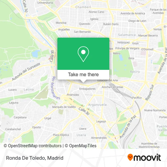
See Ronda De Toledo, Madrid, on the map
Public Transit to Ronda De Toledo in Madrid
Wondering how to get to Ronda De Toledo in Madrid? Moovit helps you find the best way to get to Ronda De Toledo with step-by-step directions from the nearest public transit station.
Moovit provides free maps and live directions to help you navigate through your city. View schedules, routes, timetables, and find out how long does it take to get to Ronda De Toledo in real time.
Looking for the nearest stop or station to Ronda De Toledo? Check out this list of stops closest to your destination: Mercado San Fernando; Embajadores; Embajadores - Ronda De Toledo; Embajadores - Acacias; Acacias; El Rastro.
Bus: 148, 27, 34, C1, M1, 41, 60, C03.Train: C5.Metro: M-3, M-5.
Want to see if there’s another route that gets you there at an earlier time? Moovit helps you find alternative routes or times. Get directions from and directions to Ronda De Toledo easily from the Moovit App or Website.
We make riding to Ronda De Toledo easy, which is why over 1.5 million users, including users in Madrid, trust Moovit as the best app for public transit. You don’t need to download an individual bus app or train app, Moovit is your all-in-one transit app that helps you find the best bus time or train time available.
For information on prices of metro, bus and train, costs and ride fares to Ronda De Toledo, please check the Moovit app.
Use the app to navigate to popular places including to the airport, hospital, stadium, grocery store, mall, coffee shop, school, college, and university.
Location: Madrid
- Parque del Casino de La Reina,
- Calle Casino 3,
- Maquiborda,
- Nox Club,
- Comisaría de Policía de Madrid-Arganzuela,
- Colegio Público Emilia Pardo Bazán,
- Real Conservatorio Danza Mariemma,
- Gibraltar,
- Policía Nacional - Comisaría De Arganzuela.,
- Instituto Bilingüe De Secundaria Cervantes,
- Calle de Embajadores 70,
- Lidl,
- Casino De La Reina,
- El Refugio,
- Calle Soria 5,
- Escuela Cientifica Basilio,
- Ieieie,
- EOI Embajadores,
- Tienda Hipica,
- Tio Pepe
Places Near Ronda De Toledo (Madrid)
- Hospital Universitario Ramón y Cajal, Madrid,
- Calle de López de Hoyos 169, Madrid,
- Estacion de Chamartin, Madrid,
- Rastro De Madrid, Área Metropolitana De Madrid Y Corredor Del Henares,
- Sala La Riviera, Madrid,
- Centro Comercial Oasiz Madrid, Área Metropolitana De Madrid Y Corredor Del Henares,
- Tres Aguas, Alcorcón,
- Centro Comercial Islazul, Área Metropolitana De Madrid Y Corredor Del Henares,
- Centro Comercial La Vaguada, Área Metropolitana De Madrid Y Corredor Del Henares,
- Wizink Center, Madrid,
- Plenilunio, Área Metropolitana De Madrid Y Corredor Del Henares,
- Plaza Mayor, Madrid,
- Hospital Clínico Universitario San Carlos, Madrid,
- Palacio De Vistalegre, Área Metropolitana De Madrid Y Corredor Del Henares,
- Centro Comercial La Gavia, Área Metropolitana De Madrid Y Corredor Del Henares,
- Estadio Wanda Metropolitano, Área Metropolitana De Madrid Y Corredor Del Henares,
- Mendez Alvaro, Madrid,
- Hospital Universitario La Paz, Madrid,
- Mercadillo de Majadahonda, Majadahonda,
- Nassica, Área Metropolitana De Madrid Y Corredor Del Henares
How to get to popular places in Madrid with public transit
Get around Madrid by public transit!
Traveling around Madrid has never been so easy. See step by step directions as you travel to any attraction, street or major public transit station. View bus and train schedules, arrival times, service alerts and detailed routes on a map, so you know exactly how to get to anywhere in Madrid.
When traveling to any destination around Madrid use Moovit's Live Directions with Get Off Notifications to know exactly where and how far to walk, how long to wait for your line, and how many stops are left. Moovit will alert you when it's time to get off — no need to constantly re-check whether yours is the next stop.
Wondering how to use public transit in Madrid or how to pay for public transit in Madrid? Moovit public transit app can help you navigate your way with public transit easily, and at minimum cost. It includes public transit fees, ticket prices, and costs. Looking for a map of Madrid public transit lines? Moovit public transit app shows all public transit maps in Madrid with all Bus, Train, Metro and Light Rail routes and stops on an interactive map.
Madrid has 4 transit type(s), including: Bus, Train, Metro and Light Rail, operated by several transit agencies, including Metro de Madrid, Metro Ligero, Tranvía de Parla, Renfe Cercanías - Servicios de Autobús especiales, Renfe Cercanias, Renfe Cercanías, EMT, Interurbanos, Urbanos de Alcalá de Henares, Urbanos de Alcobendas, Urbanos de Alcorcón, Urbanos de Algete, Urbanos de Aranjuez, Urbanos de Arganda del Rey and Urbanos de Arroyomolinos