Directions to Rondello's Roadside Rescue (Lawrence) with public transportation
The following transit lines have routes that pass near Rondello's Roadside Rescue
 Bus: 4.
How to get to Rondello's Roadside Rescue by bus?
Click on the bus route to see step by step directions with maps, line arrival times and updated time schedules.
From Indiana School for the Blind, Indianapolis City (Balance)
71 minFrom Ivy Tech Community College, Indianapolis City (Balance)
43 minFrom Ecoatm, Indianapolis City (Balance)
53 minFrom The Yellow House, Indianapolis City (Balance)
44 minFrom Tienda Guatemalteca, Indianapolis City (Balance)
59 minFrom Dina Varano Ma LMHC, Indianapolis City (Balance)
53 minFrom Hinkle Fieldhouse, Indianapolis City (Balance)
48 minFrom Dennis Sears Snap on, Indianapolis City (Balance)
37 minFrom Childrens Museum, Indianapolis City (Balance)
41 minFrom Hunt Brothers Pizza, Indianapolis City (Balance)
38 min
Bus stop near Rondello's Roadside Rescue in Lawrence
- 46th St & Kitley Ave, 8 min walk,VIEW
Bus lines to Rondello's Roadside Rescue in Lawrence
- 4, Transit Center,VIEW
What are the closest stations to Rondello's Roadside Rescue?
The closest stations to Rondello's Roadside Rescue are:
- 46th St & Kitley Ave is 633 yards away, 8 min walk.
Which bus line stops near Rondello's Roadside Rescue?
4 (Transit Center)
What’s the nearest bus station to Rondello's Roadside Rescue in Lawrence?
The nearest bus station to Rondello's Roadside Rescue in Lawrence is 46th St & Kitley Ave. It’s a 8 min walk away.
What time is the first bus to Rondello's Roadside Rescue in Lawrence?
The 4 is the first bus that goes to Rondello's Roadside Rescue in Lawrence. It stops nearby at 5:47 AM.
What time is the last bus to Rondello's Roadside Rescue in Lawrence?
The 4 is the last bus that goes to Rondello's Roadside Rescue in Lawrence. It stops nearby at 9:55 PM.
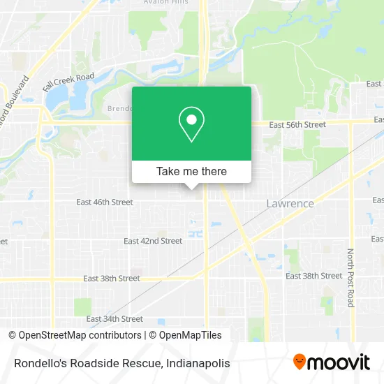
See Rondello's Roadside Rescue, Lawrence, on the map
Public Transit to Rondello's Roadside Rescue in Lawrence
Wondering how to get to Rondello's Roadside Rescue in Lawrence? Moovit helps you find the best way to get to Rondello's Roadside Rescue with step-by-step directions from the nearest public transit station.
Moovit provides free maps and live directions to help you navigate through your city. View schedules, routes, timetables, and find out how long does it take to get to Rondello's Roadside Rescue in real time.
Looking for the nearest stop or station to Rondello's Roadside Rescue? Check out this list of stops closest to your destination: 46th St & Kitley Ave.
Bus: 4.
Want to see if there’s another route that gets you there at an earlier time? Moovit helps you find alternative routes or times. Get directions from and directions to Rondello's Roadside Rescue easily from the Moovit App or Website.
We make riding to Rondello's Roadside Rescue easy, which is why over 1.5 million users, including users in Lawrence, trust Moovit as the best app for public transit. You don’t need to download an individual bus app or train app, Moovit is your all-in-one transit app that helps you find the best bus time or train time available.
For information on prices of bus, costs and ride fares to Rondello's Roadside Rescue, please check the Moovit app.
Use the app to navigate to popular places including to the airport, hospital, stadium, grocery store, mall, coffee shop, school, college, and university.
Rondello's Roadside Rescue Address: 4646 Dean St street in Lawrence
- Elect Tyrrell Giles For Indiana House District 95,
- St Lawrence Church,
- Outdoor Cover Warehouse,
- The Ekwall Insurance & Financial Group: Allstate Insurance,
- Moli Painting LLC,
- Marathon,
- E&E Garage Doors,
- Providence Star Martial Arts,
- D&T's Event Center,
- Gas Garage Inc,
- Booker's Bbq & Southern Breakfast,
- Israel Church Of Jesus Indianapolis,
- ATM,
- E 46th St / N Shadeland Ave,
- Taqueria Los Primos,
- Terminix,
- Bp,
- Dales Mobile Repairs,
- Loc’D In,
- We Are Locksmith
Places Near Rondello's Roadside Rescue (Lawrence)
- Jersey Barn, Indianapolis City (Balance),
- Lilly Corporate Center (Eli Lilly & Co), Indianapolis City (Balance),
- Cotter's Massage Parlor With Happy Endings, Indianapolis City (Balance),
- Indianapolis Airport Zone 2, Indianapolis City (Balance),
- Methodist Hospital of Indianapolis, Indianapolis City (Balance),
- Plainfield, IN, Plainfield,
- Indiana, Indianapolis City (Balance),
- THE BALT, Indianapolis City (Balance),
- Gainbridge Fieldhouse, Indianapolis City (Balance),
- Indiana Convention Center, Indianapolis City (Balance),
- I U Health Methodist Hospital, Indianapolis City (Balance),
- I-465 / I-65 Interchange, Indianapolis City (Balance),
- Indianapolis Motor Speedway, Speedway,
- Eskenazi Hospital, Indianapolis City (Balance),
- 119 W 19th St Parking, Indianapolis City (Balance),
- Lucas Oil Stadium, Indianapolis City (Balance),
- St. Vincent Hospital - Indianapolis, Indianapolis City (Balance),
- St. Vincent entrance #1, Indianapolis City (Balance),
- Castleton Square Mall, Indianapolis,
- Train Ride At Castleton Mall, Indianapolis City (Balance)
How to get to popular places in Indianapolis with public transit
Get around Lawrence by public transit!
Traveling around Lawrence has never been so easy. See step by step directions as you travel to any attraction, street or major public transit station. View bus and train schedules, arrival times, service alerts and detailed routes on a map, so you know exactly how to get to anywhere in Lawrence.
When traveling to any destination around Lawrence use Moovit's Live Directions with Get Off Notifications to know exactly where and how far to walk, how long to wait for your line, and how many stops are left. Moovit will alert you when it's time to get off — no need to constantly re-check whether yours is the next stop.
Wondering how to use public transit in Lawrence or how to pay for public transit in Lawrence? Moovit public transit app can help you navigate your way with public transit easily, and at minimum cost. It includes public transit fees, ticket prices, and costs. Looking for a map of Lawrence public transit lines? Moovit public transit app shows all public transit maps in Lawrence with all bus routes and stops on an interactive map.
Indianapolis has 1 transit type(s), including: bus, operated by several transit agencies, including IndyGo, FlixBus-us and Greyhound-us