How to get to Ropa Hindu by Colectivo?
Click on the Colectivo route to see step by step directions with maps, line arrival times and updated time schedules.
From Mercedes, Distrito Federal
49 minFrom Instituto Superior de Seguridad Pública, Distrito Federal
49 minFrom Costanera Norte, Palermo
45 minFrom Puente Saavedra, Nuñez
43 minFrom Cruce Av. General Paz y Av. del Libertador, Nuñez
44 minFrom Avenida Juan B. Alberdi, Distrito Federal
51 minFrom Paysandú 1842, Distrito Federal
27 minFrom Venezuela 1380, Avellaneda
57 minFrom Cbc Sede Paternal, Distrito Federal
34 minFrom Lacroze Y Cabildo, Distrito Federal
27 min
How to get to Ropa Hindu by Subte?
Click on the Subte route to see step by step directions with maps, line arrival times and updated time schedules.
Colectivo stops near Ropa Hindu in Distrito Federal
Train station near Ropa Hindu in Distrito Federal
- Estación Once, 3 min walk,VIEW
Colectivo lines to Ropa Hindu in Distrito Federal
- 8, Liniers - Hospital Argerich (X Av. Rivadavia),VIEW
- 86, D: S | Km. 35 Catán x Autop. x 3,VIEW
- 105, A: Correo Central x Santos Lugares,VIEW
- 151, A: Puente Saavedra,VIEW
- 7, B: Retiro,VIEW
- 98, 116 (Rojo): Barrio Gráfico x Barrio Nuñez,VIEW
- 64, A Bcas. De Belgrano (Por Hipódromo),VIEW
- 129, D: Once x Autopista,VIEW
- 197, I: Ingeniero Allan - Once (x Autopista),VIEW
- 168, D: Av. Córdoba y Darwin,VIEW
What are the closest stations to Ropa Hindu?
The closest stations to Ropa Hindu are:
- Avenida Rivadavia Y Paso (8 - 86) is 71 meters away, 2 min walk.
- Avenida Rivadavia Y Paso (105 - 129) is 92 meters away, 2 min walk.
- Plaza Once (151) is 106 meters away, 2 min walk.
- Avenida Rivadavia Y Paso (7 - 98) is 111 meters away, 2 min walk.
- Avenida Rivadavia Y Paso (64 - 129 - 151 - 197) is 145 meters away, 3 min walk.
- Paso Y Mitre is 166 meters away, 3 min walk.
- Estación Once is 234 meters away, 3 min walk.
- Alberti is 260 meters away, 4 min walk.
- Once is 288 meters away, 4 min walk.
Which Colectivo lines stop near Ropa Hindu?
These Colectivo lines stop near Ropa Hindu: 105, 168, 68, 7, 8, 98.
Which Subte line stops near Ropa Hindu?
H (Hospitales→Facultad De Derecho)
What’s the nearest Subte station to Ropa Hindu in Distrito Federal?
The nearest Subte stations to Ropa Hindu in Distrito Federal are Alberti and Once. The closest one is a 4 min walk away.
What’s the nearest train station to Ropa Hindu in Distrito Federal?
The nearest train station to Ropa Hindu in Distrito Federal is Estación Once. It’s a 3 min walk away.
What’s the nearest Colectivo station to Ropa Hindu in Distrito Federal?
The nearest Colectivo stations to Ropa Hindu in Distrito Federal are Avenida Rivadavia Y Paso (8 - 86), Avenida Rivadavia Y Paso (105 - 129), Plaza Once (151) and Avenida Rivadavia Y Paso (7 - 98). The closest one is a 2 min walk away.
What time is the first Subte to Ropa Hindu in Distrito Federal?
The A is the first Subte that goes to Ropa Hindu in Distrito Federal. It stops nearby at 5:37 AM.
What time is the last Subte to Ropa Hindu in Distrito Federal?
The H is the last Subte that goes to Ropa Hindu in Distrito Federal. It stops nearby at 11:40 PM.
What time is the first train to Ropa Hindu in Distrito Federal?
The SARMIENTO is the first train that goes to Ropa Hindu in Distrito Federal. It stops nearby at 3:59 AM.
What time is the last train to Ropa Hindu in Distrito Federal?
The SARMIENTO is the last train that goes to Ropa Hindu in Distrito Federal. It stops nearby at 7:50 AM.
What time is the first Colectivo to Ropa Hindu in Distrito Federal?
The 64 is the first Colectivo that goes to Ropa Hindu in Distrito Federal. It stops nearby at 3:01 AM.
What time is the last Colectivo to Ropa Hindu in Distrito Federal?
The 8 is the last Colectivo that goes to Ropa Hindu in Distrito Federal. It stops nearby at 4:10 AM.
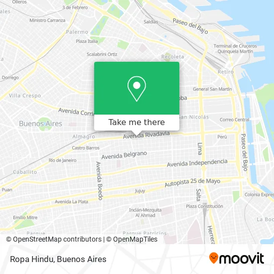
See Ropa Hindu, Distrito Federal, on the map
Public Transit to Ropa Hindu in Distrito Federal
Wondering how to get to Ropa Hindu in Distrito Federal? Moovit helps you find the best way to get to Ropa Hindu with step-by-step directions from the nearest public transit station.
Moovit provides free maps and live directions to help you navigate through your city. View schedules, routes, timetables, and find out how long does it take to get to Ropa Hindu in real time.
Looking for the nearest stop or station to Ropa Hindu? Check out this list of stops closest to your destination: Avenida Rivadavia Y Paso (8 - 86); Avenida Rivadavia Y Paso (105 - 129); Plaza Once (151); Avenida Rivadavia Y Paso (7 - 98); Avenida Rivadavia Y Paso (64 - 129 - 151 - 197); Paso Y Mitre; Estación Once; Alberti; Once.
Colectivo: 105, 168, 68, 7, 8, 98, 86, 151.Train: SARMIENTO.Subte: H, A.
Want to see if there’s another route that gets you there at an earlier time? Moovit helps you find alternative routes or times. Get directions from and directions to Ropa Hindu easily from the Moovit App or Website.
We make riding to Ropa Hindu easy, which is why over 1.5 million users, including users in Distrito Federal, trust Moovit as the best app for public transit. You don’t need to download an individual bus app or train app, Moovit is your all-in-one transit app that helps you find the best bus time or train time available.
For information on prices of Colectivo, Subte and train, costs and ride fares to Ropa Hindu, please check the Moovit app.
Use the app to navigate to popular places including to the airport, hospital, stadium, grocery store, mall, coffee shop, school, college, and university.
Ropa Hindu Address: Avenida Rivadavia street in Distrito Federal
- Zona Cines - Coto,
- Metro Blanc,
- Avenida Rivadavia 2600,
- Avenida Rivadavia / Paso,
- Avenida Rivadavia / Saavedra,
- Calle Paso,
- rivadavia 2100,
- Castelli,
- Avenida Rivadavia / Misiones,
- Avenida Rivadavia / Castelli,
- Rivadavia al 2500,
- Avenida Rivadavia 2583 C1034ACE,
- Misiones 55,
- Ministerio de Desarrollo Social de la Nación,
- Castelli (Hotel Castelli 75 - Once),
- ADOLFO ALSINA al 2600,
- Av Rivadavia 2500,
- Paseo del Once,
- Avenida Hipolito Yrigoyen 2699 12"D",
- MISIONES 100
Places Near Ropa Hindu (Distrito Federal)
- Movistar Arena, Distrito Federal,
- Estadio Monumental (River Plate), Distrito Federal,
- Tecnópolis, Vicente López,
- Abasto Shopping, Distrito Federal,
- Parque de la Ciudad, Distrito Federal,
- Once, Distrito Federal,
- Barrio Chino, Distrito Federal,
- Avellaneda, Avellaneda,
- Aeropuerto Ezeiza, Distrito Federal,
- Dot Baires Shopping, Vicente López,
- La Plata, La Plata,
- Aeroparque Jorge Newbery,
- CABA, Distrito Federal,
- Unicenter Shopping, San Isidro,
- Buenos Aires, Distrito Federal,
- Jardín Japonés, Distrito Federal,
- Flores, Distrito Federal,
- La Plata, La Plata,
- Hospital Santa Lucia, Distrito Federal,
- Facultad de Odontología (UBA), Distrito Federal
How to get to popular places in Buenos Aires with public transit
Get around Distrito Federal by public transit!
Traveling around Distrito Federal has never been so easy. See step by step directions as you travel to any attraction, street or major public transit station. View bus and train schedules, arrival times, service alerts and detailed routes on a map, so you know exactly how to get to anywhere in Distrito Federal.
When traveling to any destination around Distrito Federal use Moovit's Live Directions with Get Off Notifications to know exactly where and how far to walk, how long to wait for your line, and how many stops are left. Moovit will alert you when it's time to get off — no need to constantly re-check whether yours is the next stop.
Wondering how to use public transit in Distrito Federal or how to pay for public transit in Distrito Federal? Moovit public transit app can help you navigate your way with public transit easily, and at minimum cost. It includes public transit fees, ticket prices, and costs. Looking for a map of Distrito Federal public transit lines? Moovit public transit app shows all public transit maps in Distrito Federal with all Colectivo, Train, Subte, Light Rail and Ferry routes and stops on an interactive map.
Buenos Aires has 5 transit type(s), including: Colectivo, Train, Subte, Light Rail and Ferry, operated by several transit agencies, including Municipalidad Carmen de Areco, Trenes Argentinos, Ferrovías, Metrovías, Subte de Buenos Aires, Doscientos Ocho Transporte Automotor S.A., Empresa del Oeste, Empresa de Transportes Tratado del PIlar S.R.L., Transportes Veintidos de Septiembre, Sargento Cabral, Transportes Sesenta y Ocho, Transportes Quirno Costa, Transportes Santa Fe, Transportes Automotores Riachuelo and Transportes Atlantida