Directions to Ropa y Novedades Mary (San Jerónimo Tecuanipan) with public transportation
The following transit lines have routes that pass near Ropa y Novedades Mary
 Bus: RUTA PUEBLA-CHOLULA, RUTA S14A, RUTA S14B.
How to get to Ropa y Novedades Mary by bus?
Click on the bus route to see step by step directions with maps, line arrival times and updated time schedules.
From Boulevard San Felipe, San Pedro Cholula
50 minFrom AUTOBUSES FLETES Y PASAJES S.A de C.V fypsa puebla, San Pedro Cholula
65 minFrom LOMAS TURBAS, Ocoyucan
62 minFrom Marriott Puebla Hotel Meson Del Angel, San Pedro Cholula
60 minFrom UPAEP angelopolis, San Andrés Cholula
40 minFrom SAT Puebla 1, San Andrés Cholula
48 minFrom Centro Comercial Cruz del Sur, San Pedro Cholula
34 minFrom Plaza San Bartolo, Ocoyucan
52 minFrom Oficinas OXXO Puebla, San Andrés Cholula
56 minFrom Centro de Vinculación UPAEP, San Andrés Cholula
61 min
Bus stops near Ropa y Novedades Mary in San Jerónimo Tecuanipan
Bus lines to Ropa y Novedades Mary in San Jerónimo Tecuanipan
What are the closest stations to Ropa y Novedades Mary?
The closest stations to Ropa y Novedades Mary are:
- Calle 2 Sur, 2112 is 118 meters away, 2 min walk.
- Avenida Miguel Alemán, 1904 is 188 meters away, 3 min walk.
- Calle 25 Poniente, 408 is 222 meters away, 3 min walk.
Which bus lines stop near Ropa y Novedades Mary?
These bus lines stop near Ropa y Novedades Mary: RUTA PUEBLA-CHOLULA, RUTA S14A, RUTA S14B.
What’s the nearest bus station to Ropa y Novedades Mary in San Jerónimo Tecuanipan?
The nearest bus station to Ropa y Novedades Mary in San Jerónimo Tecuanipan is Calle 2 Sur, 2112. It’s a 2 min walk away.
What time is the first bus to Ropa y Novedades Mary in San Jerónimo Tecuanipan?
The RUTA S14B is the first bus that goes to Ropa y Novedades Mary in San Jerónimo Tecuanipan. It stops nearby at 6:07 AM.
What time is the last bus to Ropa y Novedades Mary in San Jerónimo Tecuanipan?
The RUTA S14B is the last bus that goes to Ropa y Novedades Mary in San Jerónimo Tecuanipan. It stops nearby at 11:23 PM.
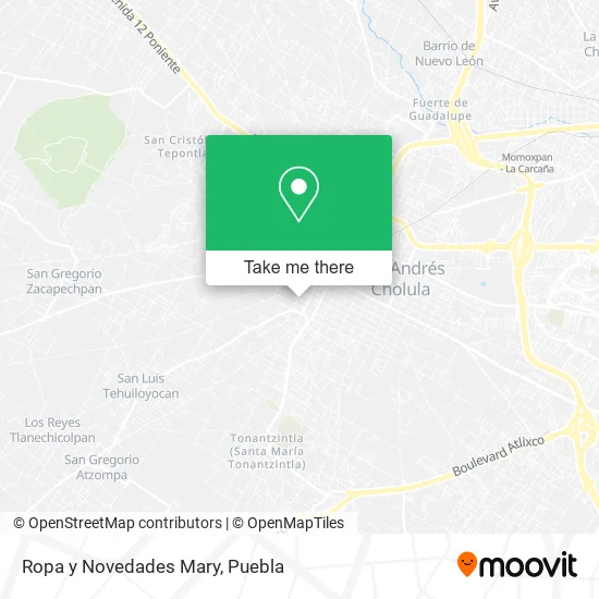
See Ropa y Novedades Mary, San Jerónimo Tecuanipan, on the map
Public Transit to Ropa y Novedades Mary in San Jerónimo Tecuanipan
Wondering how to get to Ropa y Novedades Mary in San Jerónimo Tecuanipan? Moovit helps you find the best way to get to Ropa y Novedades Mary with step-by-step directions from the nearest public transit station.
Moovit provides free maps and live directions to help you navigate through your city. View schedules, routes, timetables, and find out how long does it take to get to Ropa y Novedades Mary in real time.
Looking for the nearest stop or station to Ropa y Novedades Mary? Check out this list of stops closest to your destination: Calle 2 Sur; Avenida Miguel Alemán; Calle 25 Poniente.
Bus: RUTA PUEBLA-CHOLULA, RUTA S14A, RUTA S14B.
Want to see if there’s another route that gets you there at an earlier time? Moovit helps you find alternative routes or times. Get directions from and directions to Ropa y Novedades Mary easily from the Moovit App or Website.
We make riding to Ropa y Novedades Mary easy, which is why over 1.5 million users, including users in San Jerónimo Tecuanipan, trust Moovit as the best app for public transit. You don’t need to download an individual bus app or train app, Moovit is your all-in-one transit app that helps you find the best bus time or train time available.
For information on prices of bus, costs and ride fares to Ropa y Novedades Mary, please check the Moovit app.
Use the app to navigate to popular places including to the airport, hospital, stadium, grocery store, mall, coffee shop, school, college, and university.
Ropa y Novedades Mary Address: Ropa y Novedades Mary, Avenida 25 Poniente 103, Barrio La Magdalena, 72762 San Pedro Cholula, Puebl street in San Jerónimo Tecuanipan
- Cocina Economica Mary,
- Deposito de Cerveza Modelo,
- Polleria Baby Chiceken,
- Santuario del Señor de la Misericordia San Pedro Cholula,
- Artigiano,
- Barrio de la Magdalena,
- Centro de Control Canino,
- Miscelánea Chuyan,
- Castillo De León,
- Avenida 21 Poniente 308,
- Escuela de Artes Marciales Moo Duk Kwan,
- Pinturas y Muros Comerciales Comex,
- WESTERN UNION,
- La Via Autopartes,
- Carniceria Percino,
- Buena Tierra Cholula,
- Barrio La Magdalena,
- Olimpo Men's Club,
- Restaurante Doña Ana,
- Panteón La Magdalena
Places Near Ropa y Novedades Mary (San Jerónimo Tecuanipan)
- Ciudad Universitaria, Puebla,
- Tres Cruces, Puebla,
- Centro Comercial Angelópolis, San Andrés Cholula,
- Estadio Cuauhtémoc, Puebla,
- Zona de los Fuertes, Puebla,
- Parque Ecologico, Pue., San Andrés Cholula,
- Centro Integral de Servicios CIS, San Andrés Cholula,
- Plaza Dorada Centro Comercial, Puebla,
- Hospital General Regional 36 IMSS San Alejandro, San Andrés Cholula,
- Parque Puebla, Puebla,
- Complejo Cultural Universitario, Ocoyucan,
- Plaza Las Animas, Puebla,
- 25 Zona Militar, Puebla,
- Secretaria de Finanzas, Puebla,
- Ciudad Judicial del Estado de Puebla, San Andrés Cholula,
- Hospital Imss La Margarita, Puebla,
- Centro de Desarrollo Comunitario Tres Cruces, Puebla,
- Hospital Traumatología y Ortopedia de Puebla, San Pedro Cholula,
- SAT, San Andrés Cholula,
- Galerías Serdán, San Pedro Cholula
How to get to popular places in Puebla with public transit
Get around San Jerónimo Tecuanipan by public transit!
Traveling around San Jerónimo Tecuanipan has never been so easy. See step by step directions as you travel to any attraction, street or major public transit station. View bus and train schedules, arrival times, service alerts and detailed routes on a map, so you know exactly how to get to anywhere in San Jerónimo Tecuanipan.
When traveling to any destination around San Jerónimo Tecuanipan use Moovit's Live Directions with Get Off Notifications to know exactly where and how far to walk, how long to wait for your line, and how many stops are left. Moovit will alert you when it's time to get off — no need to constantly re-check whether yours is the next stop.
Wondering how to use public transit in San Jerónimo Tecuanipan or how to pay for public transit in San Jerónimo Tecuanipan? Moovit public transit app can help you navigate your way with public transit easily, and at minimum cost. It includes public transit fees, ticket prices, and costs. Looking for a map of San Jerónimo Tecuanipan public transit lines? Moovit public transit app shows all public transit maps in San Jerónimo Tecuanipan with all bus routes and stops on an interactive map.
Puebla has 1 transit type(s), including: bus, operated by several transit agencies, including RUTA, RUTA Alimentadoras, Rutas Convencionales and Líneas temporales