Directions to Ropa y Paqueteria Cholula (San Jerónimo Tecuanipan) with public transportation
The following transit lines have routes that pass near Ropa y Paqueteria Cholula
How to get to Ropa y Paqueteria Cholula by bus?
Click on the bus route to see step by step directions with maps, line arrival times and updated time schedules.
From Colegio San Ángel de Puebla, Ocoyucan
41 minFrom Biblioteca UMAA Hospital San Alejandro, San Andrés Cholula
45 minFrom Col. Belisario Domínguez, San Andrés Cholula
40 minFrom Agua Azul, San Andrés Cholula
64 minFrom Calzada Zavaleta, San Pedro Cholula
27 minFrom Caseta Atlixco - Puebla, Ocoyucan
68 minFrom RUTA: San Alejandro, San Andrés Cholula
48 minFrom Colonia Aquiles Serdan, San Pedro Cholula
33 minFrom Universidad Popular Autónoma Del Estado De Puebla, San Andrés Cholula
50 minFrom Oficinas OXXO Puebla, San Andrés Cholula
49 min
Bus stops near Ropa y Paqueteria Cholula in San Jerónimo Tecuanipan
Bus lines to Ropa y Paqueteria Cholula in San Jerónimo Tecuanipan
- RUTA PUEBLA-CHOLULA, Ramal 8 , Puebla - Tianguismanalco (Regreso),VIEW
- RUTA S14A, Ramal 4, Santa María Xixitla - Puebla Centro,VIEW
- RUTA S23, Ramal 1, Santa María Acuexcomac - Centro,VIEW
- RUTA PASO DE CORTÉS, Ramal San Nicolás - Cholula (Ida),VIEW
- RUTA SAN BUENAVENTURA, Ramal San Buenaventura - Cholula (Circuito),VIEW
- RUTA SAN JERÓNIMO TECUANÍPAN, Ramal San Jerónimo Tecuanípan - Cholula (Ida),VIEW
- RUTA S14B, Ramal 1, San Pedro Mexicaltzingo -Puebla Centro,VIEW
- RUTA S16, Ramal 2, San Matías Cocoyotla - San Cosme Texintla,VIEW
- RUTA SAN NICOLÁS DE LOS RANCHOS, Ramal San Nicolás De Los Ranchos - Puebla (Ida),VIEW
What are the closest stations to Ropa y Paqueteria Cholula?
The closest stations to Ropa y Paqueteria Cholula are:
- Calle 5 Sur, 104c is 51 meters away, 1 min walk.
- Calle 3 Poniente - Calle 7 Sur is 131 meters away, 2 min walk.
- Avenida 2 Poniente, 703 is 326 meters away, 5 min walk.
- Avenida Miguel Hidalgo, 204 is 333 meters away, 5 min walk.
Which bus lines stop near Ropa y Paqueteria Cholula?
These bus lines stop near Ropa y Paqueteria Cholula: RUTA PUEBLA-CHOLULA, RUTA S14A, RUTA S14B, RUTA S23.
What’s the nearest bus station to Ropa y Paqueteria Cholula in San Jerónimo Tecuanipan?
The nearest bus station to Ropa y Paqueteria Cholula in San Jerónimo Tecuanipan is Calle 5 Sur, 104c. It’s a 1 min walk away.
What time is the first bus to Ropa y Paqueteria Cholula in San Jerónimo Tecuanipan?
The RUTA PUEBLA-CHOLULA is the first bus that goes to Ropa y Paqueteria Cholula in San Jerónimo Tecuanipan. It stops nearby at 6:00 AM.
What time is the last bus to Ropa y Paqueteria Cholula in San Jerónimo Tecuanipan?
The RUTA S16 is the last bus that goes to Ropa y Paqueteria Cholula in San Jerónimo Tecuanipan. It stops nearby at 11:27 PM.
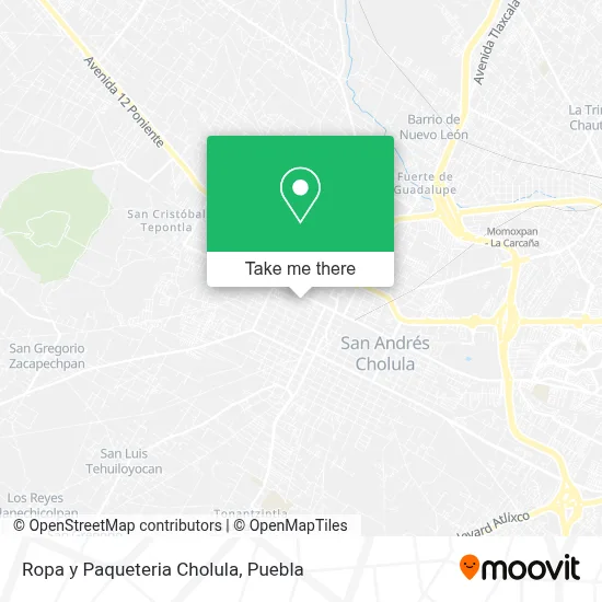
See Ropa y Paqueteria Cholula, San Jerónimo Tecuanipan, on the map
Public Transit to Ropa y Paqueteria Cholula in San Jerónimo Tecuanipan
Wondering how to get to Ropa y Paqueteria Cholula in San Jerónimo Tecuanipan? Moovit helps you find the best way to get to Ropa y Paqueteria Cholula with step-by-step directions from the nearest public transit station.
Moovit provides free maps and live directions to help you navigate through your city. View schedules, routes, timetables, and find out how long does it take to get to Ropa y Paqueteria Cholula in real time.
Looking for the nearest stop or station to Ropa y Paqueteria Cholula? Check out this list of stops closest to your destination: Calle 5 Sur; Calle 3 Poniente - Calle 7 Sur; Avenida 2 Poniente; Avenida Miguel Hidalgo.
Bus: RUTA PUEBLA-CHOLULA, RUTA S14A, RUTA S14B, RUTA S23, RUTA PASO DE CORTÉS, RUTA SAN BUENAVENTURA, RUTA SAN JERÓNIMO TECUANÍPAN, RUTA S16, RUTA SAN NICOLÁS DE LOS RANCHOS.
Want to see if there’s another route that gets you there at an earlier time? Moovit helps you find alternative routes or times. Get directions from and directions to Ropa y Paqueteria Cholula easily from the Moovit App or Website.
We make riding to Ropa y Paqueteria Cholula easy, which is why over 1.5 million users, including users in San Jerónimo Tecuanipan, trust Moovit as the best app for public transit. You don’t need to download an individual bus app or train app, Moovit is your all-in-one transit app that helps you find the best bus time or train time available.
For information on prices of bus, costs and ride fares to Ropa y Paqueteria Cholula, please check the Moovit app.
Use the app to navigate to popular places including to the airport, hospital, stadium, grocery store, mall, coffee shop, school, college, and university.
Ropa y Paqueteria Cholula Address: Ropa y Paqueteria Cholula, Avenida 3 Poniente 504, San Pedro Cholula Centro, 72760 San Pedro Cholul street in San Jerónimo Tecuanipan
- Financiera Ama,
- Financiera Crecer,
- Dr. Ahorro Cholula 1,
- Tienda de Regalos TE Lo Regalo,
- WESTERN UNION,
- CELMA,
- La Cocina de Maque,
- Carnicería Tete,
- Casa de Empeño Piramide Lori,
- Instituto Vanguardia,
- Farmacia Medina,
- Ortodental Cholula,
- Plateria El Rubi,
- Boutique So Sweet Little,
- Papas Alvarez,
- Consultorio de Fisioterapia y Rehabilitación Therapy Center,
- Cherryberry,
- Notaría 3 Cholula - Puebla,
- Productos Naturales Regiru,
- Taxi las Americas
Places Near Ropa y Paqueteria Cholula (San Jerónimo Tecuanipan)
- Tres Cruces, Puebla,
- Ciudad Universitaria, Puebla,
- Plaza Las Animas, Puebla,
- Parque Ecologico, Pue., San Andrés Cholula,
- Hospital Imss La Margarita, Puebla,
- Hospital Traumatología y Ortopedia de Puebla, San Pedro Cholula,
- Secretaria de Finanzas, Puebla,
- SAT, San Andrés Cholula,
- Zona de los Fuertes, Puebla,
- Centro Integral de Servicios CIS, San Andrés Cholula,
- Plaza Dorada Centro Comercial, Puebla,
- Parque Puebla, Puebla,
- Complejo Cultural Universitario, Ocoyucan,
- Centro Comercial Angelópolis, San Andrés Cholula,
- Estadio Cuauhtémoc, Puebla,
- Centro de Desarrollo Comunitario Tres Cruces, Puebla,
- Galerías Serdán, San Pedro Cholula,
- Hospital General Regional 36 IMSS San Alejandro, San Andrés Cholula,
- Ciudad Judicial del Estado de Puebla, San Andrés Cholula,
- 25 Zona Militar, Puebla
How to get to popular places in Puebla with public transit
Get around San Jerónimo Tecuanipan by public transit!
Traveling around San Jerónimo Tecuanipan has never been so easy. See step by step directions as you travel to any attraction, street or major public transit station. View bus and train schedules, arrival times, service alerts and detailed routes on a map, so you know exactly how to get to anywhere in San Jerónimo Tecuanipan.
When traveling to any destination around San Jerónimo Tecuanipan use Moovit's Live Directions with Get Off Notifications to know exactly where and how far to walk, how long to wait for your line, and how many stops are left. Moovit will alert you when it's time to get off — no need to constantly re-check whether yours is the next stop.
Wondering how to use public transit in San Jerónimo Tecuanipan or how to pay for public transit in San Jerónimo Tecuanipan? Moovit public transit app can help you navigate your way with public transit easily, and at minimum cost. It includes public transit fees, ticket prices, and costs. Looking for a map of San Jerónimo Tecuanipan public transit lines? Moovit public transit app shows all public transit maps in San Jerónimo Tecuanipan with all bus routes and stops on an interactive map.
Puebla has 1 transit type(s), including: bus, operated by several transit agencies, including RUTA, RUTA Alimentadoras, Rutas Convencionales and Líneas temporales