How to get to Rory's Accounting by bus?
Click on the bus route to see step by step directions with maps, line arrival times and updated time schedules.
From La Colmena del Dr. Fausto Losana, Kendale Lakes-Tamiami
36 minFrom Tropical Park, Miami
59 minFrom Charlie's Pawn Shop, Miami
43 minFrom SW 8th St / SW 62nd Ave, Miami
35 minFrom John A. Ferguson Senior High School, Kendale Lakes-Tamiami
64 minFrom Trump National Doral Miami, North Westside
45 minFrom SW 88th St / SW 137th Ave, Kendale Lakes-Tamiami
35 minFrom Doral Voice, North Westside
74 minFrom Flagler & 57 Ave, Miami
35 minFrom Florida Lottery, Miami
125 min
Bus stops near Rory's Accounting in North Westside
Bus lines to Rory's Accounting in North Westside
What are the closest stations to Rory's Accounting?
The closest stations to Rory's Accounting are:
- W Flagler St & Sw 112 Av is 35 yards away, 1 min walk.
- Sw 112 Av @ W Flagler St is 52 yards away, 1 min walk.
- Sw 109 Av & W Flagler St is 409 yards away, 5 min walk.
Which bus lines stop near Rory's Accounting?
These bus lines stop near Rory's Accounting: 107, 137, 211, 8, DLOOP4.
What’s the nearest bus station to Rory's Accounting in North Westside?
The nearest bus stations to Rory's Accounting in North Westside are W Flagler St & Sw 112 Av and Sw 112 Av @ W Flagler St. The closest one is a 1 min walk away.
What time is the first bus to Rory's Accounting in North Westside?
The 8 is the first bus that goes to Rory's Accounting in North Westside. It stops nearby at 4:46 AM.
What time is the last bus to Rory's Accounting in North Westside?
The 8 is the last bus that goes to Rory's Accounting in North Westside. It stops nearby at 1:30 AM.
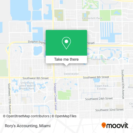
See Rory's Accounting, North Westside, on the map
Public Transit to Rory's Accounting in North Westside
Wondering how to get to Rory's Accounting in North Westside? Moovit helps you find the best way to get to Rory's Accounting with step-by-step directions from the nearest public transit station.
Moovit provides free maps and live directions to help you navigate through your city. View schedules, routes, timetables, and find out how long does it take to get to Rory's Accounting in real time.
Looking for the nearest stop or station to Rory's Accounting? Check out this list of stops closest to your destination: W Flagler St & Sw 112 Av; Sw 112 Av @ W Flagler St; Sw 109 Av & W Flagler St.
Bus: 107, 137, 211, 8, DLOOP4, SWTWTA, SWTWTB.
Want to see if there’s another route that gets you there at an earlier time? Moovit helps you find alternative routes or times. Get directions from and directions to Rory's Accounting easily from the Moovit App or Website.
We make riding to Rory's Accounting easy, which is why over 1.5 million users, including users in North Westside, trust Moovit as the best app for public transit. You don’t need to download an individual bus app or train app, Moovit is your all-in-one transit app that helps you find the best bus time or train time available.
For information on prices of bus and light rail, costs and ride fares to Rory's Accounting, please check the Moovit app.
Use the app to navigate to popular places including to the airport, hospital, stadium, grocery store, mall, coffee shop, school, college, and university.
Rory's Accounting Address: 11180 W Flagler St Miami, FL 33174 street in North Westside
- Ink Me Up Tattoo,
- La Escalerita Cafeteria Restaurant,
- Davila Signature Solutions,
- Lenier Extensiones,
- Rodriguez & Marrero, P.A. - Attorneys - Abogados,
- All Multiservices,
- Adela's Coin Laundry,
- Frank Cafeteria,
- Palabra de Fe Miami,
- Esther Taboada Bakery,
- Criollo's,
- El Valle Vinales,
- Southwest 112th Avenue,
- Del Toro Insurance,
- Fritanga Masayita Y Minimarket,
- Sweetwater House,
- Banquet Hall,
- Delirium Axe Throwing,
- Abis Adult Day Care Inc,
- Semino Family Pharmacy
Places Near Rory's Accounting (North Westside)
- Miami-Dade County Courthouse, Miami,
- Wynwood, Miami,
- Miami Design District, Miami,
- Little Havana, Miami,
- Richard E. Gerstein Justice Building, Miami,
- Keiser University Flagship Campus, West Palm Beach,
- Zoo Miami, Miami,
- Aventura Mall, Miami,
- Brickell City Centre, Miami,
- Sawgrass mall ( FL ), Miami Beach,
- Bayside Marketplace, Miami,
- Aventura Mall, Miami Beach,
- Port of Miami Cruise Terminal, Miami,
- Dolphin Mall, Miami,
- Marlins Park, Miami,
- Miami Freedom Park, Miami,
- Dolphin Mall Bus, Miami,
- Sawgrass Mall, Miami,
- Hard Rock Stadium, Miami Gardens,
- Miami VA Hospital, Miami
How to get to popular places in Miami with public transit
Get around North Westside by public transit!
Traveling around North Westside has never been so easy. See step by step directions as you travel to any attraction, street or major public transit station. View bus and train schedules, arrival times, service alerts and detailed routes on a map, so you know exactly how to get to anywhere in North Westside.
When traveling to any destination around North Westside use Moovit's Live Directions with Get Off Notifications to know exactly where and how far to walk, how long to wait for your line, and how many stops are left. Moovit will alert you when it's time to get off — no need to constantly re-check whether yours is the next stop.
Wondering how to use public transit in North Westside or how to pay for public transit in North Westside? Moovit public transit app can help you navigate your way with public transit easily, and at minimum cost. It includes public transit fees, ticket prices, and costs. Looking for a map of North Westside public transit lines? Moovit public transit app shows all public transit maps in North Westside with all Bus, Train, Light Rail and Ferry routes and stops on an interactive map.
Miami has 4 transit type(s), including: Bus, Train, Light Rail and Ferry, operated by several transit agencies, including Broward County Transit, Miami-Dade Transit, Metrorail, Palm Tran, Tri-Rail, Brightline, MARTY, City of Homestead Trolley, Key West Transit, Treasure Coast Connector, GoLine IRT, Amtrak, Greyhound-us, FlixBus-us and Aventura Express Shuttle Bus