Directions to Rosa Jagas (Colombo) with public transportation
The following transit lines have routes that pass near Rosa Jagas
How to get to Rosa Jagas by bus?
Click on the bus route to see step by step directions with maps, line arrival times and updated time schedules.
From Prado Velho, Prado Velho
47 minFrom Praça 29 de Março, Mercês
63 minFrom Rua Flávio Dallegrave, Boa Vista
39 minFrom Mercês, Mercês
63 minFrom Avenida Silva Jardim, Rebouças
56 minFrom Rua Carmen Zanon 1736, Colombo
36 minFrom Centro Politécnico da UFPR, Jardim Das Américas
37 minFrom Estação Tubo Brigadeiro Franco, Centro
63 minFrom Estação Tubo Praça 29 de Março, Mercês
64 minFrom Rua José Veríssimo, Bairro Alto
37 min
Bus stops near Rosa Jagas in Colombo
Bus lines to Rosa Jagas in Colombo
- S02 ROÇA GRANDE / ESTAÇÃO ATUBA, Terminal Roça Grande → Estação Atuba,VIEW
- B43 RIO VERDE, Terminal Boa Vista → Praça da Bíblia,VIEW
- B11 MARACANÃ / SANTA CÂNDIDA, MARACANÃ / SANTA CÂNDIDA,VIEW
- B57 CAMPO ALTO / SANTA CÂNDIDA, CAMPO ALTO / SANTA CÂNDIDA,VIEW
- B58 MARACANÃ / SANTA CÂNDIDA (CIRCULAR), MARACANÃ / SANTA CÂNDIDA (CIRCULAR),VIEW
- B39 CAMPO ALTO / SANTA CÂNDIDA, Terminal Santa Cândida ↺ Campo Alto / Capela do Atuba (Circular),VIEW
- 231 BANESTADO / CALIFÓRNIA, Terminal Santa Cândida ↺ Banestado (Circular),VIEW
What are the closest stations to Rosa Jagas?
The closest stations to Rosa Jagas are:
- R. Bahia, 681 is 339 meters away, 5 min walk.
- Rua Aquiles Stenghel Coler, 15 is 508 meters away, 7 min walk.
- Rua Rio Grande Do Norte, 98 is 559 meters away, 8 min walk.
Which bus lines stop near Rosa Jagas?
These bus lines stop near Rosa Jagas: B11 MARACANÃ / SANTA CÂNDIDA, B43 RIO VERDE, S02 ROÇA GRANDE / ESTAÇÃO ATUBA.
What’s the nearest bus station to Rosa Jagas in Colombo?
The nearest bus station to Rosa Jagas in Colombo is R. Bahia, 681. It’s a 5 min walk away.
What time is the first bus to Rosa Jagas in Colombo?
The 231 BANESTADO / CALIFÓRNIA is the first bus that goes to Rosa Jagas in Colombo. It stops nearby at 4:51 AM.
What time is the last bus to Rosa Jagas in Colombo?
The 231 BANESTADO / CALIFÓRNIA is the last bus that goes to Rosa Jagas in Colombo. It stops nearby at 12:42 AM.
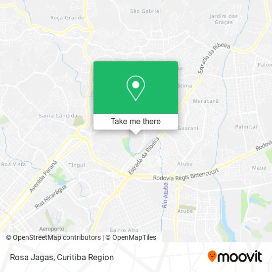
See Rosa Jagas, Colombo, on the map
Public Transit to Rosa Jagas in Colombo
Wondering how to get to Rosa Jagas in Colombo? Moovit helps you find the best way to get to Rosa Jagas with step-by-step directions from the nearest public transit station.
Moovit provides free maps and live directions to help you navigate through your city. View schedules, routes, timetables, and find out how long does it take to get to Rosa Jagas in real time.
Looking for the nearest stop or station to Rosa Jagas? Check out this list of stops closest to your destination: R. Bahia; Rua Aquiles Stenghel Coler; Rua Rio Grande Do Norte.
Bus: B11 MARACANÃ / SANTA CÂNDIDA, B43 RIO VERDE, S02 ROÇA GRANDE / ESTAÇÃO ATUBA, B57 CAMPO ALTO / SANTA CÂNDIDA, B58 MARACANÃ / SANTA CÂNDIDA (CIRCULAR), B39 CAMPO ALTO / SANTA CÂNDIDA, 231 BANESTADO / CALIFÓRNIA.
Want to see if there’s another route that gets you there at an earlier time? Moovit helps you find alternative routes or times. Get directions from and directions to Rosa Jagas easily from the Moovit App or Website.
We make riding to Rosa Jagas easy, which is why over 1.5 million users, including users in Colombo, trust Moovit as the best app for public transit. You don’t need to download an individual bus app or train app, Moovit is your all-in-one transit app that helps you find the best bus time or train time available.
For information on prices of bus, costs and ride fares to Rosa Jagas, please check the Moovit app.
Use the app to navigate to popular places including to the airport, hospital, stadium, grocery store, mall, coffee shop, school, college, and university.
Rosa Jagas Address: Rua Rio Grande do Sul, 8 Campo Pequeno Colombo-PR 83404-290 street in Colombo
- Mundial Produtos de Limpeza,
- Iasd Jd Guarani,
- V H F Representacoes Comerciais,
- Over Tenis,
- Rua Sergipe 15,
- Hamburgueria Caldeirão Bruxo,
- Ivai Rquipamentos e Instalacoes Industriais,
- Vania,
- Amylise Artesanatos,
- Escola Municipal Presidente Castelo Branco,
- Panificadora Babcia,
- Mr. Cheff,
- Climatize Climatizadores Automotivos,
- Rua Bahia 614,
- Jm Manutencao e Piscinas,
- Welington Luiz de Lima,
- Pces e Poemas,
- Bar e Lanchonete Recanto do Frangao,
- Josiete Transporte Escolar,
- Rua Paraíba 105
Places Near Rosa Jagas (Colombo)
- Shopping Palladium, Portão,
- Parque Barigui, Mercês,
- Hospital Universitário Evangélico de Curitiba, Bigorrilho,
- Rua Martim Afonso 558, Mercês,
- Pontifícia Universidade Católica do Paraná (PUCPR), Prado Velho,
- Hospital Nossa Senhora Das Graças, Mercês,
- Jockey Plaza Shopping Center, Tarumã,
- Rua General Mário Tourinho, Campina Do Siqueira,
- Campo Largo, Campo,
- Arena Da Baixada - Curitiba,
- Park Shopping Barigüi, Mossunguê,
- Hospital Madalena Sofia, Bairro Alto,
- Hospital Da Cruz Vermelha, Batel,
- Shopping Estação, Rebouças,
- Hospital de Clínicas (HC - UFPR), Centro,
- Hospital Angelina Caron, Campina Grande Do Sul,
- Jardim Botânico de Curitiba PR, Centro,
- Hospital Erasto Gaertner, Jardim Das Américas,
- Hospital do Rocio, Campo,
- Hhhhh, Fazendinha
How to get to popular places in Curitiba Region with public transit
Get around Colombo by public transit!
Traveling around Colombo has never been so easy. See step by step directions as you travel to any attraction, street or major public transit station. View bus and train schedules, arrival times, service alerts and detailed routes on a map, so you know exactly how to get to anywhere in Colombo.
When traveling to any destination around Colombo use Moovit's Live Directions with Get Off Notifications to know exactly where and how far to walk, how long to wait for your line, and how many stops are left. Moovit will alert you when it's time to get off — no need to constantly re-check whether yours is the next stop.
Wondering how to use public transit in Colombo or how to pay for public transit in Colombo? Moovit public transit app can help you navigate your way with public transit easily, and at minimum cost. It includes public transit fees, ticket prices, and costs. Looking for a map of Colombo public transit lines? Moovit public transit app shows all public transit maps in Colombo with all Bus and Cable Car routes and stops on an interactive map.
Curitiba Region has 2 transit type(s), including: Bus and Cable Car, operated by several transit agencies, including Sistema Integrado de Mobilidade (URBS), Sistema Integrado de Mobilidade (AMEP), URBS (Cartões bancários e Dinheiro), URBS (Cartões bancários / Cartão URBS), AMEP (Cartões bancários / Cartão MetroCard), AMEP (Cartões bancários / Cartão MetroCard / Dinheiro), Viação Colombo (Dinheiro), TRIAR (Cartão TRIAR / Dinheiro), Empresa Curitiba Cerro Azul (Dinheiro), Expresso Nossa Senhora da Penha (Dinheiro), Empresa Campo Alto Tijucas (Dinheiro), Auto Viação São José (Cartão VEM / Dinheiro), BRT S/A (Cartão VEM / Dinheiro), TransPiedade (Cartão Cidadão / Dinheiro) and Oceânica Sul (Cartão Transporte / Dinheiro)