Directions to Rosa Maria de Miranda Vieira (Santa Cândida) with public transportation
The following transit lines have routes that pass near Rosa Maria de Miranda Vieira
How to get to Rosa Maria de Miranda Vieira by bus?
Click on the bus route to see step by step directions with maps, line arrival times and updated time schedules.
From Rua João Parolin, Parolin
66 minFrom Terminal Colombo, Colombo
40 minFrom Rua General Mário Tourinho, Campina Do Siqueira
62 minFrom Rua Via Veneto, Santa Felicidade
59 minFrom Rua Petit Carneiro, Água Verde
54 minFrom Bigorrilho, Bigorrilho
59 minFrom Rua 24 de Maio, Rebouças
48 minFrom Avenida Senador Salgado Filho, Guabirotuba
67 minFrom Rua do Rosário, Centro
34 minFrom Rua Castro, Água Verde
59 min
Bus stops near Rosa Maria de Miranda Vieira in Santa Cândida
Bus lines to Rosa Maria de Miranda Vieira in Santa Cândida
What are the closest stations to Rosa Maria de Miranda Vieira?
The closest stations to Rosa Maria de Miranda Vieira are:
- Rua José Antônio Leprevost 973-1025 is 112 meters away, 2 min walk.
- Rua José Serrato, 551 is 127 meters away, 2 min walk.
- R. Coronel Wallace Scott Murray, 763 is 240 meters away, 4 min walk.
- R. Engenheiro Luiz Augusto Leão Fonseca, 400 is 476 meters away, 7 min walk.
Which bus lines stop near Rosa Maria de Miranda Vieira?
These bus lines stop near Rosa Maria de Miranda Vieira: 224 CASSIOPÉIA, 275 FERNANDO DE NORONHA / LARANJEIRAS, 280 NOSSA SENHORA DE NAZARÉ, B72 COLOMBO / GUADALUPE (VIA T. ROÇA GRANDE).
What’s the nearest bus station to Rosa Maria de Miranda Vieira in Santa Cândida?
The nearest bus stations to Rosa Maria de Miranda Vieira in Santa Cândida are Rua José Antônio Leprevost 973-1025 and Rua José Serrato, 551. The closest one is a 2 min walk away.
What time is the first bus to Rosa Maria de Miranda Vieira in Santa Cândida?
The 275 FERNANDO DE NORONHA / LARANJEIRAS is the first bus that goes to Rosa Maria de Miranda Vieira in Santa Cândida. It stops nearby at 5:10 AM.
What time is the last bus to Rosa Maria de Miranda Vieira in Santa Cândida?
The 275 FERNANDO DE NORONHA / LARANJEIRAS is the last bus that goes to Rosa Maria de Miranda Vieira in Santa Cândida. It stops nearby at 12:34 AM.
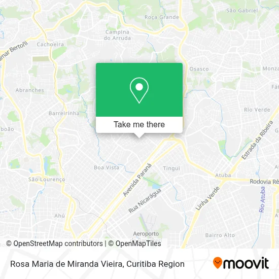
See Rosa Maria de Miranda Vieira, Santa Cândida, on the map
Public Transit to Rosa Maria de Miranda Vieira in Santa Cândida
Wondering how to get to Rosa Maria de Miranda Vieira in Santa Cândida? Moovit helps you find the best way to get to Rosa Maria de Miranda Vieira with step-by-step directions from the nearest public transit station.
Moovit provides free maps and live directions to help you navigate through your city. View schedules, routes, timetables, and find out how long does it take to get to Rosa Maria de Miranda Vieira in real time.
Looking for the nearest stop or station to Rosa Maria de Miranda Vieira? Check out this list of stops closest to your destination: Rua José Antônio Leprevost 973-1025; Rua José Serrato; R. Coronel Wallace Scott Murray; R. Engenheiro Luiz Augusto Leão Fonseca.
Bus: 224 CASSIOPÉIA, 275 FERNANDO DE NORONHA / LARANJEIRAS, 280 NOSSA SENHORA DE NAZARÉ, B72 COLOMBO / GUADALUPE (VIA T. ROÇA GRANDE), 226 ABAETÉ.
Want to see if there’s another route that gets you there at an earlier time? Moovit helps you find alternative routes or times. Get directions from and directions to Rosa Maria de Miranda Vieira easily from the Moovit App or Website.
We make riding to Rosa Maria de Miranda Vieira easy, which is why over 1.5 million users, including users in Santa Cândida, trust Moovit as the best app for public transit. You don’t need to download an individual bus app or train app, Moovit is your all-in-one transit app that helps you find the best bus time or train time available.
For information on prices of bus, costs and ride fares to Rosa Maria de Miranda Vieira, please check the Moovit app.
Use the app to navigate to popular places including to the airport, hospital, stadium, grocery store, mall, coffee shop, school, college, and university.
Rosa Maria de Miranda Vieira Address: Rua Reinaldo Jacob von Muhlen, 314 Santa Cândida Curitiba-PR 82640-330 street in Santa Cândida
- Rocel Marcenaria,
- Franciele Lima,
- Santos Comercio de Informatica,
- Guelmare Comercial,
- The Prado's,
- Nacionalle,
- J R Distribuidora de Bebidas,
- Los'Hermanos Burger e Espeto,
- La Creperia - Curitiba Em Santa Cândida,
- Energy Food,
- GMC Apoio Administrativo e Transportes,
- Doces Gourmet Amor e Fe,
- Ponto Final - ônibus Fernando de Noronha,
- Sage English,
- Eefe São Camilo,
- Consultoria Rasca,
- Caroline Viana de Alvarenga,
- Mr Rucci,
- Alana Alves,
- Vaicomotos
Places Near Rosa Maria de Miranda Vieira (Santa Cândida)
- Hospital Nossa Senhora Das Graças, Mercês,
- Campo Largo, Campo,
- Parque Barigui, Mercês,
- Jockey Plaza Shopping Center, Tarumã,
- Jardim Botânico de Curitiba PR, Centro,
- Hospital Erasto Gaertner, Jardim Das Américas,
- Rua Martim Afonso 558, Mercês,
- Hospital de Clínicas (HC - UFPR), Centro,
- Hospital Universitário Evangélico de Curitiba, Bigorrilho,
- Arena Da Baixada - Curitiba,
- Hospital Da Cruz Vermelha, Batel,
- Park Shopping Barigüi, Mossunguê,
- Hospital Angelina Caron, Campina Grande Do Sul,
- Pontifícia Universidade Católica do Paraná (PUCPR), Prado Velho,
- Hospital Madalena Sofia, Bairro Alto,
- Shopping Estação, Rebouças,
- Rua General Mário Tourinho, Campina Do Siqueira,
- Hhhhh, Fazendinha,
- Hospital do Rocio, Campo,
- Shopping Palladium, Portão
How to get to popular places in Curitiba Region with public transit
Get around Santa Cândida by public transit!
Traveling around Santa Cândida has never been so easy. See step by step directions as you travel to any attraction, street or major public transit station. View bus and train schedules, arrival times, service alerts and detailed routes on a map, so you know exactly how to get to anywhere in Santa Cândida.
When traveling to any destination around Santa Cândida use Moovit's Live Directions with Get Off Notifications to know exactly where and how far to walk, how long to wait for your line, and how many stops are left. Moovit will alert you when it's time to get off — no need to constantly re-check whether yours is the next stop.
Wondering how to use public transit in Santa Cândida or how to pay for public transit in Santa Cândida? Moovit public transit app can help you navigate your way with public transit easily, and at minimum cost. It includes public transit fees, ticket prices, and costs. Looking for a map of Santa Cândida public transit lines? Moovit public transit app shows all public transit maps in Santa Cândida with all Bus and Cable Car routes and stops on an interactive map.
Curitiba Region has 2 transit type(s), including: Bus and Cable Car, operated by several transit agencies, including Sistema Integrado de Mobilidade (URBS), Sistema Integrado de Mobilidade (AMEP), URBS (Cartões bancários e Dinheiro), URBS (Cartões bancários / Cartão URBS), AMEP (Cartões bancários / Cartão MetroCard), AMEP (Cartões bancários / Cartão MetroCard / Dinheiro), Viação Colombo (Dinheiro), TRIAR (Cartão TRIAR / Dinheiro), Empresa Curitiba Cerro Azul (Dinheiro), Expresso Nossa Senhora da Penha (Dinheiro), Empresa Campo Alto Tijucas (Dinheiro), Auto Viação São José (Cartão VEM / Dinheiro), BRT S/A (Cartão VEM / Dinheiro), TransPiedade (Cartão Cidadão / Dinheiro) and Oceânica Sul (Cartão Transporte / Dinheiro)