How to get to Rosa Parks Circle by bus?
Click on the bus route to see step by step directions with maps, line arrival times and updated time schedules.
From Markham Enterprises, East Grand Rapids
31 minFrom Sam Klug Artistry, Walker
27 minFrom Roskam Baking Company, Kentwood
52 minFrom Electronic I & S, Wyoming
43 minFrom Amazon Locker-Blasi, Kentwood
48 minFrom Rac Acceptance, Kentwood
50 minFrom Fairfield Inn & Suites Grand Rapids, Grand Rapids
50 minFrom All About Auto, Kentwood
34 minFrom 29th St SE & Lake Eastbrook Blvd SE, Kentwood
55 minFrom Oam Now Urgent Orthopaedic Care, Grand Rapids
34 min
Bus stops near Rosa Parks Circle in Grand Rapids
Train station near Rosa Parks Circle in Grand Rapids
- Grand Rapids Vernon J. Ehlers Station, 34 min walk,VIEW
Bus lines to Rosa Parks Circle in Grand Rapids
What are the closest stations to Rosa Parks Circle?
The closest stations to Rosa Parks Circle are:
- Monroe/Pearl (Sb) is 102 yards away, 2 min walk.
- Monroe/Louis Station (Sb) is 225 yards away, 3 min walk.
- Ottawa/Fulton (Sb) is 382 yards away, 5 min walk.
- Grand Rapids Vernon J. Ehlers Station is 2886 yards away, 34 min walk.
Which bus lines stop near Rosa Parks Circle?
These bus lines stop near Rosa Parks Circle: 1, 15, 6, 9, 90.
What’s the nearest bus station to Rosa Parks Circle in Grand Rapids?
The nearest bus station to Rosa Parks Circle in Grand Rapids is Monroe/Pearl (Sb). It’s a 2 min walk away.
What time is the first train to Rosa Parks Circle in Grand Rapids?
The PERE MARQUETTE is the first train that goes to Rosa Parks Circle in Grand Rapids. It stops nearby at 6:00 AM.
What time is the last train to Rosa Parks Circle in Grand Rapids?
The PERE MARQUETTE is the last train that goes to Rosa Parks Circle in Grand Rapids. It stops nearby at 11:34 PM.
What time is the first bus to Rosa Parks Circle in Grand Rapids?
The 1 is the first bus that goes to Rosa Parks Circle in Grand Rapids. It stops nearby at 4:59 AM.
What time is the last bus to Rosa Parks Circle in Grand Rapids?
The 51 is the last bus that goes to Rosa Parks Circle in Grand Rapids. It stops nearby at 1:16 AM.
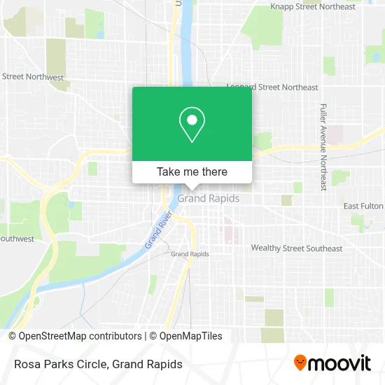
See Rosa Parks Circle, Grand Rapids, on the map
Public Transit to Rosa Parks Circle in Grand Rapids
Wondering how to get to Rosa Parks Circle in Grand Rapids? Moovit helps you find the best way to get to Rosa Parks Circle with step-by-step directions from the nearest public transit station.
Moovit provides free maps and live directions to help you navigate through your city. View schedules, routes, timetables, and find out how long does it take to get to Rosa Parks Circle in real time.
Looking for the nearest stop or station to Rosa Parks Circle? Check out this list of stops closest to your destination: Monroe/Pearl (Sb); Monroe/Louis Station (Sb); Ottawa/Fulton (Sb); Grand Rapids Vernon J. Ehlers Station.
Bus: 1, 15, 6, 9, 90, 11, 13, 51, 45, 14.Train: PERE MARQUETTE.
Want to see if there’s another route that gets you there at an earlier time? Moovit helps you find alternative routes or times. Get directions from and directions to Rosa Parks Circle easily from the Moovit App or Website.
We make riding to Rosa Parks Circle easy, which is why over 1.5 million users, including users in Grand Rapids, trust Moovit as the best app for public transit. You don’t need to download an individual bus app or train app, Moovit is your all-in-one transit app that helps you find the best bus time or train time available.
For information on prices of bus, costs and ride fares to Rosa Parks Circle, please check the Moovit app.
Use the app to navigate to popular places including to the airport, hospital, stadium, grocery store, mall, coffee shop, school, college, and university.
Rosa Parks Circle Address: Monroe Avenue Northwest street in Grand Rapids
- Rosa Parks,
- Asian Pacific Massage,
- Amway Grand Plaza Hotel Curio Collection by Hilton Grand Rapids,
- STARBUCKS,
- Residence Inn Grand Rapids Downtown,
- Grand Rapids, MI,
- Watersview Rooftop Bar,
- Ottawa/Fulton Parking Ramp,
- Amway Grand Plaza Hotel,
- Monroe Center Parking Ramp,
- Idc,
- MDRD,
- 82 Ionia,
- Amway Grand Plaza ,
- Nightwatch Lounge,
- Kendall College Of Art And Design,
- 61st District Court,
- Fifth Third Private Bank - Jackson Labbe,
- Kent County Courthouse,
- Fiorletta Law Group
Places Near Rosa Parks Circle (Grand Rapids)
- Spectrum Health-Blodgett Hospital, East Grand Rapids,
- University of Michigan Health Metro Health Hospital, Wyoming,
- Byron Center,
- Grand Rapids Community College, Grand Rapids,
- Hudsonville,
- Helel DeVos Children's Hospital Food Court, Grand Rapids,
- YMCA - David D. Hunting, Grand Rapids,
- Metro Cascade,
- Butterworth Hospital Internal Radiology, Grand Rapids,
- John Ball Zoo, Grand Rapids,
- Van Andel Arena, Grand Rapids,
- Pine Rest Mental Health, Grand Rapids,
- Spectrum Health Butterworth Hospital, Grand Rapids,
- Frederik Meijer Gardens, Grand Rapids,
- Woodland Mall, Kentwood,
- Grandville, MI, Grandville,
- Lemmen-Holton Cancer Pavilion, Grand Rapids,
- Kent County Courthouse, Grand Rapids,
- Union High School, Grand Rapids,
- Blodgett Hospital, East Grand Rapids
How to get to popular places in Grand Rapids with public transit
Get around Grand Rapids by public transit!
Traveling around Grand Rapids has never been so easy. See step by step directions as you travel to any attraction, street or major public transit station. View bus and train schedules, arrival times, service alerts and detailed routes on a map, so you know exactly how to get to anywhere in Grand Rapids.
When traveling to any destination around Grand Rapids use Moovit's Live Directions with Get Off Notifications to know exactly where and how far to walk, how long to wait for your line, and how many stops are left. Moovit will alert you when it's time to get off — no need to constantly re-check whether yours is the next stop.
Wondering how to use public transit in Grand Rapids or how to pay for public transit in Grand Rapids? Moovit public transit app can help you navigate your way with public transit easily, and at minimum cost. It includes public transit fees, ticket prices, and costs. Looking for a map of Grand Rapids public transit lines? Moovit public transit app shows all public transit maps in Grand Rapids with all Bus and Train routes and stops on an interactive map.
Grand Rapids has 2 transit type(s), including: Bus and Train, operated by several transit agencies, including The Rapid, Amtrak and FlixBus-us