Directions to Rosa's All Day Cafe (Indianapolis City (Balance)) with public transportation
The following transit lines have routes that pass near Rosa's All Day Cafe
 Bus: 34.
How to get to Rosa's All Day Cafe by bus?
Click on the bus route to see step by step directions with maps, line arrival times and updated time schedules.
From Lee Drywall, Indianapolis
51 minFrom Target (Target Store Nora-Plaza), Indianapolis City (Balance)
96 minFrom Shell, Indianapolis City (Balance)
51 minFrom Turntable, Indianapolis City (Balance)
83 minFrom ChargePoint, Indianapolis City (Balance)
94 minFrom Coles Marketing, Indianapolis City (Balance)
119 minFrom Ivy Tech Community College, Indianapolis City (Balance)
42 minFrom Lafayette Square, Indianapolis City (Balance)
86 minFrom Sheer Platinum Consignment, Indianapolis City (Balance)
55 minFrom The Julia Carson Government Center, Indianapolis City (Balance)
57 min
Bus stop near Rosa's All Day Cafe in Indianapolis City (Balance)
- Michigan Rd & Westlane Rd, 3 min walk,VIEW
Bus lines to Rosa's All Day Cafe in Indianapolis City (Balance)
- 34, St. Vincent,VIEW
What are the closest stations to Rosa's All Day Cafe?
The closest stations to Rosa's All Day Cafe are:
- Michigan Rd & Westlane Rd is 176 yards away, 3 min walk.
Which bus line stops near Rosa's All Day Cafe?
34 (St. Vincent)
What’s the nearest bus station to Rosa's All Day Cafe in Indianapolis City (Balance)?
The nearest bus station to Rosa's All Day Cafe in Indianapolis City (Balance) is Michigan Rd & Westlane Rd. It’s a 3 min walk away.
What time is the first bus to Rosa's All Day Cafe in Indianapolis City (Balance)?
The 34 is the first bus that goes to Rosa's All Day Cafe in Indianapolis City (Balance). It stops nearby at 4:55 AM.
What time is the last bus to Rosa's All Day Cafe in Indianapolis City (Balance)?
The 34 is the last bus that goes to Rosa's All Day Cafe in Indianapolis City (Balance). It stops nearby at 11:07 PM.
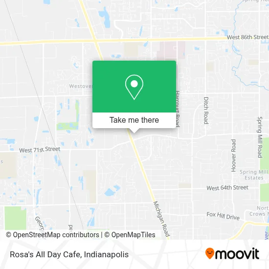
See Rosa's All Day Cafe, Indianapolis City (Balance), on the map
Public Transit to Rosa's All Day Cafe in Indianapolis City (Balance)
Wondering how to get to Rosa's All Day Cafe in Indianapolis City (Balance)? Moovit helps you find the best way to get to Rosa's All Day Cafe with step-by-step directions from the nearest public transit station.
Moovit provides free maps and live directions to help you navigate through your city. View schedules, routes, timetables, and find out how long does it take to get to Rosa's All Day Cafe in real time.
Looking for the nearest stop or station to Rosa's All Day Cafe? Check out this list of stops closest to your destination: Michigan Rd & Westlane Rd.
Bus: 34.
Want to see if there’s another route that gets you there at an earlier time? Moovit helps you find alternative routes or times. Get directions from and directions to Rosa's All Day Cafe easily from the Moovit App or Website.
We make riding to Rosa's All Day Cafe easy, which is why over 1.5 million users, including users in Indianapolis City (Balance), trust Moovit as the best app for public transit. You don’t need to download an individual bus app or train app, Moovit is your all-in-one transit app that helps you find the best bus time or train time available.
For information on prices of bus, costs and ride fares to Rosa's All Day Cafe, please check the Moovit app.
Use the app to navigate to popular places including to the airport, hospital, stadium, grocery store, mall, coffee shop, school, college, and university.
Rosa's All Day Cafe Address: 2732 Westlane Rd Indianapolis, IN 46268 street in Indianapolis City (Balance)
- El Amigo,
- Uno Tax,
- Garrett Automotive Locksmith,
- Luxury Palace,
- Used Tires dos Amigos,
- Just Like Sunday,
- Unk's Tatoos,
- ABC Road Service of Indianapolis,
- Slayed -N- Style Boutique LLC,
- Furniture Heaven,
- Caplingers Fresh Catch,
- CVS,
- Garage Door Opener Repair Garage,
- Woodmont Accessories,
- UPS Access Point,
- Multi-Cultural Community Services,
- Midtown Locksmith,
- Casal Magic Locksmith,
- Church's Texas Chicken,
- USPS Collection Box - Blue Box
Places Near Rosa's All Day Cafe (Indianapolis City (Balance))
- 119 W 19th St Parking, Indianapolis City (Balance),
- St. Vincent Hospital - Indianapolis, Indianapolis City (Balance),
- I U Health Methodist Hospital, Indianapolis City (Balance),
- Indiana, Indianapolis City (Balance),
- Indianapolis Airport Zone 2, Indianapolis City (Balance),
- Lucas Oil Stadium, Indianapolis City (Balance),
- Eskenazi Hospital, Indianapolis City (Balance),
- Plainfield, IN, Plainfield,
- Jersey Barn, Indianapolis City (Balance),
- Lilly Corporate Center (Eli Lilly & Co), Indianapolis City (Balance),
- I-465 / I-65 Interchange, Indianapolis City (Balance),
- THE BALT, Indianapolis City (Balance),
- Indiana Convention Center, Indianapolis City (Balance),
- Indianapolis Motor Speedway, Speedway,
- St. Vincent entrance #1, Indianapolis City (Balance),
- Castleton Square Mall, Indianapolis,
- Train Ride At Castleton Mall, Indianapolis City (Balance),
- Methodist Hospital of Indianapolis, Indianapolis City (Balance),
- Cotter's Massage Parlor With Happy Endings, Indianapolis City (Balance),
- Gainbridge Fieldhouse, Indianapolis City (Balance)
How to get to popular places in Indianapolis with public transit
Get around Indianapolis City (Balance) by public transit!
Traveling around Indianapolis City (Balance) has never been so easy. See step by step directions as you travel to any attraction, street or major public transit station. View bus and train schedules, arrival times, service alerts and detailed routes on a map, so you know exactly how to get to anywhere in Indianapolis City (Balance).
When traveling to any destination around Indianapolis City (Balance) use Moovit's Live Directions with Get Off Notifications to know exactly where and how far to walk, how long to wait for your line, and how many stops are left. Moovit will alert you when it's time to get off — no need to constantly re-check whether yours is the next stop.
Wondering how to use public transit in Indianapolis City (Balance) or how to pay for public transit in Indianapolis City (Balance)? Moovit public transit app can help you navigate your way with public transit easily, and at minimum cost. It includes public transit fees, ticket prices, and costs. Looking for a map of Indianapolis City (Balance) public transit lines? Moovit public transit app shows all public transit maps in Indianapolis City (Balance) with all bus routes and stops on an interactive map.
Indianapolis has 1 transit type(s), including: bus, operated by several transit agencies, including IndyGo, FlixBus-us and Greyhound-us