Directions to Rosane Modas (Ahu) with public transportation
The following transit lines have routes that pass near Rosane Modas
How to get to Rosane Modas by bus?
Click on the bus route to see step by step directions with maps, line arrival times and updated time schedules.
From São Gabriel, Colombo
44 minFrom Avenida Brasília, Capão Raso
49 minFrom Copel - Agência de Atendimento, Boqueirão
45 minFrom Tribunal Regional Eleitoral do Paraná, Prado Velho
33 minFrom Hhhhh, Fazendinha
58 minFrom Estação Tubo Xaxim, Xaxim
53 minFrom Rua Bartolomeu Lourenço de Gusmão, Boqueirão
54 minFrom Rua Doutor Ovande do Amaral 201, Jardim Das Américas
37 minFrom Avenida Brasília, Novo Mundo
50 minFrom Puteiro Da Ana, Cajuru
46 min
Bus stops near Rosane Modas in Ahu
- R. São Sebastião, 100, 2 min walk,VIEW
- Av. Anita Garibaldi, 888 - Centro Judiciário De Curitiba (Justiça Federal), 3 min walk,VIEW
- R. São Luiz, 191, 5 min walk,VIEW
- R. Doutor Manoel Pedro, 300, 6 min walk,VIEW
- R. Eçá de Queiroz, 1251, 6 min walk,VIEW
- Av. Anita Garibaldi, 1076 - Serviço Distrital Do Barreirinha, 7 min walk,VIEW
Bus lines to Rosane Modas in Ahu
- 265 AHÚ / LOS ANGELES, Los Angeles → Ahú,VIEW
- 272 PAINEIRAS, Paineiras → Travessa Moreira Garcez,VIEW
- 274 SANTA GEMA, Santa Gema → Travessa Moreira Garcez,VIEW
- 275 FERNANDO DE NORONHA / LARANJEIRAS, Travessa Moreira Garcez → Laranjeiras,VIEW
- A01 CACHOEIRA / CURITIBA (MOREIRA GARCEZ), Terminal Cachoeira → Moreira Garcez,VIEW
- A05 MAD. CURITIBA / TAMANDARÉ (VIA GRAZIELA), Praça Rui Barbosa → Tamandaré,VIEW
- A89 CACHOEIRA / CURITIBA (TAMANDARÉ / CABRAL), Terminal Tamandaré → Praça Tiradentes (Moreira Garcez),VIEW
- 205 BARREIRINHA, Terminal Barreirinha → Travessa Moreira Garcez,VIEW
- S01 ROÇA GRANDE / GUADALUPE (VIA SANTA CÂNDIDA), ROÇA GRANDE / GUADALUPE (VIA SANTA CÂNDIDA),VIEW
- B72 COLOMBO / GUADALUPE (VIA T. ROÇA GRANDE), COLOMBO / GUADALUPE (via T. ROÇA GRANDE),VIEW
- B73 JARDIM OSASCO / GUADALUPE, JARDIM OSASCO / GUADALUPE,VIEW
- B76 SÃO SEBASTIÃO / GUADALUPE, SÃO SEBASTIÃO / GUADALUPE,VIEW
- B78 SÃO GABRIEL / GUADALUPE, SÃO GABRIEL / GUADALUPE,VIEW
- B89 GUARAITUBA / RUI BARBOSA (VIA MARACANÃ / CABRAL), GUARAITUBA / RUI BARBOSA (via MARACANÃ / CABRAL),VIEW
- S89 SÃO SEBASTIÃO / GUADALUPE (VIA SÃO GABRIEL), SÃO SEBASTIÃO / GUADALUPE (via SÃO GABRIEL),VIEW
- 280 NOSSA SENHORA DE NAZARÉ, NOSSA SENHORA DE NAZARÉ,VIEW
- N61 CAMPINA GRANDE DO SUL / GUADALUPE, CAMPINA GRANDE DO SUL / GUADALUPE,VIEW
- N62 JARDIM PAULISTA / GUADALUPE, JARDIM PAULISTA / GUADALUPE,VIEW
- O62 QUATRO BARRAS / GUADALUPE (VIA ESTAÇÃO ATUBA), QUATRO BARRAS / GUADALUPE (via ESTAÇÃO ATUBA),VIEW
- B69 MAD. CURITIBA / SÃO DIMAS, MAD. CURITIBA / SÃO DIMAS,VIEW
What are the closest stations to Rosane Modas?
The closest stations to Rosane Modas are:
- R. São Sebastião, 100 is 89 meters away, 2 min walk.
- Av. Anita Garibaldi, 888 - Centro Judiciário De Curitiba (Justiça Federal) is 167 meters away, 3 min walk.
- R. São Luiz, 191 is 344 meters away, 5 min walk.
- R. Doutor Manoel Pedro, 300 is 405 meters away, 6 min walk.
- R. Eçá de Queiroz, 1251 is 424 meters away, 6 min walk.
- Av. Anita Garibaldi, 1076 - Serviço Distrital Do Barreirinha is 446 meters away, 7 min walk.
Which bus lines stop near Rosane Modas?
These bus lines stop near Rosane Modas: 203 SANTA CÂNDIDA / CAPÃO RASO, 216 CABRAL / PORTÃO, 250 LIGEIRÃO NORTE / SUL, 265 AHÚ / LOS ANGELES, B76 SÃO SEBASTIÃO / GUADALUPE, O74 QUATRO BARRAS / GUADALUPE.
What’s the nearest bus station to Rosane Modas in Ahu?
The nearest bus station to Rosane Modas in Ahu is R. São Sebastião, 100. It’s a 2 min walk away.
What time is the first bus to Rosane Modas in Ahu?
The A05 MAD. CURITIBA / TAMANDARÉ (VIA GRAZIELA) is the first bus that goes to Rosane Modas in Ahu. It stops nearby at 3:23 AM.
What time is the last bus to Rosane Modas in Ahu?
The A05 MAD. CURITIBA / TAMANDARÉ (VIA GRAZIELA) is the last bus that goes to Rosane Modas in Ahu. It stops nearby at 3:25 AM.
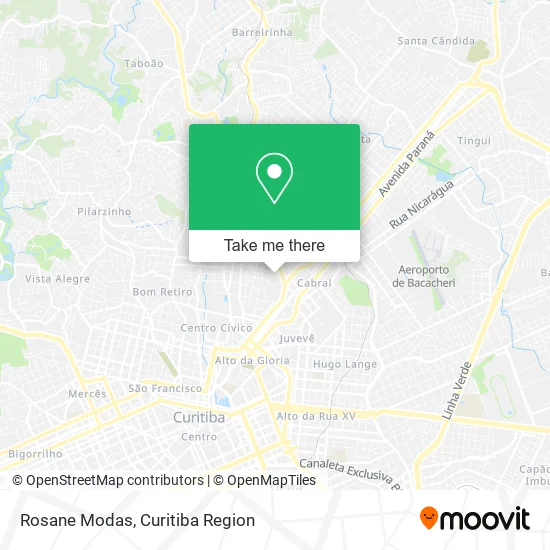
See Rosane Modas, Ahu, on the map
Public Transit to Rosane Modas in Ahu
Wondering how to get to Rosane Modas in Ahu? Moovit helps you find the best way to get to Rosane Modas with step-by-step directions from the nearest public transit station.
Moovit provides free maps and live directions to help you navigate through your city. View schedules, routes, timetables, and find out how long does it take to get to Rosane Modas in real time.
Looking for the nearest stop or station to Rosane Modas? Check out this list of stops closest to your destination: R. São Sebastião; Av. Anita Garibaldi; R. São Luiz; R. Doutor Manoel Pedro; R. Eçá de Queiroz; Av. Anita Garibaldi.
Bus: 203 SANTA CÂNDIDA / CAPÃO RASO, 216 CABRAL / PORTÃO, 250 LIGEIRÃO NORTE / SUL, 265 AHÚ / LOS ANGELES, B76 SÃO SEBASTIÃO / GUADALUPE, O74 QUATRO BARRAS / GUADALUPE, 272 PAINEIRAS, 274 SANTA GEMA, 275 FERNANDO DE NORONHA / LARANJEIRAS, A01 CACHOEIRA / CURITIBA (MOREIRA GARCEZ), A05 MAD. CURITIBA / TAMANDARÉ (VIA GRAZIELA), A89 CACHOEIRA / CURITIBA (TAMANDARÉ / CABRAL), 205 BARREIRINHA, S01 ROÇA GRANDE / GUADALUPE (VIA SANTA CÂNDIDA), B72 COLOMBO / GUADALUPE (VIA T. ROÇA GRANDE), B73 JARDIM OSASCO / GUADALUPE, B78 SÃO GABRIEL / GUADALUPE, N61 CAMPINA GRANDE DO SUL / GUADALUPE, N62 JARDIM PAULISTA / GUADALUPE, O62 QUATRO BARRAS / GUADALUPE (VIA ESTAÇÃO ATUBA), B69 MAD. CURITIBA / SÃO DIMAS, C72 VILA PALMITAL / GUADALUPE (VIA ESTAÇÃO ATUBA), 207 CABRAL / OSÓRIO, A18 TAMANDARÉ / CABRAL, 245 ANITA GARIBALDI.
Want to see if there’s another route that gets you there at an earlier time? Moovit helps you find alternative routes or times. Get directions from and directions to Rosane Modas easily from the Moovit App or Website.
We make riding to Rosane Modas easy, which is why over 1.5 million users, including users in Ahu, trust Moovit as the best app for public transit. You don’t need to download an individual bus app or train app, Moovit is your all-in-one transit app that helps you find the best bus time or train time available.
For information on prices of bus, costs and ride fares to Rosane Modas, please check the Moovit app.
Use the app to navigate to popular places including to the airport, hospital, stadium, grocery store, mall, coffee shop, school, college, and university.
Rosane Modas Address: Rua São Sebastião, 107 Ahu Curitiba-PR 80540-050 street in Ahu
- Ignus Informatica,
- Bianca Cottar Imagem Veterinaria,
- Pekka Talala,
- Kafel,
- Juliana Garcez,
- Delicada & Doce Frida,
- Kaordico,
- Cwb Cosmeticos,
- Cozinha Maromba,
- Condominio do Edificio Posidon,
- Rua Emílio Cornelsen 500,
- Rua S Sebastião, 27 - Ahu,
- Nucleo,
- Jaws Joias,
- Condominio Edificio Aruba,
- Olhos de Horus,
- Atelier de Costura Debora Oliveira,
- Cwb Tracker,
- João Kaniak Neto,
- Presídio do Ahú
Places Near Rosane Modas (Ahu)
- Hospital Universitário Evangélico de Curitiba, Bigorrilho,
- Hhhhh, Fazendinha,
- Shopping Estação, Rebouças,
- Hospital Angelina Caron, Campina Grande Do Sul,
- Arena Da Baixada - Curitiba,
- Jockey Plaza Shopping Center, Tarumã,
- Hospital do Rocio, Campo,
- Parque Barigui, Mercês,
- Shopping Palladium, Portão,
- Park Shopping Barigüi, Mossunguê,
- Hospital Da Cruz Vermelha, Batel,
- Pontifícia Universidade Católica do Paraná (PUCPR), Prado Velho,
- Hospital de Clínicas (HC - UFPR), Centro,
- Campo Largo, Campo,
- Rua Martim Afonso 558, Mercês,
- Rua General Mário Tourinho, Campina Do Siqueira,
- Hospital Erasto Gaertner, Jardim Das Américas,
- Hospital Madalena Sofia, Bairro Alto,
- Hospital Nossa Senhora Das Graças, Mercês,
- Jardim Botânico de Curitiba PR, Centro
How to get to popular places in Curitiba Region with public transit
Get around Ahu by public transit!
Traveling around Ahu has never been so easy. See step by step directions as you travel to any attraction, street or major public transit station. View bus and train schedules, arrival times, service alerts and detailed routes on a map, so you know exactly how to get to anywhere in Ahu.
When traveling to any destination around Ahu use Moovit's Live Directions with Get Off Notifications to know exactly where and how far to walk, how long to wait for your line, and how many stops are left. Moovit will alert you when it's time to get off — no need to constantly re-check whether yours is the next stop.
Wondering how to use public transit in Ahu or how to pay for public transit in Ahu? Moovit public transit app can help you navigate your way with public transit easily, and at minimum cost. It includes public transit fees, ticket prices, and costs. Looking for a map of Ahu public transit lines? Moovit public transit app shows all public transit maps in Ahu with all Bus and Cable Car routes and stops on an interactive map.
Curitiba Region has 2 transit type(s), including: Bus and Cable Car, operated by several transit agencies, including Sistema Integrado de Mobilidade (URBS), Sistema Integrado de Mobilidade (AMEP), URBS (Cartões bancários e Dinheiro), URBS (Cartões bancários / Cartão URBS), AMEP (Cartões bancários / Cartão MetroCard), AMEP (Cartões bancários / Cartão MetroCard / Dinheiro), Viação Colombo (Dinheiro), TRIAR (Cartão TRIAR / Dinheiro), Empresa Curitiba Cerro Azul (Dinheiro), Expresso Nossa Senhora da Penha (Dinheiro), Empresa Campo Alto Tijucas (Dinheiro), Auto Viação São José (Cartão VEM / Dinheiro), BRT S/A (Cartão VEM / Dinheiro), TransPiedade (Cartão Cidadão / Dinheiro) and Oceânica Sul (Cartão Transporte / Dinheiro)
Public transit lines with stations closest to Rosane Modas in Ahu
Bus lines with stations closest to Rosane Modas in Ahu
R. São Luiz, 191
 S01 ROÇA GRANDE / GUADALUPE (VIA SANTA CÂNDIDA)ROÇA GRANDE / GUADALUPE (VIA SANTA CÂNDIDA)
- B72 COLOMBO / GUADALUPE (VIA T. ROÇA GRANDE)COLOMBO / GUADALUPE (via T. ROÇA GRANDE)
- B73 JARDIM OSASCO / GUADALUPEJARDIM OSASCO / GUADALUPE
- B76 SÃO SEBASTIÃO / GUADALUPESÃO SEBASTIÃO / GUADALUPE
- B78 SÃO GABRIEL / GUADALUPESÃO GABRIEL / GUADALUPE
R. Doutor Manoel Pedro, 300
- N61 CAMPINA GRANDE DO SUL / GUADALUPECAMPINA GRANDE DO SUL / GUADALUPE
- N62 JARDIM PAULISTA / GUADALUPEJARDIM PAULISTA / GUADALUPE
- O62 QUATRO BARRAS / GUADALUPE (VIA ESTAÇÃO ATUBA)QUATRO BARRAS / GUADALUPE (via ESTAÇÃO ATUBA)
- B69 MAD. CURITIBA / SÃO DIMASMAD. CURITIBA / SÃO DIMAS
- C72 VILA PALMITAL / GUADALUPE (VIA ESTAÇÃO ATUBA)VILA PALMITAL / GUADALUPE (via ESTAÇÃO ATUBA)