How to get to Rosen Laurie L Lcsw by bus?
Click on the bus route to see step by step directions with maps, line arrival times and updated time schedules.
From Leesburg VA-684, Fairfax County
56 minFrom Walmart, Fairfax County
73 minFrom Hollywood Casino at Charles Town Races, Fairfax County
53 minFrom Mosaic District, Fairfax County
46 minFrom Tysons Corner Center, Fairfax County
49 minFrom Northern Virginia Community College - Annandale Campus, Fairfax County
25 minFrom Spa World, Fairfax County
54 minFrom Fair Oaks Mall, Fairfax County
44 minFrom Centreville, VA, Fairfax County
50 min
Bus stops near Rosen Laurie L Lcsw in Fairfax
Bus lines to Rosen Laurie L Lcsw in Fairfax
What are the closest stations to Rosen Laurie L Lcsw?
The closest stations to Rosen Laurie L Lcsw are:
- Fairfax Judicial Center is 122 yards away, 2 min walk.
- West at Fx Courthouse is 122 yards away, 2 min walk.
- Chain Bridge Road at County Court House (Sb) is 199 yards away, 3 min walk.
- Chain Bridge Road And Judicial Drive is 255 yards away, 4 min walk.
- University Dr at Main St (Nb) is 417 yards away, 5 min walk.
- University Dr at Main St is 422 yards away, 5 min walk.
Which bus lines stop near Rosen Laurie L Lcsw?
These bus lines stop near Rosen Laurie L Lcsw: 610, F23, F50, GOLD 1, GREEN 2.
What’s the nearest bus station to Rosen Laurie L Lcsw in Fairfax?
The nearest bus stations to Rosen Laurie L Lcsw in Fairfax are Fairfax Judicial Center and West at Fx Courthouse. The closest one is a 2 min walk away.
What time is the first bus to Rosen Laurie L Lcsw in Fairfax?
The F50 is the first bus that goes to Rosen Laurie L Lcsw in Fairfax. It stops nearby at 5:21 AM.
What time is the last bus to Rosen Laurie L Lcsw in Fairfax?
The GREEN 1 is the last bus that goes to Rosen Laurie L Lcsw in Fairfax. It stops nearby at 10:41 PM.
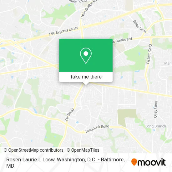
See Rosen Laurie L Lcsw, Fairfax, on the map
Public Transit to Rosen Laurie L Lcsw in Fairfax
Wondering how to get to Rosen Laurie L Lcsw in Fairfax? Moovit helps you find the best way to get to Rosen Laurie L Lcsw with step-by-step directions from the nearest public transit station.
Moovit provides free maps and live directions to help you navigate through your city. View schedules, routes, timetables, and find out how long does it take to get to Rosen Laurie L Lcsw in real time.
Looking for the nearest stop or station to Rosen Laurie L Lcsw? Check out this list of stops closest to your destination: Fairfax Judicial Center; West at Fx Courthouse; Chain Bridge Road at County Court House (Sb); Chain Bridge Road And Judicial Drive; University Dr at Main St (Nb); University Dr at Main St.
Bus: 610, F23, F50, GOLD 1, GREEN 2, GREEN 1, GOLD 2.
Want to see if there’s another route that gets you there at an earlier time? Moovit helps you find alternative routes or times. Get directions from and directions to Rosen Laurie L Lcsw easily from the Moovit App or Website.
We make riding to Rosen Laurie L Lcsw easy, which is why over 1.7 million users, including users in Fairfax, trust Moovit as the best app for public transit. You don’t need to download an individual bus app or train app, Moovit is your all-in-one transit app that helps you find the best bus time or train time available.
For information on prices of bus and metro, costs and ride fares to Rosen Laurie L Lcsw, please check the Moovit app.
Use the app to navigate to popular places including to the airport, hospital, stadium, grocery store, mall, coffee shop, school, college, and university.
Rosen Laurie L Lcsw Address: 4041 University Dr street in Fairfax
- Dessia Crawmer LCSW,
- Break Out Bail Bonds I,
- Old Town Fairfax, Virginia,
- Fairfax County Courthouse (Fairfax County Circuit Court),
- Fairfax County Probation Center,
- The United States District Court for the Eastern District of Virginia,
- Costco,
- Fairfax County Courthouse,
- Silver Diner,
- The U.S. Supreme Court,
- Paul VI Catholic High School,
- Ginger Slattery's Studio for Hair,
- Al Azhar Mosque,
- cue bus green 2 @ Inova,
- Inova Alexandria Hospital,
- Sherry's Hair Studio,
- Gmu Fairfax Campus - Rappahannock River Parking Deck,
- George Mason University Parking Services,
- Providence Park,
- 4400 University Drive
Places Near Rosen Laurie L Lcsw (Fairfax)
- Washington DC VA Medical Center, Washington,
- Basilica of the National Shrine, Washington,
- Rock Creek Tennis Center, Washington,
- M&T Bank Stadium, Baltimore,
- Westfield Montgomery Mall, Montgomery County,
- Amazon Hq2, Arlington County,
- National Zoo, Washington,
- Capital One Arena, Washington,
- Washington National Cathedral, Washington,
- Museum Of The Bible, Washington,
- Warner Theatre, Washington,
- The Anthem, Washington,
- Camden Yards, Baltimore,
- National Theatre, Washington,
- Pennsylvania Ave NW (3rd st and pennsylvania), Washington,
- Sibley Memorial Hospital, Washington,
- Marriott Marquis Washington, DC, Washington,
- National Museum of African American History and Culture, Washington,
- PG Mall, Prince George's County,
- Georgetown, Washington
How to get to popular places in Washington, D.C. - Baltimore, MD with public transit
Get around Fairfax by public transit!
Traveling around Fairfax has never been so easy. See step by step directions as you travel to any attraction, street or major public transit station. View bus and train schedules, arrival times, service alerts and detailed routes on a map, so you know exactly how to get to anywhere in Fairfax.
When traveling to any destination around Fairfax use Moovit's Live Directions with Get Off Notifications to know exactly where and how far to walk, how long to wait for your line, and how many stops are left. Moovit will alert you when it's time to get off — no need to constantly re-check whether yours is the next stop.
Wondering how to use public transit in Fairfax or how to pay for public transit in Fairfax? Moovit public transit app can help you navigate your way with public transit easily, and at minimum cost. It includes public transit fees, ticket prices, and costs. Looking for a map of Fairfax public transit lines? Moovit public transit app shows all public transit maps in Fairfax with all Bus, Train, Metro, Light Rail and Ferry routes and stops on an interactive map.
Washington, D.C. - Baltimore, MD has 5 transit type(s), including: Bus, Train, Metro, Light Rail and Ferry, operated by several transit agencies, including WMATA, Montgomery County Ride On, Fairfax Connector, TheBus, PRTC, DASH - Alexandria, Arlington Transit (ART), RTA of Central Maryland, MDOT MTA, MDOT MTA Light RailLink, MDOT MTA Commuter Bus, MDOT MTA Local Bus, FXBGO!, Virginia Railway Express (VRE) and MARC