Directions to Rosenberg & Tomko PA (Baltimore) with public transportation
The following transit lines have routes that pass near Rosenberg & Tomko PA
 Bus: 163, 40, 80, CITYLINK BLUE, CITYLINK GREEN.
- Train: MARC.
- Metro: METRO.
How to get to Rosenberg & Tomko PA by bus?
Click on the bus route to see step by step directions with maps, line arrival times and updated time schedules.
From MVA Glen Burnie, Anne Arundel County
33 minFrom Bwi2 Employee Shuttles, Baltimore
22 minFrom Good Samaritan Hospital, Baltimore
38 minFrom Johns Hopkins Bayview Medical Center, Baltimore
23 minFrom Morgan State University, Baltimore
40 minFrom Guinness Open Gate Brewery & Barrel House, Baltimore County
61 minFrom Mva, Baltimore
55 minFrom I-695 @ Exit 17 (Security Blvd/MD 122), Baltimore County
40 minFrom Reisterstown Road Plaza, Baltimore
65 minFrom Walmart, Baltimore County
52 min
How to get to Rosenberg & Tomko PA by train?
Click on the train route to see step by step directions with maps, line arrival times and updated time schedules.
How to get to Rosenberg & Tomko PA by metro?
Click on the metro route to see step by step directions with maps, line arrival times and updated time schedules.
Bus stops near Rosenberg & Tomko PA in Baltimore
Light Rail stations near Rosenberg & Tomko PA in Baltimore
- Lexington Market, 9 min walk,VIEW
Metro station near Rosenberg & Tomko PA in Baltimore
- Charles Center Metro, 9 min walk,VIEW
Bus lines to Rosenberg & Tomko PA in Baltimore
- CITYLINK GREEN, Downtown - Towson,VIEW
- CITYLINK SILVER, Curtis Bay - Hopkins/morgan State,VIEW
- 51, Towson - Downtown,VIEW
- 95, Downtown - Roland Park,VIEW
- 103, Downtown - Cromwell Bridge,VIEW
- 410, 410/6 Centreville - Bel Air,VIEW
- 411, 411/3 Hopkins Hospital,VIEW
- 420, 420/1 Johns Hopkins,VIEW
- 120, White Marsh,VIEW
- PURPLE ROUTE, Greenmount & 32nd,VIEW
- CITYLINK BLUE, Hopkins Bayview,VIEW
- 80, Downtown,VIEW
- 115, Perry Hall,VIEW
- CITYLINK ORANGE, Essex - West Baltimore Marc,VIEW
- CITYLINK PURPLE, City Hall - Paradise/catonsville,VIEW
- CITYLINK RED, Downtown - Towson/lutherville,VIEW
- 40, Cms - Essex,VIEW
- 56, Downtown - White Marsh,VIEW
- 71, Downtown - Patapsco Station,VIEW
- 78, Downtown - Cms,VIEW
What are the closest stations to Rosenberg & Tomko PA?
The closest stations to Rosenberg & Tomko PA are:
- Charles St & Lexington St FS Nb is 23 yards away, 1 min walk.
- Saint Paul Pl & Lexington St Sb is 101 yards away, 2 min walk.
- Charles St & Fayette St is 126 yards away, 2 min walk.
- Saratoga St & Charles St Eb is 128 yards away, 2 min walk.
- Fayette St & Saint Paul St Wb is 200 yards away, 3 min walk.
- Fayette St Plaza Wb is 230 yards away, 3 min walk.
- Lexington Market is 727 yards away, 9 min walk.
- Charles Center Metro is 733 yards away, 9 min walk.
Which bus lines stop near Rosenberg & Tomko PA?
These bus lines stop near Rosenberg & Tomko PA: 163, 40, 80, CITYLINK BLUE, CITYLINK GREEN, CITYLINK PURPLE, CITYLINK SILVER, CITYLINK YELLOW.
Which train line stops near Rosenberg & Tomko PA?
MARC (Inbound - Penn)
Which metro line stops near Rosenberg & Tomko PA?
METRO (Towards John Hopkins)
What’s the nearest light rail station to Rosenberg & Tomko PA in Baltimore?
The nearest light rail station to Rosenberg & Tomko PA in Baltimore is Lexington Market. It’s a 9 min walk away.
What’s the nearest metro station to Rosenberg & Tomko PA in Baltimore?
The nearest metro station to Rosenberg & Tomko PA in Baltimore is Charles Center Metro. It’s a 9 min walk away.
What’s the nearest bus station to Rosenberg & Tomko PA in Baltimore?
The nearest bus station to Rosenberg & Tomko PA in Baltimore is Charles St & Lexington St FS Nb. It’s a 1 min walk away.
What time is the first light rail to Rosenberg & Tomko PA in Baltimore?
The LIGHT RAILLINK is the first light rail that goes to Rosenberg & Tomko PA in Baltimore. It stops nearby at 3:56 AM.
What time is the last light rail to Rosenberg & Tomko PA in Baltimore?
The LIGHT RAILLINK is the last light rail that goes to Rosenberg & Tomko PA in Baltimore. It stops nearby at 1:20 AM.
What time is the first metro to Rosenberg & Tomko PA in Baltimore?
The METRO is the first metro that goes to Rosenberg & Tomko PA in Baltimore. It stops nearby at 5:08 AM.
What time is the last metro to Rosenberg & Tomko PA in Baltimore?
The METRO is the last metro that goes to Rosenberg & Tomko PA in Baltimore. It stops nearby at 12:25 AM.
What time is the first bus to Rosenberg & Tomko PA in Baltimore?
The 65 is the first bus that goes to Rosenberg & Tomko PA in Baltimore. It stops nearby at 3:21 AM.
What time is the last bus to Rosenberg & Tomko PA in Baltimore?
The 65 is the last bus that goes to Rosenberg & Tomko PA in Baltimore. It stops nearby at 3:21 AM.
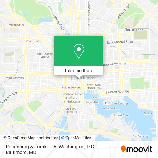
See Rosenberg & Tomko PA, Baltimore, on the map
Public Transit to Rosenberg & Tomko PA in Baltimore
Wondering how to get to Rosenberg & Tomko PA in Baltimore? Moovit helps you find the best way to get to Rosenberg & Tomko PA with step-by-step directions from the nearest public transit station.
Moovit provides free maps and live directions to help you navigate through your city. View schedules, routes, timetables, and find out how long does it take to get to Rosenberg & Tomko PA in real time.
Looking for the nearest stop or station to Rosenberg & Tomko PA? Check out this list of stops closest to your destination: Charles St & Lexington St FS Nb; Saint Paul Pl & Lexington St Sb; Charles St & Fayette St; Saratoga St & Charles St Eb; Fayette St & Saint Paul St Wb; Fayette St Plaza Wb; Lexington Market; Charles Center Metro.
Bus: 163, 40, 80, CITYLINK BLUE, CITYLINK GREEN, CITYLINK PURPLE, CITYLINK SILVER, CITYLINK YELLOW, 51, 95, 103, 410, 411, 420, 120, PURPLE ROUTE, 115.Train: MARC.Metro: METRO.
Want to see if there’s another route that gets you there at an earlier time? Moovit helps you find alternative routes or times. Get directions from and directions to Rosenberg & Tomko PA easily from the Moovit App or Website.
We make riding to Rosenberg & Tomko PA easy, which is why over 1.5 million users, including users in Baltimore, trust Moovit as the best app for public transit. You don’t need to download an individual bus app or train app, Moovit is your all-in-one transit app that helps you find the best bus time or train time available.
For information on prices of bus, metro and train, costs and ride fares to Rosenberg & Tomko PA, please check the Moovit app.
Use the app to navigate to popular places including to the airport, hospital, stadium, grocery store, mall, coffee shop, school, college, and university.
Rosenberg & Tomko PA Address: 201 N Charles St Baltimore, MD 21201 street in Baltimore
- Broadway Square Realty,
- 201 North Charles Street Building,
- Charles Center Public Parking,
- Candlewood Suites Baltimore Inner Harbor an IHG Hotel,
- St Paul and E Lexington St,
- 1 Charles Center,
- E Fayette St (fayette and charles street),
- Embassy Suites by Hilton Baltimore - Inner Harbor,
- Jury Duty Room 240,
- Fayette St Saint St,
- M&T Bank,
- Law Office of Stephanie J Robinson,
- Clarence M. Mitchell, Jr. Courthouse,
- E Ln and N Charles St,
- Mitchell Court House,
- Edj Foreclosure Mediation,
- Exelon,
- Downtown Baltimore,
- Mercy Medical Center MD USA,
- Radisson Hotel-Baltimore Downtown
Places Near Rosenberg & Tomko PA (Baltimore)
- Rock Creek Tennis Center, Washington,
- PG Mall, Prince George's County,
- Marriott Marquis Washington, DC, Washington,
- Amazon Hq2, Arlington County,
- Camden Yards, Baltimore,
- Capital One Arena, Washington,
- M&T Bank Stadium, Baltimore,
- Washington DC VA Medical Center, Washington,
- The Anthem, Washington,
- National Theatre, Washington,
- Museum Of The Bible, Washington,
- Basilica of the National Shrine, Washington,
- National Zoo, Washington,
- Pennsylvania Ave NW (3rd st and pennsylvania), Washington,
- Warner Theatre, Washington,
- Sibley Memorial Hospital, Washington,
- National Museum of African American History and Culture, Washington,
- Georgetown, Washington,
- Westfield Montgomery Mall, Montgomery County,
- Washington National Cathedral, Washington
How to get to popular places in Washington, D.C. - Baltimore, MD with public transit
Get around Baltimore by public transit!
Traveling around Baltimore has never been so easy. See step by step directions as you travel to any attraction, street or major public transit station. View bus and train schedules, arrival times, service alerts and detailed routes on a map, so you know exactly how to get to anywhere in Baltimore.
When traveling to any destination around Baltimore use Moovit's Live Directions with Get Off Notifications to know exactly where and how far to walk, how long to wait for your line, and how many stops are left. Moovit will alert you when it's time to get off — no need to constantly re-check whether yours is the next stop.
Wondering how to use public transit in Baltimore or how to pay for public transit in Baltimore? Moovit public transit app can help you navigate your way with public transit easily, and at minimum cost. It includes public transit fees, ticket prices, and costs. Looking for a map of Baltimore public transit lines? Moovit public transit app shows all public transit maps in Baltimore with all Bus, Train, Metro, Light Rail and Ferry routes and stops on an interactive map.
Washington, D.C. - Baltimore, MD has 5 transit type(s), including: Bus, Train, Metro, Light Rail and Ferry, operated by several transit agencies, including WMATA, Montgomery County Ride On, Fairfax Connector, TheBus, PRTC, DASH - Alexandria, Arlington Transit (ART), RTA of Central Maryland, MDOT MTA, MDOT MTA Light RailLink, MDOT MTA Commuter Bus, MDOT MTA Local Bus, FXBGO!, Virginia Railway Express (VRE) and MARC