How to get to Rosenblum Plastic Surgery by bus?
Click on the bus route to see step by step directions with maps, line arrival times and updated time schedules.
Bus stop near Rosenblum Plastic Surgery in Virginia Beach
- Shore & Great Neck, 2 min walk,VIEW
Bus lines to Rosenblum Plastic Surgery in Virginia Beach
What are the closest stations to Rosenblum Plastic Surgery?
The closest stations to Rosenblum Plastic Surgery are:
- Shore & Great Neck is 129 yards away, 2 min walk.
Which bus line stops near Rosenblum Plastic Surgery?
035 (Shore & Pleasure House)
What’s the nearest bus station to Rosenblum Plastic Surgery in Virginia Beach?
The nearest bus station to Rosenblum Plastic Surgery in Virginia Beach is Shore & Great Neck. It’s a 2 min walk away.
What time is the first bus to Rosenblum Plastic Surgery in Virginia Beach?
The 029 is the first bus that goes to Rosenblum Plastic Surgery in Virginia Beach. It stops nearby at 6:56 AM.
What time is the last bus to Rosenblum Plastic Surgery in Virginia Beach?
The 035 is the last bus that goes to Rosenblum Plastic Surgery in Virginia Beach. It stops nearby at 12:23 AM.
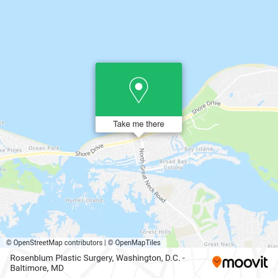
See Rosenblum Plastic Surgery, Virginia Beach, on the map
Public Transit to Rosenblum Plastic Surgery in Virginia Beach
Wondering how to get to Rosenblum Plastic Surgery in Virginia Beach? Moovit helps you find the best way to get to Rosenblum Plastic Surgery with step-by-step directions from the nearest public transit station.
Moovit provides free maps and live directions to help you navigate through your city. View schedules, routes, timetables, and find out how long does it take to get to Rosenblum Plastic Surgery in real time.
Looking for the nearest stop or station to Rosenblum Plastic Surgery? Check out this list of stops closest to your destination: Shore & Great Neck.
Bus: 035, 029.
Want to see if there’s another route that gets you there at an earlier time? Moovit helps you find alternative routes or times. Get directions from and directions to Rosenblum Plastic Surgery easily from the Moovit App or Website.
We make riding to Rosenblum Plastic Surgery easy, which is why over 1.5 million users, including users in Virginia Beach, trust Moovit as the best app for public transit. You don’t need to download an individual bus app or train app, Moovit is your all-in-one transit app that helps you find the best bus time or train time available.
For information on prices of bus, costs and ride fares to Rosenblum Plastic Surgery, please check the Moovit app.
Use the app to navigate to popular places including to the airport, hospital, stadium, grocery store, mall, coffee shop, school, college, and university.
Rosenblum Plastic Surgery Address: 2829 Shore Dr Virginia Beach, VA 23451 street in Virginia Beach
- Maniwang Jo-Marie R DDS,
- SJ Plastic Surgery,
- Konikoff Dental Associates Shore Drive,
- Spa and Laser Center,
- Dr Paige C Downs DMD,
- Truist Bank,
- Cape Henry Chiropractic,
- Trans Consciousness Therapies Dana How,
- World Instructor Training Schools,
- W.I.T.S.,
- Pdo Thread Lift,
- Hoffmeister E James CPA,
- Riva Medspa,
- Birit Design,
- Whimsy Pixies,
- The Chrysm Institute of Esthetics,
- Anna Jean Salon & Boutique,
- Mavromatis Dental,
- Dragas Homes,
- City of Virginia Beach First Landing Station 22
Places Near Rosenblum Plastic Surgery (Virginia Beach)
- Marriott Marquis Washington, DC, Washington,
- PG Mall, Prince George's County,
- Camden Yards, Baltimore,
- Warner Theatre, Washington,
- Amazon Hq2, Arlington County,
- Pennsylvania Ave NW (3rd st and pennsylvania), Washington,
- Basilica of the National Shrine, Washington,
- Sibley Memorial Hospital, Washington,
- Westfield Montgomery Mall, Montgomery County,
- Capital One Arena, Washington,
- Museum Of The Bible, Washington,
- The Anthem, Washington,
- National Museum of African American History and Culture, Washington,
- Rock Creek Tennis Center, Washington,
- Georgetown, Washington,
- National Zoo, Washington,
- Washington DC VA Medical Center, Washington,
- M&T Bank Stadium, Baltimore,
- National Mall, Washington,
- Washington National Cathedral, Washington
How to get to popular places in Washington, D.C. - Baltimore, MD with public transit
Get around Virginia Beach by public transit!
Traveling around Virginia Beach has never been so easy. See step by step directions as you travel to any attraction, street or major public transit station. View bus and train schedules, arrival times, service alerts and detailed routes on a map, so you know exactly how to get to anywhere in Virginia Beach.
When traveling to any destination around Virginia Beach use Moovit's Live Directions with Get Off Notifications to know exactly where and how far to walk, how long to wait for your line, and how many stops are left. Moovit will alert you when it's time to get off — no need to constantly re-check whether yours is the next stop.
Wondering how to use public transit in Virginia Beach or how to pay for public transit in Virginia Beach? Moovit public transit app can help you navigate your way with public transit easily, and at minimum cost. It includes public transit fees, ticket prices, and costs. Looking for a map of Virginia Beach public transit lines? Moovit public transit app shows all public transit maps in Virginia Beach with all Bus, Train, Metro, Light Rail and Ferry routes and stops on an interactive map.
Washington, D.C. - Baltimore, MD has 5 transit type(s), including: Bus, Train, Metro, Light Rail and Ferry, operated by several transit agencies, including WMATA, Montgomery County Ride On, Fairfax Connector, TheBus, PRTC, DASH - Alexandria, Arlington Transit (ART), RTA of Central Maryland, MDOT MTA, MDOT MTA Light RailLink, MDOT MTA Commuter Bus, MDOT MTA Local Bus, FXBGO!, Virginia Railway Express (VRE) and MARC