How to get to Rosenthal Chevrolet by bus?
Click on the bus route to see step by step directions with maps, line arrival times and updated time schedules.
From Alexandria,VA, Alexandria
55 minFrom Uspto, Alexandria
50 minFrom Del Ray, Alexandria
65 minFrom National Geospatial-Intelligence Agency (NGA), Fairfax County
84 minFrom Alexandria, VA, Alexandria
54 minFrom Pentagon City Mall, Arlington County
76 minFrom Fort Myer, Arlington County
80 minFrom Wilson Blvd, Arlington County
75 minFrom Eden Center, Falls Church
51 minFrom Days Inn by Wyndham Arlington Pentagon, Arlington County
46 min
Bus stops near Rosenthal Chevrolet in Fairfax County
Train station near Rosenthal Chevrolet in Fairfax County
- Backlick Road Station, 61 min walk,VIEW
Bus lines to Rosenthal Chevrolet in Fairfax County
What are the closest stations to Rosenthal Chevrolet?
The closest stations to Rosenthal Chevrolet are:
- Little River Tpke + Pinecrest Pkwy is 168 yards away, 3 min walk.
- Braddock Rd & Irvin Ct is 749 yards away, 9 min walk.
- Backlick Road Station is 5255 yards away, 61 min walk.
Which bus lines stop near Rosenthal Chevrolet?
These bus lines stop near Rosenthal Chevrolet: 306, F23, F24, F85.
What’s the nearest bus station to Rosenthal Chevrolet in Fairfax County?
The nearest bus station to Rosenthal Chevrolet in Fairfax County is Little River Tpke + Pinecrest Pkwy. It’s a 3 min walk away.
What time is the first train to Rosenthal Chevrolet in Fairfax County?
The MANASSAS LINE is the first train that goes to Rosenthal Chevrolet in Fairfax County. It stops nearby at 5:42 AM.
What time is the last train to Rosenthal Chevrolet in Fairfax County?
The MANASSAS LINE is the last train that goes to Rosenthal Chevrolet in Fairfax County. It stops nearby at 7:34 PM.
What time is the first bus to Rosenthal Chevrolet in Fairfax County?
The F85 is the first bus that goes to Rosenthal Chevrolet in Fairfax County. It stops nearby at 5:44 AM.
What time is the last bus to Rosenthal Chevrolet in Fairfax County?
The F24 is the last bus that goes to Rosenthal Chevrolet in Fairfax County. It stops nearby at 10:58 PM.
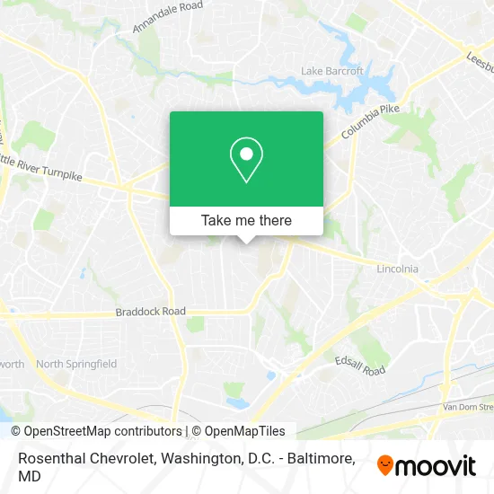
See Rosenthal Chevrolet, Fairfax County, on the map
Public Transit to Rosenthal Chevrolet in Fairfax County
Wondering how to get to Rosenthal Chevrolet in Fairfax County? Moovit helps you find the best way to get to Rosenthal Chevrolet with step-by-step directions from the nearest public transit station.
Moovit provides free maps and live directions to help you navigate through your city. View schedules, routes, timetables, and find out how long does it take to get to Rosenthal Chevrolet in real time.
Looking for the nearest stop or station to Rosenthal Chevrolet? Check out this list of stops closest to your destination: Little River Tpke + Pinecrest Pkwy; Braddock Rd & Irvin Ct; Backlick Road Station.
Bus: 306, F23, F24, F85, 834, F29.Train: MANASSAS LINE.
Want to see if there’s another route that gets you there at an earlier time? Moovit helps you find alternative routes or times. Get directions from and directions to Rosenthal Chevrolet easily from the Moovit App or Website.
We make riding to Rosenthal Chevrolet easy, which is why over 1.7 million users, including users in Fairfax County, trust Moovit as the best app for public transit. You don’t need to download an individual bus app or train app, Moovit is your all-in-one transit app that helps you find the best bus time or train time available.
For information on prices of bus and metro, costs and ride fares to Rosenthal Chevrolet, please check the Moovit app.
Use the app to navigate to popular places including to the airport, hospital, stadium, grocery store, mall, coffee shop, school, college, and university.
Rosenthal Chevrolet Address: 6500 Little River Tpke street in Fairfax County
- Robert A. Evans Memorial Stadium,
- Uzokov, Umidjon,
- Thomas Jefferson High School Track,
- Thomas Jefferson High School for Science and Technology,
- Kate Nail Art,
- Xinmei Aromatherapy,
- Thomas Jefferson HS for Sci & Tech (Thomas Jefferson High School for Science and Technology),
- Weyanoke Elementary School,
- Firehouse Subs,
- Td Bank,
- T-Mobile,
- Fang Cao Yuan Keep Healthy Spa,
- Steven's Construction Corporation,
- Allen's Cabinets VA,
- T-Mobile,
- United Pride German Shepherds,
- Discovery Mood & Anxiety Program,
- Poe Middle School,
- Aikana Esthetic Center,
- Dbls
Places Near Rosenthal Chevrolet (Fairfax County)
- Westfield Montgomery Mall, Montgomery County,
- National Zoo, Washington,
- M&T Bank Stadium, Baltimore,
- Washington National Cathedral, Washington,
- Sibley Memorial Hospital, Washington,
- Georgetown, Washington,
- Marriott Marquis Washington, DC, Washington,
- PG Mall, Prince George's County,
- The Anthem, Washington,
- Basilica of the National Shrine, Washington,
- Capital One Arena, Washington,
- Rock Creek Tennis Center, Washington,
- Amazon Hq2, Arlington County,
- National Museum of African American History and Culture, Washington,
- Pennsylvania Ave NW (3rd st and pennsylvania), Washington,
- Warner Theatre, Washington,
- Camden Yards, Baltimore,
- National Theatre, Washington,
- Washington DC VA Medical Center, Washington,
- Museum Of The Bible, Washington
How to get to popular places in Washington, D.C. - Baltimore, MD with public transit
Get around Fairfax County by public transit!
Traveling around Fairfax County has never been so easy. See step by step directions as you travel to any attraction, street or major public transit station. View bus and train schedules, arrival times, service alerts and detailed routes on a map, so you know exactly how to get to anywhere in Fairfax County.
When traveling to any destination around Fairfax County use Moovit's Live Directions with Get Off Notifications to know exactly where and how far to walk, how long to wait for your line, and how many stops are left. Moovit will alert you when it's time to get off — no need to constantly re-check whether yours is the next stop.
Wondering how to use public transit in Fairfax County or how to pay for public transit in Fairfax County? Moovit public transit app can help you navigate your way with public transit easily, and at minimum cost. It includes public transit fees, ticket prices, and costs. Looking for a map of Fairfax County public transit lines? Moovit public transit app shows all public transit maps in Fairfax County with all Bus, Train, Metro, Light Rail and Ferry routes and stops on an interactive map.
Washington, D.C. - Baltimore, MD has 5 transit type(s), including: Bus, Train, Metro, Light Rail and Ferry, operated by several transit agencies, including WMATA, Montgomery County Ride On, Fairfax Connector, TheBus, PRTC, DASH - Alexandria, Arlington Transit (ART), RTA of Central Maryland, MDOT MTA, MDOT MTA Light RailLink, MDOT MTA Commuter Bus, MDOT MTA Local Bus, FXBGO!, Virginia Railway Express (VRE) and MARC