How to get to Ross Drive Bridge by bus?
Click on the bus route to see step by step directions with maps, line arrival times and updated time schedules.
From Throw Social, Washington
75 minFrom DoubleTree by Hilton Hotel Washington DC-Crystal City, Arlington County
74 minFrom Intelligence Community Campus—Bethesda, Montgomery County
56 minFrom The Westin Arlington Gateway, Arlington County
96 minFrom AMC Theatres-Loews Georgetown 14, Washington
60 minFrom U.S. Botanic Garden, Washington
53 minFrom Kimpton Hotel Monaco Washington DC, Washington
47 minFrom Congressional Cemetery, Washington
74 minFrom Frederick Douglass Memorial Bridge, Washington
84 minFrom NPR Music Tiny Desk, Washington
59 min
How to get to Ross Drive Bridge by metro?
Click on the metro route to see step by step directions with maps, line arrival times and updated time schedules.
From DoubleTree by Hilton Hotel Washington DC-Crystal City, Arlington County
75 minFrom The Westin Arlington Gateway, Arlington County
77 minFrom AMC Theatres-Loews Georgetown 14, Washington
75 minFrom U.S. Botanic Garden, Washington
67 minFrom Kimpton Hotel Monaco Washington DC, Washington
56 minFrom Congressional Cemetery, Washington
77 minFrom Frederick Douglass Memorial Bridge, Washington
82 minFrom NPR Music Tiny Desk, Washington
67 min
Bus stop near Ross Drive Bridge in Washington
- 16 St Nw+Colorado Av NW, 8 min walk,VIEW
Metro stations near Ross Drive Bridge in Washington
Bus lines to Ross Drive Bridge in Washington
What are the closest stations to Ross Drive Bridge?
The closest stations to Ross Drive Bridge are:
- 16 St Nw+Colorado Av NW is 636 yards away, 8 min walk.
- Georgia Ave - Petworth is 2031 yards away, 24 min walk.
- Cleveland Park - East Side Of Connecticut Ave., North Of Ordway St. NW is 4254 yards away, 50 min walk.
Which bus lines stop near Ross Drive Bridge?
These bus lines stop near Ross Drive Bridge: C81, D60, D6X.
Which metro lines stop near Ross Drive Bridge?
These metro lines stop near Ross Drive Bridge: GREEN, RED, YELLOW.
What’s the nearest metro station to Ross Drive Bridge in Washington?
The nearest metro station to Ross Drive Bridge in Washington is Georgia Ave - Petworth. It’s a 24 min walk away.
What’s the nearest bus station to Ross Drive Bridge in Washington?
The nearest bus station to Ross Drive Bridge in Washington is 16 St Nw+Colorado Av NW. It’s a 8 min walk away.
What time is the first metro to Ross Drive Bridge in Washington?
The GREEN is the first metro that goes to Ross Drive Bridge in Washington. It stops nearby at 5:14 AM.
What time is the last metro to Ross Drive Bridge in Washington?
The GREEN is the last metro that goes to Ross Drive Bridge in Washington. It stops nearby at 12:27 AM.
What time is the first bus to Ross Drive Bridge in Washington?
The D60 is the first bus that goes to Ross Drive Bridge in Washington. It stops nearby at 3:12 AM.
What time is the last bus to Ross Drive Bridge in Washington?
The D60 is the last bus that goes to Ross Drive Bridge in Washington. It stops nearby at 3:14 AM.
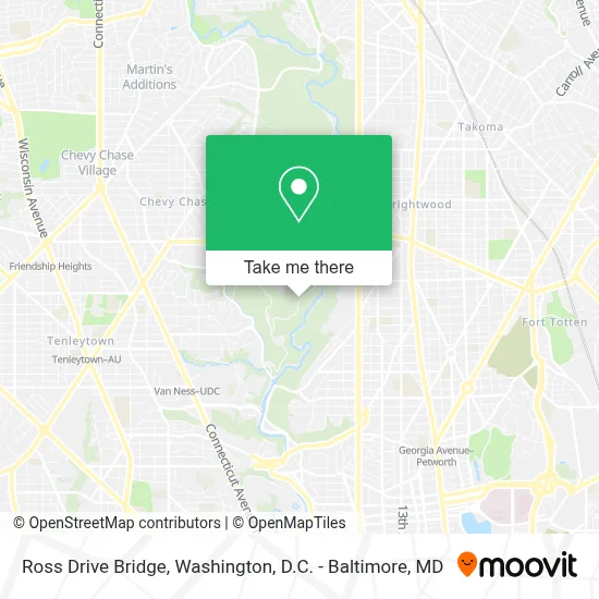
See Ross Drive Bridge, Washington, on the map
Public Transit to Ross Drive Bridge in Washington
Wondering how to get to Ross Drive Bridge in Washington? Moovit helps you find the best way to get to Ross Drive Bridge with step-by-step directions from the nearest public transit station.
Moovit provides free maps and live directions to help you navigate through your city. View schedules, routes, timetables, and find out how long does it take to get to Ross Drive Bridge in real time.
Looking for the nearest stop or station to Ross Drive Bridge? Check out this list of stops closest to your destination: 16 St Nw+Colorado Av NW; Georgia Ave - Petworth; Cleveland Park - East Side Of Connecticut Ave..
Bus: C81, D60, D6X.Metro: GREEN, RED, YELLOW.
Want to see if there’s another route that gets you there at an earlier time? Moovit helps you find alternative routes or times. Get directions from and directions to Ross Drive Bridge easily from the Moovit App or Website.
We make riding to Ross Drive Bridge easy, which is why over 1.7 million users, including users in Washington, trust Moovit as the best app for public transit. You don’t need to download an individual bus app or train app, Moovit is your all-in-one transit app that helps you find the best bus time or train time available.
For information on prices of bus and metro, costs and ride fares to Ross Drive Bridge, please check the Moovit app.
Use the app to navigate to popular places including to the airport, hospital, stadium, grocery store, mall, coffee shop, school, college, and university.
Ross Drive Bridge Address: Ross Drive street in Washington
- Rock Creek Park,
- Rock Creek Park Tennis Center (William Hg Fitzgerald),
- Rock Creek Park,
- William H.G. Fitzgerald Tennis Stadium,
- Rock Creek Tennis Center,
- Rock Creek Park Horse Center ,
- Citi Open,
- William Hg Fitzgerald Tennis Center,
- Carter Barron Soccer Fields,
- Embassy of Liberia,
- Rock Creek Park Nature Center and Planetarium,
- 16th St NW (kennedy street nw and 16th St),
- Chua Giac Hoang Buddhist Temple,
- Rock Creek Park Parking Lot 6,
- Capital Spanish 7th Day Adventist Church (Iglesia Adventista Capital Washington DC),
- Mekane Selam St Urael Ethiopian Orthodox Tewahedo Church,
- Latin American Montessori Bilingual Public Charter School (Lamb PCS),
- Colorado Ave NW and 14th,
- Nineteenth Street Baptist,
- Theater J
Places Near Ross Drive Bridge (Washington)
- National Museum of African American History and Culture, Washington,
- Pennsylvania Ave NW (3rd st and pennsylvania), Washington,
- Camden Yards, Baltimore,
- Westfield Montgomery Mall, Montgomery County,
- M&T Bank Stadium, Baltimore,
- Amazon Hq2, Arlington County,
- Georgetown, Washington,
- National Zoo, Washington,
- Marriott Marquis Washington, DC, Washington,
- Sibley Memorial Hospital, Washington,
- Rock Creek Tennis Center, Washington,
- PG Mall, Prince George's County,
- Warner Theatre, Washington,
- Museum Of The Bible, Washington,
- Basilica of the National Shrine, Washington,
- Capital One Arena, Washington,
- National Theatre, Washington,
- The Anthem, Washington,
- Washington National Cathedral, Washington,
- Washington DC VA Medical Center, Washington
How to get to popular places in Washington, D.C. - Baltimore, MD with public transit
Get around Washington by public transit!
Traveling around Washington has never been so easy. See step by step directions as you travel to any attraction, street or major public transit station. View bus and train schedules, arrival times, service alerts and detailed routes on a map, so you know exactly how to get to anywhere in Washington.
When traveling to any destination around Washington use Moovit's Live Directions with Get Off Notifications to know exactly where and how far to walk, how long to wait for your line, and how many stops are left. Moovit will alert you when it's time to get off — no need to constantly re-check whether yours is the next stop.
Wondering how to use public transit in Washington or how to pay for public transit in Washington? Moovit public transit app can help you navigate your way with public transit easily, and at minimum cost. It includes public transit fees, ticket prices, and costs. Looking for a map of Washington public transit lines? Moovit public transit app shows all public transit maps in Washington with all Bus, Train, Metro, Light Rail and Ferry routes and stops on an interactive map.
Washington, D.C. - Baltimore, MD has 5 transit type(s), including: Bus, Train, Metro, Light Rail and Ferry, operated by several transit agencies, including WMATA, Montgomery County Ride On, Fairfax Connector, TheBus, PRTC, DASH - Alexandria, Arlington Transit (ART), RTA of Central Maryland, MDOT MTA, MDOT MTA Light RailLink, MDOT MTA Commuter Bus, MDOT MTA Local Bus, FXBGO!, Virginia Railway Express (VRE) and MARC