How to get to Aghabi Rotisserie by bus?
Click on the bus route to see step by step directions with maps, line arrival times and updated time schedules.
From Florence Charterhouse, Florence
45 minFrom First of May Square Brozzi, Florence
56 minFrom Chiusi Street, Florence
73 minFrom Civil Motorization of Florence, Sesto Fiorentino
58 minFrom Colossus of the Apennines, Vaglia
46 minFrom Sesto Fiorentino Station, Sesto Fiorentino
60 minFrom Casellina, Scandicci
88 minFrom Rifredi, Florence
36 minFrom Pratolino Park, Vaglia
46 minFrom Antonio Canova Street, Florence
73 min
How to get to Aghabi Rotisserie by train?
Click on the train route to see step by step directions with maps, line arrival times and updated time schedules.
Bus stops near Aghabi Rotisserie in Florence
Train stations near Aghabi Rotisserie in Florence
Light Rail stations near Aghabi Rotisserie in Florence
- San Marco - University, 52 min walk,VIEW
Bus lines to Aghabi Rotisserie in Florence
- 3, Bisarno,VIEW
- 14, Rocca Tedalda Villa Favard,VIEW
- 18, Scalette Station,VIEW
- 82, Boccaccio Cino Da Pistoia,VIEW
- SI90, Ponticelli,VIEW
- 322 A, Rufina Center,VIEW
- 330 A, Santa Brigida Terminal,VIEW
- 343 A, Consuma Terminal,VIEW
- 345 A, Florence Montelungo Hub,VIEW
- 345BIS A, Pontassieve State Road 67,VIEW
- 345BIS A, Florence Montelungo Hub,VIEW
- 357 A, Pontassieve State Road 67,VIEW
- 357 A, Giovanni Meyer Square,VIEW
- 360 A, Ciliegi,VIEW
- 360 A, Florence Montelungo Hub,VIEW
- 333 A, Monterifrassine-Molino Del Piano-Florence,VIEW
- 360 A, Montevarchi-Incisa Valdarno-Pontassieve-Florence,VIEW
- 351 A, Figline Valdarno,VIEW
- 351 A, Giovanni Meyer Square,VIEW
- 365 A, Florence Montelungo Hub,VIEW
What are the closest stations to Aghabi Rotisserie?
The closest stations to Aghabi Rotisserie are:
- Campofiore Saddle is 125 meters away, 2 min walk.
- Lanza De Sanctis is 258 meters away, 4 min walk.
- Colombo Campofiore is 296 meters away, 4 min walk.
- Piagentina Beato Angelico is 375 meters away, 5 min walk.
- Arrivabene Villa is 651 meters away, 9 min walk.
- Firenze Rovezzano is 2553 meters away, 33 min walk.
- Florence Campo di Marte is 2704 meters away, 35 min walk.
- San Marco - University is 4053 meters away, 52 min walk.
Which bus lines stop near Aghabi Rotisserie?
These bus lines stop near Aghabi Rotisserie: 14, 20, 6.
Which train line stops near Aghabi Rotisserie?
R (Rimini)
What’s the nearest bus station to Aghabi Rotisserie in Florence?
The nearest bus station to Aghabi Rotisserie in Florence is Campofiore Saddle. It’s a 2 min walk away.
What time is the first light rail to Aghabi Rotisserie in Florence?
The T2 is the first light rail that goes to Aghabi Rotisserie in Florence. It stops nearby at 5:04 AM.
What time is the last light rail to Aghabi Rotisserie in Florence?
The T2 is the last light rail that goes to Aghabi Rotisserie in Florence. It stops nearby at 12:34 AM.
What time is the first train to Aghabi Rotisserie in Florence?
The R is the first train that goes to Aghabi Rotisserie in Florence. It stops nearby at 6:06 AM.
What time is the last train to Aghabi Rotisserie in Florence?
The R is the last train that goes to Aghabi Rotisserie in Florence. It stops nearby at 11:39 PM.
What time is the first bus to Aghabi Rotisserie in Florence?
The 14 is the first bus that goes to Aghabi Rotisserie in Florence. It stops nearby at 5:39 AM.
What time is the last bus to Aghabi Rotisserie in Florence?
The 14 is the last bus that goes to Aghabi Rotisserie in Florence. It stops nearby at 1:13 AM.
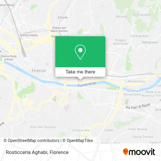
See Aghabi Rotisserie, Florence, on the map
Public Transit to Aghabi Rotisserie in Florence
Wondering how to get to Aghabi Rotisserie in Florence? Moovit helps you find the best way to get to Aghabi Rotisserie with step-by-step directions from the nearest public transit station.
Moovit provides free maps and live directions to help you navigate through your city. View schedules, routes, timetables, and find out how long does it take to get to Aghabi Rotisserie in real time.
Looking for the nearest stop or station to Aghabi Rotisserie? Check out this list of stops closest to your destination: Campofiore Saddle; Lanza De Sanctis; Colombo Campofiore; Piagentina Beato Angelico; Arrivabene Villa; Firenze Rovezzano; Florence Campo di Marte; San Marco - University.
Bus: 14, 20, 6, 3, 18, 82, SI90, 333 A, 360 A, 351 A, 351 A, 365 A, 365 A.Train: R.
Want to see if there’s another route that gets you there at an earlier time? Moovit helps you find alternative routes or times. Get directions from and directions to Aghabi Rotisserie easily from the Moovit App or Website.
We make riding to Aghabi Rotisserie easy, which is why over 1.5 million users, including users in Florence, trust Moovit as the best app for public transit. You don’t need to download an individual bus app or train app, Moovit is your all-in-one transit app that helps you find the best bus time or train time available.
For information on prices of bus, train and light rail, costs and ride fares to Aghabi Rotisserie, please check the Moovit app.
Use the app to navigate to popular places including to the airport, hospital, stadium, grocery store, mall, coffee shop, school, college, and university.
Aghabi Rotisserie Address: Via Quintino Sella, 27 50136 Firenze street in Florence
- Il Tulipano by Scopetani Antonella,
- Constantine Nigra Street 23/25,
- 50&Più Enasco,
- Bellariva,
- Dr. Benedetta Goretti Psychologist-Psychotherapist,
- A.D.A. Home Care for Elderly Association,
- Florence Campo Marte,
- Elettra Terzani Nutritional Biologist,
- Dr. Andrea Cozzi Lep,
- Quintino Sella Street, 100,
- Giovanni Lanza Street, 73,
- De Sanctis Da Verrazzano,
- Sun & Moon Aesthetics Solarium,
- Borgogni S.R.L,
- Donnini Knife Sharpener and Cutlery,
- Quintino Sella Street / Campofiore Street,
- Quintino Sella Street,
- Giovanni Lanza Street / Urbano Rattazzi Street,
- Bellariva Chalet,
- San Giuseppe Institute
Places Near Aghabi Rotisserie (Florence)
- Cascine Park, Florence,
- Santa Maria Novella Station, Florence,
- Verdi Theater, Florence,
- IKEA Florence, Sesto Fiorentino,
- Visarno Arena, Florence,
- Campi Bisenzio, Campi Bisenzio,
- Michelangelo Square, Florence,
- I Gigli, Campi Bisenzio,
- Tobacco Manufacture, Florence,
- Nelson Mandela Forum, Florence,
- Michelangelo Square, Florence,
- OOO, Florence,
- Torregalli Hospital Scandicci *, Scandicci,
- Mandela Forum (Nelson Mandela Forum), Florence,
- Piero Palagi Hospital Facility-Florence, Florence,
- Visarno Hippodrome, Florence,
- Artemio Franchi Municipal Stadium, Florence,
- Field of Mars, Florence,
- Asmana, Campi Bisenzio,
- Santa Maria Nuova Hospital, Florence
How to get to popular places in Florence with public transit
Get around Florence by public transit!
Traveling around Florence has never been so easy. See step by step directions as you travel to any attraction, street or major public transit station. View bus and train schedules, arrival times, service alerts and detailed routes on a map, so you know exactly how to get to anywhere in Florence.
When traveling to any destination around Florence use Moovit's Live Directions with Get Off Notifications to know exactly where and how far to walk, how long to wait for your line, and how many stops are left. Moovit will alert you when it's time to get off — no need to constantly re-check whether yours is the next stop.
Wondering how to use public transit in Florence or how to pay for public transit in Florence? Moovit public transit app can help you navigate your way with public transit easily, and at minimum cost. It includes public transit fees, ticket prices, and costs. Looking for a map of Florence public transit lines? Moovit public transit app shows all public transit maps in Florence with all Bus, Train, Light Rail, Ferry and Funicular routes and stops on an interactive map.
Florence has 5 transit type(s), including: Bus, Train, Light Rail, Ferry and Funicular, operated by several transit agencies, including Florence Urban - Tuscan Bus Lines, GEST, Livorno and Province - Tuscan Bus Lines, Arezzo, Florence and Provinces - Tuscan Bus Lines, Prato and Province - Tuscan Bus Lines, Lucca and Province - Tuscan Bus Lines, Massa, Carrara and Province - Tuscan Bus Lines, Pisa and Province - Tuscan Bus Lines, Grosseto, Siena and Provinces - Tuscan Bus Lines, Arezzo, Siena and Provinces - Tuscan Bus Lines, Florence and Province - Tuscan Bus Lines, Pistoia and Province - Tuscan Bus Lines, Siena and Province - Tuscan Bus Lines, Arezzo and Province - Tuscan Bus Lines and Trenitalia