How to get to Rosticeria by bus?
Click on the bus route to see step by step directions with maps, line arrival times and updated time schedules.
From Tultepec, Gustavo A. Madero
71 minFrom Atizapán de Zaragoza, Tlalnepantla
72 minFrom Huixquilucan, Gustavo A. Madero
76 minFrom Tlalnepantla (Tlalnepantla de Baz), Gustavo A. Madero
53 minFrom Colonia San Felipe de Jesús, Gustavo A. Madero
70 minFrom Facultad de Estudios Superiores Aragón Unam (Fes Aragón Unam), Tlalnepantla
116 minFrom Juzgados Civiles Y Familiares de Tecamac, Estado de México, Zumpango
40 minFrom Price-Shoes Ecatepec, Ecatepec De Morelos
113 minFrom Ixtapaluca, Gustavo A. Madero
76 minFrom Universidad tecnologica de valle de toluca, Tultitlán
85 min
How to get to Rosticeria by metro?
Click on the metro route to see step by step directions with maps, line arrival times and updated time schedules.
Bus stop near Rosticeria in Ecatepec De Morelos
- Adolfo López M. (Mexibus), 5 min walk,VIEW
Metro station near Rosticeria in Ecatepec De Morelos
- Ciudad Azteca, 10 min walk,VIEW
Bus lines to Rosticeria in Ecatepec De Morelos
- 1, Ojo de Agua - Cd. Azteca (Ruta Exprés),VIEW
What are the closest stations to Rosticeria?
The closest stations to Rosticeria are:
- Adolfo López M. (Mexibus) is 347 meters away, 5 min walk.
- Ciudad Azteca is 775 meters away, 10 min walk.
Which bus lines stop near Rosticeria?
These bus lines stop near Rosticeria: 1, 18.
Which metro line stops near Rosticeria?
B (Dirección Ciudad Azteca)
What’s the nearest metro station to Rosticeria in Ecatepec De Morelos?
The nearest metro station to Rosticeria in Ecatepec De Morelos is Ciudad Azteca. It’s a 10 min walk away.
What’s the nearest bus station to Rosticeria in Ecatepec De Morelos?
The nearest bus station to Rosticeria in Ecatepec De Morelos is Adolfo López M. (Mexibus). It’s a 5 min walk away.
What time is the first metro to Rosticeria in Ecatepec De Morelos?
The B is the first metro that goes to Rosticeria in Ecatepec De Morelos. It stops nearby at 5:00 AM.
What time is the last metro to Rosticeria in Ecatepec De Morelos?
The B is the last metro that goes to Rosticeria in Ecatepec De Morelos. It stops nearby at 12:49 AM.
What time is the first bus to Rosticeria in Ecatepec De Morelos?
The 1 is the first bus that goes to Rosticeria in Ecatepec De Morelos. It stops nearby at 4:39 AM.
What time is the last bus to Rosticeria in Ecatepec De Morelos?
The 1 is the last bus that goes to Rosticeria in Ecatepec De Morelos. It stops nearby at 1:17 AM.
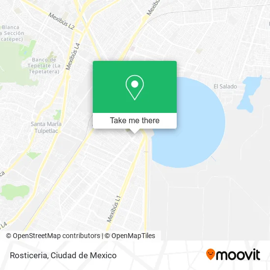
See Rosticeria, Ecatepec De Morelos, on the map
Public Transit to Rosticeria in Ecatepec De Morelos
Wondering how to get to Rosticeria in Ecatepec De Morelos? Moovit helps you find the best way to get to Rosticeria with step-by-step directions from the nearest public transit station.
Moovit provides free maps and live directions to help you navigate through your city. View schedules, routes, timetables, and find out how long does it take to get to Rosticeria in real time.
Looking for the nearest stop or station to Rosticeria? Check out this list of stops closest to your destination: Adolfo López M. (Mexibus); Ciudad Azteca.
Bus: 1, 18.Metro: B.
Want to see if there’s another route that gets you there at an earlier time? Moovit helps you find alternative routes or times. Get directions from and directions to Rosticeria easily from the Moovit App or Website.
We make riding to Rosticeria easy, which is why over 1.5 million users, including users in Ecatepec De Morelos, trust Moovit as the best app for public transit. You don’t need to download an individual bus app or train app, Moovit is your all-in-one transit app that helps you find the best bus time or train time available.
For information on prices of bus and metro, costs and ride fares to Rosticeria, please check the Moovit app.
Use the app to navigate to popular places including to the airport, hospital, stadium, grocery store, mall, coffee shop, school, college, and university.
Rosticeria Address: Rosticeria, Avenida Adolfo López Mateos 1, Sagitario 10 - Alfredo del Mazo, 55117 Ecatepec de Morel street in Ecatepec De Morelos
- Jarcieria,
- Blancos Venta de Cobijas y Cojines,
- Taqueria El Cuñado,
- Clases de Zumba,
- Super Tortas Juanito,
- Novedades Wendy,
- Plantas Medicinales y Articulos Religiosos,
- Abarrotes Roger,
- Compra de Pet,
- Tenango del Valle Avenida Vía R1,
- Avenida Adolfo López Mateos Calle Atlacomulco,
- Ryr Paint México,
- Salon Bambino's,
- Molino de Chiles Secos El Poblanito,
- CONSULTORIO MEDICO,
- Papeleria La Chiquita,
- Refaccionaria Mundo de Autopartes,
- R1,
- Iglesia La Curva,
- Mercado 12 de Diciembre
Places Near Rosticeria (Ecatepec De Morelos)
- Hospital Magdalena de las Salinas, Gustavo A. Madero,
- Central de Abasto de la Ciudad de México, Cuauhtémoc,
- Clínica 29 Imss, Gustavo A. Madero,
- CECyT 6 Miguel Othón de Mendizábal, Azcapotzalco,
- Zona de Hospitales Tlalpan, Alvaro Obregón,
- HAMBURGO 213, Azcapotzalco,
- Centro Banamex (Centro Citibanamex), Naucalpan De Juárez,
- Plaza Tepeyac, Gustavo A. Madero,
- Monumental Plaza de Toros México, Miguel Hidalgo,
- Parque Las Antenas, Iztapalapa,
- Deportivo Los Galeana, Gustavo A. Madero,
- Plaza Parque Tezontle, Iztapalapa,
- Instituto Nacional de Neurologia y Neurocirugia "Manuel Velasco Suarez", Alvaro Obregón,
- Plaza Galerias De Las Estrellas, Azcapotzalco,
- BUCARELI 134 COL CENTRO DELEG CUAUHTEMOC D F, Azcapotzalco,
- Hospital Gabriel Mancera - Urgencias, Miguel Hidalgo,
- World Trade Center Ciudad de México, Miguel Hidalgo,
- Antara Polanco (Antara Polanco-Puerta 1), Naucalpan De Juárez,
- Hospital Juarez de México, Gustavo A. Madero,
- Hospital Regional Lic. Adolfo López Mateos, Miguel Hidalgo
How to get to popular places in Ciudad de Mexico with public transit
Get around Ecatepec De Morelos by public transit!
Traveling around Ecatepec De Morelos has never been so easy. See step by step directions as you travel to any attraction, street or major public transit station. View bus and train schedules, arrival times, service alerts and detailed routes on a map, so you know exactly how to get to anywhere in Ecatepec De Morelos.
When traveling to any destination around Ecatepec De Morelos use Moovit's Live Directions with Get Off Notifications to know exactly where and how far to walk, how long to wait for your line, and how many stops are left. Moovit will alert you when it's time to get off — no need to constantly re-check whether yours is the next stop.
Wondering how to use public transit in Ecatepec De Morelos or how to pay for public transit in Ecatepec De Morelos? Moovit public transit app can help you navigate your way with public transit easily, and at minimum cost. It includes public transit fees, ticket prices, and costs. Looking for a map of Ecatepec De Morelos public transit lines? Moovit public transit app shows all public transit maps in Ecatepec De Morelos with all Bus, Train, Metro, Cable Car and Gondola routes and stops on an interactive map.
Ciudad de Mexico has 5 transit type(s), including: Bus, Train, Metro, Cable Car and Gondola, operated by several transit agencies, including STC (Metro CDMX), Metrobús, RTP, Trolebús elevado, Trolebús, Tren El Insurgente, Tren Ligero, Cablebús, Corredores Concesionados, Ferrocarriles Suburbanos, Mexibus, Mexicable, Puma Bus and Potrobús