How to get to Rosticeria Ricky by bus?
Click on the bus route to see step by step directions with maps, line arrival times and updated time schedules.
From 14/A. Zona Militar, Aguascalientes
57 minFrom Alameda, Aguascalientes
41 minFrom Fraccionamiento Jardines De La Cruz, Aguascalientes
45 minFrom Vista las Cumbres, Aguascalientes
59 minFrom Avenida Gabriela Mistral, Aguascalientes
51 minFrom CECyTEA Plantel Aguascalientes, Aguascalientes
57 minFrom Fracc. Municipio Libre, Aguascalientes
42 minFrom Fiscalia General del Estado, Aguascalientes
40 minFrom Prepa Reyes Heroles, Aguascalientes
52 minFrom Sam's Club Santa Monica, Aguascalientes
47 min
Bus stops near Rosticeria Ricky in Aguascalientes
Bus lines to Rosticeria Ricky in Aguascalientes
What are the closest stations to Rosticeria Ricky?
The closest stations to Rosticeria Ricky are:
- Perama, 203 is 362 meters away, 5 min walk.
- Terminal San Antonio is 381 meters away, 5 min walk.
Which bus lines stop near Rosticeria Ricky?
These bus lines stop near Rosticeria Ricky: RUTA 37, RUTA 43, RUTA 47.
What’s the nearest bus station to Rosticeria Ricky in Aguascalientes?
The nearest bus stations to Rosticeria Ricky in Aguascalientes are Perama, 203 and Terminal San Antonio. The closest one is a 5 min walk away.
What time is the first bus to Rosticeria Ricky in Aguascalientes?
The RUTA 37 is the first bus that goes to Rosticeria Ricky in Aguascalientes. It stops nearby at 5:45 AM.
What time is the last bus to Rosticeria Ricky in Aguascalientes?
The RUTA 43 is the last bus that goes to Rosticeria Ricky in Aguascalientes. It stops nearby at 10:50 PM.
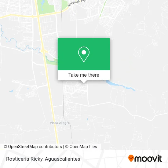
See Rosticeria Ricky, Aguascalientes, on the map
Public Transit to Rosticeria Ricky in Aguascalientes
Wondering how to get to Rosticeria Ricky in Aguascalientes? Moovit helps you find the best way to get to Rosticeria Ricky with step-by-step directions from the nearest public transit station.
Moovit provides free maps and live directions to help you navigate through your city. View schedules, routes, timetables, and find out how long does it take to get to Rosticeria Ricky in real time.
Looking for the nearest stop or station to Rosticeria Ricky? Check out this list of stops closest to your destination: Perama; Terminal San Antonio.
Bus: RUTA 37, RUTA 43, RUTA 47.
Want to see if there’s another route that gets you there at an earlier time? Moovit helps you find alternative routes or times. Get directions from and directions to Rosticeria Ricky easily from the Moovit App or Website.
We make riding to Rosticeria Ricky easy, which is why over 1.5 million users, including users in Aguascalientes, trust Moovit as the best app for public transit. You don’t need to download an individual bus app or train app, Moovit is your all-in-one transit app that helps you find the best bus time or train time available.
For information on prices of bus, costs and ride fares to Rosticeria Ricky, please check the Moovit app.
Use the app to navigate to popular places including to the airport, hospital, stadium, grocery store, mall, coffee shop, school, college, and university.
Rosticeria Ricky Address: Rosticeria Ricky, Avenida Rancho San Antonio, Fracc Paseos de San Antonio, 20298 Aguascalientes, Ag street in Aguascalientes
- La Doña de los Bionicos y Dulces,
- Cenaduria,
- WESTERN UNION,
- Paseos de San Antonio,
- Paseos de San Antonio,
- La Familia,
- Carniceria Chuy Jr,
- Tortas Lucy,
- Fracc Paseos de San Antonio,
- Abarrotes Fresnillo,
- Rafael Francisco Aguilar Lomeli,
- Chicharrones y Carnitas,
- Parque Hacienda San Marcos,
- Hacienda San Marcos,
- WESTERN UNION,
- Sup San Marcos,
- Los Parga,
- Fracc. Hacienda San Marcos,
- Secundaria General Num. 37 Gabriel Garcia Márquez,
- WESTERN UNION
Places Near Rosticeria Ricky (Aguascalientes)
- clinica 3 uaa, Aguascalientes,
- Universidad Autónoma de Aguascalientes, Aguascalientes,
- Blvd. Luis Donaldo Colosio, Aguascalientes,
- Aeropuerto de Aguascalientes S.A. de C.V., Aguascalientes,
- ESPACIOS, Aguascalientes,
- Parque Las Tres Centurias, Aguascalientes,
- Central De Autobuses, Aguascalientes,
- Centro Comercial Altaria, Aguascalientes,
- Villas de Nuestra Señora de la Asunción, Aguascalientes,
- Agropecuario, Aguascalientes,
- Ciudad industrial, Aguascalientes,
- Nuevo Hospital Hidalgo, Aguascalientes,
- La Isla San Marcos, Aguascalientes,
- Centro, Aguascalientes,
- Hospital Imss No. 3, Aguascalientes,
- Isla San Marcos, Aguascalientes,
- Imss Clinica 1, Aguascalientes,
- Jesús María, Aguascalientes,
- Villasuncion, Aguascalientes,
- Terminal De Combis, Aguascalientes
How to get to popular places in Aguascalientes with public transit
Get around Aguascalientes by public transit!
Traveling around Aguascalientes has never been so easy. See step by step directions as you travel to any attraction, street or major public transit station. View bus and train schedules, arrival times, service alerts and detailed routes on a map, so you know exactly how to get to anywhere in Aguascalientes.
When traveling to any destination around Aguascalientes use Moovit's Live Directions with Get Off Notifications to know exactly where and how far to walk, how long to wait for your line, and how many stops are left. Moovit will alert you when it's time to get off — no need to constantly re-check whether yours is the next stop.
Wondering how to use public transit in Aguascalientes or how to pay for public transit in Aguascalientes? Moovit public transit app can help you navigate your way with public transit easily, and at minimum cost. It includes public transit fees, ticket prices, and costs. Looking for a map of Aguascalientes public transit lines? Moovit public transit app shows all public transit maps in Aguascalientes with all bus routes and stops on an interactive map.
Aguascalientes has 1 transit type(s), including: bus, operated by several transit agencies, including Coordinación General de Movilidad