How to get to Rota 247 by bus?
Click on the bus route to see step by step directions with maps, line arrival times and updated time schedules.
From Avenida Central (av central laranjeiras), U.T.P. Candida De Morais/Maria Dilce
26 minFrom Setor Santo Hilario, U.T.P. Santo Hilario
41 minFrom Linha 020 - T. Garavelo / T. da Bíblia - Via T. Isidória, U.T.P. Pedro Ludovico/Bela Vista/Jardim Das Esmeraldas
30 minFrom Campus Samambaia (campus II), U.T.P. Campus Universitario/Conj. Itatiaia
46 minFrom Autódromo Internacional de Goiânia, U.T.P. Autodromo Ou Parque Lozandes
44 minFrom Setor Estrela Dalva, Goiania
62 minFrom vila Galvão, Senador Canedo
53 minFrom Parque Oeste Industrial, U.T.P. Parque Oeste Industrial
33 minFrom Residencial Center Ville, U.T.P. Caravelas
71 minFrom Conjunto Itatiaia, U.T.P. Campus Universitario/Conj. Itatiaia
45 min
Bus stops near Rota 247 in U.T.P. Oeste
Bus lines to Rota 247 in U.T.P. Oeste
- 166, T. Praça A / Vl. João Vaz,VIEW
- 174, T. Hailé Pinheiro / T. Praça A / Sevene,VIEW
- 178, Jd. Curitiba / T. Praça A,VIEW
- 305, T. Rec. Bosque / Campinas / T. Praça A,VIEW
- 938, Jd. Curitiba / T. Praça A / T. Cruzeiro,VIEW
- 113, BRT Oeste | T. Goianira,VIEW
- 118, BRT Leste | T. Praça A,VIEW
- 110, BRT Oeste | T. Pe. Pelágio,VIEW
- 112, BRT Leste | Pça. da Bíblia - Via T. Vera Cruz,VIEW
- 116, BRT Oeste | T. Vera Cruz,VIEW
- 117, BRT Leste | T. Novo Mundo,VIEW
- 052, Vera Cruz ⇆ Centro - Via Campinas,VIEW
- 164, Vera Cruz ⇆ Praça Cívica,VIEW
- 605, Rodoviária - Via Campinas,VIEW
- 009, T. Pe. Pelágio,VIEW
- 010, T. Veiga Jd.,VIEW
- 014, Campinas,VIEW
- 187, T. Pq. Oeste ⇆ T. Paulo Garcia - Via Detran,VIEW
- 400, T. Praça A → Av. Independência → T. Bíblia,VIEW
- 401, T. Praça A → Pça. Walter Santos → T. Bíblia,VIEW
What are the closest stations to Rota 247?
The closest stations to Rota 247 are:
- T. Praça A Provisório | Saída is 397 meters away, 6 min walk.
- T. Praça A Provisório | Plataforma 13 is 499 meters away, 7 min walk.
- Est. Lago Das Rosas | Leste is 543 meters away, 8 min walk.
- Av. 24 De Outubro is 548 meters away, 8 min walk.
- Av. Castelo Branco is 674 meters away, 9 min walk.
Which bus lines stop near Rota 247?
These bus lines stop near Rota 247: 009, 105, 113, 116, 117, 164, 605.
What’s the nearest bus station to Rota 247 in U.T.P. Oeste?
The nearest bus station to Rota 247 in U.T.P. Oeste is T. Praça A Provisório | Saída. It’s a 6 min walk away.
What time is the first bus to Rota 247 in U.T.P. Oeste?
The 187 is the first bus that goes to Rota 247 in U.T.P. Oeste. It stops nearby at 3:00 AM.
What time is the last bus to Rota 247 in U.T.P. Oeste?
The 187 is the last bus that goes to Rota 247 in U.T.P. Oeste. It stops nearby at 3:00 AM.
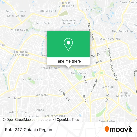
See Rota 247, U.T.P. Oeste, on the map
Public Transit to Rota 247 in U.T.P. Oeste
Wondering how to get to Rota 247 in U.T.P. Oeste? Moovit helps you find the best way to get to Rota 247 with step-by-step directions from the nearest public transit station.
Moovit provides free maps and live directions to help you navigate through your city. View schedules, routes, timetables, and find out how long does it take to get to Rota 247 in real time.
Looking for the nearest stop or station to Rota 247? Check out this list of stops closest to your destination: T. Praça A Provisório | Saída; T. Praça A Provisório | Plataforma 13; Est. Lago Das Rosas | Leste; Av. 24 De Outubro; Av. Castelo Branco.
Bus: 009, 105, 113, 116, 117, 164, 605, 166, 174, 178, 305, 938, 118, 052, 110, 112, 010, 014, 187, 400, 401.
Want to see if there’s another route that gets you there at an earlier time? Moovit helps you find alternative routes or times. Get directions from and directions to Rota 247 easily from the Moovit App or Website.
We make riding to Rota 247 easy, which is why over 1.5 million users, including users in U.T.P. Oeste, trust Moovit as the best app for public transit. You don’t need to download an individual bus app or train app, Moovit is your all-in-one transit app that helps you find the best bus time or train time available.
For information on prices of bus, costs and ride fares to Rota 247, please check the Moovit app.
Use the app to navigate to popular places including to the airport, hospital, stadium, grocery store, mall, coffee shop, school, college, and university.
Rota 247 Address: Rua 247 street in U.T.P. Oeste
- Coma e Emagreça Auriculoterapia,
- Larisse Faria Semi-Joias,
- Etech,
- My house,
- Hospital Materno Infantil,
- Associação Servos de Deus (ASD),
- Caixa Econômica Federal,
- Residencial Talismã,
- Secretaria Estadual da Educação de Goiás,
- Praça do Racha,
- SPA Odonto-Médico,
- Stiueg Sindicato,
- Praça Godofredo Leopoldino (Praça do Racha),
- Laboratório Moderno,
- Maori Esportescursostreinamentos e Arbitragem,
- Vigilância Sanitária Estadual,
- Rede Oeste Carnes,
- Cannys & Fellys Veterinária,
- Embalagens Santa Luzia,
- Abrigos Tempra Toldos
Places Near Rota 247 (U.T.P. Oeste)
- Avenida T-2, U.T.P. Bueno,
- Senador Canedo, Senador Canedo,
- Hospital de Urgências de Goiânia (HUGO), U.T.P. Pedro Ludovico/Bela Vista/Jardim Das Esmeraldas,
- Terminal Araguaia, Aparecida De Goiânia,
- Shopping Flamboyant, U.T.P. Jardim Goias,
- Hospital Santa Casa de Misericórdia de Goiânia, U.T.P. Bueno,
- Avenida 44, Goiania,
- Rodovia BR - 153, Aparecida De Goiânia,
- Rodeio Show de Aparecida, Aparecida De Goiânia,
- Setor Expansul, Aparecida De Goiânia,
- Aeroporto de Goiânia / Santa Genoveva (GYN), U.T.P. Aeroporto Internacional,
- Terminal Recanto do Bosque, Goiania,
- ICF Instituto de Ciências Farmacêuticas Unidade Clinica, U.T.P. Novo Horizonte/Faicalville,
- HUGOL - Hospital De Urgências Governador Octávio Lage, U.T.P. V. Regina/Pq. Ind. Paulista/Santos Dumont,
- Terminal Praça A, U.T.P. Campinas,
- Terminal Rodoviário De Goiânia, U.T.P. Central,
- Buriti Shopping, Aparecida De Goiânia,
- Hospital e Maternidade São Judas Tadeu, U.T.P. Jardim Europa,
- Avenida Rio Verde, Aparecida De Goiânia,
- Parque Das Nacoes, Aparecida De Goiânia
How to get to popular places in Goiania Region with public transit
Get around U.T.P. Oeste by public transit!
Traveling around U.T.P. Oeste has never been so easy. See step by step directions as you travel to any attraction, street or major public transit station. View bus and train schedules, arrival times, service alerts and detailed routes on a map, so you know exactly how to get to anywhere in U.T.P. Oeste.
When traveling to any destination around U.T.P. Oeste use Moovit's Live Directions with Get Off Notifications to know exactly where and how far to walk, how long to wait for your line, and how many stops are left. Moovit will alert you when it's time to get off — no need to constantly re-check whether yours is the next stop.
Wondering how to use public transit in U.T.P. Oeste or how to pay for public transit in U.T.P. Oeste? Moovit public transit app can help you navigate your way with public transit easily, and at minimum cost. It includes public transit fees, ticket prices, and costs. Looking for a map of U.T.P. Oeste public transit lines? Moovit public transit app shows all public transit maps in U.T.P. Oeste with all bus routes and stops on an interactive map.
Goiania Region has 1 transit type(s), including: bus, operated by several transit agencies, including Redemob Consórcio - CMTC