Directions to Rota Bike (Colombo) with public transportation
The following transit lines have routes that pass near Rota Bike
How to get to Rota Bike by bus?
Click on the bus route to see step by step directions with maps, line arrival times and updated time schedules.
From Rua Marechal Deodoro 51, Centro
43 minFrom Rua Gago Coutinho, Bacacheri
33 minFrom rua Rockefeller 1450, Rebouças
46 minFrom Centro, Centro
40 minFrom Jardim Social, Jardim Social
50 minFrom Rua Emílio de Menezes, São Francisco
73 minFrom Centro Politécnico da UFPR, Jardim Das Américas
39 minFrom Colonia Antonio Prado, Almirante Tamandaré
58 minFrom Avenida Silva Jardim, Rebouças
52 minFrom Rua Monsenhor Célso 256-2 andar, Centro
41 min
Bus stops near Rota Bike in Colombo
Bus lines to Rota Bike in Colombo
- B43 RIO VERDE, Terminal Boa Vista → Praça da Bíblia,VIEW
- S02 ROÇA GRANDE / ESTAÇÃO ATUBA, Terminal Roça Grande → Estação Atuba,VIEW
- 231 BANESTADO / CALIFÓRNIA, Terminal Santa Cândida ↺ Banestado (Circular),VIEW
- I90 CACHOEIRA / MARACANÃ, Terminal Cachoeira → Terminal Maracanã,VIEW
- B11 MARACANÃ / SANTA CÂNDIDA, Terminal Maracanã → Terminal Santa Cândida,VIEW
- B39 CAMPO ALTO / SANTA CÂNDIDA, Terminal Santa Cândida ↺ Campo Alto / Capela do Atuba (Circular),VIEW
- B57 CAMPO ALTO / SANTA CÂNDIDA, Terminal Santa Cândida ↺ Terminal Maracanã (Circular),VIEW
- B58 MARACANÃ / SANTA CÂNDIDA (CIRCULAR), Terminal Santa Cândida ↺ Terminal Maracanã (Circular),VIEW
What are the closest stations to Rota Bike?
The closest stations to Rota Bike are:
- Rua Da Pedreira, 914-990 is 226 meters away, 4 min walk.
- R. Quintino Bocaiúva, 642 is 291 meters away, 4 min walk.
- Rua Vicente Gorski 30 is 703 meters away, 10 min walk.
- Rua Rio Grande Do Norte, 91 is 838 meters away, 11 min walk.
Which bus lines stop near Rota Bike?
These bus lines stop near Rota Bike: 231 BANESTADO / CALIFÓRNIA, I90 CACHOEIRA / MARACANÃ, S02 ROÇA GRANDE / ESTAÇÃO ATUBA.
What’s the nearest bus station to Rota Bike in Colombo?
The nearest bus stations to Rota Bike in Colombo are Rua Da Pedreira, 914-990 and R. Quintino Bocaiúva, 642. The closest one is a 4 min walk away.
What time is the first bus to Rota Bike in Colombo?
The 231 BANESTADO / CALIFÓRNIA is the first bus that goes to Rota Bike in Colombo. It stops nearby at 4:55 AM.
What time is the last bus to Rota Bike in Colombo?
The 231 BANESTADO / CALIFÓRNIA is the last bus that goes to Rota Bike in Colombo. It stops nearby at 12:45 AM.
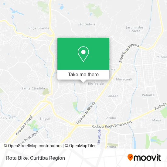
See Rota Bike, Colombo, on the map
Public Transit to Rota Bike in Colombo
Wondering how to get to Rota Bike in Colombo? Moovit helps you find the best way to get to Rota Bike with step-by-step directions from the nearest public transit station.
Moovit provides free maps and live directions to help you navigate through your city. View schedules, routes, timetables, and find out how long does it take to get to Rota Bike in real time.
Looking for the nearest stop or station to Rota Bike? Check out this list of stops closest to your destination: Rua Da Pedreira; R. Quintino Bocaiúva; Rua Vicente Gorski 30; Rua Rio Grande Do Norte.
Bus: 231 BANESTADO / CALIFÓRNIA, I90 CACHOEIRA / MARACANÃ, S02 ROÇA GRANDE / ESTAÇÃO ATUBA, B43 RIO VERDE, B11 MARACANÃ / SANTA CÂNDIDA, B39 CAMPO ALTO / SANTA CÂNDIDA, B57 CAMPO ALTO / SANTA CÂNDIDA, B58 MARACANÃ / SANTA CÂNDIDA (CIRCULAR).
Want to see if there’s another route that gets you there at an earlier time? Moovit helps you find alternative routes or times. Get directions from and directions to Rota Bike easily from the Moovit App or Website.
We make riding to Rota Bike easy, which is why over 1.5 million users, including users in Colombo, trust Moovit as the best app for public transit. You don’t need to download an individual bus app or train app, Moovit is your all-in-one transit app that helps you find the best bus time or train time available.
For information on prices of bus, costs and ride fares to Rota Bike, please check the Moovit app.
Use the app to navigate to popular places including to the airport, hospital, stadium, grocery store, mall, coffee shop, school, college, and university.
Rota Bike Address: Rua Gregório de Matos, 456 Campo Pequeno Colombo-PR 83404-130 street in Colombo
- Residencial Villa Nova,
- F Nunes Instalacoes,
- Distribuidora Molha Guella,
- A Lameck Colombo,
- Jk Express,
- MB Consultoria Esportiva,
- Jean Marcel Bressan,
- Silva e Reis,
- Condominio Residencial Vivare,
- Om Projetos,
- Fhm Engenharia,
- Pamela Souza,
- Ebbenezer Gesso,
- Souza Dolinski,
- Rb Representacoes,
- Auana Hair Stylist,
- Residencial Spazio Florenca,
- Japao Express,
- Japaoexpresslog,
- Kinho Lopes
Places Near Rota Bike (Colombo)
- Hospital Nossa Senhora Das Graças, Mercês,
- Hospital Angelina Caron, Campina Grande Do Sul,
- Parque Barigui, Mercês,
- Hospital Madalena Sofia, Bairro Alto,
- Shopping Estação, Rebouças,
- Jockey Plaza Shopping Center, Tarumã,
- Hospital Da Cruz Vermelha, Batel,
- Arena Da Baixada - Curitiba,
- Campo Largo, Campo,
- Shopping Palladium, Portão,
- Hospital Erasto Gaertner, Jardim Das Américas,
- Hospital de Clínicas (HC - UFPR), Centro,
- Rua General Mário Tourinho, Campina Do Siqueira,
- Rua Martim Afonso 558, Mercês,
- Pontifícia Universidade Católica do Paraná (PUCPR), Prado Velho,
- Hospital Universitário Evangélico de Curitiba, Bigorrilho,
- Hhhhh, Fazendinha,
- Hospital do Rocio, Campo,
- Jardim Botânico de Curitiba PR, Centro,
- Park Shopping Barigüi, Mossunguê
How to get to popular places in Curitiba Region with public transit
Get around Colombo by public transit!
Traveling around Colombo has never been so easy. See step by step directions as you travel to any attraction, street or major public transit station. View bus and train schedules, arrival times, service alerts and detailed routes on a map, so you know exactly how to get to anywhere in Colombo.
When traveling to any destination around Colombo use Moovit's Live Directions with Get Off Notifications to know exactly where and how far to walk, how long to wait for your line, and how many stops are left. Moovit will alert you when it's time to get off — no need to constantly re-check whether yours is the next stop.
Wondering how to use public transit in Colombo or how to pay for public transit in Colombo? Moovit public transit app can help you navigate your way with public transit easily, and at minimum cost. It includes public transit fees, ticket prices, and costs. Looking for a map of Colombo public transit lines? Moovit public transit app shows all public transit maps in Colombo with all Bus and Cable Car routes and stops on an interactive map.
Curitiba Region has 2 transit type(s), including: Bus and Cable Car, operated by several transit agencies, including Sistema Integrado de Mobilidade (URBS), Sistema Integrado de Mobilidade (AMEP), URBS (Cartões bancários e Dinheiro), URBS (Cartões bancários / Cartão URBS), AMEP (Cartões bancários / Cartão MetroCard), AMEP (Cartões bancários / Cartão MetroCard / Dinheiro), Viação Colombo (Dinheiro), TRIAR (Cartão TRIAR / Dinheiro), Empresa Curitiba Cerro Azul (Dinheiro), Expresso Nossa Senhora da Penha (Dinheiro), Empresa Campo Alto Tijucas (Dinheiro), Auto Viação São José (Cartão VEM / Dinheiro), BRT S/A (Cartão VEM / Dinheiro), TransPiedade (Cartão Cidadão / Dinheiro) and Oceânica Sul (Cartão Transporte / Dinheiro)