Rotellini/S. Savarino stop - Monday schedule
| Line | Direction | Time |
|---|---|---|
| 706 | Eur Fermi (Metro B) | 5:30 AM |
| 706 | Eur Fermi (Metro B) | 5:50 AM |
| 706 | Eur Fermi (Metro B) | 6:10 AM |
| 706 | Eur Fermi (Metro B) | 6:30 AM |
| 706 | Eur Fermi (Metro B) | 6:50 AM |
| 706 | Eur Fermi (Metro B) | 7:10 AM |
| 706 | Eur Fermi (Metro B) | 7:29 AM |
| 706 | Eur Fermi (Metro B) | 7:45 AM |
| 706 | Eur Fermi (Metro B) | 8:02 AM |
| 706 | Eur Fermi (Metro B) | 8:20 AM |
| 706 | Eur Fermi (Metro B) | 8:36 AM |
| 706 | Eur Fermi (Metro B) | 8:53 AM |
| 706 | Eur Fermi (Metro B) | 9:10 AM |
| 706 | Eur Fermi (Metro B) | 9:27 AM |
| 706 | Eur Fermi (Metro B) | 9:44 AM |
| 706 | Eur Fermi (Metro B) | 10:01 AM |
| 706 | Eur Fermi (Metro B) | 10:19 AM |
| 706 | Eur Fermi (Metro B) | 10:37 AM |
| 706 | Eur Fermi (Metro B) | 10:53 AM |
| 706 | Eur Fermi (Metro B) | 11:10 AM |
| 706 | Eur Fermi (Metro B) | 11:26 AM |
| 706 | Eur Fermi (Metro B) | 11:43 AM |
| 706 | Eur Fermi (Metro B) | 12:00 PM |
| 706 | Eur Fermi (Metro B) | 12:18 PM |
| 706 | Eur Fermi (Metro B) | 12:35 PM |
Directions to Rotellini/S. Savarino stop (Roma) with public transit
The following transit lines have routes that pass near Rotellini/S. Savarino
 Bus: 706, 078, 705, N705, 731.
- Train: FC2.
How to get to Rotellini/S. Savarino stop by bus?
Click on the bus route to see step by step directions with maps, line arrival times and updated time schedules.
Bus stops near Rotellini/S. Savarino stop in Roma
- Rotellini/S. Savarino, 1 min walk,
- Pontina/Clementi, 6 min walk,
- Eroi Di Rodi/Manca, 8 min walk,
Train stations near Rotellini/S. Savarino station in Roma
- Vitinia, 53 min walk,
Bus lines to Rotellini/S. Savarino stop in Roma
- 706, Rotellini,
- 078, Liberation Martyrs,
- 705, Piermarini,
- N705, Laurentina (Metro B),
- 731, Dino Viola,
- COTRAL, Latina Bus Terminal,
- COTRAL, Torvaianica | Zoomarine,
- COTRAL, Nettuno | Bus Station,
- COTRAL, Ardea via Piazza Del Popolo,
- COTRAL, Pomezia | Viale Po Via Arno,
- COTRAL, Tor San Lorenzo | Via Pinete Seafront,
What are the closest stations to Rotellini/S. Savarino?
The closest stations to Rotellini/S. Savarino are:
- Rotellini/S. Savarino stop is 71 meters away, 1 min walk.
- Pontina/Clementi stop is 449 meters away, 6 min walk.
- Eroi Di Rodi/Manca stop is 608 meters away, 8 min walk.
- Vitinia station is 4204 meters away, 53 min walk.
Which bus line stops near Rotellini/S. Savarino?
706 (Rotellini)
What’s the nearest bus station to Rotellini/S. Savarino in Roma?
The nearest bus station to Rotellini/S. Savarino in Roma is Rotellini/S. Savarino. It’s a 1 min walk away.
What time is the first train to Rotellini/S. Savarino in Roma?
The FC2 is the first train that goes to Rotellini/S. Savarino in Roma. It stops nearby at 5:28 AM.
What time is the last train to Rotellini/S. Savarino in Roma?
The FC2 is the last train that goes to Rotellini/S. Savarino in Roma. It stops nearby at 11:53 PM.
What time is the first bus to Rotellini/S. Savarino in Roma?
The N705 is the first bus that goes to Rotellini/S. Savarino in Roma. It stops nearby at 3:28 AM.
What time is the last bus to Rotellini/S. Savarino in Roma?
The N705 is the last bus that goes to Rotellini/S. Savarino in Roma. It stops nearby at 3:28 AM.
Rotellini/S. Savarino station
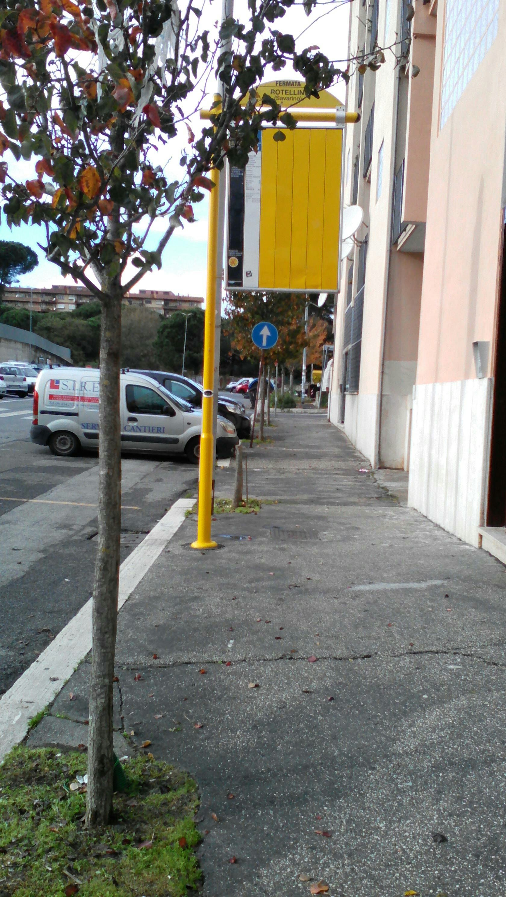 Taken by Ayodele G.
See Rotellini/S. Savarino stop, Roma, on the map
Public transit to Rotellini/S. Savarino stop (ID: 74354) in Roma
Looking for directions to Rotellini/S. Savarino in Roma, Italy?
Download the Moovit App to find the current schedule and step-by-step directions for Bus or Metro routes that pass through Rotellini/S. Savarino.
Looking for the nearest stops closest to Rotellini/S. Savarino ? Check out this list of closest stops to your destination: Rotellini/S. Savarino; Pontina/Clementi; Eroi Di Rodi/Manca; Vitinia.
Bus: 706, 078, 705, N705, 731, COTRAL, COTRAL, COTRAL, COTRAL.Train: FC2.
We make riding on public transit to Rotellini/S. Savarino easy, which is why over 1.7 billion users, including users in Roma trust Moovit as the best app for public transit.
Use the app to navigate to popular places including to the airport, hospital, stadium, grocery store, mall, coffee shop, school, college, and university.
Rotellini/S. Savarino stop’s code is 74354
The first line to this stop is 706, at 5:30 AM, and the last line is 706 at 12:10 AM.
This stop serves ATAC’s lines
- Rotellini/S. Savarino,
- Pontina/Clementi,
- Eroi Di Rodi/Manca
Bus stops near Rotellini/S. Savarino stop
- Vitinia
Train station near Rotellini/S. Savarino station
- Tor Bella Monaca,
- Ostiense Circle/Father Giuliani,
- Tiburtina/Bargellini,
- Latina,
- Prima Porta,
- Leone IV,
- Via Palombarese - Via Santa Lucia, Fonte Nuova,
- Vittorio Emanuele Course/Tassoni,
- Cesano Di Roma,
- Arnara New Gate Square,
- Colli Portuensi/Fermi C.,
- Tenuta Torrenova/Tor Vergata,
- Bufalotta/Albertazzi,
- Grimaldi/Pietra Papa,
- Lorenzo The Magnificent/Stamira,
- Trionfale/Catholic University of Sacred Heart,
- Cefalonia/Giordano,
- Parioli/Secchi,
- Crescenzio/Terenzio,
- Vigne Nuove/Pasinetti
Popular public transit stations in Roma
Get around Roma by public transit!
Traveling around Roma has never been so easy. See step by step directions as you travel to any attraction, street or major public transit station. View bus and train schedules, arrival times, service alerts and detailed routes on a map, so you know exactly how to get to anywhere in Roma.
When traveling to any destination around Roma use Moovit's Live Directions with Get Off Notifications to know exactly where and how far to walk, how long to wait for your line, and how many stops are left. Moovit will alert you when it's time to get off — no need to constantly re-check whether yours is the next stop.
Wondering how to use public transit in Roma or how to pay for public transit in Roma? Moovit public transit app can help you navigate your way with public transit easily, and at minimum cost. It includes public transit fees, ticket prices, and costs. Looking for a map of Roma public transit lines? Moovit public transit app shows all public transit maps in Roma with all Bus, Train, Metro, Light Rail, Ferry, Funicular and Gondola routes and stops on an interactive map.
Rome and Lazio has 7 transit type(s), including: Bus, Train, Metro, Light Rail, Ferry, Funicular and Gondola, operated by several transit agencies, including ATAC, Cotral, Trenitalia, Troiani Transportation Services, BIS, ATR Mobility, Tuscia, Shuttle, Seatour, Troiani Bus Lines, CSC Mobility, Terravision, ATRAL, Tambus and Sitbus