How to get to Roter Ortenauer by bus?
Click on the bus route to see step by step directions with maps, line arrival times and updated time schedules.
From Lotto-Annahmestelle, Vereinbarte Verwaltungsgemeinschaft Sinzheim
155 minFrom Klinik Hohenfreudenstadt, Vereinbarte Verwaltungsgemeinschaft Freudenstadt
212 minFrom Berghütte Lauterbad, Vereinbarte Verwaltungsgemeinschaft Freudenstadt
227 minFrom Hotel Palmenwald, Vereinbarte Verwaltungsgemeinschaft Freudenstadt
220 minFrom Baden-Baden, Karlsruhe/Baden-Baden Airport, Rheinmünster
176 minFrom Panorama-Bad Freudenstadt, Vereinbarte Verwaltungsgemeinschaft Freudenstadt
227 minFrom Grinde-Hütte, Seebach
165 minFrom Lützenhardt, Verwaltungsverband Dornstetten
262 minFrom Krankenhaus Freudenstadt, Vereinbarte Verwaltungsgemeinschaft Freudenstadt
229 min
How to get to Roter Ortenauer by train?
Click on the train route to see step by step directions with maps, line arrival times and updated time schedules.
From Lotto-Annahmestelle, Vereinbarte Verwaltungsgemeinschaft Sinzheim
77 minFrom Klinik Hohenfreudenstadt, Vereinbarte Verwaltungsgemeinschaft Freudenstadt
144 minFrom Hotel Palmenwald, Vereinbarte Verwaltungsgemeinschaft Freudenstadt
107 minFrom Höhenhotel Pfeifle, Baiersbronn
118 minFrom Panorama-Bad Freudenstadt, Vereinbarte Verwaltungsgemeinschaft Freudenstadt
131 minFrom Krankenhaus Freudenstadt, Vereinbarte Verwaltungsgemeinschaft Freudenstadt
137 min
Bus stops near Roter Ortenauer in Verwaltungsgemeinschaft Offenburg
Train stations near Roter Ortenauer in Verwaltungsgemeinschaft Offenburg
Bus lines to Roter Ortenauer in Verwaltungsgemeinschaft Offenburg
- 301, Kehl Rathaus Bstg 2 - Kittersburg Süd,VIEW
- 7134, Berghaupten Obertal - Offenburg Bahnhof / ZOB,VIEW
- 7135, Bühl (Baden) Bstg 8 - Offenburg Bahnhof / ZOB,VIEW
- 7136, Willstätt Schule - Kehl Rathaus Bstg 1,VIEW
- 7141, Lahr Schlüssel Bstg 1 - Offenburg Bahnhof / ZOB,VIEW
- 7146, Offenburg Bahnhof / ZOB Bstg 6 - Kehl Rathaus Bstg 1,VIEW
- 7160, Haslach Stadthalle - Hausach,VIEW
- R2, Altenheim Lindengasse - Offenburg Bahnhof / ZOB Bstg 2,VIEW
- R9, Höfen Binzburgstraße - Offenburg Bahnhof / ZOB Bstg 4,VIEW
- S10, Offenburg Bahnhof / ZOB Bstg 2 - Offenburg Hochschule,VIEW
- S2, Offenburg Altenburger Allee - Zell-Weierbach Abtsberghalle,VIEW
- S3, Hildboltsweier Kleingärten - Weier Alme,VIEW
- S6, Diersburg Rathaus - Offenburg Bahnhof / ZOB Bstg 2,VIEW
- S7, Offenburg Bahnhof / ZOB Bstg 3 - Offenburg Auferstehungskirche,VIEW
- S9, Zell-Weierbach Am Sahlesbach - Offenburg Schulztr. Nord,VIEW
- S4, Offenburg Bahnhof / Zob,VIEW
- S8, Zunsweier Wendeplatz,VIEW
What are the closest stations to Roter Ortenauer?
The closest stations to Roter Ortenauer are:
- Offenburg Rathaus/Zentrum is 184 meters away, 3 min walk.
- Offenburg Landratsamt is 363 meters away, 5 min walk.
- Offenburg Lindenplatz/Zentrum is 461 meters away, 6 min walk.
- Offenburg Kreisschulzentrum is 1116 meters away, 15 min walk.
- Offenburg is 3098 meters away, 40 min walk.
- Offenburg Bahnhof is 3098 meters away, 40 min walk.
Which bus lines stop near Roter Ortenauer?
These bus lines stop near Roter Ortenauer: 7135, 7160, R2, S2, S3.
Which train lines stop near Roter Ortenauer?
These train lines stop near Roter Ortenauer: RE 2, RE2, RS 1, RS1.
What’s the nearest train station to Roter Ortenauer in Verwaltungsgemeinschaft Offenburg?
The nearest train station to Roter Ortenauer in Verwaltungsgemeinschaft Offenburg is Offenburg Kreisschulzentrum. It’s a 15 min walk away.
What’s the nearest bus station to Roter Ortenauer in Verwaltungsgemeinschaft Offenburg?
The nearest bus station to Roter Ortenauer in Verwaltungsgemeinschaft Offenburg is Offenburg Rathaus/Zentrum. It’s a 3 min walk away.
What time is the first train to Roter Ortenauer in Verwaltungsgemeinschaft Offenburg?
The RS2 is the first train that goes to Roter Ortenauer in Verwaltungsgemeinschaft Offenburg. It stops nearby at 4:03 AM.
What time is the last train to Roter Ortenauer in Verwaltungsgemeinschaft Offenburg?
The 20N is the last train that goes to Roter Ortenauer in Verwaltungsgemeinschaft Offenburg. It stops nearby at 6:42 AM.
What time is the first bus to Roter Ortenauer in Verwaltungsgemeinschaft Offenburg?
The 7141 is the first bus that goes to Roter Ortenauer in Verwaltungsgemeinschaft Offenburg. It stops nearby at 4:34 AM.
What time is the last bus to Roter Ortenauer in Verwaltungsgemeinschaft Offenburg?
The 7141 is the last bus that goes to Roter Ortenauer in Verwaltungsgemeinschaft Offenburg. It stops nearby at 11:57 PM.
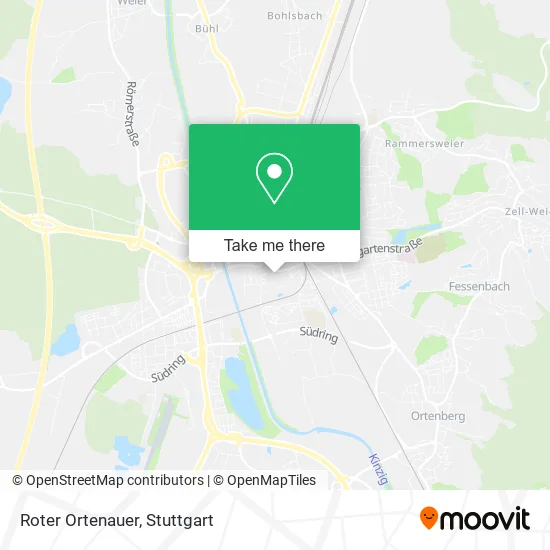
See Roter Ortenauer, Verwaltungsgemeinschaft Offenburg, on the map
Public Transit to Roter Ortenauer in Verwaltungsgemeinschaft Offenburg
Wondering how to get to Roter Ortenauer in Verwaltungsgemeinschaft Offenburg? Moovit helps you find the best way to get to Roter Ortenauer with step-by-step directions from the nearest public transit station.
Moovit provides free maps and live directions to help you navigate through your city. View schedules, routes, timetables, and find out how long does it take to get to Roter Ortenauer in real time.
Looking for the nearest stop or station to Roter Ortenauer? Check out this list of stops closest to your destination: Offenburg Rathaus/Zentrum; Offenburg Landratsamt; Offenburg Lindenplatz/Zentrum; Offenburg Kreisschulzentrum; Offenburg; Offenburg Bahnhof.
Bus: 7135, 7160, R2, S2, S3, 301, 7134, 7136, 7141, S4.Train: RE 2, RE2, RS 1, RS1, RS2, RS4, RS12, RS 2, RS 4, RS 12, RS 3, RE 7, RB 26, RB 27, TGD, RS3, RE7, 12N, 12N.
Want to see if there’s another route that gets you there at an earlier time? Moovit helps you find alternative routes or times. Get directions from and directions to Roter Ortenauer easily from the Moovit App or Website.
We make riding to Roter Ortenauer easy, which is why over 1.5 million users, including users in Verwaltungsgemeinschaft Offenburg, trust Moovit as the best app for public transit. You don’t need to download an individual bus app or train app, Moovit is your all-in-one transit app that helps you find the best bus time or train time available.
For information on prices of bus and train, costs and ride fares to Roter Ortenauer, please check the Moovit app.
Use the app to navigate to popular places including to the airport, hospital, stadium, grocery store, mall, coffee shop, school, college, and university.
Roter Ortenauer Address: Stegermattstraße 24 77652 Offenburg street in Verwaltungsgemeinschaft Offenburg
- Spd-Ortsverein Appenweier,
- Stadtteil- und Familienzentrum Innenstadt,
- Städt. Kindertageseinrichtung im Stadtteil-und Familienzentrum Albersbösch,
- Kindertagesstätte,
- Kletterwand,
- Tod Aus Liebe,
- Villa Billet,
- Rathaus/Rosengarten,
- Bürgerpark,
- Clr Strategie Management,
- Linkedin,
- Spielplatz Badstraße/Mühlbach,
- Lehmann Gerhard a.,
- Björn Büttner Dipl.Ing. Maschinenbau,
- Grimmelshausen-Gymnasium,
- Siegfried Bernheimer,
- Musik-Pavillion,
- Kleinkindsandspielbereich,
- Namenloser Brunnen Im Rosengarten,
- Kriegerdenkmal
Places Near Roter Ortenauer (Verwaltungsgemeinschaft Offenburg)
- Porsche Museum, Zuffenhausen,
- Mettingen Eros-Center Puff Laufhaus, Esslingen Am Neckar,
- Hauptbahnhof Stuttgart, Stuttgart-Mitte,
- SI-Centrum, Möhringen,
- Mercedes-Benz Museum (Mercedes Museum Stuttgart), Bad Cannstatt,
- Porsche-Arena, Bad Cannstatt,
- Marmorsaal Im Weissenburgpark, Stuttgart-Süd,
- Hanns-Martin-Schleyer-Halle (Stuttgart Hans-Martin-Schleyerhalle), Bad Cannstatt,
- Klinikum Stuttgart - Katharinenhospital, Stuttgart-Mitte,
- Waldfriedhof, Degerloch,
- Gasometer Pforzheim, Pforzheim,
- Schleyerhalle, Bad Cannstatt,
- Im Wizemann (Halle), Bad Cannstatt,
- Mercedes-Benz Museum, Bad Cannstatt,
- Wilhelma (U-Bahn Wilhelma), Bad Cannstatt,
- Gleis 101/102 (tief), Stuttgart-Mitte,
- Hanns-Martin-Schleyer-Halle, Bad Cannstatt,
- Geilhaus Haus 33a, Reutlingen-Betzingen,
- Pariser Platz Stuttgart, Stuttgart-Mitte,
- FlixBus Haltestelle, Stuttgart
How to get to popular places in Stuttgart with public transit
Get around Verwaltungsgemeinschaft Offenburg by public transit!
Traveling around Verwaltungsgemeinschaft Offenburg has never been so easy. See step by step directions as you travel to any attraction, street or major public transit station. View bus and train schedules, arrival times, service alerts and detailed routes on a map, so you know exactly how to get to anywhere in Verwaltungsgemeinschaft Offenburg.
When traveling to any destination around Verwaltungsgemeinschaft Offenburg use Moovit's Live Directions with Get Off Notifications to know exactly where and how far to walk, how long to wait for your line, and how many stops are left. Moovit will alert you when it's time to get off — no need to constantly re-check whether yours is the next stop.
Wondering how to use public transit in Verwaltungsgemeinschaft Offenburg or how to pay for public transit in Verwaltungsgemeinschaft Offenburg? Moovit public transit app can help you navigate your way with public transit easily, and at minimum cost. It includes public transit fees, ticket prices, and costs. Looking for a map of Verwaltungsgemeinschaft Offenburg public transit lines? Moovit public transit app shows all public transit maps in Verwaltungsgemeinschaft Offenburg with all Bus, Train, Subway, Light Rail, Ferry, S-Bahn and Funicular routes and stops on an interactive map.
Stuttgart has 7 transit type(s), including: Bus, Train, Subway, Light Rail, Ferry, S-Bahn and Funicular, operated by several transit agencies, including SSB - Stadtbahn, SSB, SSB - Seilbahn / Zacke, S-Bahn Stuttgart, Rhein-Neckar-Verkehr GmbH (rnv), Karlsruher Verkehrsverbund, DB AG, DB Regiobus BW, Arverio Baden-Württemberg GmbH, DB RegioNetz Verkehrs GmbH Westfrankenbahn, DB Regio AG Baden-Württemberg, Südwestdeutsche Verkehrs-AG, DB Regio AG Mitte Region Hessen, DB and Bodensee-Oberschwaben-Bahn