How to get to Rothermel by bus?
Click on the bus route to see step by step directions with maps, line arrival times and updated time schedules.
From GRN-Klinik Schwetzingen, Schwetzingen
78 minFrom Hans-Warsch-Platz,Ludwigshafen Oggersheim, Ludwigshafen-Oggersheim
130 minFrom Luxor Filmpalast, Bahnstadt
96 minFrom Thoraxklinik Heidelberg, Neuenheim
123 minFrom Agaplesion Bethanien Krankenhaus Heidelberg, Südstadt
105 minFrom Möbel Höffner, Schwetzingen
32 minFrom Friedhof Käfertal, Käfertal
70 minFrom Thingstätte, Handschuhsheim
118 minFrom Universitätsklinikum Heidelberg-Notaufnahme, Neuenheim
111 min
How to get to Rothermel by train?
Click on the train route to see step by step directions with maps, line arrival times and updated time schedules.
From GRN-Klinik Schwetzingen, Schwetzingen
88 minFrom Hans-Warsch-Platz,Ludwigshafen Oggersheim, Ludwigshafen-Oggersheim
86 minFrom Luxor Filmpalast, Bahnstadt
47 minFrom Agaplesion Bethanien Krankenhaus Heidelberg, Südstadt
65 minFrom Möbel Höffner, Schwetzingen
83 minFrom Krankenhaus GRN, Weinheim
73 min
Bus stops near Rothermel in Seckenheim
Light Rail stations near Rothermel in Seckenheim
Bus lines to Rothermel in Seckenheim
What are the closest stations to Rothermel?
The closest stations to Rothermel are:
- Kapellenplatz is 200 meters away, 3 min walk.
- Seckenheim, Kapellenplatz is 203 meters away, 3 min walk.
- Seckenheim, Zähringer Straße is 579 meters away, 8 min walk.
- Meßkircher Straße is 588 meters away, 8 min walk.
- Seckenheim, Meßkircher Straße is 590 meters away, 8 min walk.
- Seckenheim, Oeg-Bahnhof Bstg Gl2 is 1275 meters away, 17 min walk.
- Seckenheim Oeg-Bahnhof is 1286 meters away, 17 min walk.
- Seckenheim, Deutscher Hof Bstg 2 is 1387 meters away, 18 min walk.
Which train lines stop near Rothermel?
These train lines stop near Rothermel: RE60, S3.
Which bus lines stop near Rothermel?
These bus lines stop near Rothermel: 40, 628, RNV 40, RNV 50.
What’s the nearest light rail station to Rothermel in Seckenheim?
The nearest light rail stations to Rothermel in Seckenheim are Seckenheim, Oeg-Bahnhof Bstg Gl2 and Seckenheim Oeg-Bahnhof. The closest one is a 17 min walk away.
What’s the nearest bus station to Rothermel in Seckenheim?
The nearest bus stations to Rothermel in Seckenheim are Kapellenplatz and Seckenheim, Kapellenplatz. The closest one is a 3 min walk away.
What time is the first light rail to Rothermel in Seckenheim?
The RNV 5 is the first light rail that goes to Rothermel in Seckenheim. It stops nearby at 4:29 AM.
What time is the last light rail to Rothermel in Seckenheim?
The E is the last light rail that goes to Rothermel in Seckenheim. It stops nearby at 1:31 AM.
What time is the first bus to Rothermel in Seckenheim?
The RNV 40 is the first bus that goes to Rothermel in Seckenheim. It stops nearby at 4:07 AM.
What time is the last bus to Rothermel in Seckenheim?
The RNV 40 is the last bus that goes to Rothermel in Seckenheim. It stops nearby at 1:44 AM.
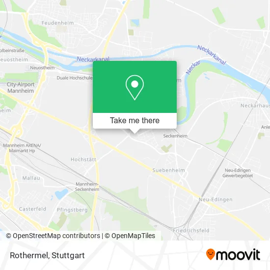
See Rothermel, Seckenheim, on the map
Public Transit to Rothermel in Seckenheim
Wondering how to get to Rothermel in Seckenheim? Moovit helps you find the best way to get to Rothermel with step-by-step directions from the nearest public transit station.
Moovit provides free maps and live directions to help you navigate through your city. View schedules, routes, timetables, and find out how long does it take to get to Rothermel in real time.
Looking for the nearest stop or station to Rothermel? Check out this list of stops closest to your destination: Kapellenplatz; Seckenheim, Kapellenplatz; Seckenheim, Zähringer Straße; Meßkircher Straße; Seckenheim, Meßkircher Straße; Seckenheim, Oeg-Bahnhof Bstg Gl2; Seckenheim Oeg-Bahnhof; Seckenheim, Deutscher Hof Bstg 2.
Train: RE60, S3.Bus: 40, 628, RNV 40, RNV 50, RNV 42, 43, RNV 43.
Want to see if there’s another route that gets you there at an earlier time? Moovit helps you find alternative routes or times. Get directions from and directions to Rothermel easily from the Moovit App or Website.
We make riding to Rothermel easy, which is why over 1.5 million users, including users in Seckenheim, trust Moovit as the best app for public transit. You don’t need to download an individual bus app or train app, Moovit is your all-in-one transit app that helps you find the best bus time or train time available.
For information on prices of bus, light rail and train, costs and ride fares to Rothermel, please check the Moovit app.
Use the app to navigate to popular places including to the airport, hospital, stadium, grocery store, mall, coffee shop, school, college, and university.
Rothermel Address: Endinger Straße 16 Seckenheim, 68239 Mannheim street in Seckenheim
- Vinos Ibericos Miguel a. Herce,
- Andreas Kurzweg Kleintransporte,
- Zubehör für Handys Online Bestellen,
- Daniela Sowada,
- Stellar Technologie,
- Die Volksimmobilie,
- Handwerkerkiste,
- Badsanierung Mannheim,
- Claudia Schmid M.A,
- Travunity,
- Akv Metallbau Gmbh,
- Profitplan E. K.,
- Thomas Kresic Elektrotechnik,
- Niklas Blumenthaler,
- Förderverein,
- Spargel Michl,
- Marmorkamin-Studio,
- Wasserturmanlage,
- Hgw Hausmeisterservice,
- Mannheim-Seckenheim
Places Near Rothermel (Seckenheim)
- Mercedes-Benz Museum, Bad Cannstatt,
- Gleis 101/102 (tief), Stuttgart-Mitte,
- FlixBus Haltestelle, Stuttgart,
- SI-Centrum, Möhringen,
- Wilhelma (U-Bahn Wilhelma), Bad Cannstatt,
- Im Wizemann (Halle), Bad Cannstatt,
- Schleyerhalle, Bad Cannstatt,
- Klinikum Stuttgart - Katharinenhospital, Stuttgart-Mitte,
- Hauptbahnhof Stuttgart, Stuttgart-Mitte,
- Geilhaus Haus 33a, Reutlingen-Betzingen,
- Mettingen Eros-Center Puff Laufhaus, Esslingen Am Neckar,
- Waldfriedhof, Degerloch,
- Porsche Museum, Zuffenhausen,
- Mercedes-Benz Museum (Mercedes Museum Stuttgart), Bad Cannstatt,
- Hanns-Martin-Schleyer-Halle (Stuttgart Hans-Martin-Schleyerhalle), Bad Cannstatt,
- Pariser Platz Stuttgart, Stuttgart-Mitte,
- Porsche-Arena, Bad Cannstatt,
- Gasometer Pforzheim, Pforzheim,
- Hanns-Martin-Schleyer-Halle, Bad Cannstatt,
- Marmorsaal Im Weissenburgpark, Stuttgart-Süd
How to get to popular places in Stuttgart with public transit
Get around Seckenheim by public transit!
Traveling around Seckenheim has never been so easy. See step by step directions as you travel to any attraction, street or major public transit station. View bus and train schedules, arrival times, service alerts and detailed routes on a map, so you know exactly how to get to anywhere in Seckenheim.
When traveling to any destination around Seckenheim use Moovit's Live Directions with Get Off Notifications to know exactly where and how far to walk, how long to wait for your line, and how many stops are left. Moovit will alert you when it's time to get off — no need to constantly re-check whether yours is the next stop.
Wondering how to use public transit in Seckenheim or how to pay for public transit in Seckenheim? Moovit public transit app can help you navigate your way with public transit easily, and at minimum cost. It includes public transit fees, ticket prices, and costs. Looking for a map of Seckenheim public transit lines? Moovit public transit app shows all public transit maps in Seckenheim with all Bus, Train, Subway, Light Rail, Ferry, S-Bahn and Funicular routes and stops on an interactive map.
Stuttgart has 7 transit type(s), including: Bus, Train, Subway, Light Rail, Ferry, S-Bahn and Funicular, operated by several transit agencies, including SSB - Stadtbahn, SSB, SSB - Seilbahn / Zacke, S-Bahn Stuttgart, Rhein-Neckar-Verkehr GmbH (rnv), Karlsruher Verkehrsverbund, DB AG, DB Regiobus BW, Arverio Baden-Württemberg GmbH, DB RegioNetz Verkehrs GmbH Westfrankenbahn, DB Regio AG Baden-Württemberg, Südwestdeutsche Verkehrs-AG, DB Regio AG Mitte Region Hessen, DB and Bodensee-Oberschwaben-Bahn