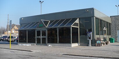
Rouge Hill Go
-
-
-
-
-
Directions to Rouge Hill Go station (Toronto) with public transit
The following transit lines have routes that pass near Rouge Hill Go
 Bus: 38A, 54A, 85A, 954, 38.
- Train: LE.
How to get to Rouge Hill Go station by bus?
Click on the bus route to see step by step directions with maps, line arrival times and updated time schedules.
How to get to Rouge Hill Go station by train?
Click on the train route to see step by step directions with maps, line arrival times and updated time schedules.
Bus stops near Rouge Hill Go stop in Toronto
- Rouge Hill Go Station Loop, 1 min walk,
- Rouge Hill Go Station Loop at Lawrence Ave East, 1 min walk,
- Lawrence Ave East at East Ave - Rouge Hill Go Station, 2 min walk,
- Lawrence Ave East at Stotts Ter, 4 min walk,
Bus lines to Rouge Hill Go station in Toronto
- 38, Kennedy Station at Bus Bay 12 (Platform B),
- 38A, Rouge Hill Go Station Loop,
- 38S, Ellesmere Rd at Markham Rd,
- 395, York Mills Rd at Old York Mills Rd,
- 85, Don Mills Station at Bus Bay 11,
- 85A, Rouge Hill Go Station Loop at Lawrence Ave East,
- 85S, Sheppard Ave East at Markham Rd West Side,
- 385, Sheppard-Yonge Station at Bus Bay 3/3a,
- 54, Don Valley Station at Bus Bay 3,
- 54S, Lawrence Ave East at East Ave - Rouge Hill Go Station,
- 354, Starspray Loop at Lawrence Ave East,
- 354S, Lawrence Ave East at East Ave - Rouge Hill Go Station,
- 954, Starspray Loop at Lawrence Ave East,
- 54A, Starspray Loop at Lawrence Ave East,
What are the closest stations to Rouge Hill Go?
The closest stations to Rouge Hill Go are:
- Rouge Hill Go Station Loop is 17 meters away, 1 min walk.
- Rouge Hill Go Station Loop at Lawrence Ave East is 36 meters away, 1 min walk.
- Lawrence Ave East at East Ave - Rouge Hill Go Station is 138 meters away, 2 min walk.
- Lawrence Ave East at Stotts Ter is 301 meters away, 4 min walk.
Which bus lines stop near Rouge Hill Go?
These bus lines stop near Rouge Hill Go: 38A, 54A, 85A, 954.
Which train line stops near Rouge Hill Go?
LE (Southbound)
What’s the nearest bus station to Rouge Hill Go in Toronto?
The nearest bus stations to Rouge Hill Go in Toronto are Rouge Hill Go Station Loop and Rouge Hill Go Station Loop at Lawrence Ave East. The closest one is a 1 min walk away.
What time is the first bus to Rouge Hill Go in Toronto?
The 385 is the first bus that goes to Rouge Hill Go in Toronto. It stops nearby at 3:03 AM.
What time is the last bus to Rouge Hill Go in Toronto?
The 395 is the last bus that goes to Rouge Hill Go in Toronto. It stops nearby at 3:37 AM.
See Rouge Hill Go station, Toronto, on the map
Public transit to Rouge Hill Go station in Toronto
Looking for directions to Rouge Hill Go in Toronto, Canada?
Download the Moovit App to find the current schedule and step-by-step directions for Bus or Train routes that pass through Rouge Hill Go.
Looking for the nearest stops closest to Rouge Hill Go ? Check out this list of closest stops to your destination: Rouge Hill Go Station Loop; Rouge Hill Go Station Loop at Lawrence Ave East; Lawrence Ave East at East Ave - Rouge Hill Go Station; Lawrence Ave East at Stotts Ter.
Bus: 38A, 54A, 85A, 954, 38, 38S, 395, 85, 85S, 385, 54, 54S, 354, 354S.Train: LE.
We make riding on public transit to Rouge Hill Go easy, which is why over 1.5 million users, including users in Toronto trust Moovit as the best app for public transit.
Use the app to navigate to popular places including to the airport, hospital, stadium, grocery store, mall, coffee shop, school, college, and university.
The station has the following entrances: Rouge Hill Go-Chesterton Shores, Rouge Hill Go-Port Union Rd, Rouge Hill Go-Bridgegend St, Waterfront Trail 1, Lawrence Avenue East, Chesterton Shores, Lawrence Avenue East and Waterfront Trail 2
The first line to this station is KI, at 5:29 AM, and the last line is KI at 12:55 AM.
Chesterton Shores, Toronto, ON, Canada
This station serves GO Transit’s lines
Live Arrivals for Rouge Hill Go station
See real-time arrivals at Rouge Hill Go station, similar to an information board at station itself. Check arrival times with live updates, delays, and service information. If you use this station often or want to check arrival times in advance, we recommend saving this page.
Popular routes from Rouge Hill Go station, Toronto
- Rouge Hill Go Station Loop,
- Rouge Hill Go Station Loop at Lawrence Ave East,
- Lawrence Ave East at East Ave - Rouge Hill Go Station,
- Lawrence Ave East at Stotts Ter
Bus stops near Rouge Hill Go stop
- Highway 7 / Edgeley Blvd,
- Finch Ave West at Highway 27 West Side,
- East Beaver Creek Rd / Highway 7,
- Streetsville Go,
- Main at Brown,
- Winston Churchill Blvd. And Upper Middle Rd. East,
- University Ave. / Sunview,
- Dixie Rd 3105 Dixie Rd,
- Dufferin St / Rutherford Rd,
- Leslie St / Davis Dr,
- Yonge / Clark,
- Goodwin at Sinclair Westbound,
- Bramalea Rd S/Of Countryside Dr,
- Yonge St. @ Innisfil Beach Rd.,
- Third St Louth + Fourth Ave,
- John Street Terminal,
- Trafalgar Rd + Highway 407 Go Carpool,
- Davis Dr / Highway 404 Park & Ride,
- Mohawk at Garth,
- Bullock Dr At Hwy 7
Popular public transit stations in Toronto
Get around Toronto by public transit!
Traveling around Toronto has never been so easy. See step by step directions as you travel to any attraction, street or major public transit station. View bus and train schedules, arrival times, service alerts and detailed routes on a map, so you know exactly how to get to anywhere in Toronto.
When traveling to any destination around Toronto use Moovit's Live Directions with Get Off Notifications to know exactly where and how far to walk, how long to wait for your line, and how many stops are left. Moovit will alert you when it's time to get off — no need to constantly re-check whether yours is the next stop.
Wondering how to use public transit in Toronto or how to pay for public transit in Toronto? Moovit public transit app can help you navigate your way with public transit easily, and at minimum cost. It includes public transit fees, ticket prices, and costs. Looking for a map of Toronto public transit lines? Moovit public transit app shows all public transit maps in Toronto with all Bus, Train, Subway, Streetcar and Ferry routes and stops on an interactive map.
Toronto has 5 transit type(s), including: Bus, Train, Subway, Streetcar and Ferry, operated by several transit agencies, including TTC, Toronto Subway, Brampton Transit, MiWay, York Region Transit, GO Transit Bus, GO Transit, Durham Region Transit, UP Express, Grand River Transit, Guelph Transit, Hamilton Street Railway, Burlington Transit, Oakville Transit and Peterborough Transit