How to get to Roux Philippe Patrice by bus?
Click on the bus route to see step by step directions with maps, line arrival times and updated time schedules.
From Passerelle de l'Avre, Saint-Cloud
52 minFrom Alfortville, Alfortville
61 minFrom Hôpital Marie Lannelongue, Le Plessis-Robinson
61 minFrom Crematorium de Clamart, Clamart
74 minFrom Hôpital Privé de Thiais, Thiais
59 minFrom Porte d'Auteuil, Paris
46 minFrom Le Dôme de Paris – Palais des Sports, Paris
43 minFrom Hôpital Henri Mondor, Creteil
87 minFrom Primark, Villeneuve-La-Garenne
67 minFrom Colombes, Colombes
57 min
How to get to Roux Philippe Patrice by metro?
Click on the metro route to see step by step directions with maps, line arrival times and updated time schedules.
Bus stops near Roux Philippe Patrice in Paris
Metro stations near Roux Philippe Patrice in Paris
Bus lines to Roux Philippe Patrice in Paris
- 69, Champs de Mars,VIEW
- 67, Palais Royal - Musée du Louvre,VIEW
- 72, Parc de Saint-Cloud,VIEW
- 70, Porte de Passy,VIEW
- N11, Pont de Neuilly - Métro,VIEW
- N16, Pont de Levallois - Bécon,VIEW
- N21, Châtelet,VIEW
- 38, Porte D'Orléans,VIEW
- N12, Romainville - Carnot,VIEW
- N13, Bobigny - Pablo Picasso,VIEW
- N14, Mairie de Saint-Ouen - République,VIEW
- N23, Porte Des Lilas,VIEW
- N24, Porte Maillot - Grande Armée,VIEW
- 76, Montreuil - Hôpital,VIEW
- N123, Gare D'Arpajon,VIEW
- N22, Châtelet,VIEW
- 47, Châtelet,VIEW
- N15, Gabriel Péri - Métro,VIEW
- 96, Hôtel de Ville,VIEW
- N122, Châtelet,VIEW
What are the closest stations to Roux Philippe Patrice?
The closest stations to Roux Philippe Patrice are:
- Hôtel de Ville is 102 meters away, 2 min walk.
- Châtelet is 175 meters away, 3 min walk.
- Centre Georges Pompidou is 316 meters away, 5 min walk.
Which RER lines stop near Roux Philippe Patrice?
These RER lines stop near Roux Philippe Patrice: A, B, D.
Which metro lines stop near Roux Philippe Patrice?
These metro lines stop near Roux Philippe Patrice: 1, 14, 4.
Which bus lines stop near Roux Philippe Patrice?
These bus lines stop near Roux Philippe Patrice: 38, 47, 72, 85.
What’s the nearest metro station to Roux Philippe Patrice in Paris?
The nearest metro station to Roux Philippe Patrice in Paris is Hôtel de Ville. It’s a 2 min walk away.
What’s the nearest bus station to Roux Philippe Patrice in Paris?
The nearest bus station to Roux Philippe Patrice in Paris is Hôtel de Ville. It’s a 2 min walk away.
What time is the first metro to Roux Philippe Patrice in Paris?
The 1 is the first metro that goes to Roux Philippe Patrice in Paris. It stops nearby at 5:30 AM.
What time is the last metro to Roux Philippe Patrice in Paris?
The 11 is the last metro that goes to Roux Philippe Patrice in Paris. It stops nearby at 1:15 AM.
What time is the first bus to Roux Philippe Patrice in Paris?
The N12 is the first bus that goes to Roux Philippe Patrice in Paris. It stops nearby at 3:00 AM.
What time is the last bus to Roux Philippe Patrice in Paris?
The N123 is the last bus that goes to Roux Philippe Patrice in Paris. It stops nearby at 4:06 AM.
What time is the first RER to Roux Philippe Patrice in Paris?
The D is the first RER that goes to Roux Philippe Patrice in Paris. It stops nearby at 5:17 AM.
What time is the last RER to Roux Philippe Patrice in Paris?
The A is the last RER that goes to Roux Philippe Patrice in Paris. It stops nearby at 1:02 AM.
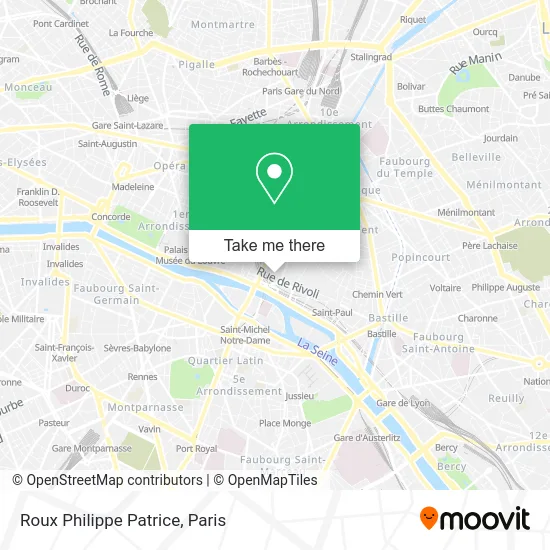
See Roux Philippe Patrice, Paris, on the map
Public Transit to Roux Philippe Patrice in Paris
Wondering how to get to Roux Philippe Patrice in Paris? Moovit helps you find the best way to get to Roux Philippe Patrice with step-by-step directions from the nearest public transit station.
Moovit provides free maps and live directions to help you navigate through your city. View schedules, routes, timetables, and find out how long does it take to get to Roux Philippe Patrice in real time.
Looking for the nearest stop or station to Roux Philippe Patrice? Check out this list of stops closest to your destination: Hôtel de Ville; Châtelet; Centre Georges Pompidou.
RER: A, B, D.Metro: 1, 14, 4, 11, 7.Bus: 38, 47, 72, 85, 69, 67, 70, N11, N16, N21, N12, N13, N14, N23.
Want to see if there’s another route that gets you there at an earlier time? Moovit helps you find alternative routes or times. Get directions from and directions to Roux Philippe Patrice easily from the Moovit App or Website.
We make riding to Roux Philippe Patrice easy, which is why over 1.5 million users, including users in Paris, trust Moovit as the best app for public transit. You don’t need to download an individual bus app or train app, Moovit is your all-in-one transit app that helps you find the best bus time or train time available.
For information on prices of metro, bus, RER, light rail and train, costs and ride fares to Roux Philippe Patrice, please check the Moovit app.
Use the app to navigate to popular places including to the airport, hospital, stadium, grocery store, mall, coffee shop, school, college, and university.
Roux Philippe Patrice Address: 8 Rue Saint-Bon 75004 Paris street in Paris
- 82 Rivoli,
- Hotel Andréa Paris,
- La Petite Épicerie,
- Rue Saint Martin,
- Passage du Désir,
- 76 Rue de la Verrerie,
- Miin Korean Cosmetics,
- Lucky Records,
- Parking Rivoli-Sébastopol,
- Le Presbytère,
- Intimissimi,
- Andel,
- Le Marais Notre Dame,
- Église Saint-Merri,
- Au Verre Luisant,
- Bears Den,
- Maison de l'Astronomie,
- Boutique France Loisirs,
- Galerie Nathalie Obadia,
- Minelli
Places Near Roux Philippe Patrice (Paris)
- Hopital Lariboisière, Paris,
- 29 Rue Manin, Paris,
- Hôpital Pitié Salpêtrière, Paris,
- Hôpital Beaujon, Clichy,
- Théâtre Mogador, Paris,
- Atelier Des Lumieres, Paris,
- Galeries Lafayette, Paris,
- Hôpital Henri Mondor, Creteil,
- Hôpital Cochin, Paris,
- Marché Saint-Pierre, Paris,
- Hôpital de la Pitié-Salpêtrière, Paris,
- Centre Hospitalier des 15/20, Paris,
- Hôpital Necker, Paris,
- Fondation Louis Vuitton, Paris,
- Hopital Foch, Suresnes,
- Beaugrenelle, Paris,
- Hôpital Saint-Joseph, Paris,
- Galeries Lafayette Haussmann, Paris,
- Gare Routière Flixbus, Paris,
- Créteil Soleil, Creteil
How to get to popular places in Paris with public transit
Get around Paris by public transit!
Traveling around Paris has never been so easy. See step by step directions as you travel to any attraction, street or major public transit station. View bus and train schedules, arrival times, service alerts and detailed routes on a map, so you know exactly how to get to anywhere in Paris.
When traveling to any destination around Paris use Moovit's Live Directions with Get Off Notifications to know exactly where and how far to walk, how long to wait for your line, and how many stops are left. Moovit will alert you when it's time to get off — no need to constantly re-check whether yours is the next stop.
Wondering how to use public transit in Paris or how to pay for public transit in Paris? Moovit public transit app can help you navigate your way with public transit easily, and at minimum cost. It includes public transit fees, ticket prices, and costs. Looking for a map of Paris public transit lines? Moovit public transit app shows all public transit maps in Paris with all Bus, Train, Metro, Light Rail, RER, Funicular and Gondola routes and stops on an interactive map.
Paris has 7 transit type(s), including: Bus, Train, Metro, Light Rail, RER, Funicular and Gondola, operated by several transit agencies, including RATP, RER, RER Bus de remplacement, Train, Train Bus de remplacement, Tramway Bus de remplacement, TER, ADP, Magical Shuttle, Argenteuil - Boucles de Seine, Autocars Dominique, Bièvre, Brie et 2 Morin, Le Bus - C.C. du Clermontois and Cœur d’Essonne